


Past landslide sparks questions in the Highlands over plan for Loch Fearna pumped hydro storage dams

A past landslide very close to the site of a major planned hydro storage scheme has sparked questions in a Highland community.
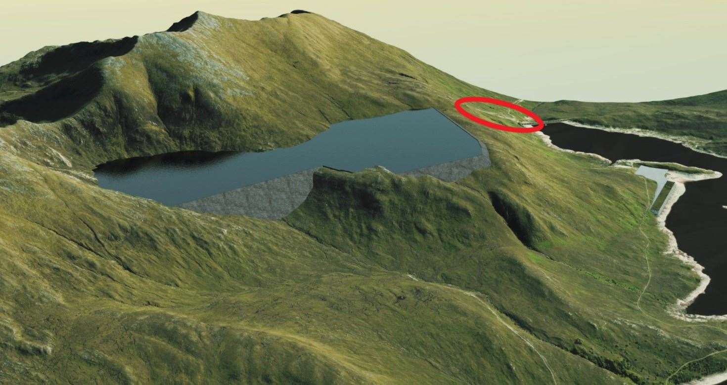
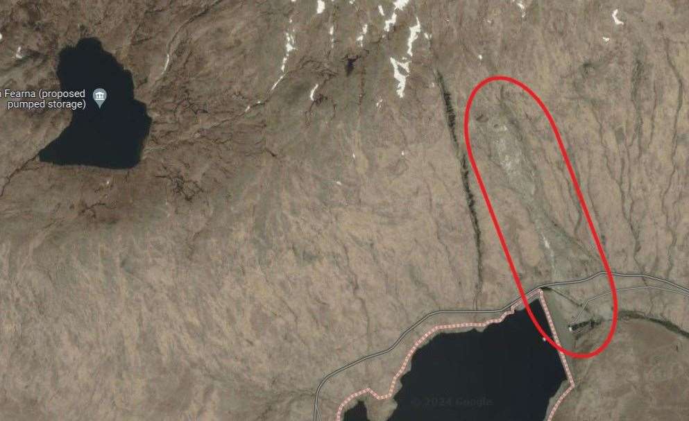
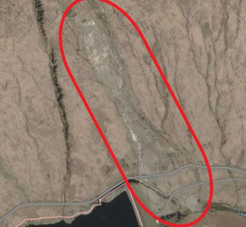
In 2018, a landslide on the slopes immediately above the eastern dam of Loch Quoich sent a large amount of earth and rock cascading down into the reservoir's spillway - blocking the road to Kinloch Hourn and severing power lines that left 20,000 people without electricity.
The slide, the scar of which is still easily visible in the landscape today, sits just a few hundred metres to the east of Loch Fearna - which is now the proposed site of a major new pumped hydro power storage scheme.
READ MORE
Proposed hydro scheme in the Highlands would be among largest in UK
YOUR VIEWS: Hydro storage proposals lodged and car park complaints continue
Back above the dinosaur loch on traverse of Gleouraich and Spidean Mialach
If it goes ahead, developer GIlkes Energy plans to build two large dams on Loch Fearna's southern and south-eastern flanks - deepening the lochan by dozens of metres. It would be one of the largest hydro storage projects of its type in the UK - capable of generating 2000MW, storing 36 Gigawatt hours of energy and providing power to the equivalent of two million homes.
However, its position so close to the site of a large recent landslide - a proximity that means the scar of the slip is even visible in artist's impressions of the proposed new dams - has raised questions from some in the community.
And Glengarry Community Council has now said residents will "wish to be completely reassured that the structural integrity of the proposed and existing dams will be maintained in the event of further landslips".
They also noted that previous plans for a hydro power scheme "around and below Loch Fearna" were refused due to the "significant adverse and long-term impact on the [official] Wild Land Area" in which it would have sat.
Speaking to the Courier, the community council's vice-chairman, George Cross, stressed that the group were still to canvas the community's views about the newly-announced proposals and would not wish to prejudge those findings.
But he did add that it was "safe to say" the community would have questions over possible landslide risks.
He said: "In 2016/17 an application for a hydro power scheme around and below Loch Fearna was refused due to the ‘significant adverse and long term impact on the Wild Land Area’ (amongst other reasons).
"Since that time a large landslip in the immediate vicinity destroyed the power line that runs to Skye, necessitating the import of hundreds of lorry loads of stone to rebuild.
"Although the project is in the early stages and we are still gathering local opinions, it is safe to say that the communities of Glengarry would wish to be completely reassured that the structural integrity of the proposed and existing dams will be maintained in the event of further landslips.
"We look forward to being kept informed of the results of any surveys dealing with this matter.
Responding to local concerns, Fraser Allison, the project director at Gilkes Energy, moved to reassure residents. He stressed that the cause of the past landslide was due to what he described as a very specific set of circumstances - and that similar conditions were not present on the slopes above or below Loch Fearna.
Asked about concerns over the past landslide, he said is was "a valid question" that had "cropped up" in conversations with some residents in early consultations.
He added that following the landslide, "a lot of investigation and review was done" to determine the cause, and that it concluded that it was caused by a "large rock mass that sloped off".
"The short answer is that it was a quite specific landslide. There was a large crack on a large overhanging rock", he said, adding that the "huge crack [was] running through [it] 10 o'clock to 4 o'clock and then that split."
When it gave, he says that triggered the subsequent landslide, and that no such cracked and overhanging boulders were known to be present above or below Loch Fearna.
He added that the team behind the project had already carried out "geo tech surveys" at the site of the planned hydro storages site and landslip site" to understand the causes and any risks, and that these had been very "positive".
But he added that the project was still at the the design stage "and will develop more over time. We've a long way to go", stating that further geological surveys will be conducted as the planning process proceeds in addition to what has already been carried out.