


WATCH: Further snow forecast for Highlands after Met Office issues two new yellow weather warnings
Register for free to read more of the latest local news. It's easy and will only take a moment.

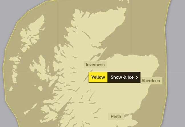
SNOW and ice warnings have been issued for the whole of the Highlands – amid forecasts for wintry weather overnight.
The band of sleet and snow comes hard of the heels of the coldest night of winter so far, and is expected to arrive in the north-west sometime on Wednesday afternoon and head southwards tonight – dumping up to 10cm inches of snow on land above 300 metres, but even bringing 1-2cm "quite widely" at low levels.
The warning, which covers the whole of Scotland, comes into force at 3pm and will remain in place right through the whole of Thursday.
It will then be followed by a further warning on Friday for snow showers across Orkney, Caithness, Sutherland, northern parts of Ross-shire, the Black Isle, Inverness, the Moray Firth and Cairngorms. This second warning runs from just after midnight on Friday morning until midday the same day. The alert also covers parts of Moray and Aberdeenshire.
Commenting on the first of the yellow weather warnings, a Met Office spokesman said: "A band of sleet and snow will arrive across north-west Scotland on Wednesday afternoon and move south-eastwards across most parts of Scotland overnight, clearing southwards on Thursday morning.
"One to two centimetres of snow is likely to settle at low levels quite widely with 3-6cm above 200 metres and up to 10cm above 300 metres.
"Rain is more likely around some coasts, and snow may also turn to rain at low levels inland before clearing to leave a risk of ice on untreated surfaces on Thursday morning.
"Following the clearance of the rain, sleet and snow on Thursday morning, much of inland Scotland will be dry for most of the day. However, snow showers will then follow into northern Scotland on Thursday, especially during the afternoon and evening.
"A further 2-5cm is likely at low levels with around 10cm accumulating above 200 metres. This warning will likely be updated on Thursday."
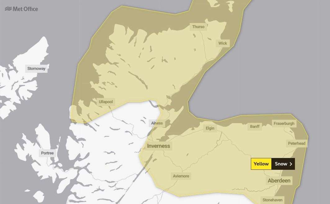
Commenting on Friday's separate yellow warning for snow, they added: "Frequent and heavy snow showers will affect the region overnight, before gradually easing during Friday morning, with many areas becoming dry in the afternoon. Around two to five centimetres is expected to fall widely in the area, with up to 10cm possible in a few places above 150 metres."
Meanwhile, Highland Council was reporting no major issues on the region's roads following Tuesday night's very hard frost. The region saw its coldest night of the winter so far, with temperatures dipping as low as -12.2C.
But despite some icy patches across all parts, and some "localised hard packed snow" on some routes in Sutherland, and Badenoch & Strathspey, there were no major problems.
Visit the Met Office website for its latest weather warnings and advice.
Related news: Coldest night of the winter recorded as temperatures dip to -12.2C