A winter walk over Creag an Leth-choin – Lurcher's Crag – in the Cairngorms
Register for free to read more of the latest local news. It's easy and will only take a moment.

Time to get the boots on. Unless of course, you’ve left them sitting in the hall at home and driven to the ski centre car park at Cairngorm without them.
Peter’s predicament was an interesting start to our winter walk in the hills – and something he’d never done in quite a few decades of hiking!
We weighed up our options. After checking if we could get walking boots at the base station (apparently not), we decided to head back down the hill into Aviemore and see if he could buy or hire a pair.
Not expecting to be spending cash in the Cairngorms, he hadn’t even brought his wallet, so my credit card took a temporary hit as we geared up and returned to the car park, which at 600m above sea level gives great access to this high plateau.
It was one of those in between days. The crampons and ice axe were packed, although it was hard to tell if we’d need them for our planned route. Still, it meant Peter had to get good quality winter boots that would take his particular type of crampon.
Thankfully, they gave a comfortable footing as we finally made our way along the path towards the Northern Corries, each footstep taking us deeper into this wild winter landscape.
Losing an hour had not been an ideal start, but our planned walk was not expected to keep us out into the darkness, so we had some time to play with.
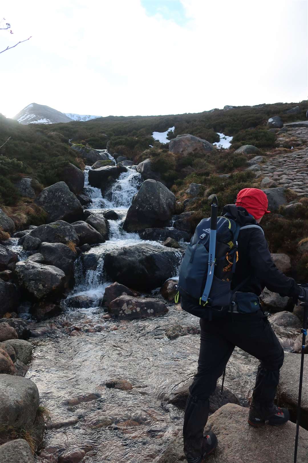
As we climbed higher, the path became frosted over, with some icy rocks here and there. It was nothing the winter boots couldn’t handle, as we crossed the Allt Coire an t-Sneachda – ignoring an earlier path off to the left that leads up into that particular coire, as well as another one leading up into Coire an Lochain.
We were aiming for the easy ridge to the west of that latter coire, a popular route to Ben Macdui – though as the wind picked up it would have been a tough trek across the plateau to the second highest mountain in the UK, despite the lack of deep snow you might expect in the Cairngorms in mid-January.
We watched various groups on winter training courses seeking out patches of snow here and there. As we made our way up the easy way, others were climbing out of Coire an Lochain on steep snow with crampons and axes.
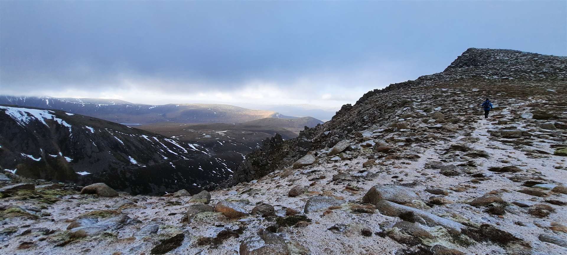
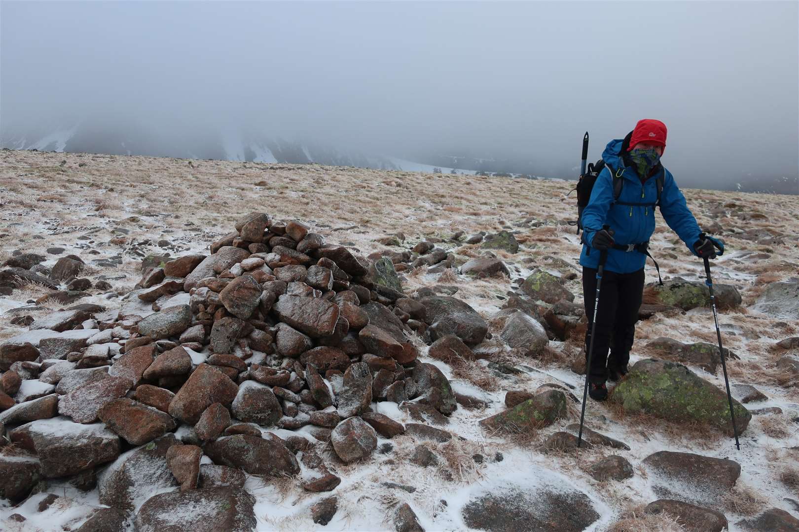
When the gradient eased, we soon cut off the path and aimed for the 1083m spot height above the Lairig Ghru. The high point is marked by a fairly prominent cairn on an otherwise featureless small rise.
The cloud came down and I took a bearing towards the large, flat bealach between here and our main hill for the day, Creag an Leth-choin – or Lurcher’s Crag to give it its more commonly used name.
It appears the name originates from a tale – tall or otherwise – of a hunter’s dog chasing a deer and falling over the precipice into the pass below.
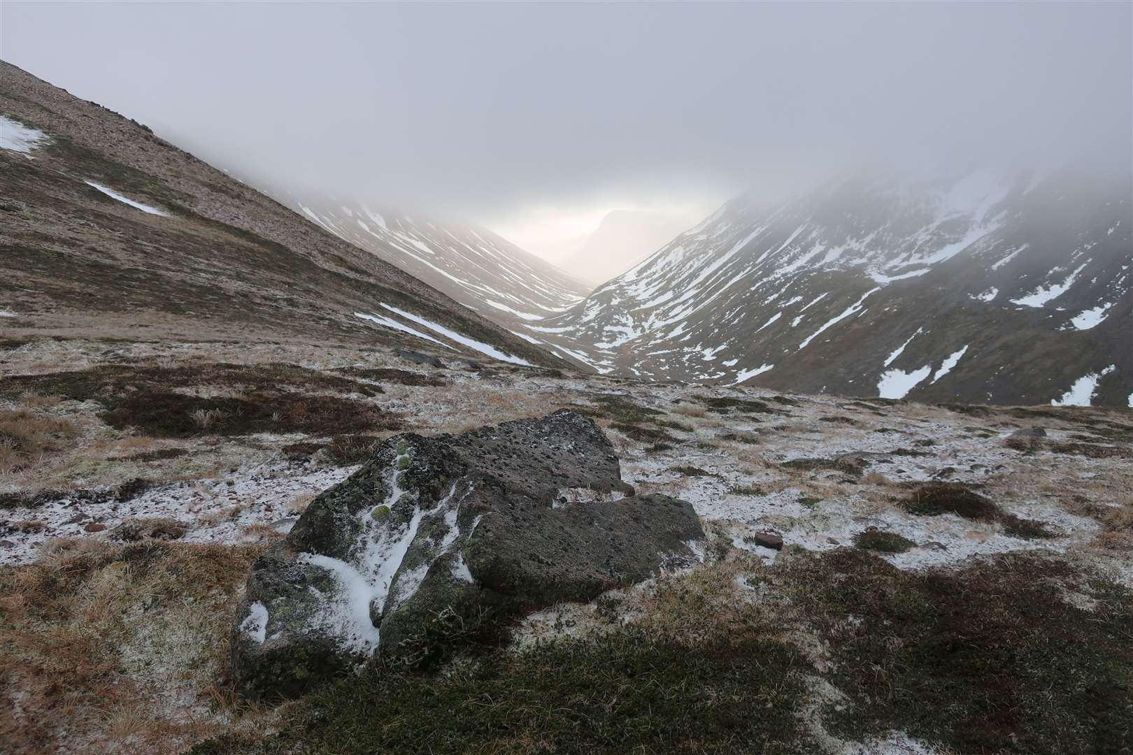
As we descended to the bealach, we found ourselves just below the well-defined cloud base and I wandered to the edge to check out the view. It was a mesmerising sight as the light shone through from the southern end of the Lairig Ghru, lighting up the underside of the cloud and creating a defining silhouette of Bod an Deamhain, the Devil’s Point.
We sat for a lunch break at the bealach, enjoying the peace in this quiet corner of the Cairngorms. Creag an Leth-choin is considered a Top rather than having any designation of its own, so it is only on the lists of fully committed baggers or those, like us, just looking for something different.
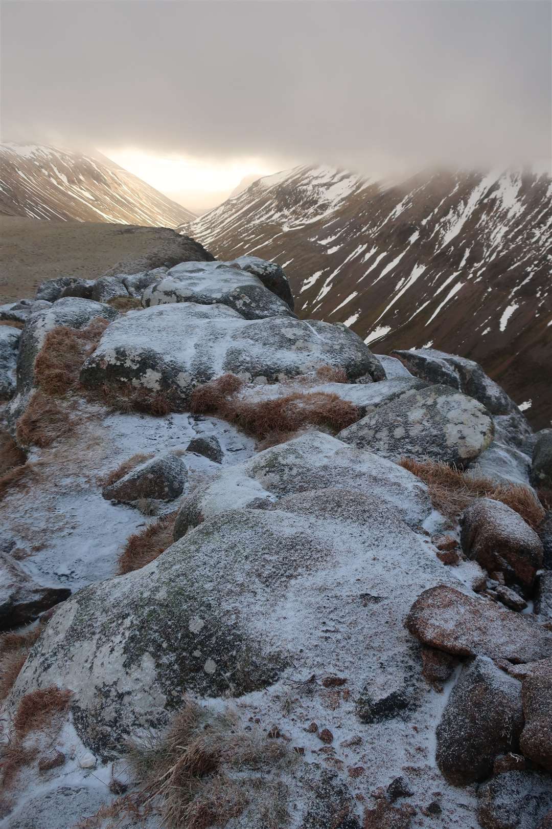
A well-defined path leads up the southern ridge, occasionally necessitating the crossing of a few boulders on the way. We took extra care in the frozen conditions because while some rocks had a little ice, there was certainly no need for the crampons, so we had to ensure each step was secure.
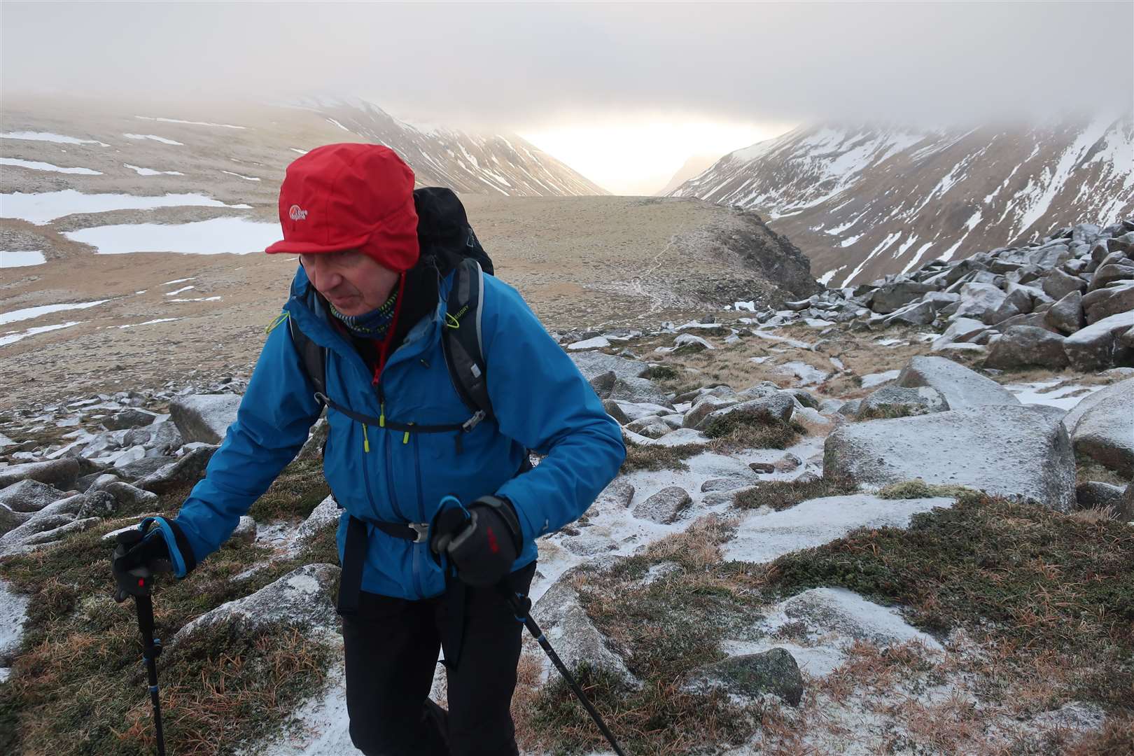
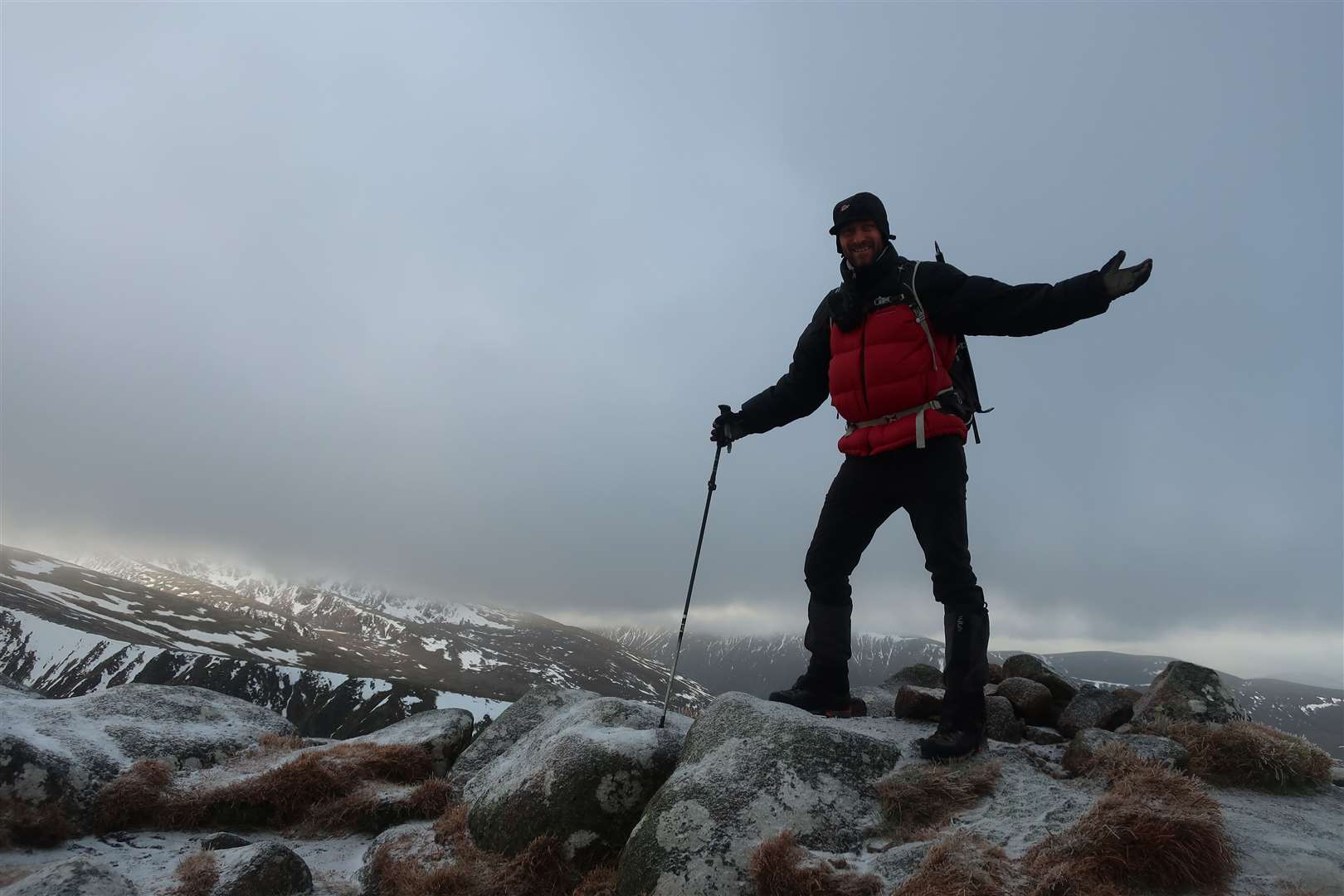
We made our way to the precipitous summit, its blocky granite cliffs providing a dramatic foreground to the view that drops suddenly into the depths of the Lairig Ghru. These rocks and gullies provide a number of winter climbs as well as a handful of summer scrambles.
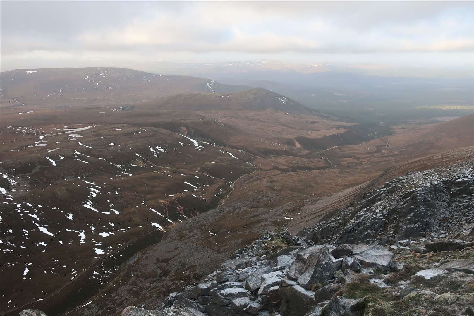
This must be one of the best vantage points to see the Lairig Ghru almost in its entirety. Looking south, we could still see to the Devil’s Point and the brighter weather in Deeside while to the north we saw the path as it leads down into the Rothiemurchus Forest.
Our own way down didn’t seem to have the luxury of a path. We headed north to pick up the ridge that heads towards the Chalamain Gap. At first there are a few interesting rocky stretches which would make for fun, easy scrambling in the summer, but which we had to tread carefully through in these conditions.
Partway down we did pick up some kind of path, which soon disappeared again as we forked right to avoid heading straight to the cliffs above the gap. This was a long and rough descent through heather, rocks and tussocky grass, not to mention occasional solid snow patches.
Eventually the excellent path that leads from the Chalamain Gap to the bridge over the Allt Mor was reached, and we sat down for a well-earned break.

This great path provides views into the Northern Corries and, though we could see the car park, there was still a little way to go on foot. The route bends left to descend to the burn – passing the reindeer enclosure on the way.
The newly rebuilt Utsi’s Bridge takes you over the water and then there are a couple of options to return to the ski centre. The most direct is via a path to the right immediately after the bridge which is marked as dangerous due to landslides and erosion – take this option at your own risk. The alternative is to follow the path straight up from the bridge to reach the road and follow that back to the top.
Finally back at the car, and with a shiny new pair of boots for Peter, hopefully there will still be time for a few more winter outings – and even an opportunity to get the crampons back in action.
Route details
Creag an Leth-choin / Lurcher’s Crag
Distance 8 miles / 13km
Terrain Mountain footpaths, pathless mountains, rough descent, winter conditions – navigation and winter mountaineering skills required
Start/finish Cairngorms ski centre car park
Map OS Landranger 36; OS Explorer OL57; Harvey British Mountain Map, Cairngorms
A little winter outing in the Cairngorms to visit a spectacular viewpoint