


UK sees ‘snowiest spell’ in two years as almost seven inches falls
Register for free to read more of the latest local news. It's easy and will only take a moment.
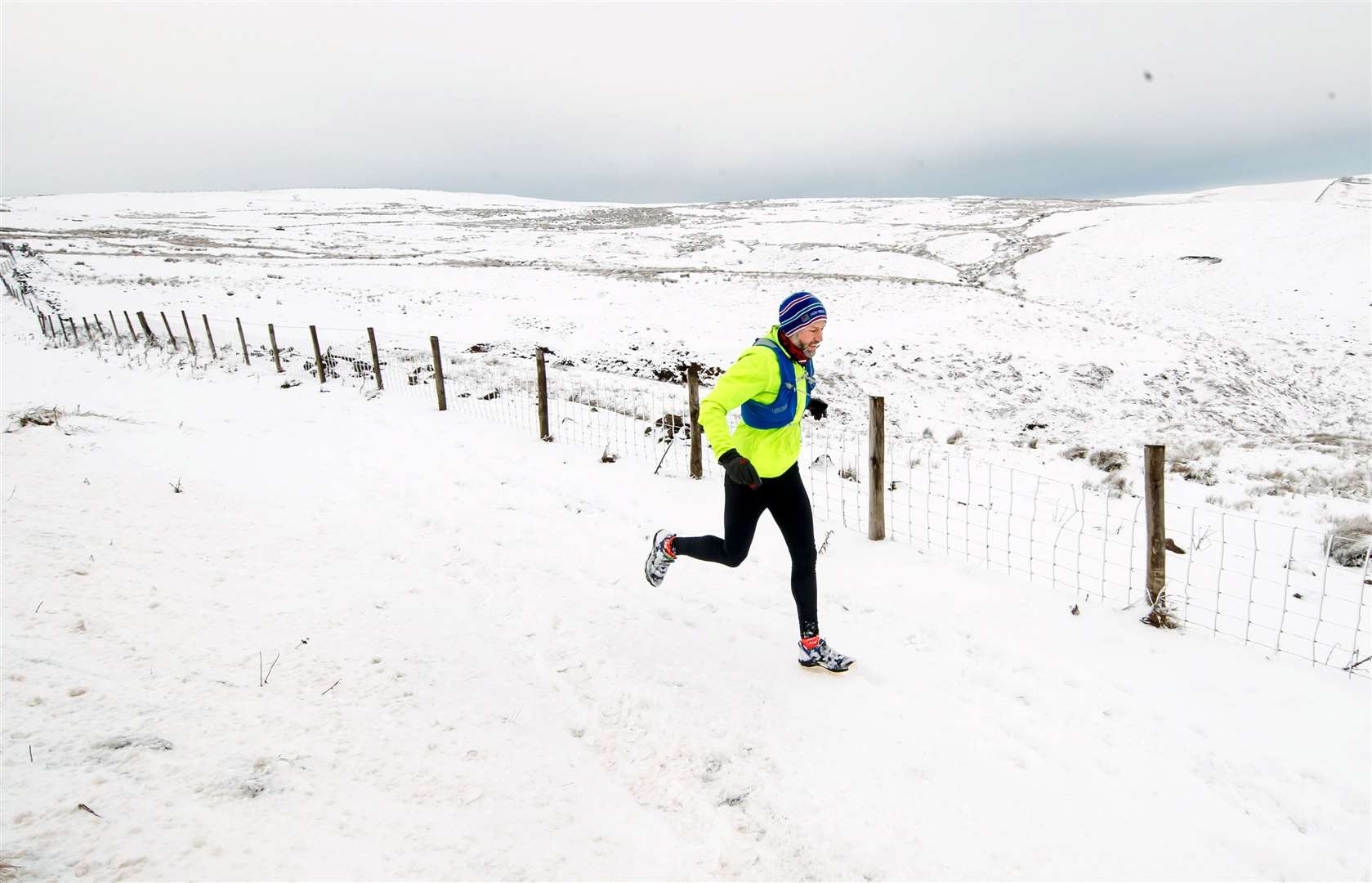
Almost seven inches of snow fell across parts of the UK overnight as forecasters warn of more wet and windy weather in the coming days.
Loch Glascarnoch in the Scottish Highlands saw the highest accumulation of snow, with 17cm (6.7 inches) recorded at 6am on Monday, the Met Office said.
It was closely followed by the village of Wittering in Cambridgeshire, which woke up to some 15cm, while 8cm fell in Coleshill, Warwickshire.
By contrast, just 2cm was recorded at Heathrow in west London, and 5cm in the village of Shawbury in Shropshire.
Met Office spokesman Oli Claydon said it was the “snowiest spell” the UK had experienced since late January 2019, when 20 weather stations in England recorded accumulations of 5cm or more for three days consecutively.
While Monday is forecast to be cold and bright, the rest of week will turn “milder, wetter and windier”, Mr Claydon said.
Heavy rain and 40mph winds are forecast for the south-west of England and Wales from Wednesday, with the bad weather moving east into Thursday.
“Everywhere will likely see rain over the next week, as it moves west to east. Weather systems will pass over pretty much everywhere over the UK,” Mr Claydon said.
“With lots of the UK already saturated from the heavy rainfall we have seen last week, it doesn’t take much for it to tip the balance and provide another flood risk.”
Weather warnings for rain should be expected, Mr Claydon said.
Temperatures are forecast to rise to about 12C by Thursday, before dropping again over the weekend.
It comes as Wales saw its coldest night of the year so far as the temperature dropped to minus 9.7C at Sennybridge in Powys on Sunday night.
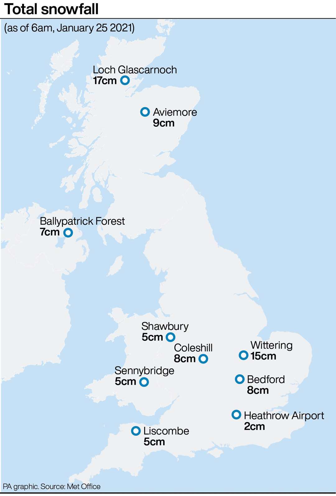
The coldest temperature recorded in the UK overnight was at Katesbridge in County Down, Northern Ireland, where the mercury fell to minus 10.4C.
The return of a warmer weather front will bring more anxiety to communities hit hard by Storm Christoph last week.
A recent investigation by Greenpeace’s investigative arm Unearthed and the Guardian found many flood defences across England could be in a state of disrepair following years of high rainfall.
Freedom of Information requests found 3,400 flood defence assets were deemed to be in a poor condition last year – 6% of all structures in England – by Environment Agency inspectors.
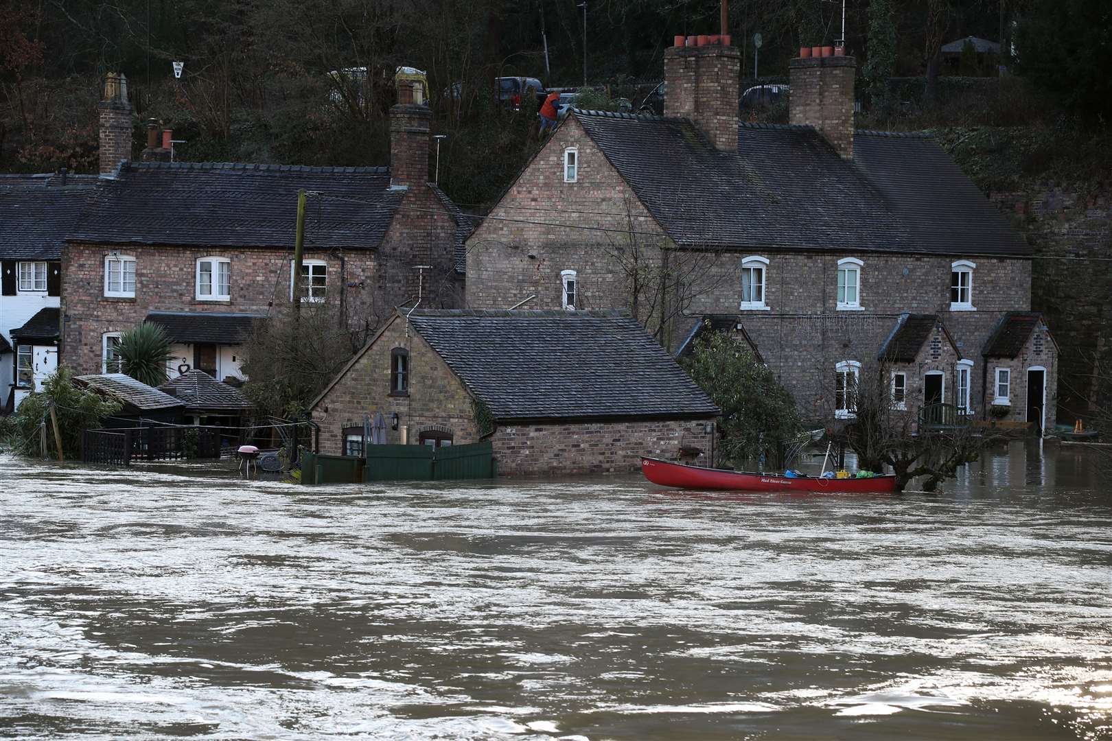
Many areas in northern, central England and Wales, particularly towns and villages along the River Severn, endured flooding last week.
According to the Guardian and Unearthed investigation, as many as one in 10 flood defences in these regions were in disrepair in 2019-20.
The Environment Agency said, over the last year, repairs had been prioritised in areas at greatest risk.
A spokesman said: “We maintain approximately 78,000 flood assets across England, 95% of which are in good condition and repairs are prioritised where there is significant threat to lives and livelihoods.”