


Met Office warns ‘unsettled’ conditions could return days after Storm Antoni
Register for free to read more of the latest local news. It's easy and will only take a moment.
The Met Office has warned there may only be a couple of days of warm weather following Storm Antoni before conditions become “unsettled” again heading into the weekend.
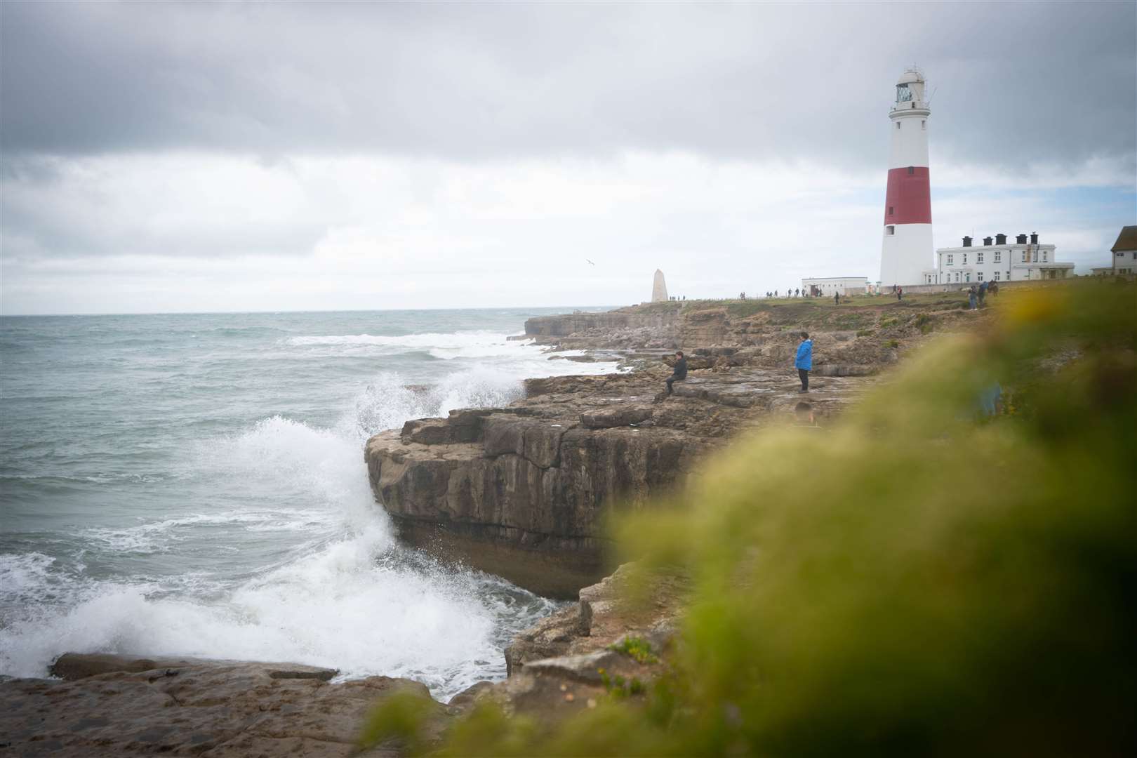
Storm Antoni saw 78mph winds hit the UK and trees blown down – blocking 100 miles of railway between Exeter and Penzance.
A danger to life alert had been issued for Saturday during the amber wind warning, which covered south-western areas of both England and Wales.
Met Office meteorologist Ellie Wilson told PA: “Weather warnings were enforced for Storm Antoni which came across the UK through Friday evening and into Saturday.
“That has all passed through and it has moved across towards the continent now so we’re not being dominated by Storm Antoni anymore.
“We have got this brief ridge of high pressure through Wednesday and Thursday bringing subtle conditions but then another area of low pressure moves in from the west which will be bringing more changeable conditions as we head towards the weekend.
“The position of the jet stream is allowing low pressure systems to be pushed towards the UK, which is why we’ve seen this unsettled theme through much of the summer so far.”
The forecaster said the southern half of the UK could see a “grey and murky day” on Tuesday before brighter conditions on Wednesday and Thursday.
The rest of the UK is forecast to have a drier day on Tuesday with isolated showers mainly confined to the northern parts of Scotland.
The band of cloud and rain across the South is expected to clear its way eastward on Wednesday and temperatures could start to increase to highs of 23 or 24 degrees across the South-East.
Temperatures could then reach 26 or 27 degrees in southern parts of the UK on Thursday and the mercury is expected to stay above 20 degrees across most of the country.
But heavier showers and thunderstorms could appear in the north of the country as soon as Thursday evening and Friday morning.
Ms Wilson added: “Through Friday and into the weekend we are generally returning to that more unsettled theme that we’ve seen over the past couple of days with low pressure out to the north-west bringing outbreaks of rain and showers at times but with some dry interludes in between.”