


Glastonbury at risk of being hit by ‘damaging’ downpours
Register for free to read more of the latest local news. It's easy and will only take a moment.
Glastonbury is at risk of being hit by “damaging” downpours with thunderstorms set to hit southern England on Thursday.
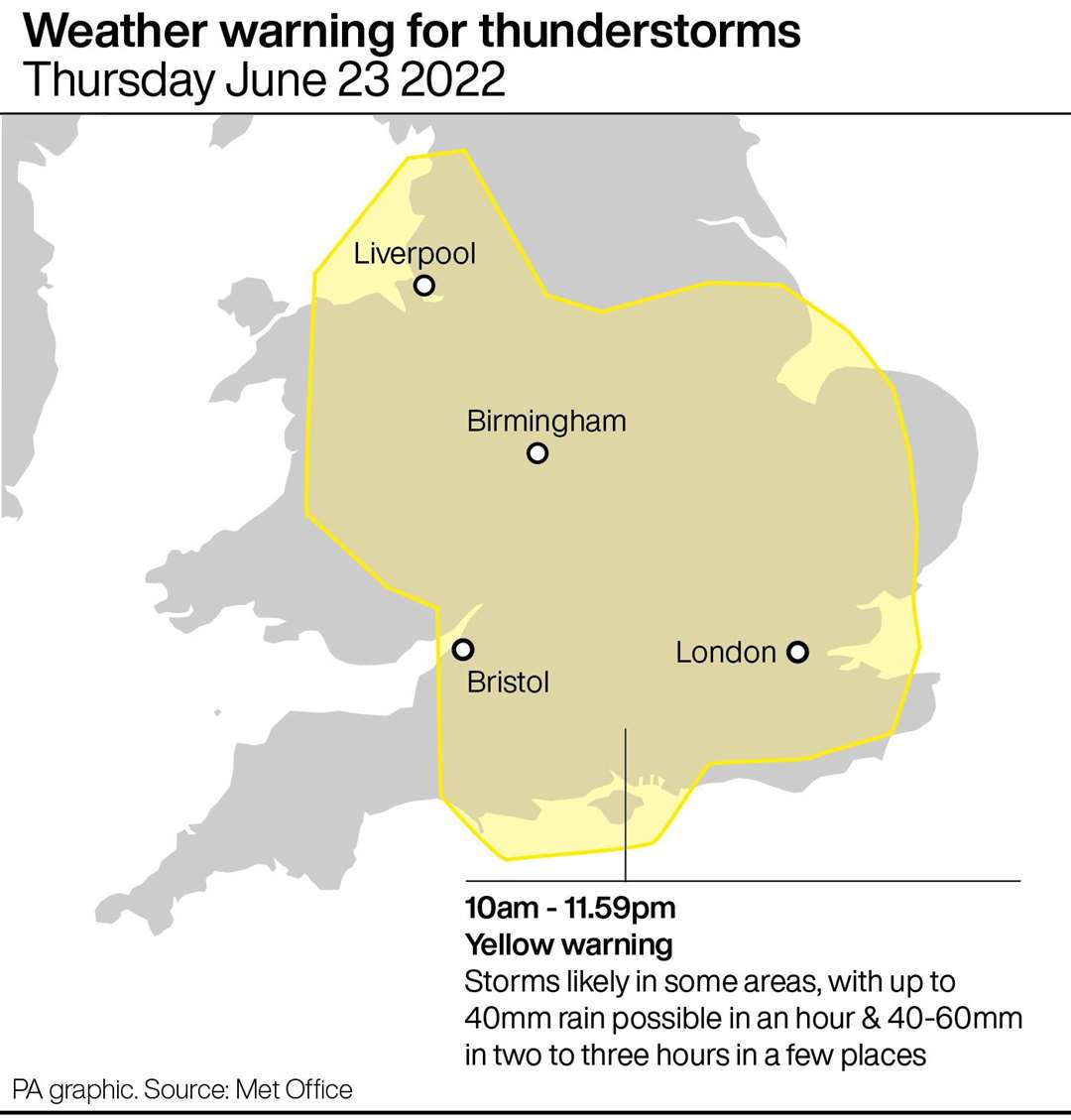
The Met Office has issued a yellow thunderstorm warning for Thursday, stretching from Sheffield in the North, across the South East and down to Bath in the South West.
Thursday is also set to see more rail strikes, with the poor weather likely to add to travel woes.
Met Office meteorologist Alex Burkill said: “The only thing that we have to be aware of is there is, an albeit small but not tiny, risk of some intense thundery downpours, particularly tomorrow. Chances of Glastonbury itself actually getting hit by one is very small.
“So hopefully they stay fine.
“The warning talks of the risk of 40 to 60 millimetres of rain falling in just a few hours, large hail, frequent lightning, that kind of thing.
“So it could be quite damaging. But the risk is very small of it actually hitting the Glastonbury site.”
Thursday will also see hot temperatures, he said, with highs of 29C to 30C in the north of England, before dropping over the weekend.
Scotland and Northern Ireland will see dry weather, with the best of the weather towards eastern Scotland.
“Temperatures as we go into the weekend, a little bit lower, still so probably like 19C-20C, that kind of thing on both Saturday and Sunday”, Mr Burkill said.
“So a bit fresher, a bit more comfortable than what we’ve got at the moment.”