


Met Office issues update on Arctic blast set to hit the Highlands with up to 10cm of snow
Register for free to read more of the latest local news. It's easy and will only take a moment.

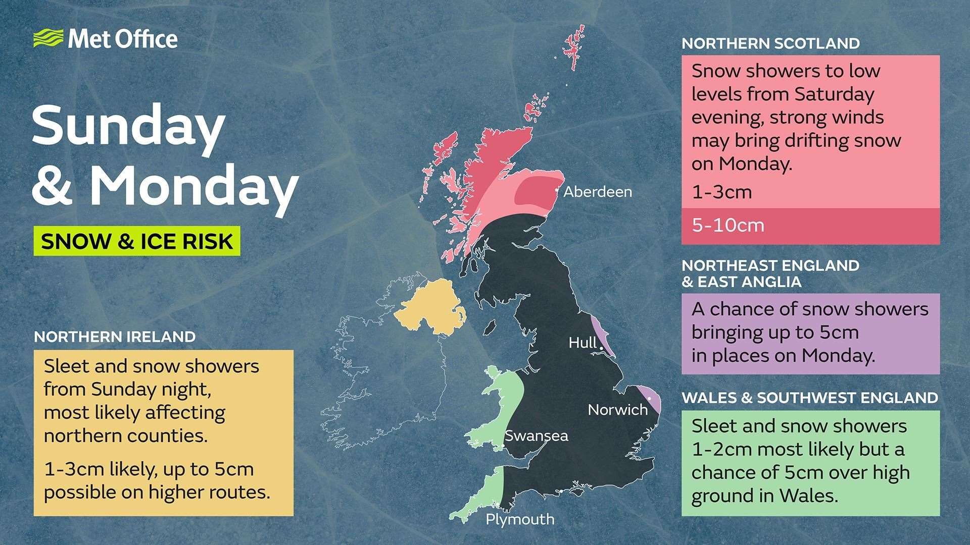
The north is once again braced for more wintery weather after the Met Office forecasted a comprehensive dusting of snow and ice starting from this evening across the whole of the region.
Yellow weather warnings have been issued for the whole of the region for snow and ice to advise about the possible impact of such weather on travel in particular.
But some areas are likely to see anything from 5-10cm of snow – or enough to build a snowman as the Met Office suggests – across an area including parts of Easter Ross, Wester Ross, Caithness and Sutherland.
The heaviest snows of 5-10cm are expected north of a line extending from around the Dornoch Bridge in the east to about half way up Loch Linnhe in the west while the rest of the region should expect snow showers.
The Met Office states: “Snow showers to low levels from Saturday evening, strong winds may bring drifting snow on Monday,” predicting 1-3cm which includes much of the A9 to around the northern parts of Perthshire.