


Keeping the Focus on the Vision: Plotting the future active travel routes as the Inverness Strategy aims to transform the pedestrian and cycle experience to and from the city centre
Register for free to read more of the latest local news. It's easy and will only take a moment.

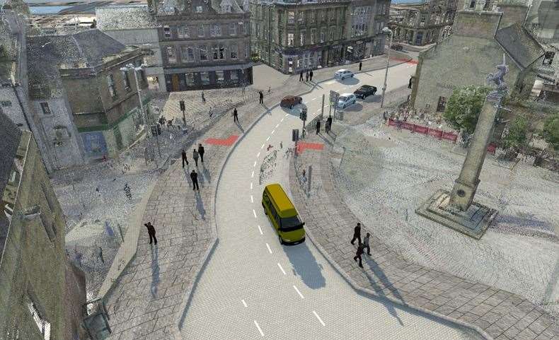
The “overall ambition” of the Inverness strategy is to deliver nine active travel routes that criss-cross the city in a bid to “improve community health and reduce short car journeys.”
Following on from last week’s report outlining why Highland Council believes active travel is a necessary component of maximising the economic and social potential of the city centre, as well as tackling climate change, we now look at the routes under construction and those that have been proposed.
Of the nine possible routes, just two currently have funding – the East-West Active Travel Link and Active Travel Route 4.
Thefirst connects the city centre to Merkinch, Raigmore, the UHI Campus and “Inverness East Development Area”, which is an area extending east of UHI to Milton of Culloden.
A major element of this link is nearing completion as the final touches are put to a development at the Raigmore interchange – on the slip road near Millburn Road, expected to be finished by the end of this month.
The strategy states: “This should transform the pedestrian and cycle experience, encouraging and improving journeys to and from the city centre for two of the key low car ownership groups of Merkinch residents and UHI students.”
Active Travel Route 4 will connect the city centre with the communities in Torvean and Ness-side and the extensive sport and leisure facilities situated around Bught Park in a “revitalised riverside environment.”
The others are: the Beauly Firth Cycle Route, which involves long-held plans to connect the town with Inverness, mostly through off-road routes.
It would enter Inverness at the mouth of the Caledonian Canal, round the edge of South Kessock to Ness Bridge.
The Scottish Canals Towpath route, running from the start of the canal down both sides of the bank to Whin Park, would connect with the Beauly section at the mouth of the canal.
Active Travel Audit Route 3 would connect Ness Bridge to Kinmylies following a direction going down Tomnahurich Street onto Bruce Gardens then St Valery Street where it would cross the river to the back of Charleston Academy – but a new bridge would have to be constructed according to the layout in the plans.
Active Travel Audit Route 7 runs along almost the full length of Old Edinburgh Road before picking up Southside Road and meeting another active travel route on Kingsmills Road where it carries on to the city centre.
However, the two most contentious elements of the scheme involve vital arteries at the heart of the city centre – around Inverness Castle and Academy Street. During the pandemic active travel measures on both roads provoked uproar – something that will have to be overcome if the full plans are to be successful.
Neither active travel activists nor local traders were happy with the move, creating tensions before anything permanent is even tabled.