


Inverness woman shows way with award for her new Loch Ness map
Register for free to read more of the latest local news. It's easy and will only take a moment.

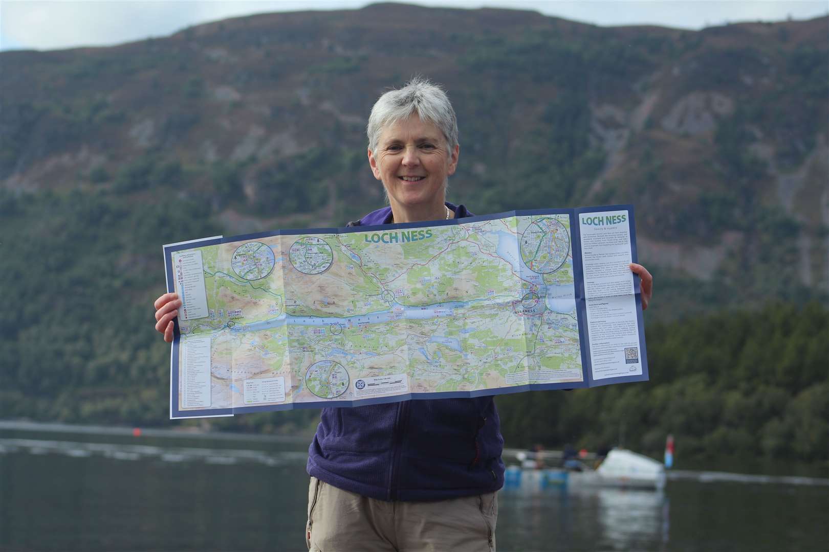
An Inverness map-maker has received backing from the industry that she is heading in the right direction with her latest publication.
Helen Stirling, a freelance cartographer, was awarded “highly commended” in the prestigious Stanfords printed mapping category at this year’s British Cartographic Society Awards.
The recognition is for her new Explore Loch Ness map, which is aimed at visitors to the area and highlights points of interest around the water. It has also been chosen by Standfords as its map of the month for October in its regular newsletter that is shared to nearly 50,000 subscribers.
Helen (61), who lives in Lochardil, explained that Stanfords is the world’s largest map and travel guide independent bookshop.
“They got in touch with me about a month ago to say they wanted to stock the map, and I was curious as to where they’d found it,” she said. “They said they’d found it on a British Cartographic Society event, which reminded me that I had actually submitted this map for the competition.
“I’m more than delighted with being highly commended as a small freelance cartographer.”
It is not the first time Helen’s maps have been noticed by the sector’s leading lights. She won the same award outright for a project on behalf of Moray Council in 2008 – but this latest award was special as the Loch Ness map was something of a labour of love.
She said: “We’ve been going to these places for years, and I’ve driven around Loch Ness so many times in the last couple of years checking out details!
“My own projects have to kind of fit in between the paid work, but I’ve also been working – for longer than I have on this map – trying to compile a map of the actual walks round Loch Ness as well.”
Helen’s maps can be spotted in many places around the area, including on the Black Isle, at Dores and on the Paths Around Inverness panels in the city.
She previously worked for the Forestry Commission – now Forest and Land Scotland – before going freelance in 1990.
A spokeswoman for Stanfords said: “The Stanfords award for best printed mapping has been running for decades and this year we had a great number of entries from cartographers across many countries. Helen should feel very proud to be highly commended.”
The judges praised the Explore Loch Ness guide as a “fun map of the Loch Ness area that folds to a helpful pocket size,” adding that it has a “great level of detail and information provided for the general public for leisure activities”.
They also described it as making good use of colours and shading, having a clear typeface and simple key, as well as including practical insets of urban areas.
Emma Harrison, destination development manager at Visit Inverness Loch Ness, said: “There are so many places to discover and explore around Loch Ness, so Visit Inverness Loch Ness was delighted to support Helen to develop a map showcasing the loch and the attractions, trails and beauty spots around it.
“To be highly commended in the 2023 British Cartographic Society Awards is testament to Helen’s passion, creativity and hard work to develop a fantastic guide for the area.”
The map is available in a growing number of outlets including the Ness Gift Shop at Dores, Foyers Stores, some hotels and campsites around the loch and online at www.helenstirlingmaps.com