


EXPLAINED: What is the big standing stone at Inverness Castle? a quick look at the Great Glen Way and its much-photographed start/end point
Register for free to read more of the latest local news. It's easy and will only take a moment.

ONE of the most photographed landmarks in Inverness city centre celebrates its 16th birthday tomorrow.
It's located in the grounds of Inverness Castle, but it's not the castle – and nor is it the famous statue of Flora MacDonald, saviour of Bonnie Prince Charlie.
No, this mass of Caithness flagstone probably gets little more than a cursory glance by many a city resident, and even a fair few visitors – but, for hikers out there, it's a goal they've been striving towards for days... or even weeks.
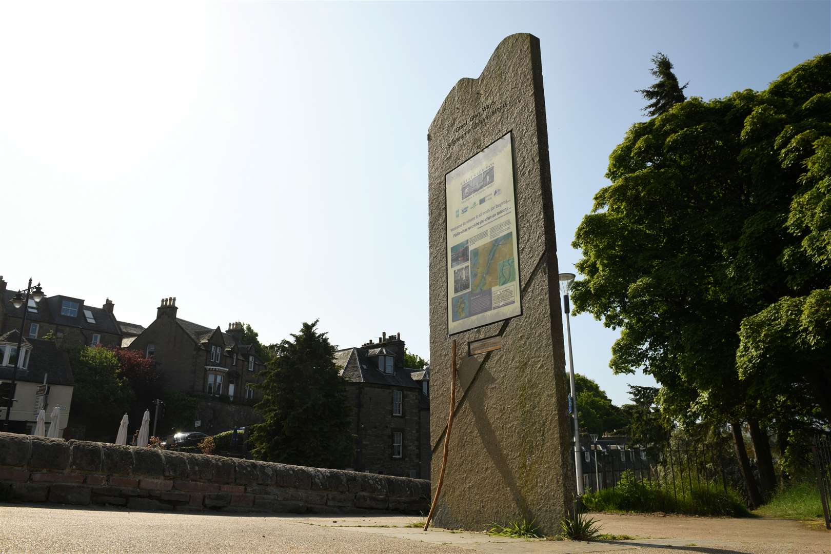
Yes, it's the standing monolith that marks the beginning/end of the Great Glen Way.
And it appears in scrapbooks and photo collections of walkers from all corners of the world – whose selfie snaps marking the beginning or end of their Highland hiking adventure will no doubt spark many a fond memory.
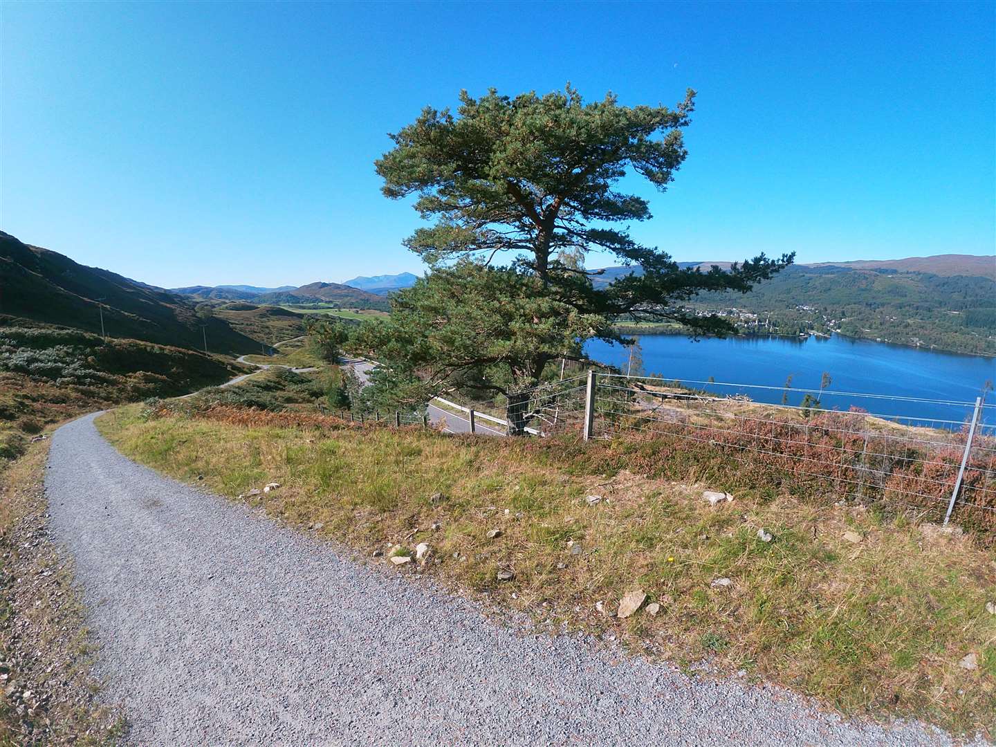
What is the Great Glen Way?
A beautiful long-distance hiking trail that stretches for 79 miles from Fort William at its southern end and up through the Great Glen into Inverness... and the Caithness flagstone monolith that marks its terminus.
The route itself snakes its way along the sides of the Caledonian Canal for a chunk of its distance and also along the route of the the long since defunct Spean Bridge to Fort Augustus railway line.
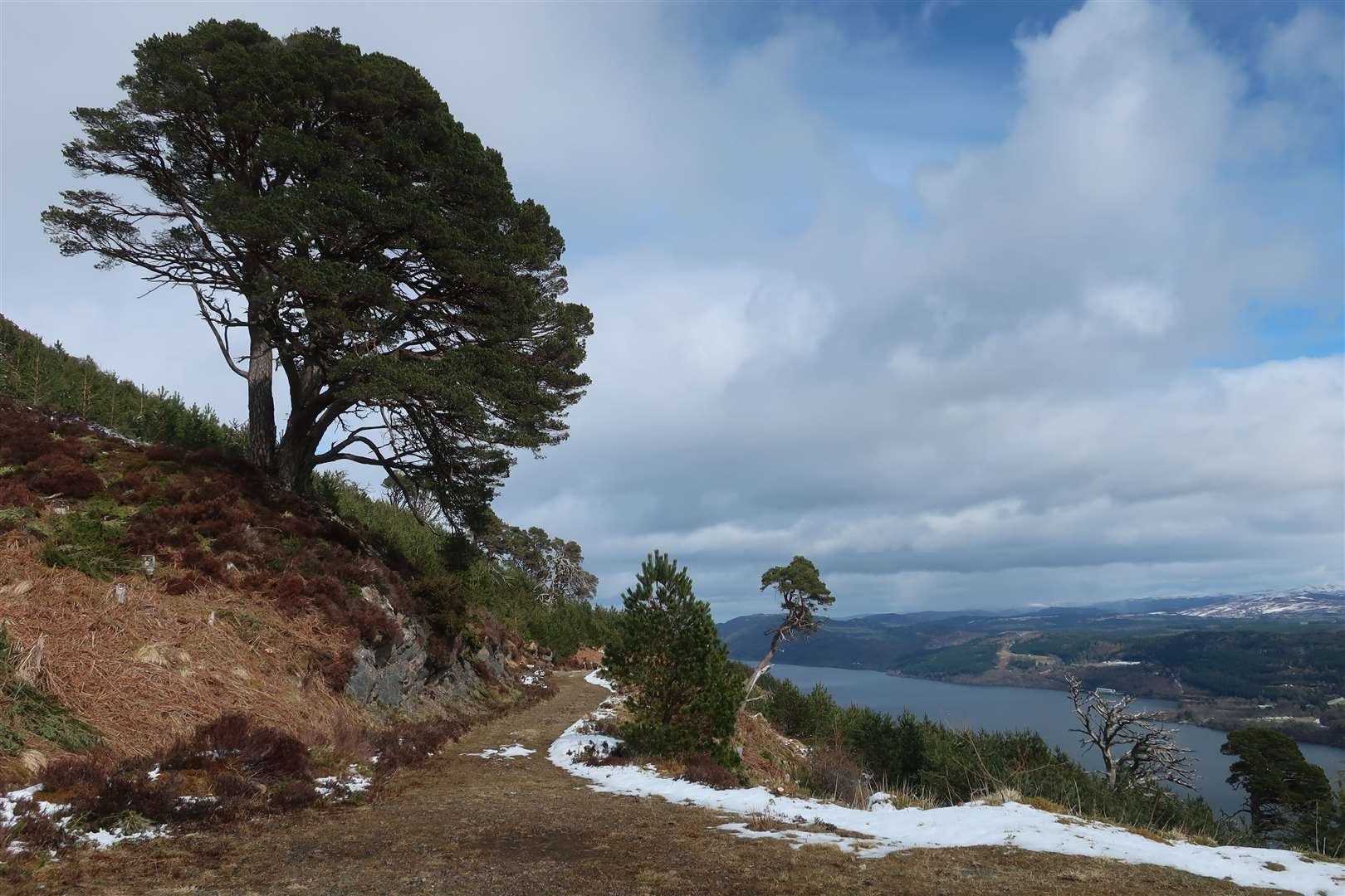
But it also features some elevated sections, especially once it journeys through the hills on the northern flanks above Loch Ness – and in particular once it climbs out of Drumnadrochit for its final section through Abriachan and on into Inverness.
The route
A host of guides and maps are available for those looking to tackle the Great Glen Way – including from major publishers like Cicerone.
The number of days it takes to complete the 79 mile route naturally varies depending on the individual walker's plans but it can be completed comfortably inside a week, and many will complete it in five or six days depending on whether they want to break some of the longer sections into smaller chunks or not.
This variation also extends to the route itself. Although it mostly follows low level routes that hug close to the Caledonian Canal and its various lochs, it becomes hillier once Loch Ness is reached. The final section heading north, from Drumnadrochit to Inverness, takes you high into the hills above the loch, but you can take to the hills even sooner by deviating onto the alternative (but still official and waymarked) 'high level' route between Fort Augustus and Invermoriston (and on beyond the latter village).
On your travels from one end of the full trail to the other you'll pass the likes of Gairlochy, Laggan Locks, Fort Augustus and Drumnadrochit. Those who wish to can also deviate into Invergarry by taking the Invergarry Link, which instead of following the old railway line on the south side of Loch Oich, runs on the loch's northern side before rejoining the main route at the Bridge of Oich.
And is it just a hiking route?
Although the Great Glen Way itself is a hiking route, its creation came as part of a wider Great Glen Ways project that was designed to encourage people to explore the glen on foot, by boat and by bike.
As well as the hiking route, this wider project also included work on the Great Glen Mountain Bike Trails and on routes along the Caledonian Canal.
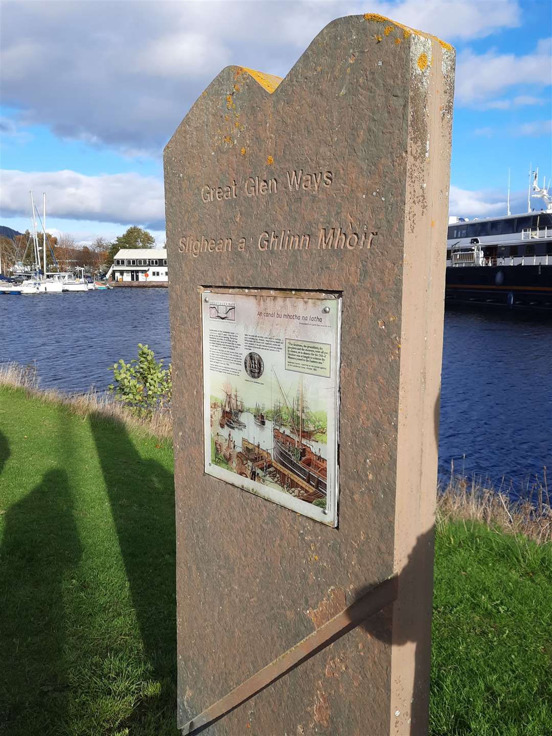
Indeed, the canal later opened the Great Glen Canoe Trail in 2012, giving outdoor fans another way to experience the glen under their own power. Naturally the canoe trail doesn't terminate at the castle but on the canal, which has its own standing stones marking its northern and southern entrances as well as numerous others along the way.
And what is the marker at the castle?
The current Great Glen Way start/end monolith was installed at the castle on Monday, May 28, 2007 and replaced an earlier marker that had stood on the site since the official opening of the long-distance route in April 2002.
Its installation was part of a wider £200,000 project designed to increase and improve the number of public interpretation facilities along the Great Glen.
An identical stone marker was also installed at Fort William just a day later to mark the terminus at the other end of the glen, with a number of others already in situ at various locations along the Caledonian Canal by that date in 2007.
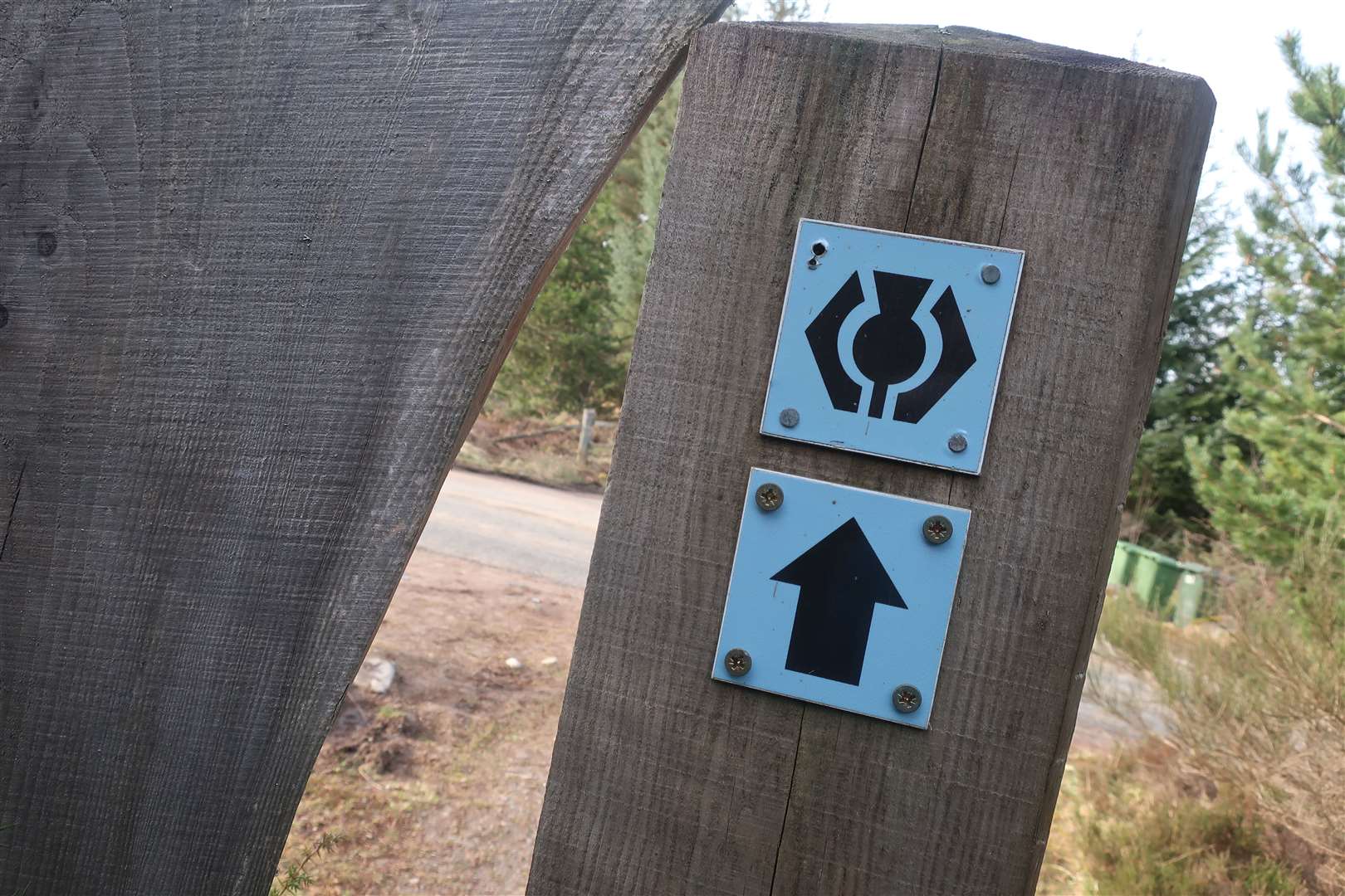
In total more than 30 large and distinctive timber structures were set up throughout the glen along with waymarker posts and 52 separate information and interpretation panels describing some of the history, archaeology, folklore and wildlife in the Great Glen.
The monolith's importance as a hiking landmark has been growing
When it was first installed in the grounds of the castle it served only to mark the beginning of the Great Glen Way (or end, depending on which direction you tackled the route).
But in more recent years it has begun to serve as the start and end point for numerous other long-distance hiking trail routes.
Although the South Loch Ness Trail – which stretches down to Fort Augustus on the south side of Loch Ness – technically starts/finishes at Torbreck on the outskirts of the Highland capital, many a walker chooses to extend their route into the very heart of the city at the castle.
This has become even more common in recent years after the trail, which initially only ran as far south as Loch Tarff, was finally extended into Fort Augustus – where it links up with the Great Glen Way.
That new connection to the Great Glen Way helped to create an entirely new long-distance route – the Loch Ness 360°.
Doing exactly what it says on the tin, the Loch Ness 360° is a waymarked route that completely encircles Loch Ness, using the Great Glen Way and South Loch Ness Trail.
And as soon as that option opened up, the monolith marker became a key landmark on this third long-distance route.
What's more, the Great Glen Way's connection at its southern end to the West Highland Way at Fort William means some walkers opt to walk all the way from just outside Glasgow to Inverness via the two long-distance trails – making that monolith outside the castle an even more memorable sight.
And it's position at the beginning/end of the still evolving John O'Groats Trail is certain to only help cement its place at the heart of a whole host of long-distance Highland routes enjoyed by walkers of all ages well into the future.
Will you be one of the hikers to pose beside it at the start or end of your own walking adventure, and what form and route will that adventure take?
More Active Outdoors news and routes.