A winter hike up the Torridon Corbett of Sgorr nan Lochan Uaine
Register for free to read more of the latest local news. It's easy and will only take a moment.

FLASHBACK: After a spell of grim conditions in the mountains, John Davidson recounts a previous winter outing from the Active Outdoors archive
The giants of Torridon act as a magnet to hill walkers and mountaineers from far afield, so much so that smaller hills like this one are often bypassed with little thought.
Sgorr nan Lochan Uaine is a wild hill, a fairly high Corbett at 871m (2860ft) situated between Glen Torridon and Achnashellach.
Its summit is accessible via a good stalkers’ path from the Ling hut then some climbing on rough ground.
One advantage of heading for these hills is the views to those more popular Munros of Beinn Eighe, Liathach and Beinn Alligin, as well as the real sense of wildness on the largely pathless terrain on the tops.
We’d originally planned to take in its neighbouring summit, Sgurr Dubh – another Corbett, although lower at 782m (2565ft) – but fading light after a testing start to the walk made us reassess our route.
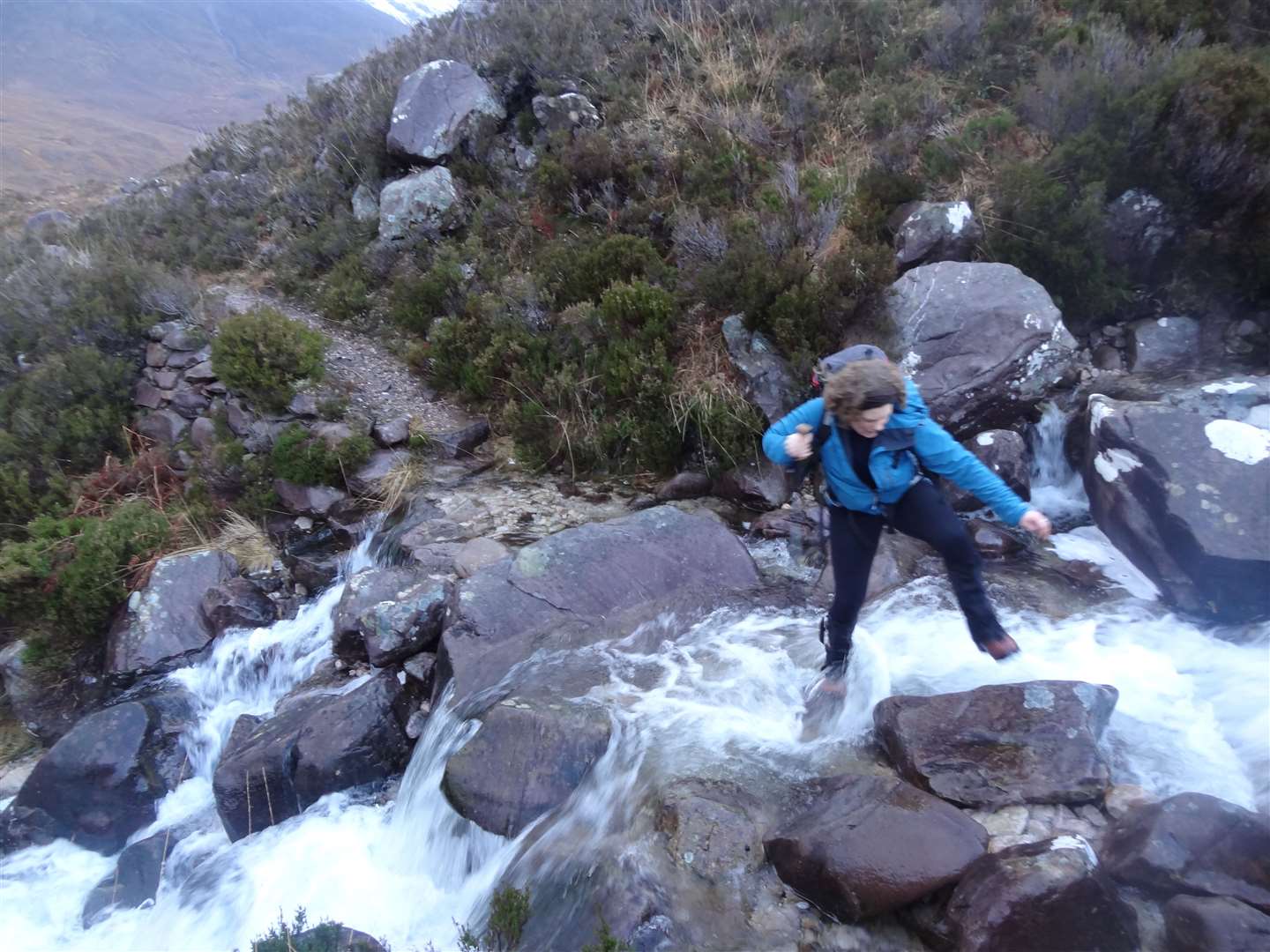
The stalkers’ path, well made as it is, involves several burn crossings and after persistent rain these were not as easy to negotiate as we had anticipated.
Thankfully our intrepid trio – myself, Peter and my cousin Rosie – all had walking poles which can be a real aid to such crossings, when care and attention are of utmost importance.
In some ways the weather was in our favour – reports of low cloud and showers weren’t 100 per cent accurate and luckily the low temperature wasn’t quite low enough to have covered the rocks with verglas as we needed to get a good grip in order to cross all the burns safely.
The path is accessed from the Coire Dubh Mor car park in Glen Torridon, a popular starting point for a circuit of the Beinn Eighe Munros on the opposite side of the glen.
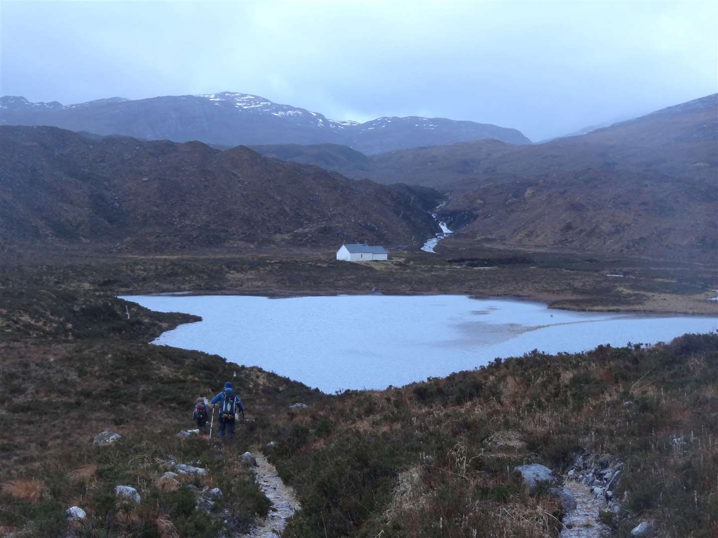
Cross the road bridge then go right onto a narrow path that crosses a small burn via a footbridge then passes Lochan an Iasgair to reach the Ling hut, which is owned by the Scottish Mountaineering Club, to access the hills.
After approximately 4km the path levels out – and peters out to some extent. We were able to make out the summit below the cloud so we planned a vague route, crossing the Allt nan Lochan Uaine and following the line of a tributary burn that leads to Sgorr nan Lochan Uaine’s west ridge.
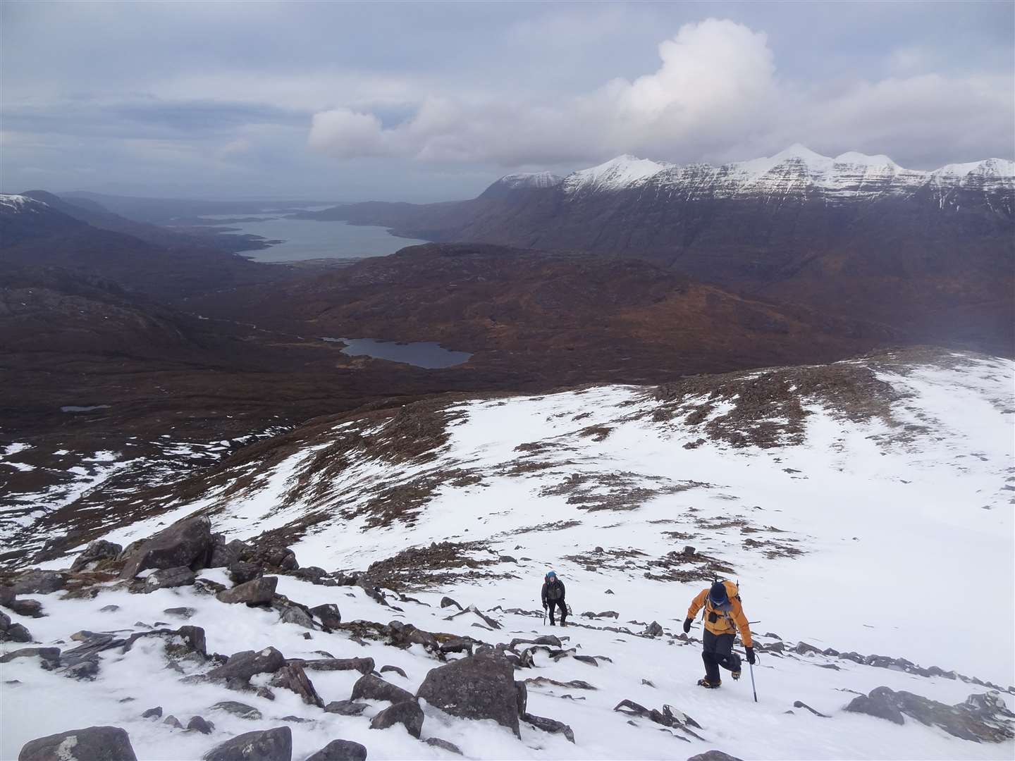
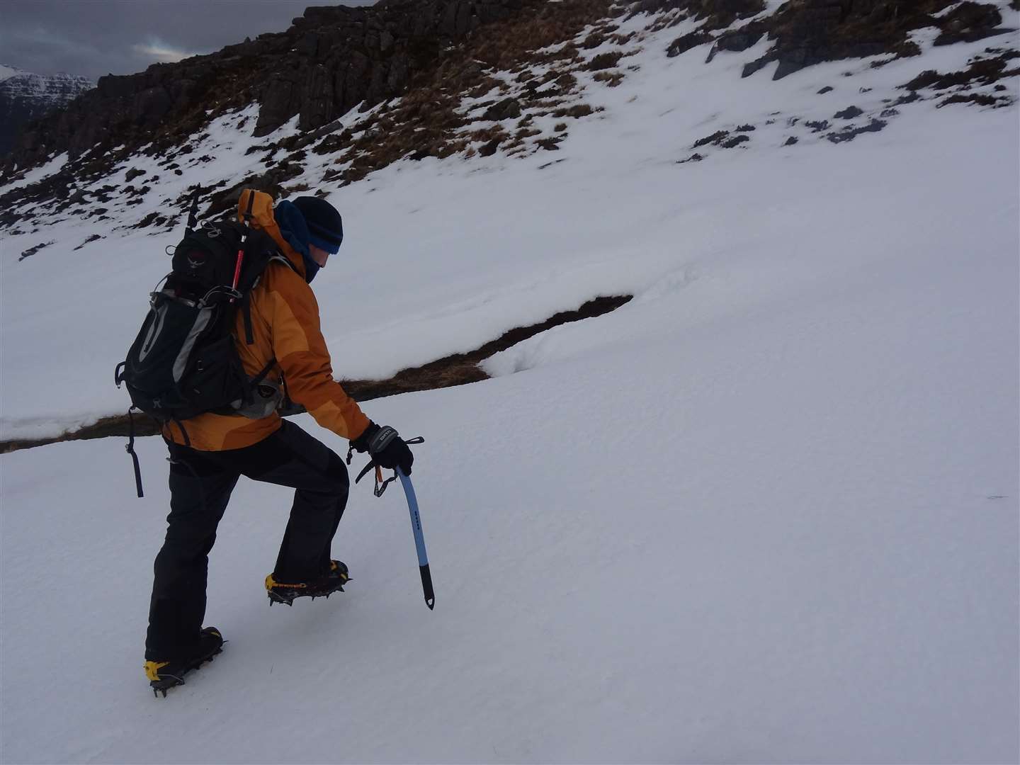
Higher up we entered the snow, patchy at first but with a good crisp top that meant we were soon getting the crampons out of our sacks and preparing for a real winter ascent.
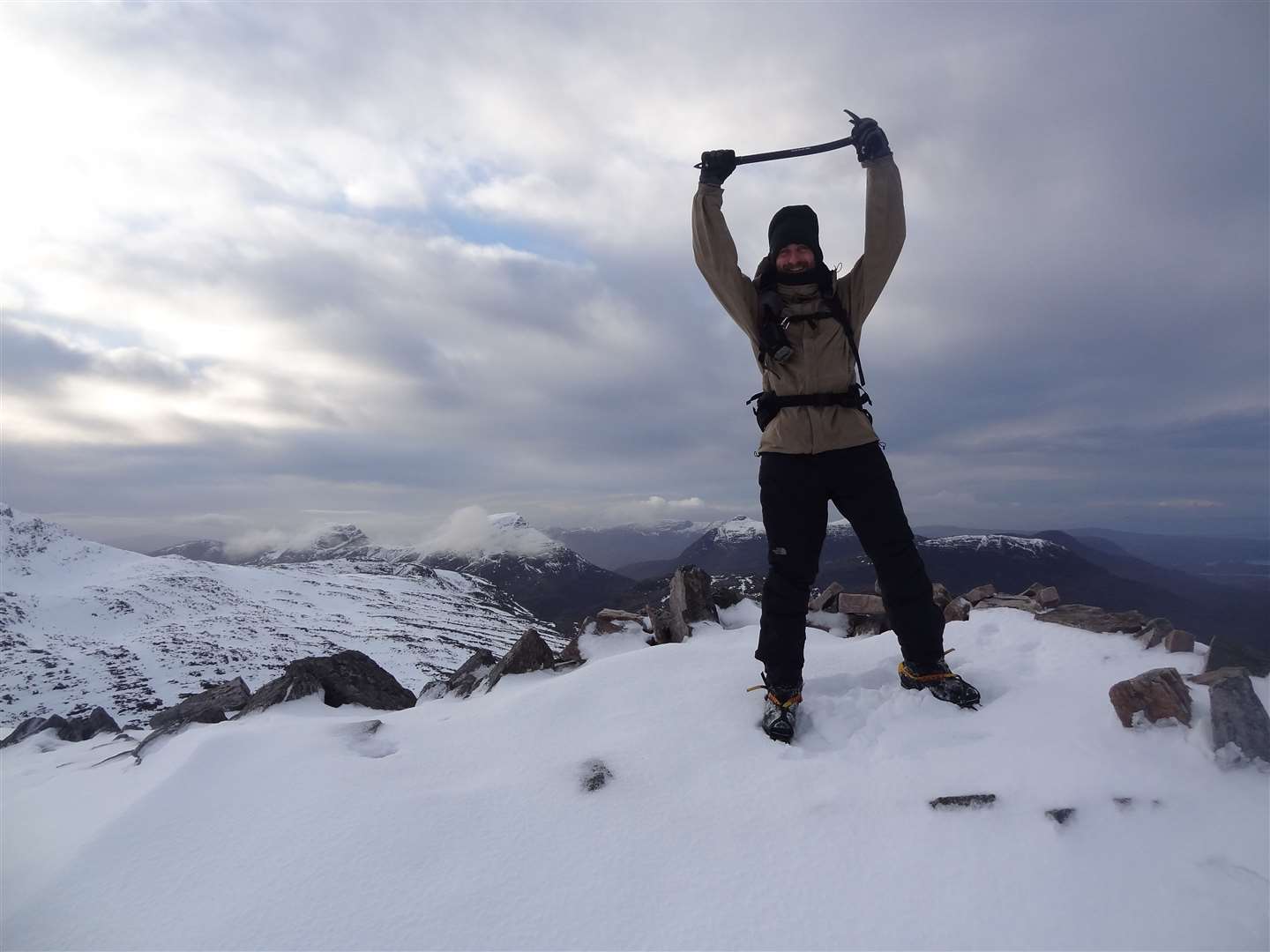
The cone-shaped summit was a joy to ascend, steep and icy allowing the points of the crampons to bite into the surface, so we made good progress to the small shelter that marks the top – though we found it filled with snow today and therefore little use.
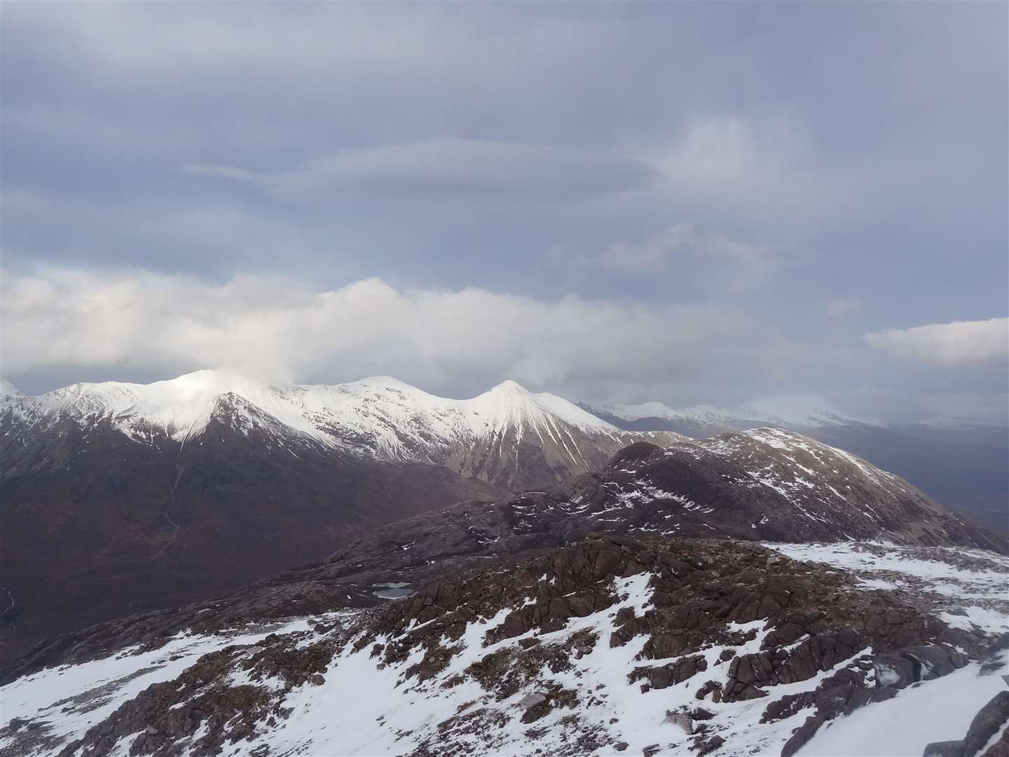
Well wrapped up against the cold, we stopped for a few minutes and enjoyed views over to Beinn Alligin, Liathach and Beinn Eighe, with Beinn Liath Mhor immediately to the south across the bealach which holds Lochan Uaine.
Between here and Sgurr Dubh the ridge is what the guidebooks like to call “complex”. It’s very difficult to navigate in mist or low cloud and pretty tricky even in good visibility. We descended past a few lochansu to the bealach at 596m, below the snow now and having removed the crampons.
Along the way down I’d almost gone through the snow into a hidden burn below, and even back on the heather and rock we were making fairly slow progress.
Combined with the fading light and the fact we knew the direct descent to the Ling hut from Sgurr Dubh involved some tricky ledges, we all agreed an alternative would be the more sensible option.
Back the way we’d come would have been shorter but those burn crossings would slow us down once we eventually reached the stalkers’ path. So we opted for the longer route via Coulin Lodge.
About 400m east of the bealach we should find another path which would lead us down to Loch Clair, from where an estate track takes you to the road in Glen Torridon, about 4km from the car park.
Staying just right of the burn at the lowest point on the ridge, we dropped down the slope and soon found the clear stalkers’ path, which was in reasonable condition, if a little boggy here and there. We were happy to have some easier terrain to follow as we made our way down, passing Loch Clair in the atmospheric fading light and looking across to Sgurr Dubh, a summit we will have to return to tackle another day.
The long walk along the road in the darkness was tiring but, we reassured ourselves, better than fighting our way down difficult slopes and across torrential burns. Safety should always come first in the mountains, especially in winter, and we felt we’d made the right choice as we dropped Rosie at the youth hostel – stopping only for tea and cake before making our way home through the darkness.
Route details
Sgorr nan Lochan Uaine
Distance 12 miles / 19 km
Terrain Stalkers’ path; river crossings; pathless mountain terrain; estate track, road
Start/finish Coire Dubh Mor car park, Glen Torridon
Map OS Landranger 25; OS Explorer 429
A change of plan leads to a long day on Torridon’s smaller peaks