


Wintry thrills on ride to stunning sea loch
Register for free to read more of the latest local news. It's easy and will only take a moment.

“Use alternative route in winter conditions” – so the sign halfway round this fine cycle warned.
The forecast had suggested an overnight frost and ongoing low temperatures, so I had decided to take the mountain bike despite this being an on-road circuit.
It was a wise decision. I reached the red warning sign after being pleasantly surprised that the road so far had been well gritted. “No gritting or snow clearance carried out beyond this point,” the sign added.
There was no going back now. The road ahead looked okay, and there was no danger of snow. It was a glorious sunny day, which made the autumn colours look spectacular wherever it shone.
I started the ride in Dornoch, following the first sign I saw to the free car park, which is situated on The Meadows, a right turn off the main road as you enter the high street (Castle Street).
Begin by going left along The Meadows, then turning right at the T-junction to reach Castle Street. Turn left then go immediately left again onto Sutherland Road, which soon leaves the village behind as it heads through Lonemore to Cuthill, where it sweeps to the right and crosses the River Evelix on the first of many fine little stone bridges on this ride.
Carefully go right onto the A9, which you follow for almost a mile until a left turn towards Lairg and Bonar Bridge on the A949.
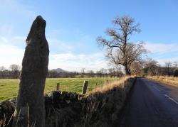
This is a much quieter road with wonderful scenery as it heads inland parallel to the Dornoch Firth, wiggling its way up to Bonar Bridge. There’s a standing stone – marked on the OS map – by the roadside after a great little downhill section.
After a gentle climb up to Spinningdale drop down through the S-bends and slow down for a narrow right turn signposted to Migdale.
From here the circuit gets even quieter as it follows a single-track road up this pretty glen, soon climbing past the popular walking spot at Loch Migdale through the lichen-clad trees.
Eventually I emerged into the sunshine again, with views ahead to some of the higher Sutherland summits in the west. Ignore a left turn down to Migdale and continue to the crossroads.
Bonar Bridge is just a short way down the hill to the left, but our route goes right up the hill towards the remote Loch Buidhe. There were patches of ice at the extreme edges of the road here but otherwise the surface was reasonable and the views to the forest ahead spectacular.
I could see the road climbing past a house at Sleastary to the highest point on the route, at 188m above sea level. A short way past the house I saw the aforementioned sign, sitting ominously in front of a frozen puddle.
I continued, more cautiously than before, up to the high point then dropped round the corner to the beautiful Loch Buidhe, bathed in sunlight – unlike much of the road which was white with frost for long stretches.
Thankfully the frost was dry and it was safe to pedal on with care, give or take one or two slippery moments where the road wasn’t as well drained and water had frozen on the surface.
Beyond the loch, I began to descend gradually through the beautiful Srath Carnaig with a frost-covered winding road to concentrate on and a tumbling burn cascading down to my left. My hands were on the cold side now as I was sheltered from the sun on this side of the hill, but I was warmed by the stunning location.
Soon the Duke of Sutherland statue on top of Ben Bhraggie came into view and I knew I was nearing the coast again. But then I caught sight of a huge waterfall off the road to the left. It looked spectacular, as did the rickety footbridge crossing over the top of it.
I decided to pass on the option of doing the walk and instead continued carefully down a last steep stretch to a long straight which meets the A9 overlooking Loch Fleet at The Mound.
Turning right onto the A9 again, it’s only about 1km until you can escape the trunk road and enjoy one of my favourite cycling roads in the Highlands. Fork left at the sign for Embo and Dornoch and follow the minor road as it hugs the shore of this stunning sea loch.
The tide was out as I enjoyed my cycle, watching and listening to the birds as they fed and called through the cold clear air. Further on a number of seals were basking on a sand spit as another swam to meet them. Meanwhile, an oystercatcher and a heron sat on their respective rocks as I pedalled on, seeing Littleferry across the narrow entrance to the loch.
It always strikes me that a cycle and pedestrian bridge here would make a fabulous link between Dornoch and Golspie, as well as providing a way for Land’s End to John O’Groats cyclists to steer clear of the A9 for a huge stretch between the Dornoch Firth Bridge and Golspie.
Follow the road as it bends right and heads south, passing the turn-off for Embo before finally returning to Dornoch. In the village, turn right onto Castle Street then go first left before the jail, passing the public toilets before taking the next right onto The Meadows.
Then it’s a short ride past the Historylinks museum and the fire station to the car park.