


Balintore to Rockfield walk full of coastal surprises
Register for free to read more of the latest local news. It's easy and will only take a moment.

It was the last throw of the dice for summer – a warm day with no rain forecast, and let's face it, they were pretty rare this year.
A seaside stroll seemed like a good idea, so Rosemary and I set off to Balintore, one of Easter Ross's pretty seaboard villages, with the aim of getting to Rockfield, just over eight kilometres away on the coastal path.
The Seaboard Centre, a modern community hall with a café, was our starting point in Balintore. From the car park opposite we walked towards the sea, behind a children's playground, to join a path that runs along the back of the houses, parallel to the main street.
I must admit, on a day like today I envied the residents, whose back gardens overlook the sea, and many of them have created places to relax and enjoy the view.
The path leads through Hilton of Cadboll to emerge on Lady Street, where a left turn at the end of the street is followed by a right, leading to the footpath sign for Rockfield and the Cadboll cliff walk.
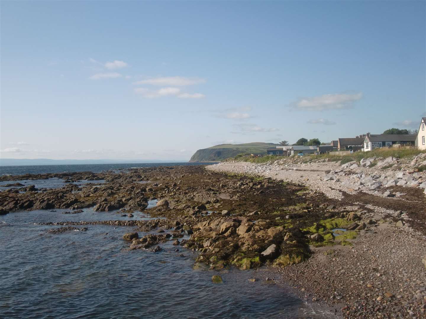
A broad grassy track stays close to the sea, with the coastline stretching out ahead. A sandy beach is reached, popular with dog walkers, then a former salmon netting station – the first indication that by the mid-1900s salmon fishing rivalled catching herring and white fish for seaboard folk.
The level track continues with cliffs on the left, and soon another salmon station is passed – this time in the form of a rather utilitarian-looking concrete bunker.
After a breezy start the air was warming up now, and with no concerns about navigation or changes in terrain, we could concentrate on the seascape and watching the birds. There were the usual seabirds of course, while stonechats scolded us in the vegetation and the odd pied wagtail caused amusement dodging about after insects.
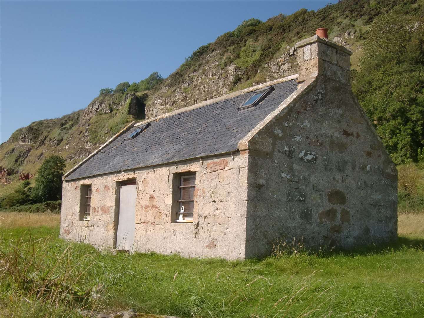
Further along, the path passes through a drystone wall with another salmon bothy just beyond – this one slate-roofed and intact but with the door blocked.
Continuing, the path turns slightly left and rises to circumvent an inlet, then returns to the shoreline.
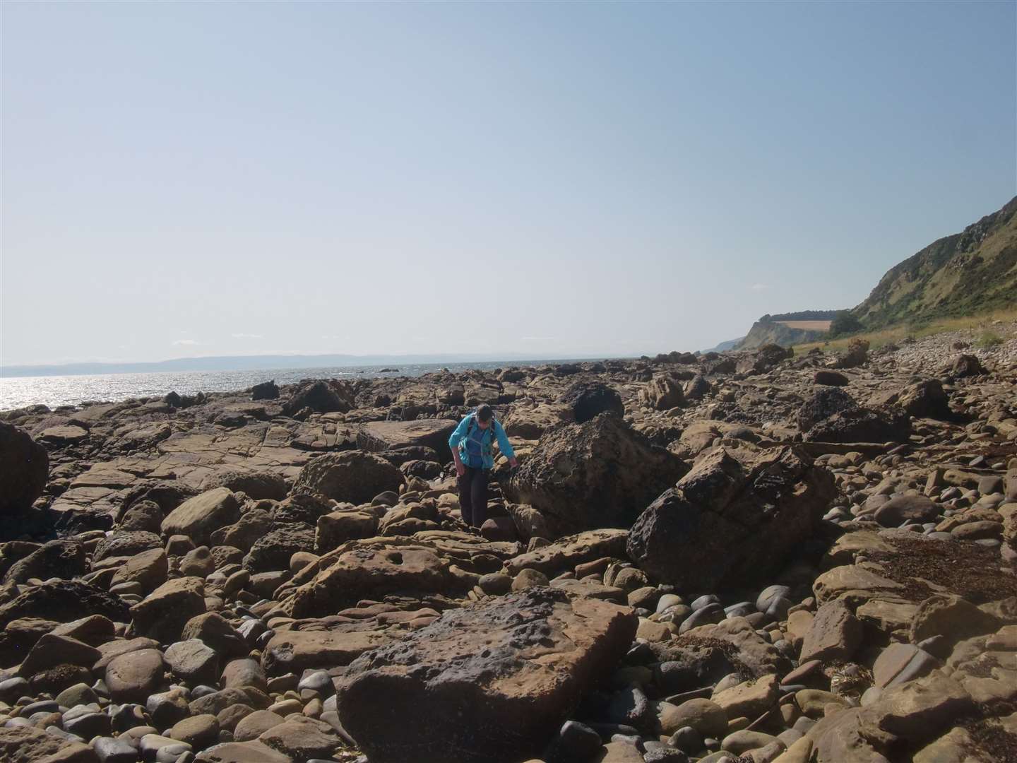
For some variety we veered off the path and took to scrambling through the shoreline rocks for a while, looking at the colours and shapes – at one point coming across a rock shaped for all the world like a human ear.
Back on the path, a diagonal track on the left comes down from the corner of a forestry plantation. Ignore this and carry on towards Rockfield. I'd decided to wear shorts, which proved not such a clever choice with patches of nettles lining the path, which I constantly had to flatten to avoid being stung – not entirely successfully. Ouch!
The route arrives at a Tarrel fishing bothy – the fourth on this walk, showing just how important the trade was to local people. If you're fortunate, dolphins, seals and even whales can be seen off this coast, though we saw none today.
Staying on the shore path, we could see Rockfield ahead and arrived there after walking through sheep grazings, sealed off by a variety of fences and gates.
Rockfield lies on the Tarbat peninsula and buses run from Portmahomack, one-and-a-half kilometres north along a minor road, but services are few and far between and careful planning would need to be done if you feel like a ride back to Balintore. My research suggested a bus from Portmahomack to Tain, then another from Tain to Balintore, with an hour's delay between them.
We were sorry to see the Stardreme café in Rockfield closed for the day. The proprietors were sunning themselves outside and told us that was the first break they'd had in months, so we couldn't begrudge them that.
We had made up our minds in advance to walk back to Balintore and got there to see a group of children playing in the sea – not a bad way to end your day after you've come home from school.


Route details
Balintore to Rockfield
Distance 10 miles / 17km
Terrain Level coastal path
Start/finish Car park opposite the community centre in Balintore
Maps OS Landranger 21, Dornoch & Alness; OS Explorer 438, Dornoch & Tain
A coastal ramble with a link to salmon fishing in Ross-shire