


Coastal walks in the Highlands and Moray to mark the start of Scotland’s year of coasts and waters
Register for free to read more of the latest local news. It's easy and will only take a moment.

Water, water everywhere – those of us who enjoy the great outdoors in Scotland will know from experience that there is usually plenty of the wet stuff around. That’s why we’ve decided to join in with VisitScotland’s 2020 celebration as the year of coasts and waters.
We’ll be heading for the coast, trying our hand at some watersports, discovering hidden lochans in the hills and maybe – just maybe – donning a wetsuit to try out some wild swimming.
Almost every route we do will have some connection to Scotland’s coast or inland waters, whether that be visiting a golden beach, looping round a loch or following a canal – on the towpath or even by boat.
To get us going at the start of the year, here are a few suggestions for coastal walks to enjoy across the north of Scotland.
Moray Coast Trail
The Moray Coast Trail is a 50-mile long-distance route that links Forres with Cullen, passing through the coastal villages of Burghead, Hopeman, Lossiemouth and Buckie on the way.
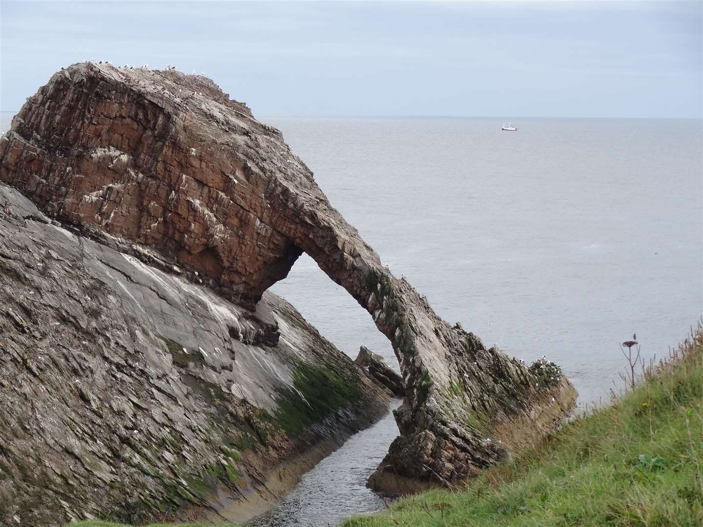
Don’t miss Portknockie with its fishertown harbour, Pictish fort and – just east of the village – the magnificent Bow Fiddle Rock, which is often teeming with birdlife.
The trail’s terminus in Cullen is a great place to visit too, with a glorious sandy beach, terraced fishertown cottages and the village’s centrepiece – the railway viaduct, now part of a cycle route along the coast.
Brora to Golspie
This is a coastal walk that’s full of interest, with plenty to see on the way. It’s almost seven miles each way, so it’s best to catch a train or bus back to your starting point.
Starting at Brora gives great views ahead to Ben Bhraggie, where the statue to the first Duke of Sutherland stands above Golspie.
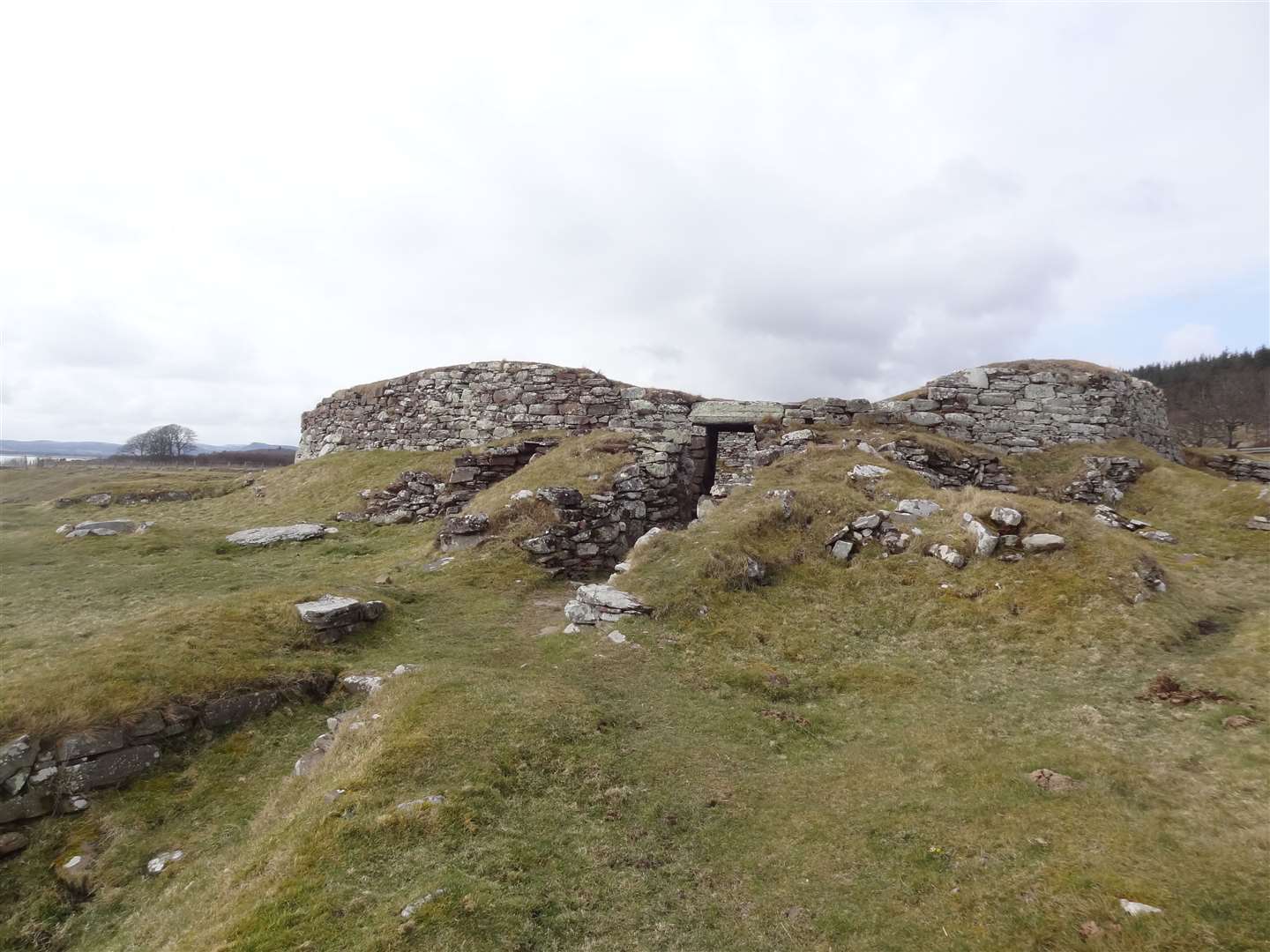
At the north end, the route begins near Brora’s old harbour, following the beach and a high-tide path most of the way. Highlights along the route include the Sputie Burn, which spills beautifully onto the beach in a little waterfall, the well-preserved remains of an Iron Age broch at Dun Liath and the fairytale castle at Dunrobin.
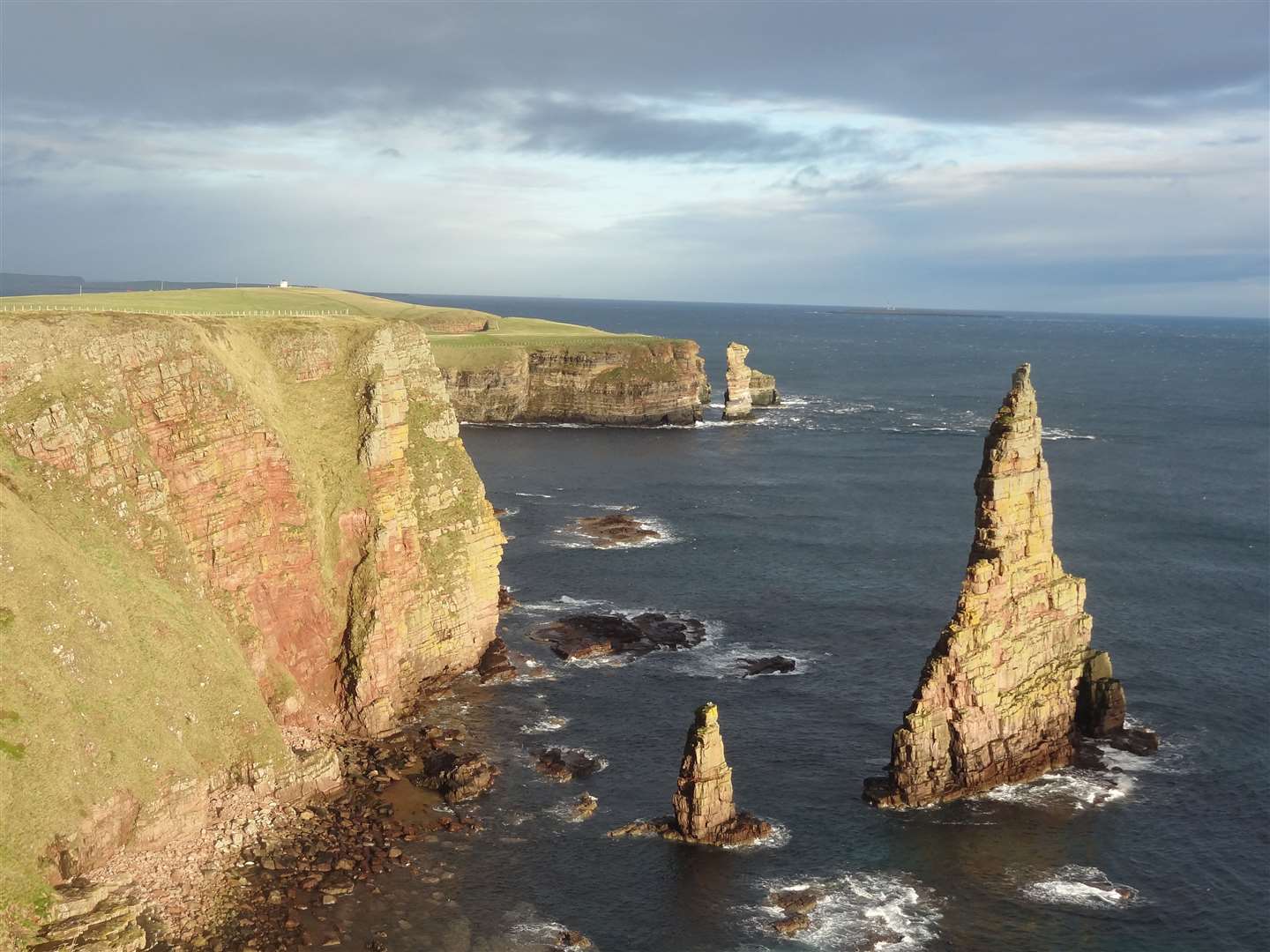
Duncansby Stacks
The path from the road end at John O’Groats to the lighthouse and spectacular sea stacks at Duncansby is well worth following.
As you’d expect from a path exposed to the forces of the Pentland Firth, there has been some erosion over the years, but this same erosion has caused the incredible features along the way.
These range from little inlets, known as geos, to sandy bays and of course the stacks themselves, which rise out of the sea like giant arrowheads.
You can return the same way or via the quiet road that leads to the lighthouse – or there’s a longer, more complex return route outlined in my Walking and Cycling in the Highlands book.
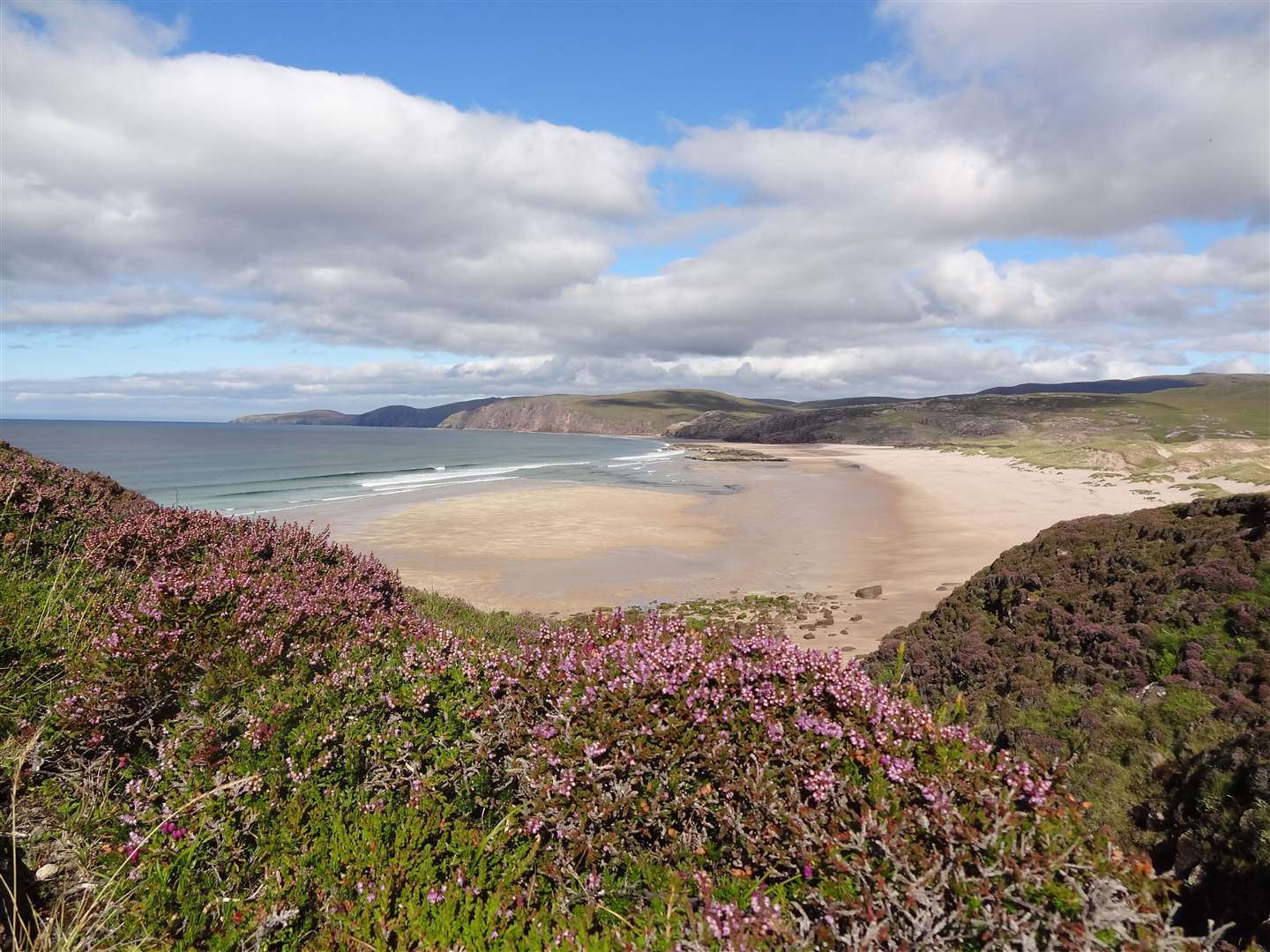
Sandwood Bay
Myths and legends surround this beautiful bay with its two-kilometre-long sandy beach near the north-west tip of the British mainland. It was reportedly the last place in the country where a mermaid was spotted – make of that what you will.
However, a trip to Sandwood Bay is well worth it. There’s a well-maintained path from Blairmore, beyond Kinlochbervie, that heads past a number of lochs to reach the beach just over four miles away.
Long-distance walkers pass here and continue north to Cape Wrath across pathless country, some of which is owned by the Ministry of Defence – but it’s easy to follow the path back or alternatively follow the clifftops for a while before meeting the path at Loch a’ Mhuilinn.
Inverness
The Highland capital may not have the same attraction as the north-west, but a walk from the city centre – heading from the river to the Caledonian Canal at Muirtown, then out to the sea lock at Clachnaharry – makes for a great little outing.
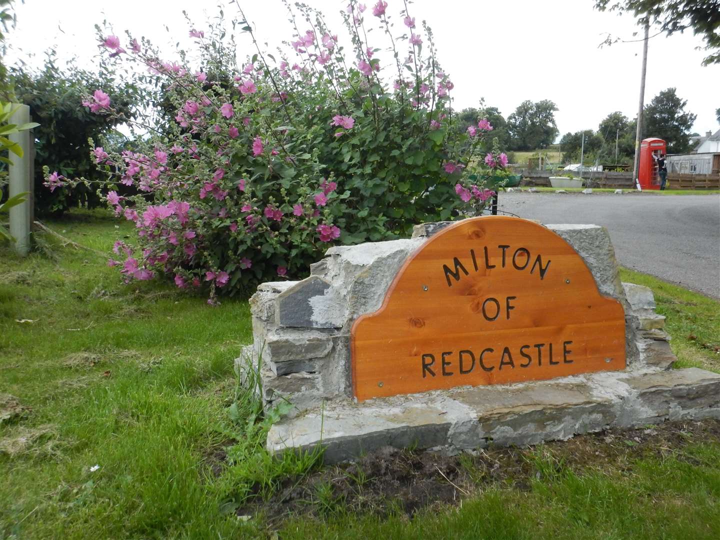
You can also get up high for a great view of the Beauly Firth from the old fort at Craig Phadrig, or head over to the Black Isle and enjoy a stroll along the shore-side road between North Kessock and Redcastle, where there is plenty of wildlife to be spotted.
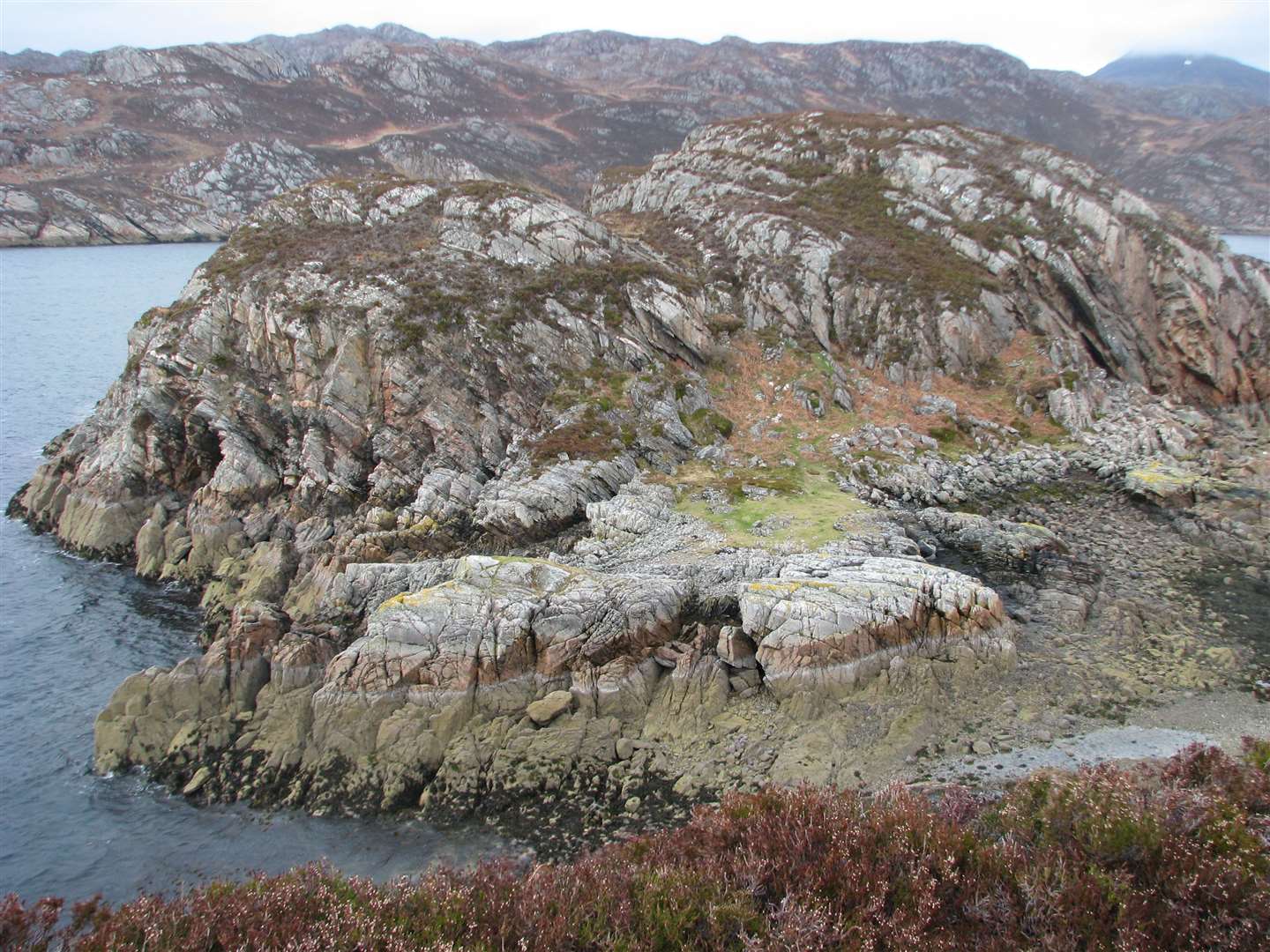
Shieldaig peninsula
This lovely route leaves Shieldaig village to explore the peninsula that juts out into Upper Loch Torridon. It can be rough going in places, with some rocky sections to negotiate, but it is less than three miles long and the views can be special on a good day.
You’ll see the loch with the Torridonian giants of Beinn Alligin and Liathach as its backdrop. There are beautiful hidden bays, woodland areas, ruins and even a secluded house in its own idyllic spot by the shore.