Running circles round the Ring of Steall
Register for free to read more of the latest local news. It's easy and will only take a moment.

The alarm going off at 6am on a day off work is always hard for the first couple of minutes but as the midsummer sun also urged me awake from behind the curtains I was pleased I’d packed the night before in readiness for a day trip over to Fort William to tick off one of my bucket list mountain runs – the Ring of Steall in Glen Nevis.
Arriving in the glen just after 9am, the Lower Falls car park was still quiet, allowing me to bag a parking space with some shade. Most route descriptions suggest starting at the upper car park, but I wanted to get the road section out of the way at the beginning, rather than have to endure a hot, tired plod at the end of the day.
I took the path on the right-hand side of the river. It was well surfaced and the undulations nicely loosened up my legs after the long drive. I crossed the river at a footbridge after just over a kilometre and joined the road up the glen until it turned into the well-worn path to the Steall Falls at a large car park. It was already busy here and I took my time along the path to allow walkers negotiating some of the trickier sections time to notice my arrival behind them.
To the right of the path the ground drops steeply towards the Water of Nevis and breaks in the trees give a view of the amazing rock formations sculpted by millions of years of water running through the gorge.
As the wood ended the world famous view of the Steall Falls, known around the world from the big screen, made for a dramatic entrance to the upper glen.
After a short wait for my turn across the wire bridge, I passed the bothy and carefully picked my way across the base of the falls. The efforts to keep my feet dry across the stream were soon rendered pointless as a field of unavoidable bog followed, with not just feet getting wet but, after one very ill-judged jump, my lower legs as I found myself knee-high in peaty water.
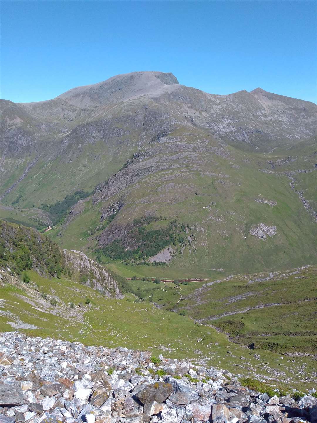
The path soon turned south to begin climbing steeply up the flank of An Gearanach, the first Munro of the day. After being initially badly eroded, the path then became an impeccably constructed stalkers' path, zigzagging upwards alongside the burn, and any need for a breather was perfectly justifiable, indeed much recommended, as the view back to Ben Nevis was spectacular.
The OS Landranger map shows the path swinging east before returning to the main ridge of An Gearanach but in reality it makes a much more direct, albeit steeper, ascent of the north ridge of the mountain. After a short, tough section the ground levelled off slightly to give the first view down to the right into Coire a’Mhail, the corrie that the Ring of Steall encircles.
The summit cairn arrived surprisingly quickly for once and while on the top I was treated to an unusual view from above of a fast jet flying low through Glen Nevis and turning sharply north, presumably to take in the Grey Corries on a high octane sight-seeing tour.
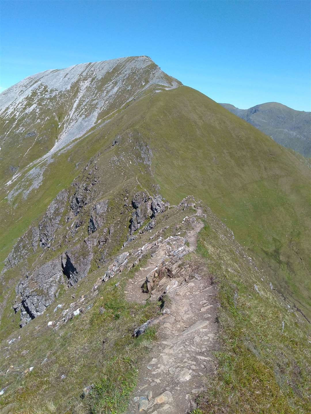
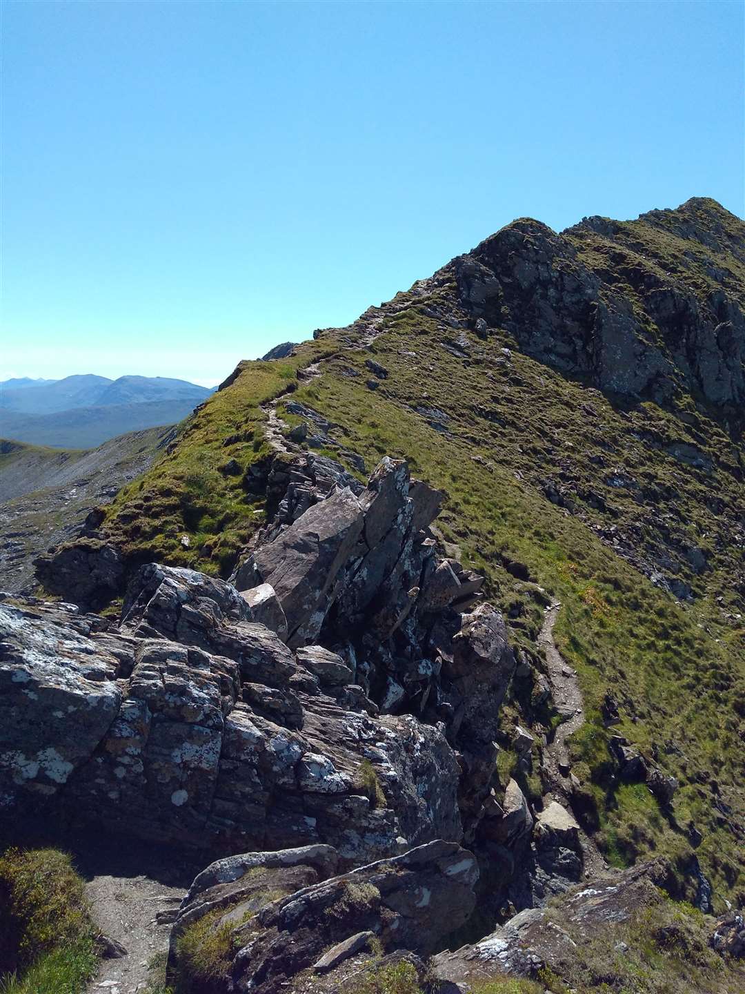
Just past the summit the ground changed and it was time to get my hands on the rock for a short scrambling section on the narrow ridge before the second top. The following descent to the next bealach was steep and loose but very enjoyable, with both brain and legs working hard.
Giving my quads a chance to recover at the base of the ridge, I checked the map to place the hills to my left, Binnein Beag being the easily recognisable outlier of the eastern Mamores that rise up from Loch Eilde Mor above Kinlochleven.
The network of paths along the ridges promised a whole plethora of mountain days and I made a note to be back soon to cover the ground.
The steep flank of Stob Coire a’ Chairn ahead couldn’t be put off forever but it was a reassuringly short climb to bag the second Munro of the day. The ground off the summit was less steep and made for fast, enjoyable running that ended abruptly at the base of the summit cone of Am Bodach.
A light northerly breeze was very welcome here as the high sun and cloudless skies made for hot work on the steep ascent. This climb felt tougher than the previous summit but the very easy sections of scrambling gave some interest and I was glad when a cairn came into view on the skyline.
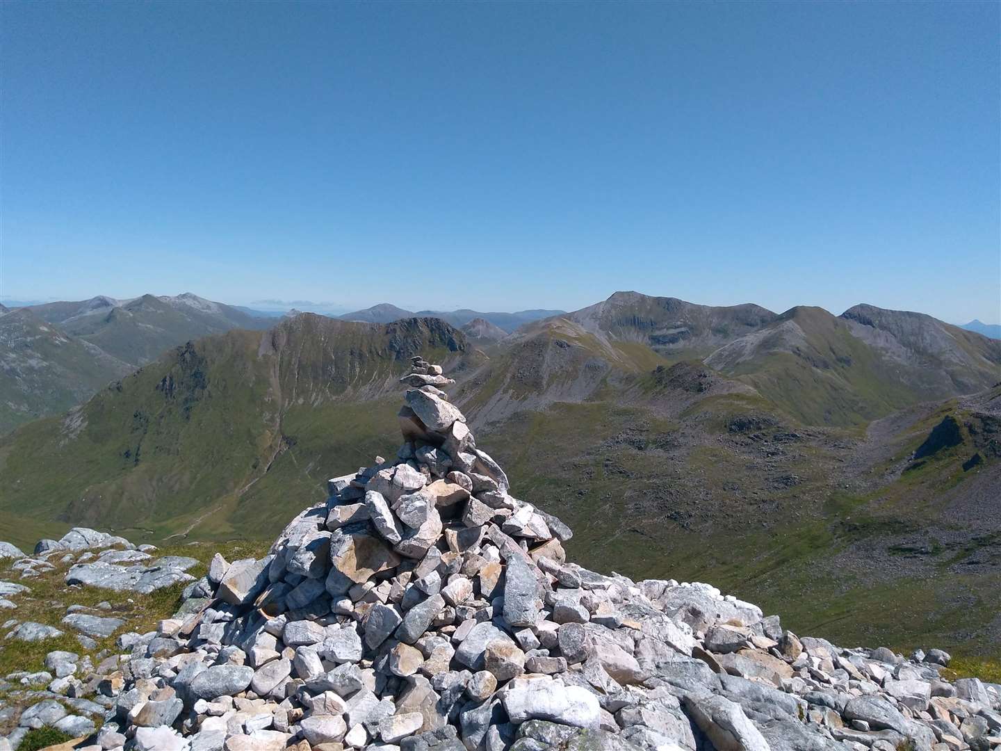
A second cairn further south on the small summit plateau was the perfect place to stop for a rest. The view across Loch Leven towards the Aonach Eagach and the Three Sisters of Glen Coe vied with the glistening waters of Loch Linnhe stretching away westwards towards the sea for attention.
From here, the next few kilometres along the ridge were relatively straightforward to achieve the only ex-Munro of the day, Sgurr an Iubhair. Although a top without status, the picturesque summit cairn gave a good viewing point of Stob Ban and the web of paths up from Glen Nevis and around the ridges.
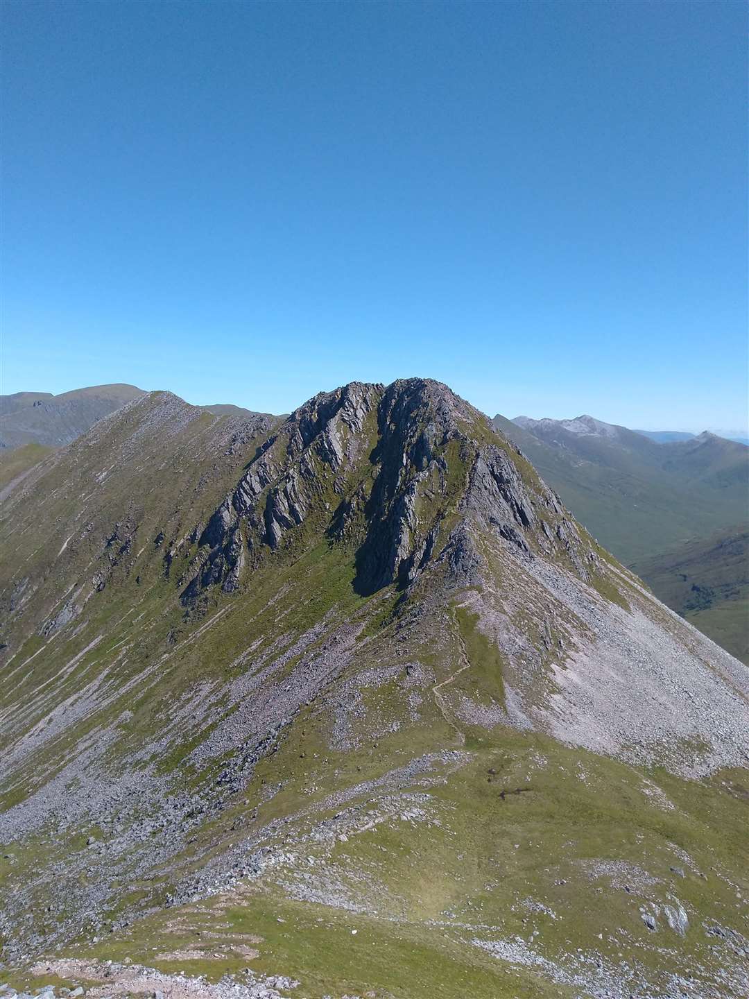
The last Munro, Sgurr a' Mhaim, now beckoned from beyond the Devil’s Ridge and as the view along the grassy arête appeared over a small crest, I knew it would be easy to forget the weariness in my legs.
The small rocky section in the middle of the arête gave a short, exciting scramble (most of the difficulties are avoidable but I like a quick shot of exposure!) and then it was the final short ascent to the grey summit dome of Sgurr a' Mhaim.
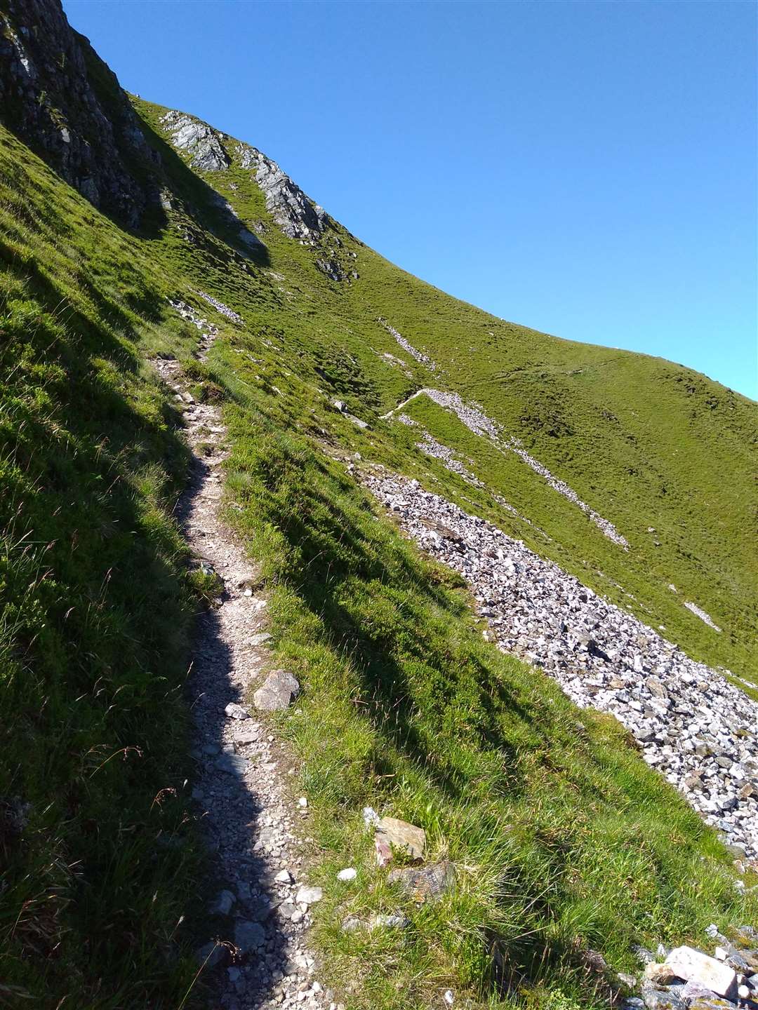
The clear air meant Glen Nevis looked enticingly close directly below and the loose scree proved fast, enjoyable ground for descent… for the first third of the hill. After this the path became eroded and with tired legs it was hard work to keep up momentum over the rough ground. The floor of the glen inched closer and a gate in a deer fence was a welcome sight as it meant the ground was finally beginning to level out.
Muddy and rough, but at a more conducive angle, the final section through the glen meant I was soon down at the riverbank. Making a beeline for the river, I waded straight in to find a suitable rock from which to dangle my legs into the cold water, effectively easing the ache from the punishing descent.
It’s great when a route you’ve had in your mind to do for a long time lives up to, and even exceeds expectations. There are no photos of me on the route as I had intended asking people I met along the ridges to take pictures – amazingly I hardly met anyone and was entirely alone for the main portion of the day, a real treat on such a deservedly popular route.
Route details
Ring of Steall
Distance 11 miles / 17.5km
Terrain Clear but rough paths, including some easy scrambling and exposed locations
Start/finish Lower Falls car park, Glen Nevis
Maps OS Landranger 41; OS Explorer 392; Harveys Ben Nevis Superwalker Map
A classic mountain circuit, with exciting positions and, on a clear day, spectacular views of the west Highlands – a challenging day with suitable rewards for the effort