Ride offers a flood for the senses – a road bike route from Nairn harbour to Dulsie Bridge using network of old military roads
Register for free to read more of the latest local news. It's easy and will only take a moment.

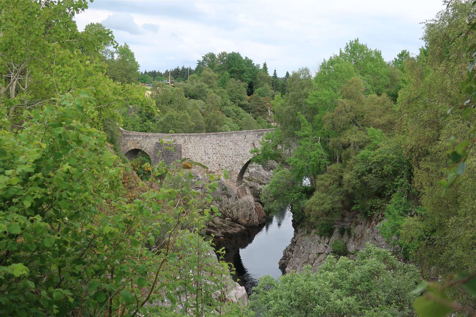
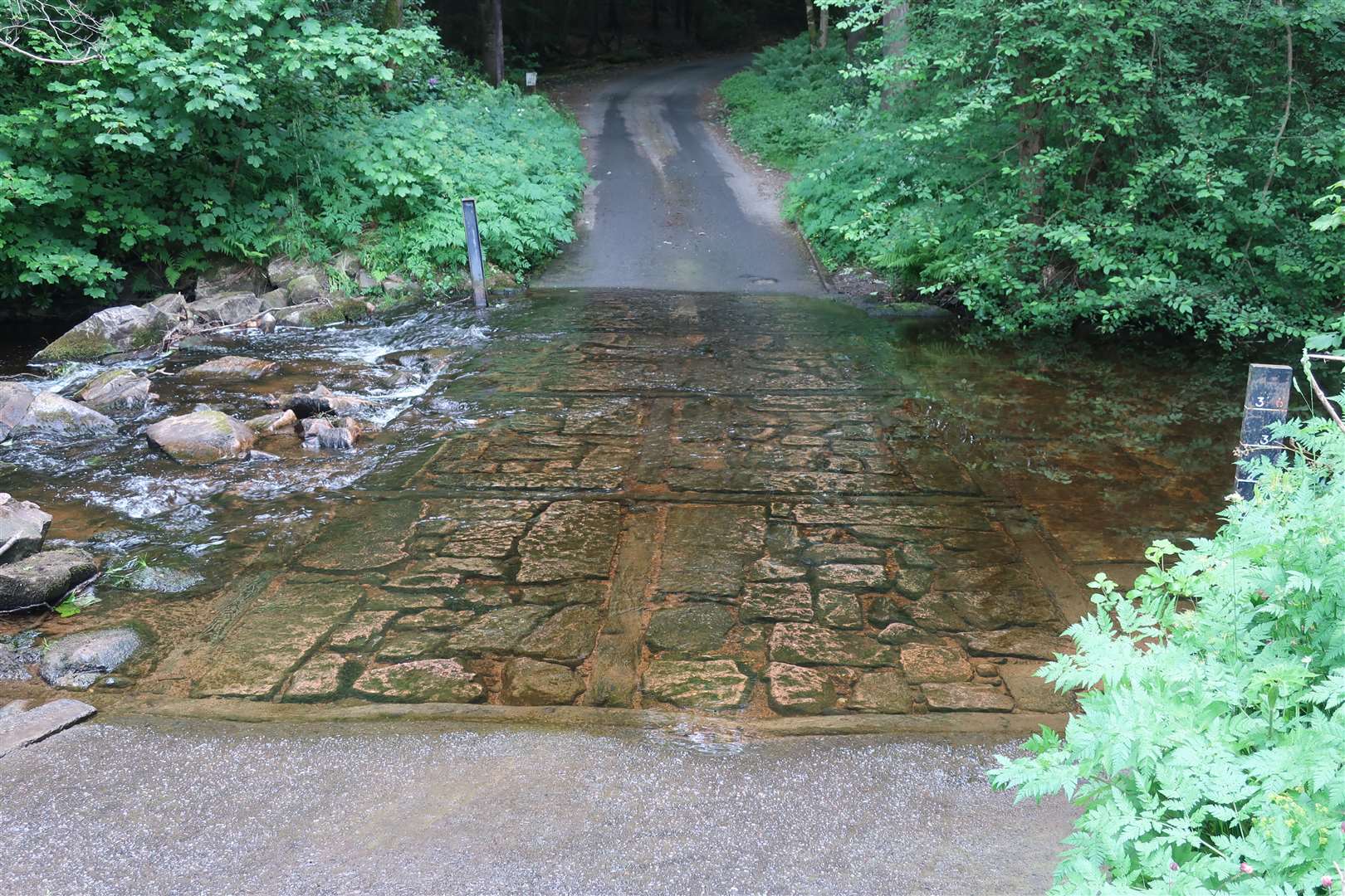
Dulsie Bridge survived the Muckle Spate of 1829, which wrought devastation on many farms and settlements as the river rose to 40 feet above its usual level.
The water reached within three feet of the keystone in the main arch, which seemed nigh-on impossible on this dry summer’s day as I looked on from the viewpoint.
The bridge was built in 1755 by Major William Caulfield, the successor to the better remembered General George Wade, as part of the military road network which helped to suppress the local populace in the 18th century.
For £150, this particular bridge has stood the test of time pretty well. It’s a great target to aim for on any road ride in the area, and I’ve enjoyed variations of this circuit for many years.
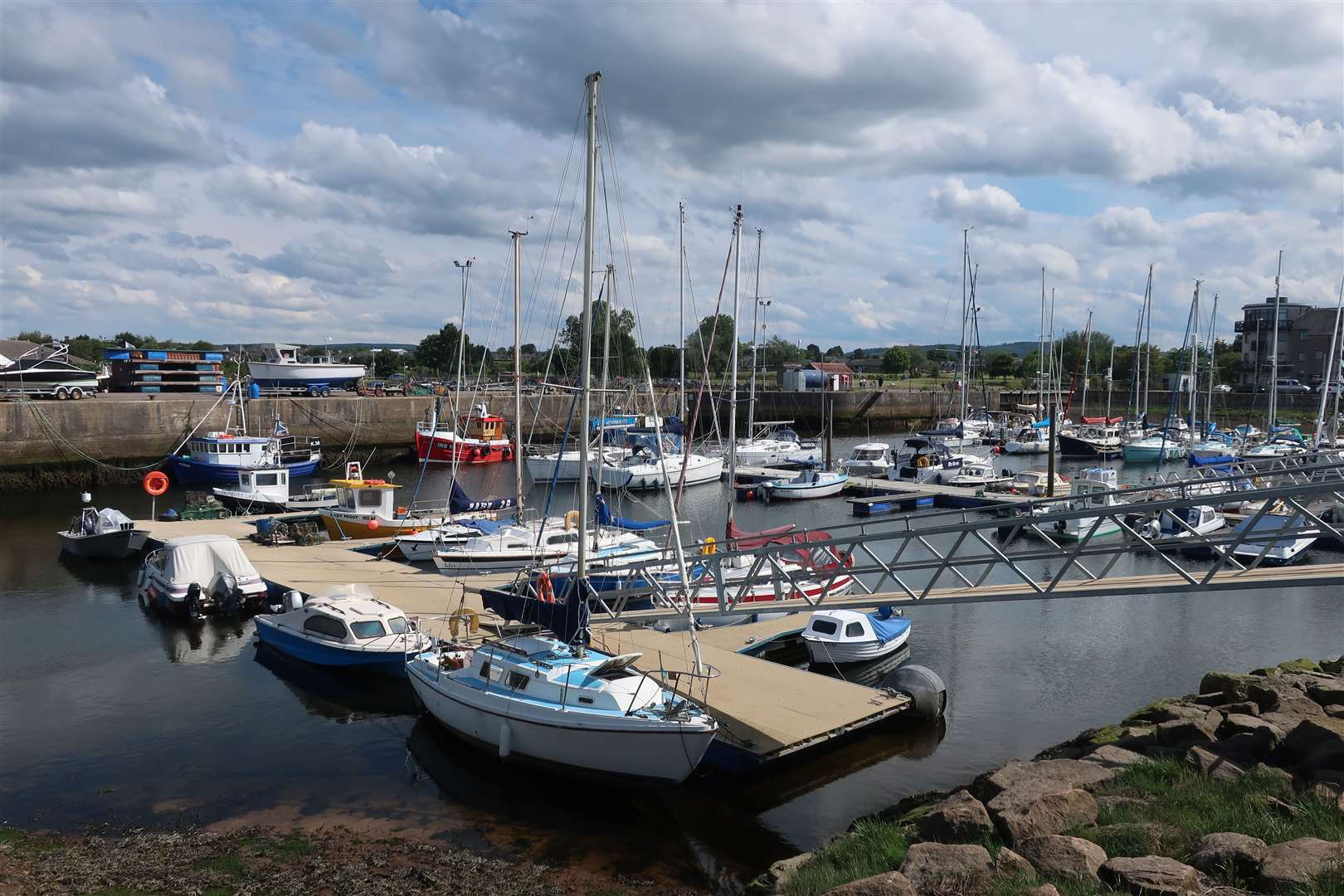
Starting at the harbour in Nairn gives a satisfying ascent into the hills to the south, and you are well rewarded on the return journey not only with plenty of downhill but, on a day like this, with fabulous views over the Moray Firth.
There’s parking at the harbour (for an optional donation) and I headed past the boats and went over the bridge onto the far side of the river. Go right onto a shared-use cycle path and follow the river upstream, continuing straight ahead where it joins the national cycle route.
This is a stretch to slow down and take your time on, as it can be busy with pedestrians, and it won’t be long until you’re on the open road in any case. Follow the route under the road bridge then continue under the railway before the route forks. Go left to follow the path out to meet the A939 Grantown road.
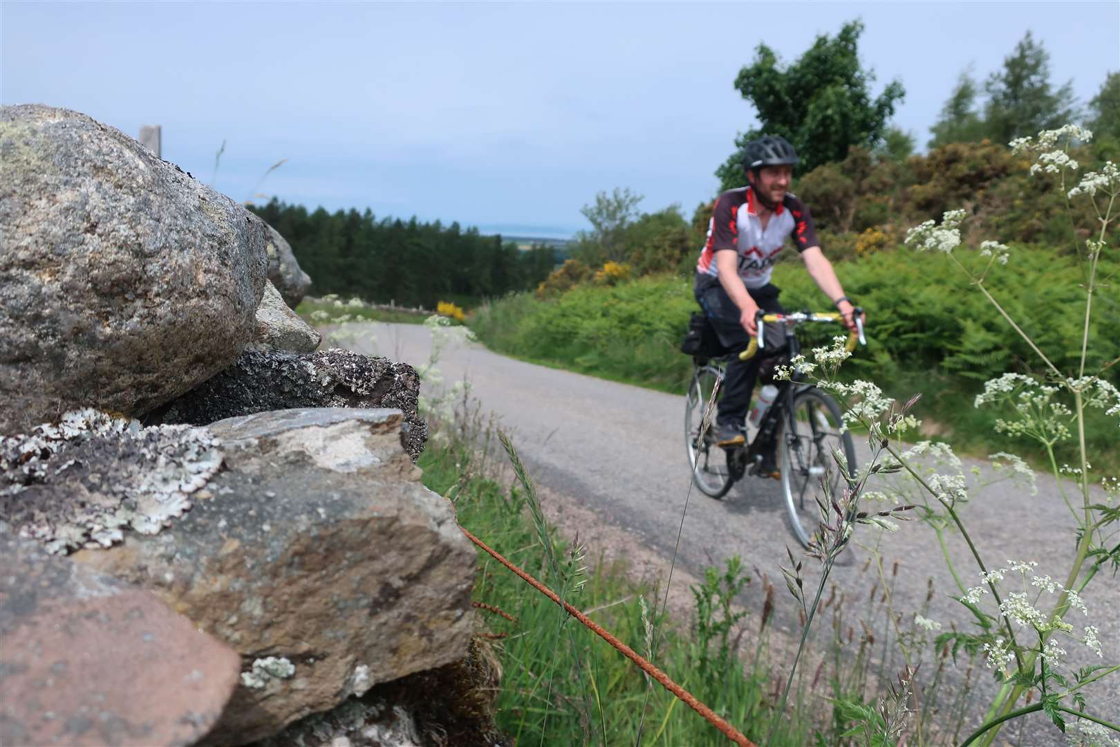
Turn right onto the main road for a few hundred metres then leave it to take a right turn at a 90-degree left-hand bend, still on national cycle route 1. We stick to this route for some time now as the climbing begins gently, going right then immediately left to cross the B9101 and continue through a series of small, scenic settlements.
If in doubt, just follow the blue route 1 cycle signs which soon lead you right at a junction near Mid Urchany, then left at a crossroads approaching Little Urchany. At the next junction, however, we leave the cycle route and instead turn left to pass Clunas where the climbing starts to intensify.
The roads here are fabulous and I’d barely seen more than a handful of cars as I approached the junction at Highland Boath, where Drynachan and Dalness are signposted 4.5 miles ahead. This exposed road crosses the moors and with a slight headwind and more ascent to come, I knew it was going to be tough for a while.
You are soon warned to look out for lambs on the road and, sure enough, there were plenty of them, leaping from side to side to be with their mothers as I approached. I looked forward to the shelter of the woodland I knew was ahead.
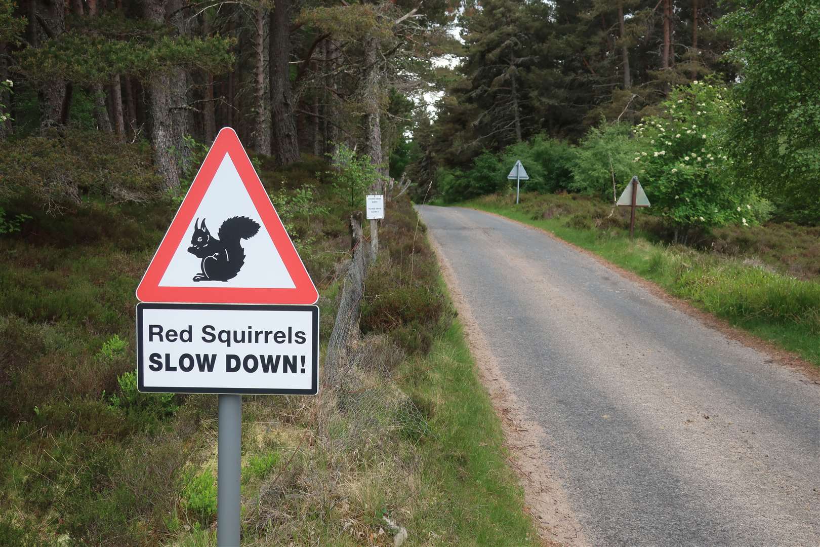
After a cattle grid, a sign warns of red squirrels and a great road starts to descend to Drynachan, straight at first then through tight hairpin bends on a very narrow road – it’s tempting to let some speed build up down here, but the thought of any vehicle coming the other way combined with the steep drop off the side means it’s not a place to take any risks.
At the bottom, take a sharp left turn and follow the road along the route of the River Findhorn, serene and peaceful along this stretch save for the odd fish surfacing today.
A steep climb follows as you move away from the river and head through the forest to a T-junction at Dulsie. Our route heads left from here but you can’t come this close and not visit the historic Dulsie Bridge, so I turned right and dropped down to cross the Findhorn by the two-arched structure that seems to leap across the water from rock to rock.
A short way up the other side, a picnic area offers a great view of the bridge if you follow the path a short distance behind some trees. It’s possible to get closer to the water by following the path further, but I still had a few miles to go so after a quick bite to eat I headed back over the bridge and up the steep incline back to the junction.
Going straight ahead now, ignore the first road off to the right, signed to Nairn, and instead take an unmarked junction right a mile or so beyond. Finally you get to enjoy some real descent now, and it was an easy ride with the wind behind and the sun on my back as I crossed the Muckle Burn to reach another junction.
It seems logical – and probably is – to go left here, but I went right to cross a dry ford over the burn and re-enter the forest. Ahead of me on the road was a red squirrel that leapt into the cover of the trees as I approached.
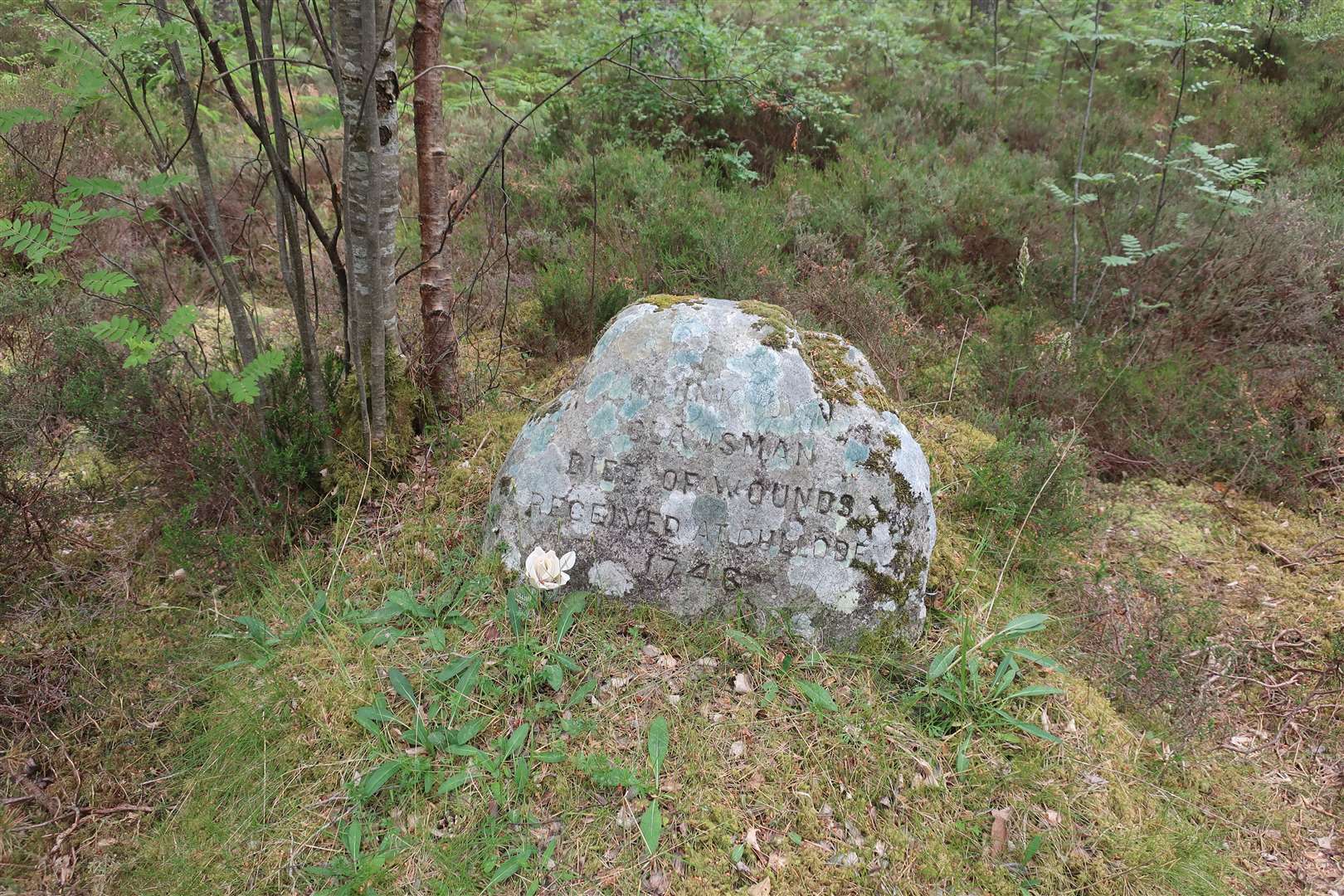
There’s a tight left bend in the road, and the OS map shows a grave here. The roadside stone commemorates an ‘unknown clansman’ said to have died here after succumbing to wounds received at the Battle of Culloden in 1746.
This road continues to reach the A939 again. I turned left onto the main road then took the first right back onto a quiet road that led to Fornighty. After passing the main house, fork left down a steep drop to a ford – but the footbridge to the left is definitely a safer option than this finely constructed ford for those of us on two wheels.
Beyond the burn, the road bends left then climbs to a junction, where we go right to continue uphill past the appropriately named Braeside. There was work going on in the fields here and I let a tractor coming out of a field get some distance ahead to avoid the worst of the dust and debris it was leaving in its wake, so that I could enjoy the descent I had just earned.
Bear left at Easter Arr and continue down towards Auldearn, ignoring a left turn on a bend but looking out, further down, for the unmarked left turn at Newmill that passes over a small bridge and past a number of nice houses and a couple of little lochans, at first obscured by trees.
This pleasant little road reaches the B9101 at Grigorhill, where you cross straight over to go down Granny Barbour’s Road – past a sawmill – to emerge on the Grantown road opposite where the cycle route heads back along the riverside.
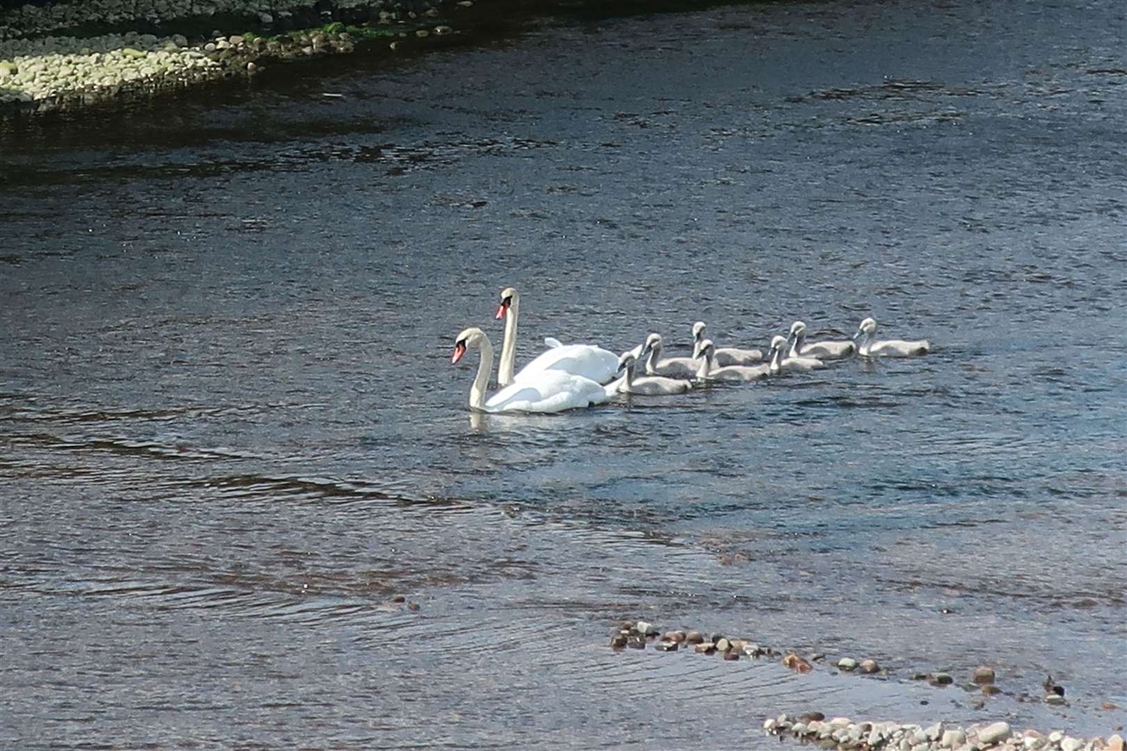
With plenty of people wandering around, I freewheeled gently most of the way back, to be welcomed by a family of swans with seven cygnets entering the mouth of the River Nairn as I crossed the bridge back to the harbour.
Route details
Nairn to Dulsie Bridge road-bike circuit
Distance 35 miles / 56km
Terrain Minor roads, short sections of surfaced cycle path, very short stretch on main road
Start/finish Nairn harbour
Map OS Landranger 27
From harbour to hillside on a ride through history