On the right path – Corrieyairack Pass
Register for free to read more of the latest local news. It's easy and will only take a moment.

Our series looking at historic paths across the Highlands continues with John Davidson's review of the Corrieyairack Pass from Laggan to Fort Augustus
Distance: 15 miles / 24km
Route and terrain: Garva Bridge to road south-west of Ardachy House, near Fort Augustus.
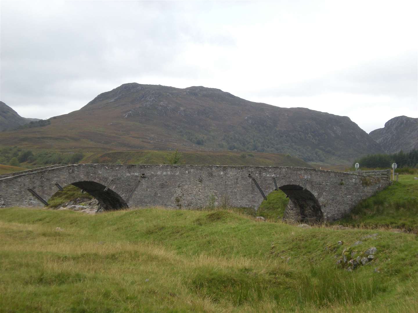
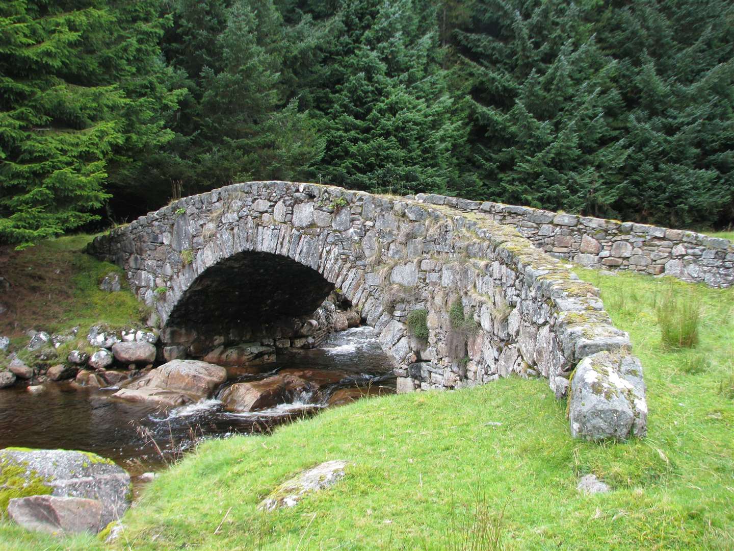
The impressive crossing at Garva Bridge built under the command of General Wade, who was tasked with building a series of military roads across the Highlands in the 18th century to help quash the Jacobite uprisings, is a fitting place to begin this virtual journey over the Corrieyairack Pass.
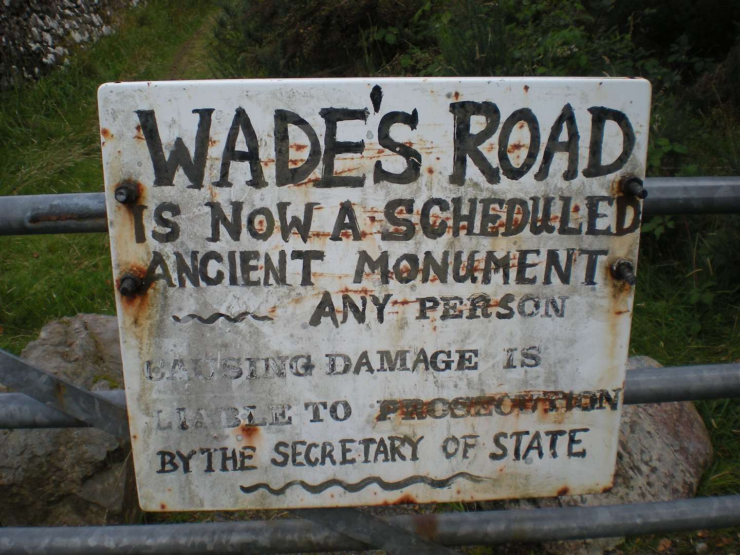
Unusually, this long stretch of military road is preserved as a Scheduled Ancient Monument, meaning it is a criminal offence to damage it.
Debates have raged over the years as to whether motor vehicles are legally allowed to use the ‘road’ but Highland Council has made clear that it is not suitable for that purpose – as well as the fact that untold damage would no doubt be done to this historic route if they were to drive on it.
The council also advises walkers to refrain from using shortcuts at the zigzags which are eroding the hillside.
From Garva Bridge, the road goes in a series of long straights for around 6km to Melgarve. A short distance up the burn just east of here, another bridge is hidden in the forest – Melgarve East Bridge was built under Wade’s successor, General Caulfield, after this crossing was originally left as a ford.
Another route, known as the Soft Road for the Hoggs, branches off south-west from here to reach Glenfintaig Lodge, north of Spean Bridge.
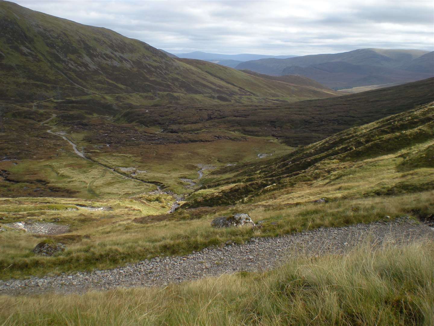
Continuing on the Corrieyairack route, Wade’s road leaves the Spey and begins to climb alongside the Allt Yairack, culminating in a series of 12 zigzags to its 775m summit, from where there are magnificent views on a good day – despite the presence of a line of pylons that detract somewhat from the otherwise wild setting.
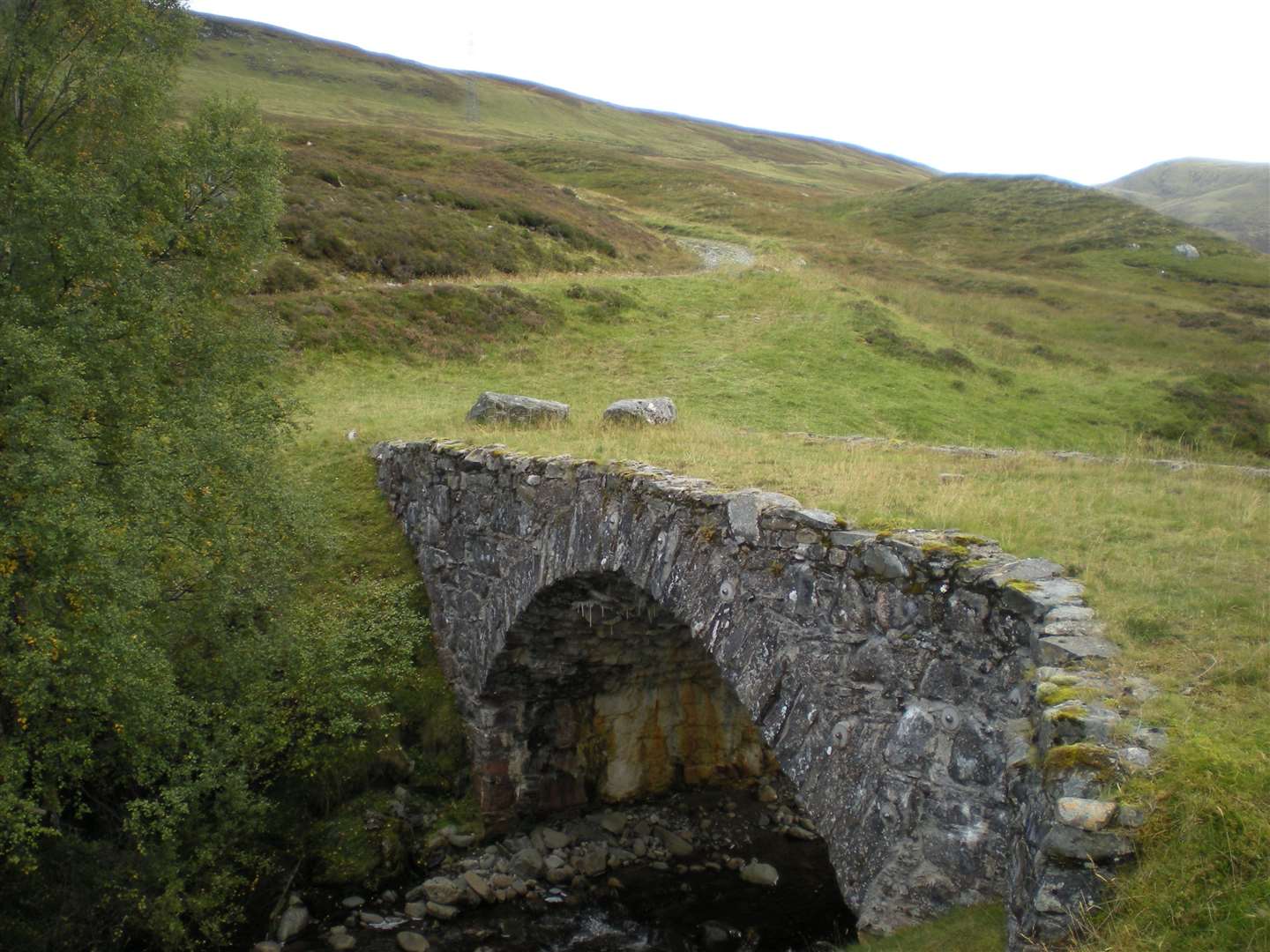
The descent is steep but perhaps less rough than the Wade road on the eastern side of the pass. It crosses two bridges, first over the Allt Coire Uchdachan then the Allt Lagan a’ Bhainne; the latter bridge having been restored to its original state in recent years.
The road then drops down through Glen Tarff, above a steep-sided, tree-lined gorge to reach Culachy and a minor road not far from Fort Augustus.
Map: OS Landranger 34 & 35
Access: The village of Laggan is often used as the starting point for a trip over the Corrieyairack, but more of the military road can be taken in from the original start 2km west on the A86. Both options meet around 3km west of Laggan near Spey Dam.
The public road continues past the old barracks and former inn at Garvamore to end at Garva Bridge, which was constructed as part of the route by Wade’s men. The route description above starts from this point.
At the north-western end, the terminus of the route is on a minor road south of Fort Augustus, around 800m south-west of Ardachy House.
History: The Corrieyairack road was made by Hanoverian troops under General Wade's command in 1731 as a continuation of the road from Crieff to Dalnacardoch.
The military road came north over the Drumochter Pass to Dalwhinnie, where it divided, one branch going by Aviemore to Inverness and the other by Laggan, over the Corrieyairack, to Fort Augustus.
There was an older road between these two points before Wade’s time; it is shown on a map of 1725 in the British Museum.
It was by the Corrieyairack that Prince Charles Edward Stewart marched south after raising his standard at Glenfinnan in 1745.
As this route was blocked by snow for months every winter, it was ultimately replaced by a better road from Spean Bridge by Loch Laggan to Kingussie. It did, however, continue to be used by drovers until the end of the 19th century.
Thanks to ScotWays for the use of heritage information relating to this route.