


On a high in the Great Glen
Register for free to read more of the latest local news. It's easy and will only take a moment.

THE peace is unbroken as I bask in the evening sunlight, enjoying views that some people would travel the globe to get. Loch Ness is strung out below, seemingly endless, with sailing boats and other craft drifting down or battling against the wind on its dark blue surface. On the far side of the loch I can see smaller lochs and tracks up in the hills.
This is the new Great Glen Way. It takes you high into the hills on the north side of Loch Ness on a newly built path avoiding much of the current route, which often follows vehicle tracks with restricted views.
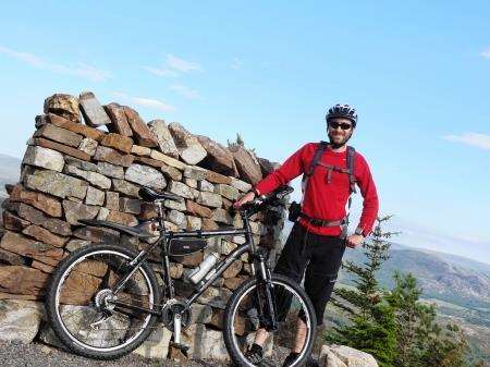
It’s a different story as I take the mountain bike out after work one evening to have a look at "The High Route". As the name suggests, there’s some climbing to do – and some of it is very steep – but it’s worth the effort for these views.
I started at Grotaig, a few miles south of Drumnadrochit, down a minor road signed to Bunloit. There’s a car park at the road end and the Great Glen Way is signed left, with the hill path to Meall Fuar-mhonaidh continuing up the track to the right.
I headed through the gate and followed the blue marker posts to cross a concrete bridge before a short section of the new route. In the past the GGW headed steeply down the hill before rising sharply at a forestry track. Now, as you emerge into an open area with your first view of Loch Ness, the route is signed right on the obviously new path, which keeps the height and offers more views across the water below. There are some steep drops down through the trees, so you need to take care on the loose surface.
The route rejoins a forest track in an area that was felled a few years ago, so the open vista down the loch is incredible and you can see the route – part of the original GGW – weaving along ahead of you.
Soon you come to a set of three information boards on a hairpin bend. From here a new section of the high route leads off to the right and heads all the way to Invermoriston. My plan was to follow this and use the old route to return. A further section between Invermoriston and Fort Augustus is also being re-routed above the trees and there are plans in Lochaber for a similar project between Fort Augustus and Fort William.
I went right at the junction to go uphill on an old forest track which heads under the slopes of Creag Dhearg, with the views getting better and better the higher I got.
There’s an S-shaped sheltered seat at a viewpoint at the end of the track – a lovely simple design and a great place to rest before a seriously steep section! I pedalled a short way before deciding walking would be much easier.
Some of the new route between here and the Allt Saigh bridge is near impossible to ride, with steep ascents and descents as well as big cross drains and rocky sections. I didn’t fancy coming off the bike in this remote spot so went for the sensible option of walking when I wasn’t 100 per cent certain. It’s no real hardship when there’s so much to see and, at more than 400 metres above sea level in places, you get a real sense of being in the hills, miles from civilisation.
I was surprised to be able to see Ben Nevis ahead as I stopped at another new bench – one of many constructed as part of this £1 million project by the Forestry Commission in an effort to improve the long-distance trail and reduce the effect of route closures due to timber harvesting.
The drop to the Allt Ruighe Bhacain is severe and is definitely not one for riding. It was hard enough to stop the bike while pushing it down the hill. My effort was rewarded, however, when I spotted a family of birds – possibly hen harriers – circling in the sky above me before I reached the stunning little bridge at the bottom. It’s one of several new artworks designed by Brian Wilson of Wildland Services. I was concerned at my slow pace now but the path gradually improves for mountain biking after this point and I was able to ride more between here and the Allt Saigh bridge.
After the bridge the new route goes right, and I wondered whether to take the shortcut down the forest track towards the youth hostel at the bottom. But there was one more thing I wanted to find.
Somewhere along this next section there was an art installation called the Viewcatcher Wheel. I didn’t know how far it was but I decided to continue on the high route, following the path along a relatively easier section until I came upon the artwork, which captures the view behind in a circle of Caledonian pine.
A steep little drop after the wheel takes you onto a track for an easier ride. At the next junction, around 1km from Invermoriston, I decided to take the unmarked shortcut by going straight on where the GGW was signed right.
This led me down to the existing route. I turned left onto it once I reached the markers half a mile down the track.
A fine singletrack descent, using a number of hairpin bends, brought me out on the vehicle track at the bottom and I followed the GGW markers back past Alltsigh and up the long climb to the information boards where I had joined the high route.
Following my outward route back to Grotaig, I felt I’d had a real adventure on this testing but satisfying trip on the new Great Glen Way.
The high route of the Great Glen Way will be officially launched by broadcaster and author Cameron McNeish at an event next Tuesday (August 5).