


Route delves deeper into Abernethy Forest
Register for free to read more of the latest local news. It's easy and will only take a moment.

I’ve run through Abernethy Forest many times on the well-publicised track linking Nethy Bridge and Glenmore, but up until now the tempting tracks radiating out from the eastern side of the River Nethy have been unexplored territory.
This run appealed immediately as it explores more of the forest, using the car park at the RSPB headquarters at Forest Lodge as a starting point.
As Dave and I Iocked the car, the sunshine from the drive disappeared behind a sheet of high cloud, and there was a slight autumnal chill in the breeze as we set off, initially heading north-east, following signs for the Scottish Rights of Way path to Nethy Bridge.
Reaching a polytunnel within a small enclosure, we turned right to cross the River Nethy on a substantial bridge and started climbing gently through the trees and deeper into the pine forest. A quick glance at the map told us that navigation through the forest would be straightforward – right at the first junction and then straight on when three tracks met the main route.
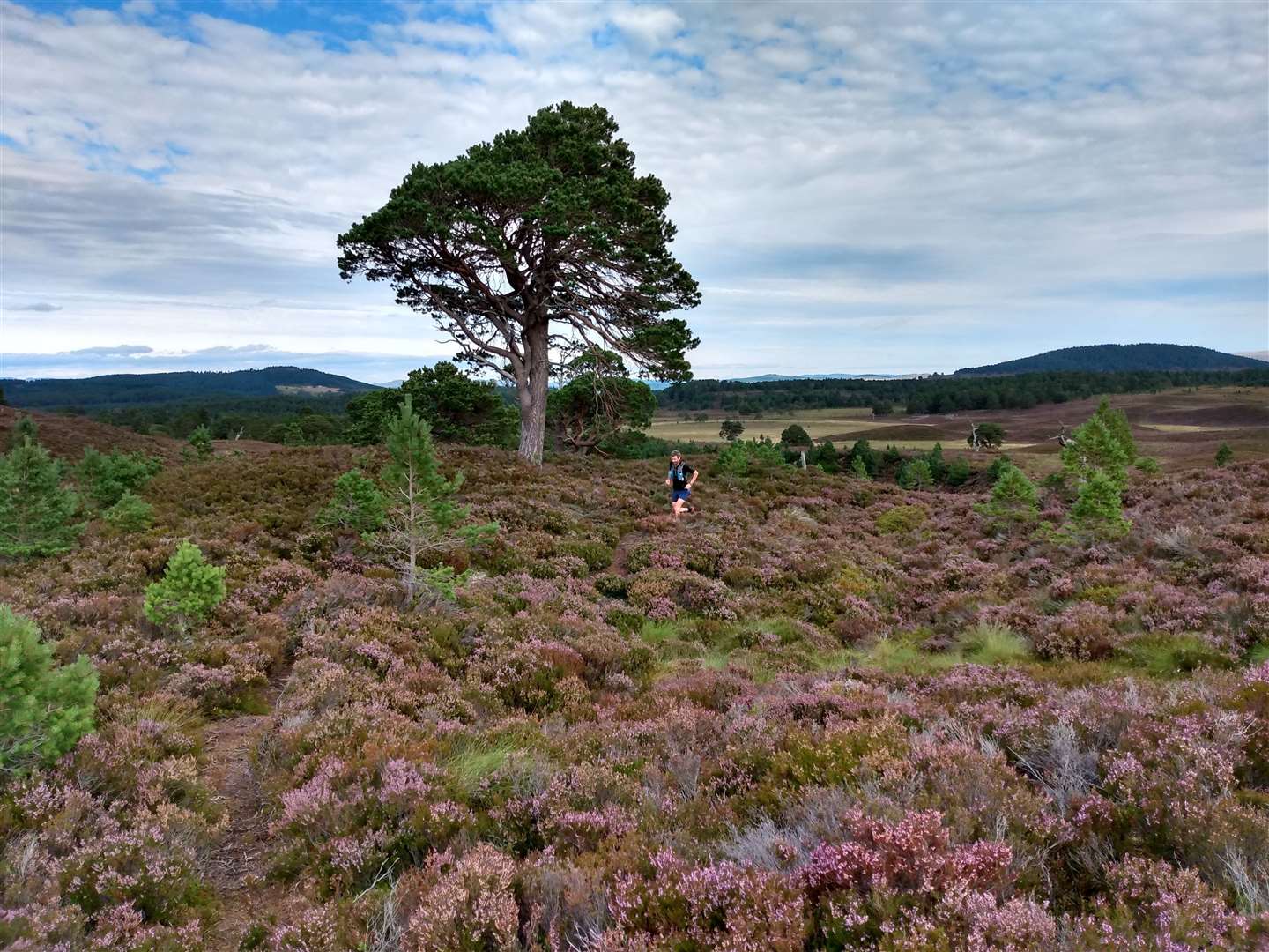
We jogged upwards through the forest and the day now began to take on a distinctly summery feel as the clouds broke above, revealing a bright blue sky. The forest floor was a carpet of heather, now fully in bloom, and the vibrant colours of late summer were picked out by the sunlight percolating down through the tree canopy.
The trees became less uniform as we reached the edge of the forest, a result of the RSPB’s aim to reinstate the natural woodland. As if planned by nature to give a big reveal, the forest ended at the top of a rise, and the wide, open expanse of Strath Nethy was suddenly visible in front of us – the open moorland an apt foreground to the Cairngorm mountains rising up on the skyline. We could see the tors of both Bynack Mor and Beinn Mheadhoin, the granite outcrops marking the northern boundary of the main Cairngorm plateau.
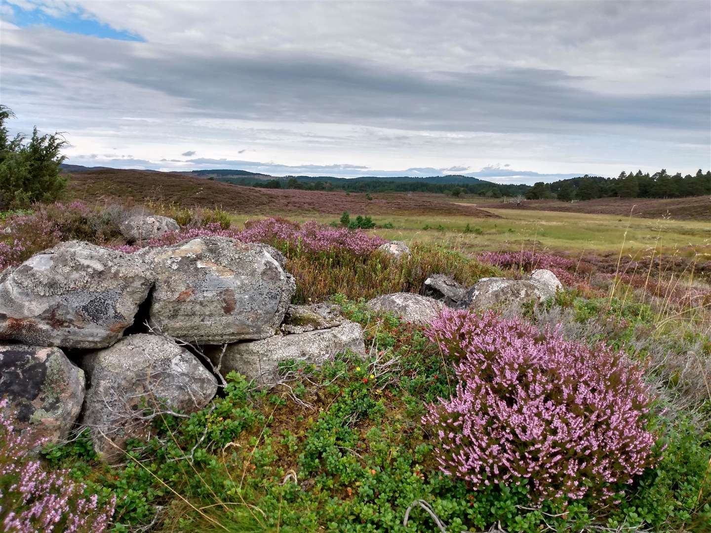
The track remained good for now, changing from forest road to grass path as we made our way onto the moor. Crossing a burn, we reached a high point on the open ground where the ruins of an old croft were visible among the high heather. The spot had been chosen well as, although the lines of old walls were still visible on the surrounding ground, the terrain was very wet so the high vantage point gave a dry island among a sea of bog.
We had been pre-warned that the path petered out, so it wasn’t a surprise that, as we reached the heather bank on the far side of the marshy ground, the trail disappeared. The route description told us to make for the banks of the river, so we contoured round the hillock through rough heather that was sore on bare legs.
Floundering through the deep heather, we finally found a trod that had started next to a set of fence posts, and the thin path gave some respite from the painful scratches and allowed for some slightly quicker going. Upon reaching the high banks above the river, the path became more certain and it was now the River Nethy that stole the show, running through small waterfalls and around boulders as it made its way down towards the Spey.
Self-seeded pines and small rowan trees growing close to the path meant I needed to concentrate on my feet but, as far as trip hazards go, they were hardly something to complain about. The branches of grown-up relatives of the rowans bore bright red bunches of berries and these, along with the carpet of purple heather, made for a exuberant variation on the normally muted colours of the Cairngorms.
Dave’s feet kicked up clouds of yellow pollen as he ran through the heather ahead of me, the bright purple flowers ready to seed new life.
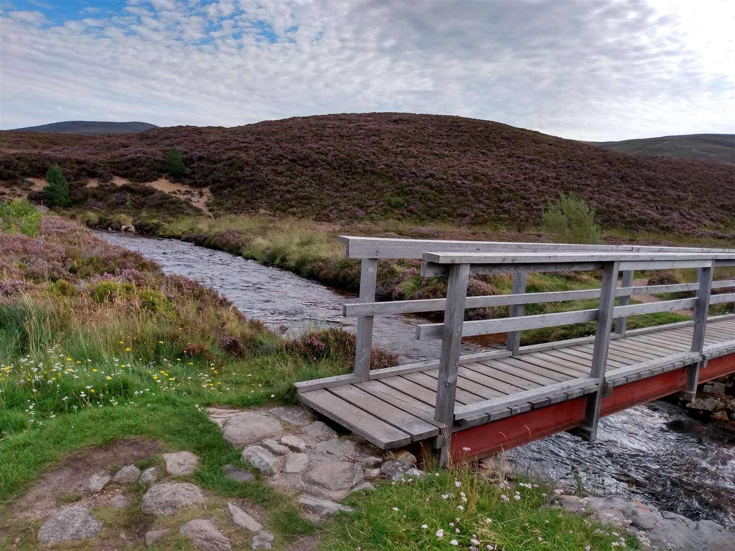
The trod brought us to the Stables of Bynack, the site of a former pony shelter, and we turned right to cross a footbridge and took the large track towards our next destination, Ryvoan Bothy. We started seeing other walkers for the first time of the day, and sharing the time of day somehow made the previous hours’ quiet exploration of the forest even more enjoyable.
At the large junction we turned right to continue climbing towards Ryvoan and I laughed off a suggestion by Dave to make a quick detour from the bothy to the top of Meall a' Bhuachaille, 400m above us up a zigzagging path. Given Dave’s ability and keenness to run up any steep hill very quickly I’m still not sure whether it was a joke or not...
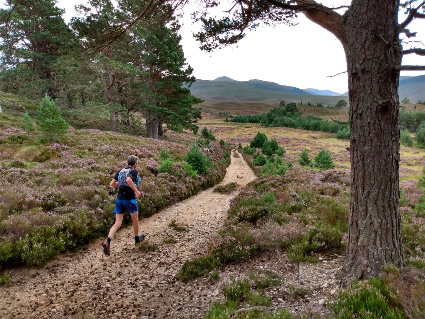
The main track continues rising gently past Ryvoan, passing a picturesque lochan on the left. The view ahead towards Speyside is vast and it’s worth stopping as you run this section to look back towards the Cairngorms to appreciate the full panorama. The track stays large as it re-enters Abernethy Forest and it was great to feel like we could cover the ground quickly as we descended from the high point of the run.
The track undulates through the forest with no complications navigationally for the first section. After a distinctive straight section of forest road, watch out for a track leading up the hill into open fields towards a couple of houses. The climb is well worth it as from the top the views give a sensational perspective of Strath Nethy and this circuit.
Passing through a couple of gates we again re-entered the forest and it was a straightforward descent, going straight on at the junction, to get back to the car park at Forest Lodge.
It had been great morning to explore routes off the main right of way through the forest and, as is always the case for me, a look at the map showed that there was much more exploration to be had on the quiet forest tracks and trails of Abernethy Forest.
Route details
Abernethy Forest from Forest Lodge
Distance 10 miles / 16km
Terrain Mainly good paths and tracks. A couple of kilometres of rough, sometimes pathless ground between the forest and the Stables of Bynack
Start/finish Car park at Forest Lodge, access via forest road. Grid Ref NJ019160
Maps OS Landranger 36; OS Explorer OL57; Harvey British Mountain Map, The Cairngorms
A low-level forest route giving expansive views of the northern Cairngorms and Strath Nethy