


Long-distance love on the Bin of Cullen – a forest run from the Moray coastal village
Register for free to read more of the latest local news. It's easy and will only take a moment.


Although nothing special in height, the Bin of Cullen is a justifiably popular hill due to its commanding position above the Moray Firth.
I haven’t run the hill for a while as, despite the great views, the short blast up from the car park on the south of the hill just isn’t quite enough to make the journey from home worthwhile.
With the ice and snow at higher levels making many inland hills a more serious outing than I had time for on a Sunday afternoon, I finally got round to looking at the map and other people’s routes to plan a longer run of my own.
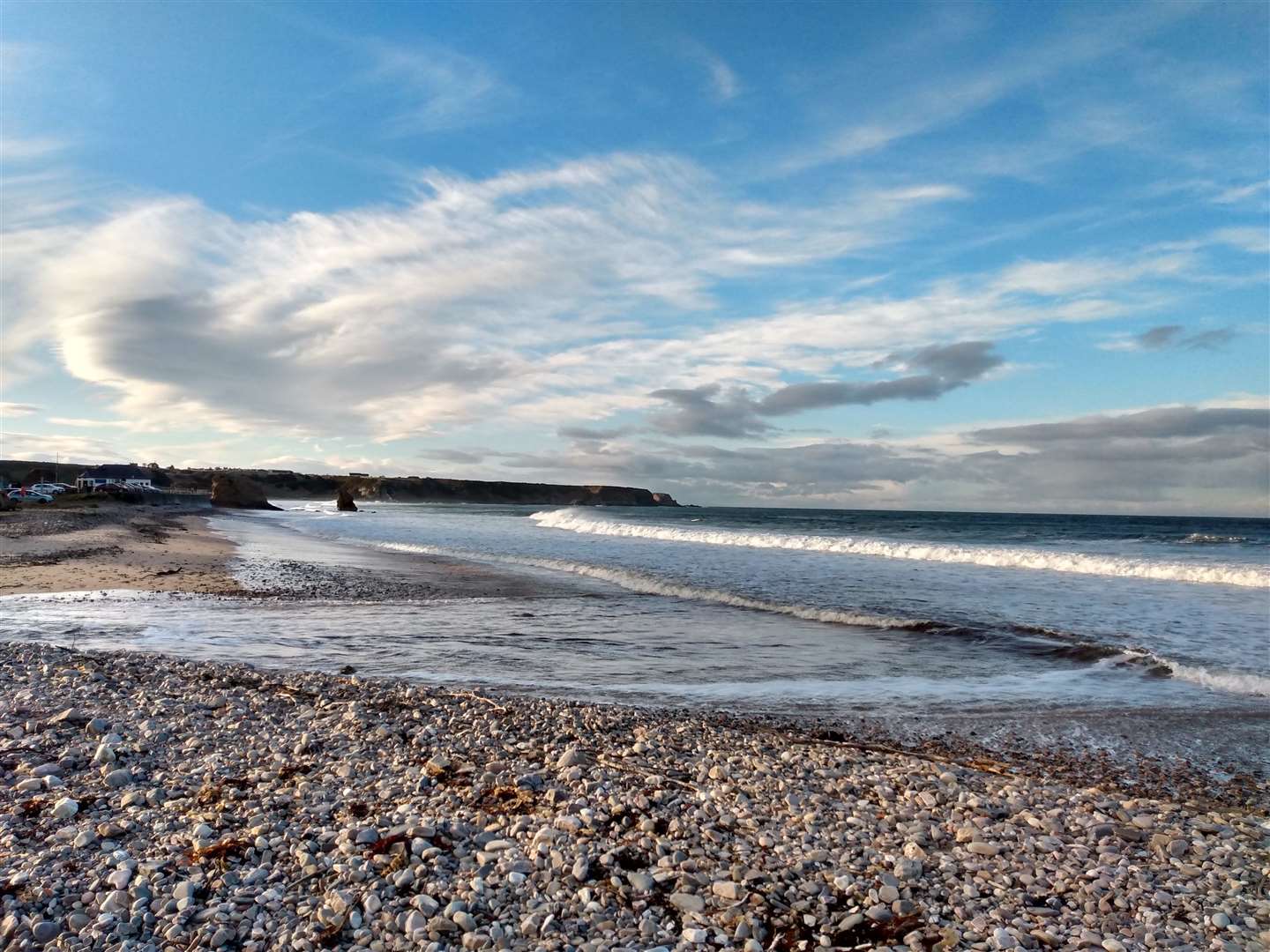
Starting at the beach car park in Cullen, the sands themselves were busy with walkers making the most of the refreshing winter breeze and blue skies. Heading away from the beach I crossed the pedestrian bridge and made my way along the harbour wall, looking down at the sheltered man-made coves below. As the tide was out, the water had retreated enough to leave small sandy beaches and a family was enjoying a small suntrap with a picnic spread.
I headed up a steep brae and took quiet streets to reach the top end of the village, heading out onto farmland from near the caravan park, following signs for the Crannoch Circular walk on tracks that made their way through newly ploughed fields. As the track made several turns to climb the hill, the ruins of Logie House and the remains of Crannoch Hill radar station were clear on the skyline.
The track turned away from these as I followed the path through a gate, soon turning steeply uphill at a signpost.
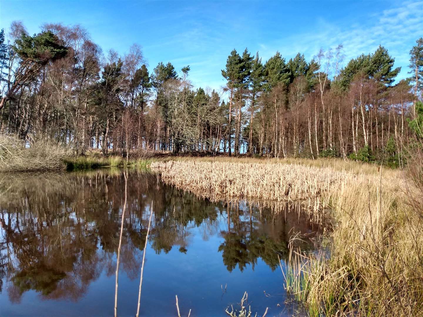
This is a small detour, but well worth it for a quick hit of serenity on the shores of small Crannoch Loch, where last year’s reeds had faded to a straw yellow but still rose in thick clusters out of the calm waters.
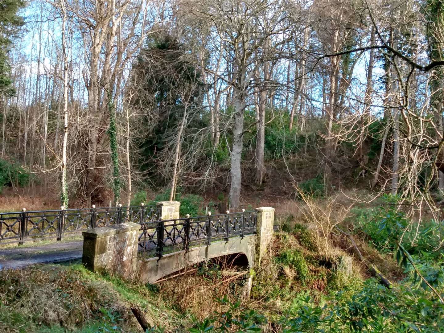
The path dropped down to join a larger track and this took me naturally down, over a bridge spanning a cutting for the long disused railway, and leading the way to the side of the A98. Turning right and running alongside the road, the sign welcoming motorists to Cullen soon came into view and here I crossed the road to jog down the avenue of trees flanking the drive towards Cullen House. Just before reaching the buildings outside the grand gate leading into the grounds, a track forked off left to take me alongside the old garden nursery.
The track here was grassy and dappled in the afternoon sunlight, the vast mire of puddles spanning the track being the only thing to break the idyllic spell and end any chance of my feet remaining dry.
Reaching a house I turned right to cross a bridge, a bright flash of white across the track ahead of me revealing itself to be a cat rather than anything wilder, then carried straight on at a junction to pass through the ruins of a sawmill. The half collapsed sheet metal buildings and twisted metal alongside the track were an unexpected sight in amongst the thick undergrowth.
As an elaborate bridge crossed the river on my right, I turned left away from it and stayed left at the next couple of forks to keep alongside the Glen Burn. The burn here flowed in tortuous meanders around dense foliage and fallen trees, the ferns bright green even at this time of year.
The track dried out as it climbed gradually through the trees and always stayed alongside the burn. At several points the trees opened out and, as the afternoon sunlight bathed everything in a gentle yellow hue, I could almost be tricked into thinking it was a warmer time of year here on the sheltered east side of the hill.
Reaching a crossroads, I carried straight on, now starting to encounter people as I was on the familiar territory of the shorter route. The gradient steepened but, knowing this section of the route pretty well, I knew it was only a couple of straightforward kilometres to the top.
The path zigzagged up the final climb, breaking out of the trees, and I made a short sprint for the top. I immediately regretted creating the need to stop for a rest as a biting westerly wind welcomed me to the summit cairn, its plinth sadly smashed but the view all along the Moray Coast left undamaged.
Stopping only briefly I turned to descend the hill, this time turning left at the first junction to descend northwards, keeping left again at the next fork to follow the muddy track westwards along the side of the hill.
I was glad of the big lugs on my trainers as I reached a slippery hairpin corner, thick with mud, but the track quickly improved, running alongside a large cleared area. A lone JCB stood in the middle of the decimated forest, looking aimless without a single tree left to fell.
Reaching a large junction I took further turnings left then right, and began to get the feeling that I was back among the designed environs of the Seafield Estate as huge overgrown rhododendron bushes towered above old metal fencing and gate posts.
It was unsurprising then when I reached the edge of the forest and turned left to run towards Home Farm, taking tracks to run two sides of the square around the large field in front of it. Home Farm itself is a grand range of farmyard buildings, the entrance to the courtyard marked by a large clocktower. The building dates from 1816, and a bronze-age beaker that was found here shortly after the courtyard was completed can be seen in Banff Museum.
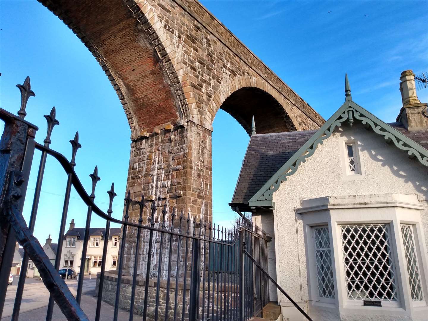
I now took a track to cross the Burn of Cullen at Claypots Bridge, the Cullen viaduct clearly in view ahead as I finished the final leg of my run at a white gatehouse underneath the bridge’s high arches.
I took my time crossing the busy A98 at this blind corner, and it was a short, warm-down walk around the cottages to reach the pedestrian bridge to arrive back in the car park. Sadly, I was too late for a coffee from the silver Airstream caravan of Coffee at the Kings – perhaps an incentive to run round just a little bit faster next time, although my opinion is that a run such as this, done in fine weather, is too good to rush.
Route details
Bin of Cullen
Distance 12.5 miles / 20km
Terrain Clear tracks and paths throughout, side roads around Cullen
Start/finish Beach car park on the west side of Cullen
Maps OS Landranger 29; OS Explorer 425. The Explorer map is recommended as the Landranger doesn’t include all of the forest roads
A longer route through the forests surrounding the Bin of Cullen, using the complicated network of forest tracks to navigate the hill