


Sgurr an Airgid in Kintail is a Corbett worth the walk
Register for free to read more of the latest local news. It's easy and will only take a moment.

Outside of the Scottish Highlands, a hill with a vista as grand as Sgurr an Airgid would have a path up it as wide as the single-track road to the bottom of it and, on a Sunday afternoon, you would not have the whole hill to yourself.
Feel sorry then for poor Sgurr an Airgid as, if you are a Corbett situated right next to the Five Sisters of Kintail, you often tend to get understandably overlooked.
Where Sgurr an Airgid excels though is as a short, relatively straightforward mountain walk with a view from the top that any level of camera would fail to truly capture.
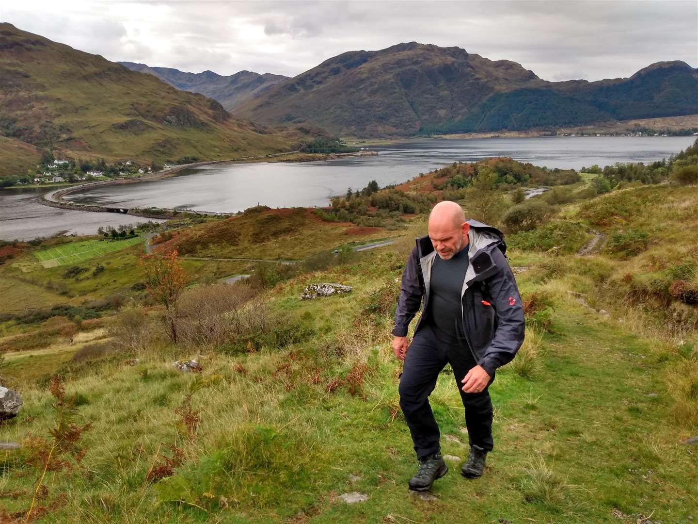
Eric and I started walking from the large roadside car park next to the Clachan Duich burial ground, where the ruins of St Dubhthac’s Church stand amid the still-in-use graveyard, while the church building itself was declared unsafe way back in 1855.
Some say that the building was never sound after being shelled by the Royal Navy during the 1719 uprising in their efforts to recapture Eileen Donan Castle from the Spanish-backed Jacobites.
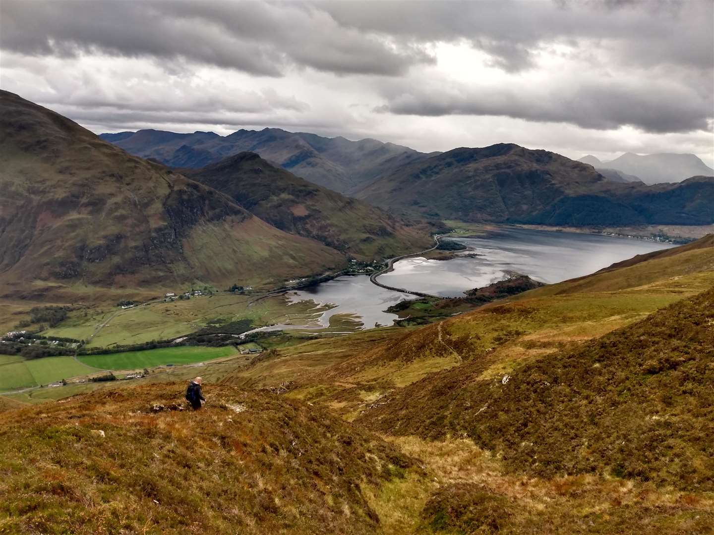
Crossing over the road and through a kissing gate, the path took us through native trees, over a stream and then started steadily climbing the open hillside. We seemed to gain height quickly and easily but maybe it was the perspective of the flat-bottomed Strath Croe getting further beneath us beyond the steep sides of the hill.
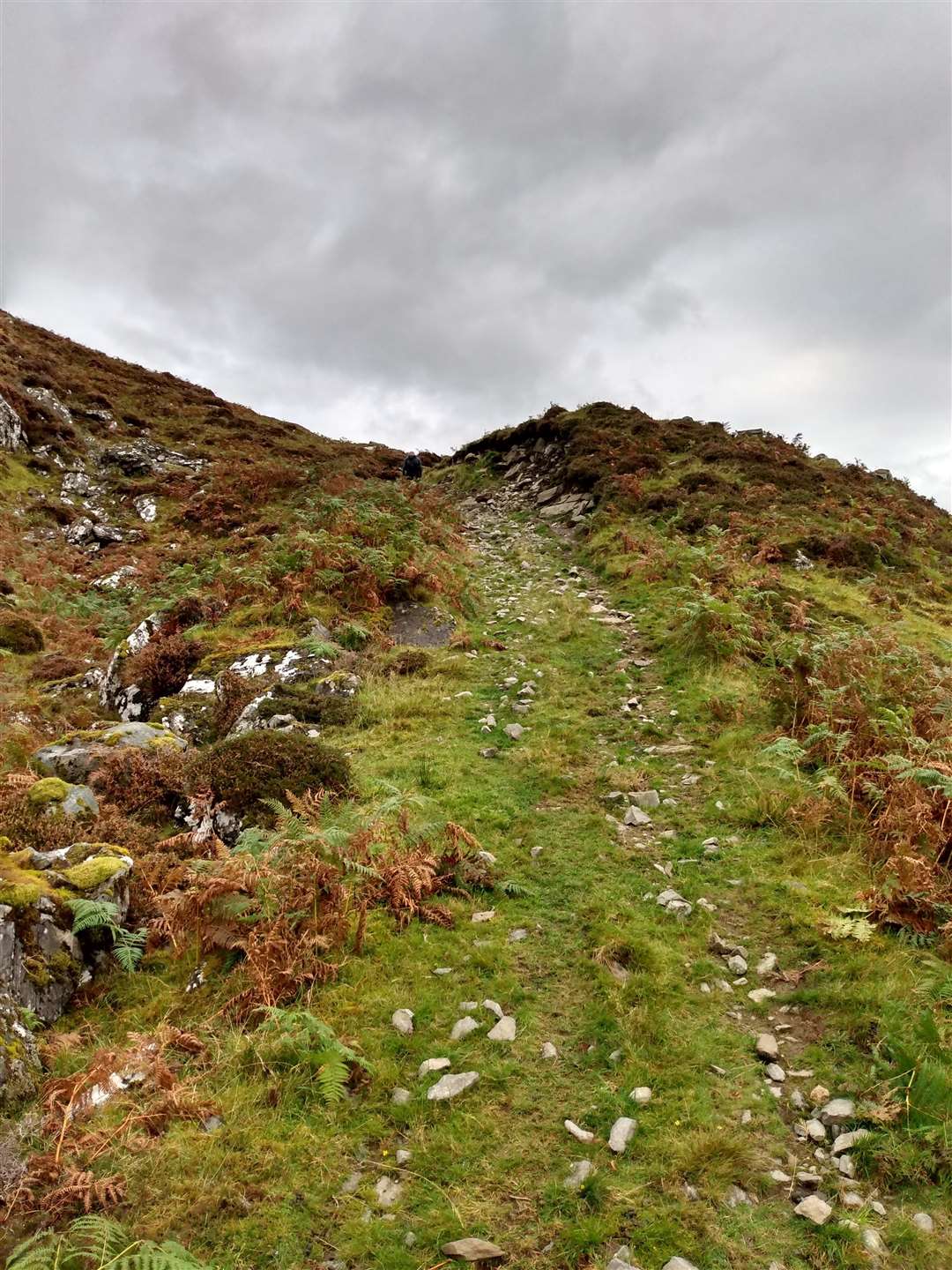
About a kilometre in, we reached a flatter area with several large boulders and took a quick breather. The way here became a little fainter and I was pleased to spot the stalkers' path as it doubled back on itself, executing a couple of broad bends to ease the ascent. The path then became much clearer, traversing the hillside before making a series of switchbacks as the gradient steepened.
A cairn, standing below the shallow but rocky outcrops of Beinn Bhuide to our right, marked the top of this climb. The stalkers' path as shown on the map continues straight on, but the clear walkers' path makes its way across the southern edge of a broad plateau.
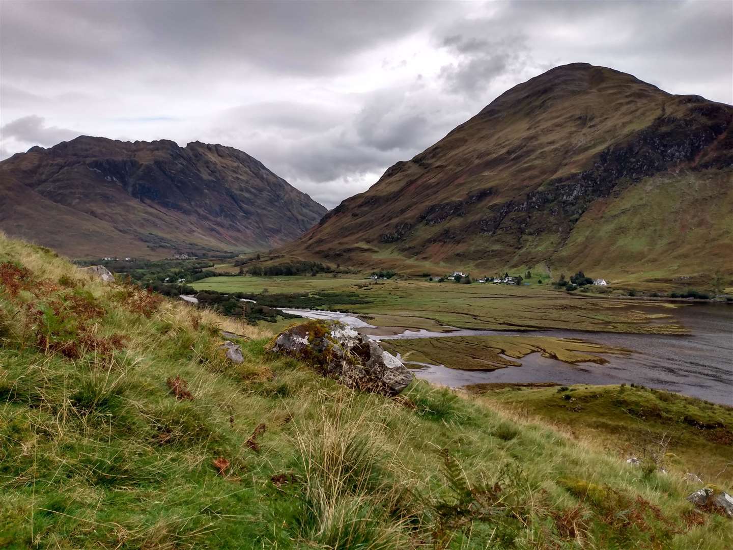
With a cold autumn wind blowing and stags roaring from across the lochan-strewn moorland, it felt as if we had suddenly arrived in the wilderness from the gentle picturesque glen below.
The rocky summit dome of Sgurr an Airgid was a steep but straightforward walk in the clear weather; in winter conditions it would be a different beast altogether. Just before the top we passed a small lochan where the path became a little fainter but it was easy to see the way ahead, the trig point on the summit soon coming into view. The concrete pillar is shattered, possibly hit by lightning, and makes a jagged centrepiece to the hill.
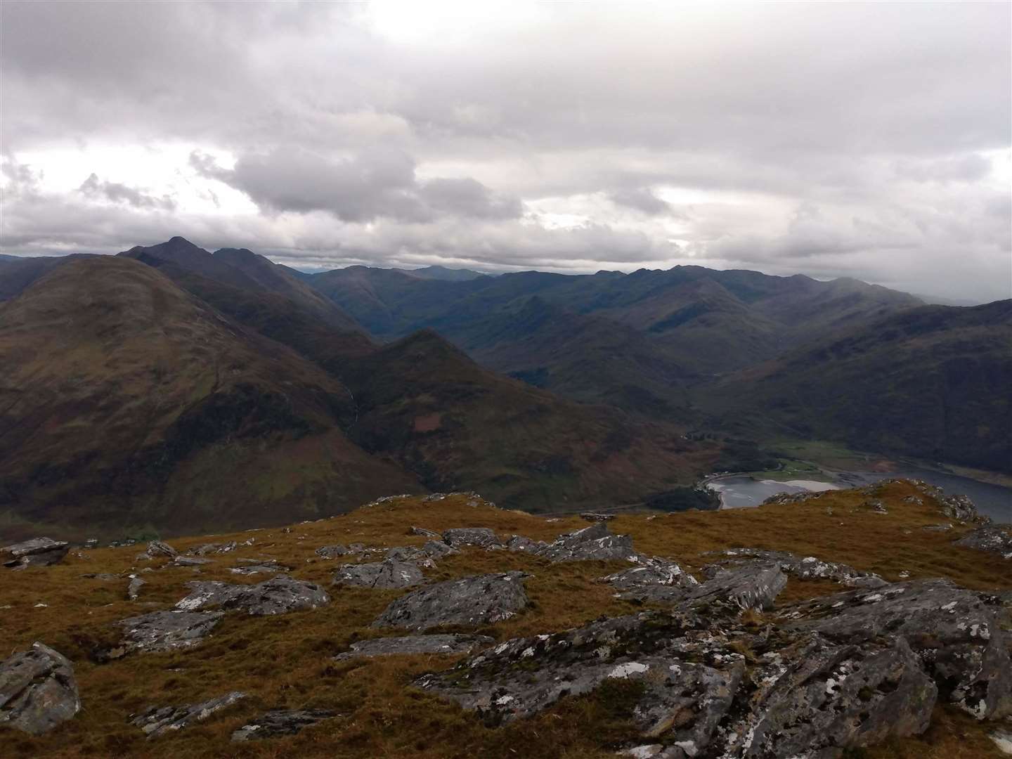
From the top the panorama is remarkable, even in the context of west coast panoramas. The slightly lower viewpoint allows the scale of the Glen Shiel Munros to be accentuated by the neighbouring sea lochs of Loch Duich and Loch Alsh.
To the north, across a high moorland plain, the hills of Attadale and Applecross had their heads way up in the clouds, but the brown autumnal covering of their lower slopes were visible below the hill fog.
To the east the River Croe wound silver through the base of the glen, showing the route of the Affric Kintail Way as it arrives on the West Coast after starting 44 miles away on the shores of Loch Ness.
The wind was strengthening, so it was the cold that drew us away from the view and encouraged us to start retracing our steps back down. It was a little tough on the knees at first – the start of the descent reminds you that although the hill is diminutive compared to its neighbours, you’ve still had an 840m climb from sea level.
As we descended, we watched a distinctive red and white search and rescue helicopter hovering above the outdoor centre for an unfeasibly long time – we concluded that they must be training and that the hover hold in the newly arrived Sikorsky helicopters must definitely work.
This is a great half-day hill with the views and exposure of a big one, great for fitting into the journey to or from Skye or perhaps if you had a later than expected start on these shortening autumn and winter days.
Route details
Sgurr an Airgid
Distance 6 miles / 10km
Terrain Rough but generally clear hill path
Start/finish Roadside car park at Clachan Duich burial ground, on minor road off A87 at Kintail, grid ref: NG946212
Maps OS Landranger 33; OS Explorer 413
A short out-and-back hill day with a vista at the top worth the climb