Going off the rails on the Dava Way
Register for free to read more of the latest local news. It's easy and will only take a moment.

The Dava Way, steaming its way across the high ground of the Dava Moor between Forres and Grantown-on-Spey is yet another positive use of the ghost rail network whose spider web of empty track beds forms the basis of many paths, not just locally but nationwide.
The way itself is not somewhere I run a lot, mainly because I have a low threshold for running at a constant pace for any great distance or time. The long straights stretching along the old line aren’t actually that long, but give me a choice between them and a good steep pull up a heathery hillside and I’ll usually choose the latter!
The other thing with the Dava Way is finding circular routes off the main path so that sections can be enjoyed in a more inventive way than a simple out-and-back manner.
I was really excited to find the basis for this route on a blog post (thank you internet for not being all fake news and cat memes!), and it was on one of the strangely mild and windy winter mornings that feel much more like spring that Debbie and I set off from a parking spot just outside Rafford, where the path uses an old bridge to cross above a minor road.
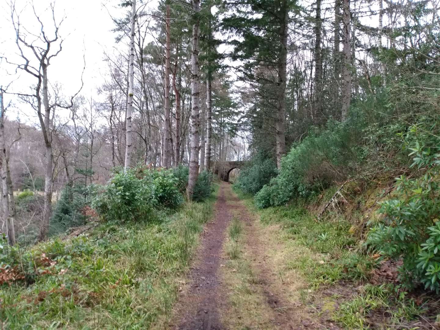
The two of us set off southwards, following the gentle curve of the track bed as it took us above the fields below and into an area of pleasant pine woodland. We followed marker posts easily, carrying straight on past a cottage and as forest roads joined from the left.
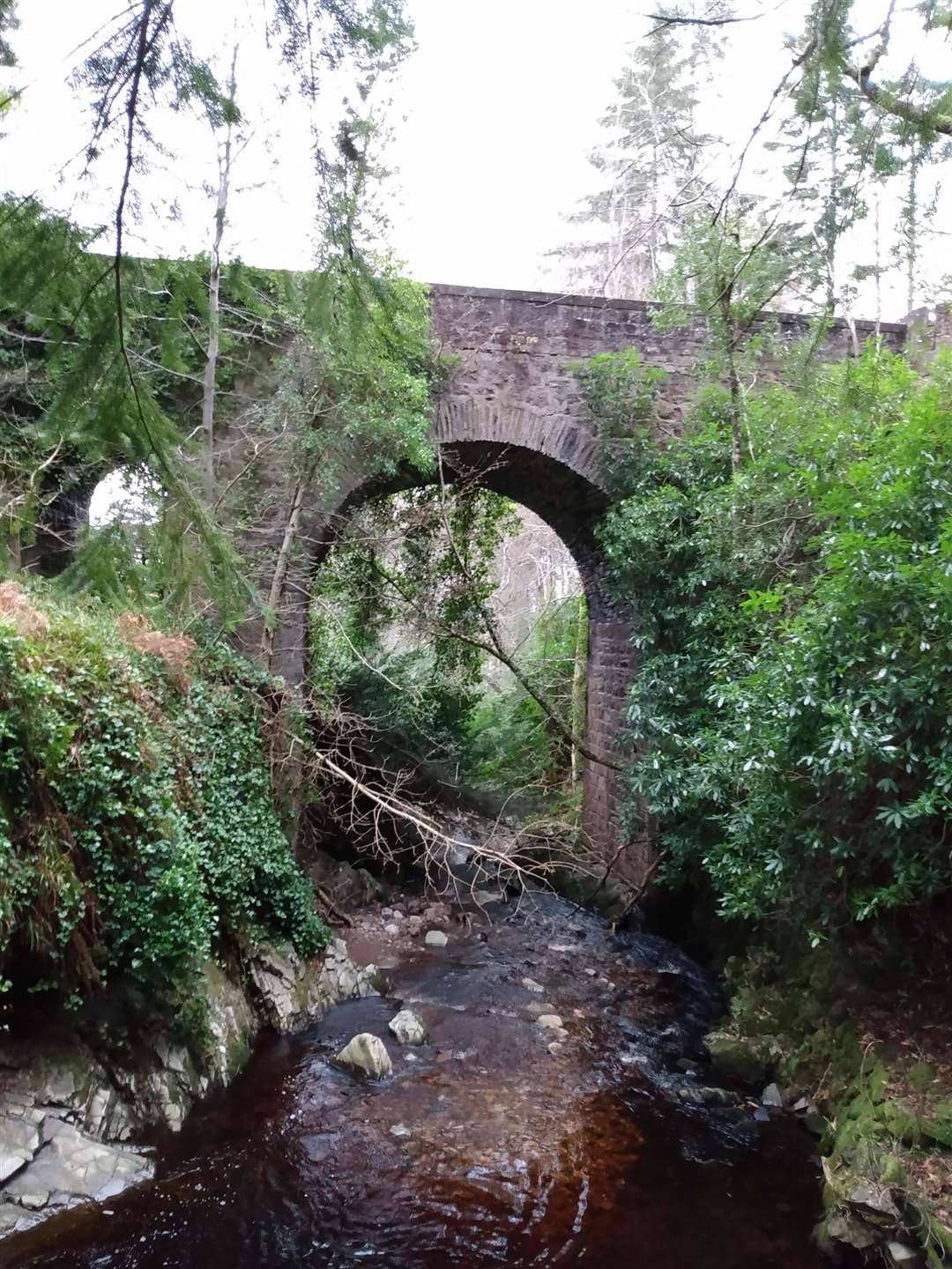
We reached a bridge and took a waymarked path down beside it. It was worth stopping to look back up at the bridge, with its surprisingly fine turreted design. The accompanying information board told us that this was Scurrypool Bridge, an example of how both the directors and chief engineer of the Highland Railway wanted to “combine function with fine architecture” on their railway, thus explaining the fine masonry now half hidden in the greenery surrounding the Altyre Burn.
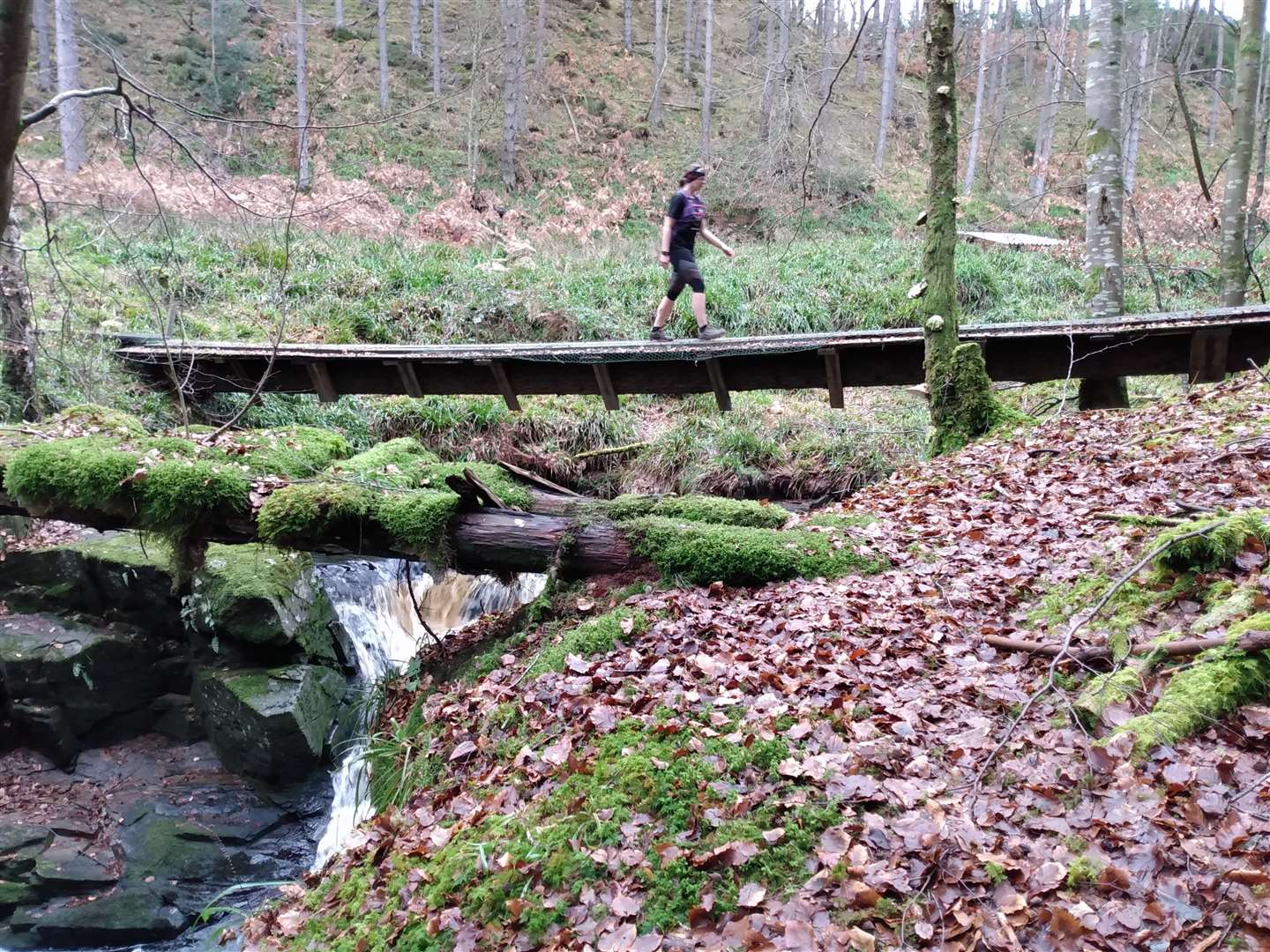
Beyond Scurrypool Bridge, we passed under a much plainer bridge before reaching a lattice footbridge spanning a burn where the original masonry structure had long since been removed. This was a test of Debbie’s bravery as one wary of heights – this bridge turned out to be a good warm up for what was to come.
About a kilometre after this bridge we turned left off the Dava Way as a substantial bridge appeared right on cue. After crossing the bridge we carried onto large forest tracks, chatting away and only briefly checking the map. It suddenly dawned on me that the river was on the wrong side. No amount of compass checking could persuade it to suddenly appear on the north side of the track, and a closer inspection of the map revealed we shouldn’t have crossed the bridge at all, rather followed tracks on the southern bank of the Romach Burn.
However, the map showed footbridges further upstream so we decided to carry on to these; the river looked just about fordable if it came to it. The bridges appeared but were in no way health-and-safety approved – I crossed quickly and watched as Debbie gritted her teeth and followed gingerly across.
We then made a beeline up through the native woodland to the track we should have been on, passing through the farmyard of Craigroy to reach a minor road. Turning left, we followed the road past houses before dropping down, crossing a bridge and turning right onto a substantial track.
This time the track and map matched correctly. We took the first left and climbed steadily along the side of the hill, before descending more steeply down, reaching a sharp hairpin and doubling back below where we’d previously been.
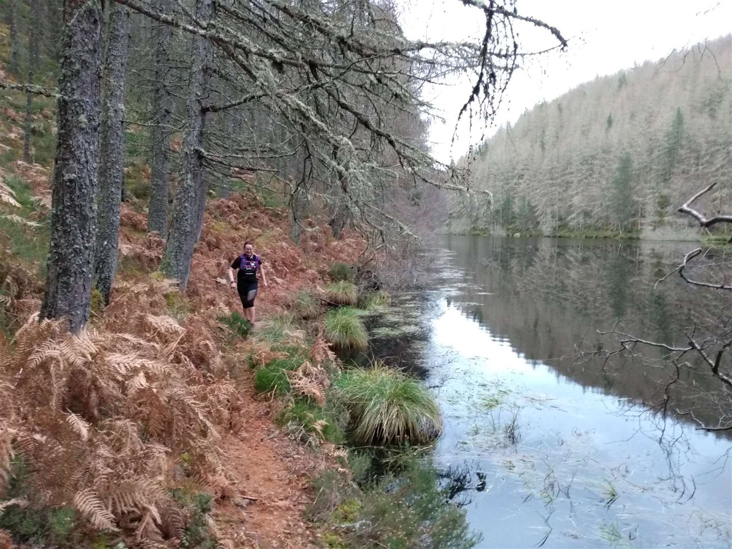
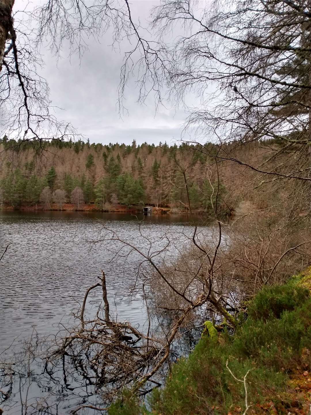
The dammed end of Loch Romach appeared ahead, the artificial loch itself stretching away round the corner and steadily revealing its long, thin shape as we followed the track around the shoreline. As the bracken was dormant and there was relatively little vegetation, we chose to take a minor path alongside the loch – it was easy to imagine that this would be overgrown by midsummer and a much better option would be to stick to the main forestry path.
As we picked away along the rough trod, close to the water’s edge, Debbie commented that the steep, forested sides dropping straight down to the water's edge had an almost Canadian feel and hopefully no bears would emerge from the thick woods. This was the first time I had been to this area on the edge of the Dava Moor and, despite the large tracks criss-crossing the forest, it felt far away from the familiar environs of Forres and Logie.
Now keeping a closer eye on the map, we were faced with several changes of route as some of the forest tracks marked no longer existed and some were extra to expectation. Reaching the top of one rise, the track descended directly north and the blue waters of the Moray Firth were perfectly framed in the gap between the tall pines.
After several junctions we rejoined the Dava Way near Forestry Cottages, turning off left soon after the buildings to cross a bridge on a grassy track. At a broad turning area, we looked for the single-track path leading up into a recently deforested area to continue our way northwards, again soon meeting the main Dava Way after this little exploratory detour.
It was then a mere kilometre back to the bridge to where the car was parked. It took a bit of planning, a good bit of going the wrong way and a much bigger bit of great running but I think this is an exploration of the Dava Way I look forward to doing again.
Route details
Loch Romach and the Dava Way
Distance 12 miles/19 km
Terrain Large path, forestry tracks, short section of minor road
Start/finish Layby on Rafford to Forres Road under the Dava Way Bridge, NJ050558
Maps OS Landranger 27; OS Explorer 432
A circular route exploring the tracks and paths linking Loch Romach with the Dava Way