


A run round Carn Meadhonach visiting the Ailnack Gorge, near Tomintoul
Register for free to read more of the latest local news. It's easy and will only take a moment.

This time of year is fickle in Scotland – one day it’s shorts, T-shirts and suncream and the next day you step outside into a biting wind straight from the Arctic.
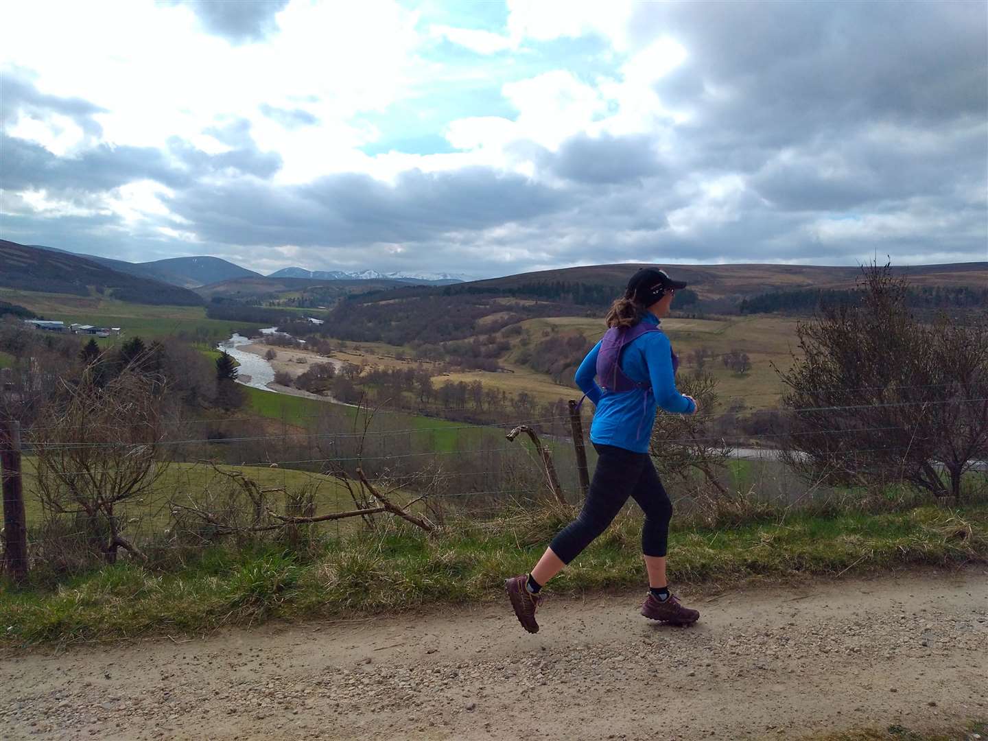
It was into just such a wind that Debbie and I set out from the Old Fire Station car park in Tomintoul for a circular run around the hill of Carn Meadhonach that culminates in a visit to the Ailnack Gorge.
We took the A939 northwards out of the village to have a look around the newly finished wildlife hide before following the orbital path through the fields flanking the houses. Around us lapwings rose out of the grass, calling out a warning as we passed their nesting spots. Just beyond an area of natural woodland we met the Speyside Way spur, and left to return to the road next to an information board.
We took the track leading up the hillside parallel to the road and it didn’t take much ascent before the view across the glen opened up. Looking south the sweeping curves of the River Avon drew my eye toward Ben Avon, its white valance of late snowfields marking it out as the highest hill around.
Continuing through a small plantation and past a farm, we then crossed a stile and took a grassy track leading downwards through the fields to meet a gate. The fields were full of ewes clearly ready to lamb, their bellies and udders both full, so we took our time being careful not to alarm any nervous mothers to be.
We now dropped downhill between fences, passing a house and reaching the road. Turning right here signs soon pointed us left between houses and towards the old Bridge of Avon. Running across it, we didn’t notice the different-sized arches beneath our feet but, if the two of us had stopped to peer over the side, we’d have noticed the 19th-century repairs to the smaller one – yet another reminder of the Muckle Spate of 1849, a flood that has left numerous marks across Moray.
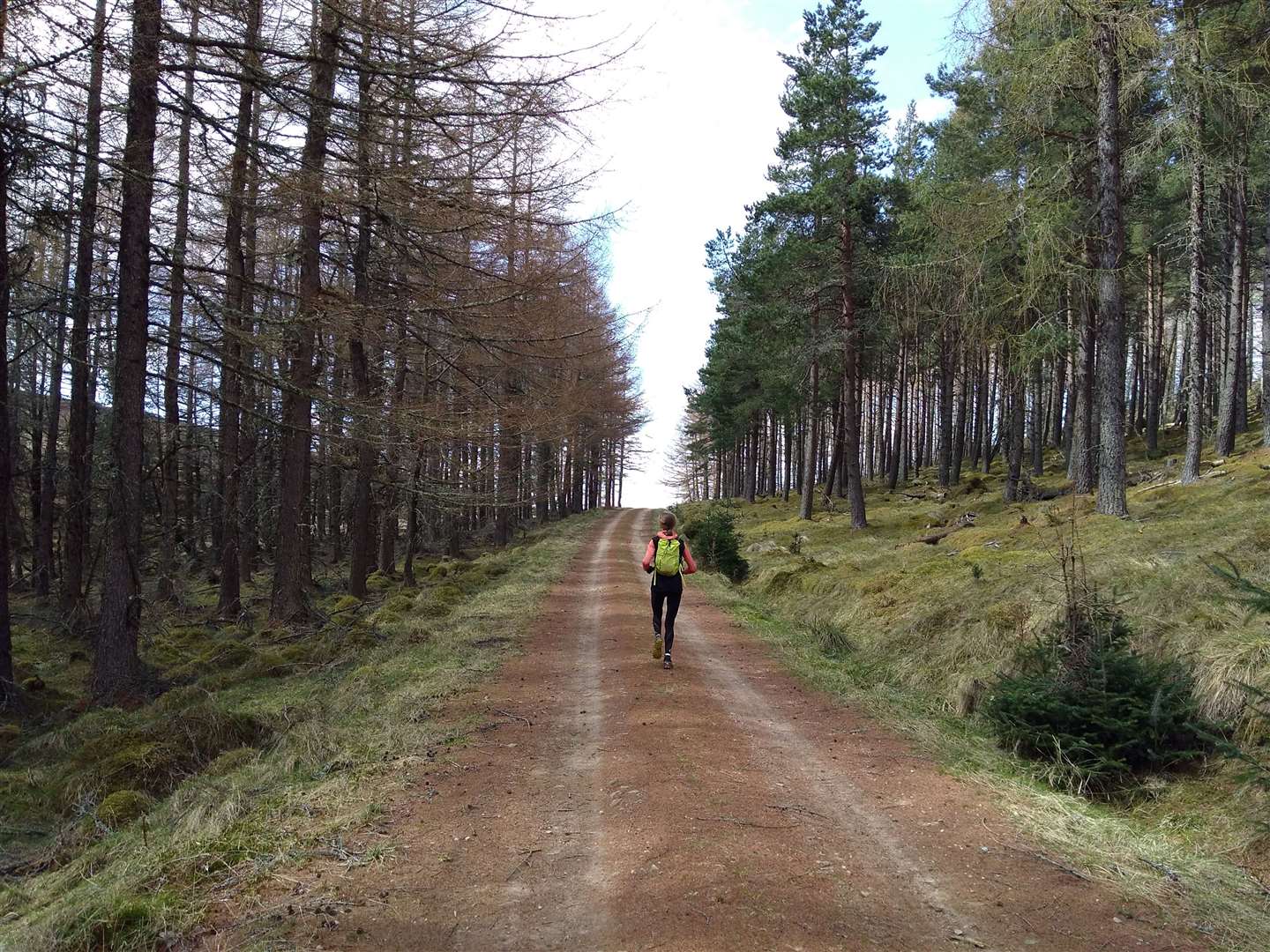
Climbing up to the road, we crossed directly over it to join the forest road towards Kylnadrochit Lodge, keeping right to avoid sprinting down the lodge's driveway, then taking the left fork at a junction of two forest roads. The track climbed gently and on the horizon ahead there was the tantalising feeling of a view opening up beyond the trees.
Reaching the brow and leaving the forest behind, the open moorland rolled away east. On the hillside to our right the gable end of a ruined croft was silhouetted against the sky, the track leading up to it now grassy and indistinct. We took a significantly more modern and substantial hill track leading left, following the contours until a rougher trail branched off to the right, dropping down the hillside to run alongside a plantation and meet the Burn of Brown.
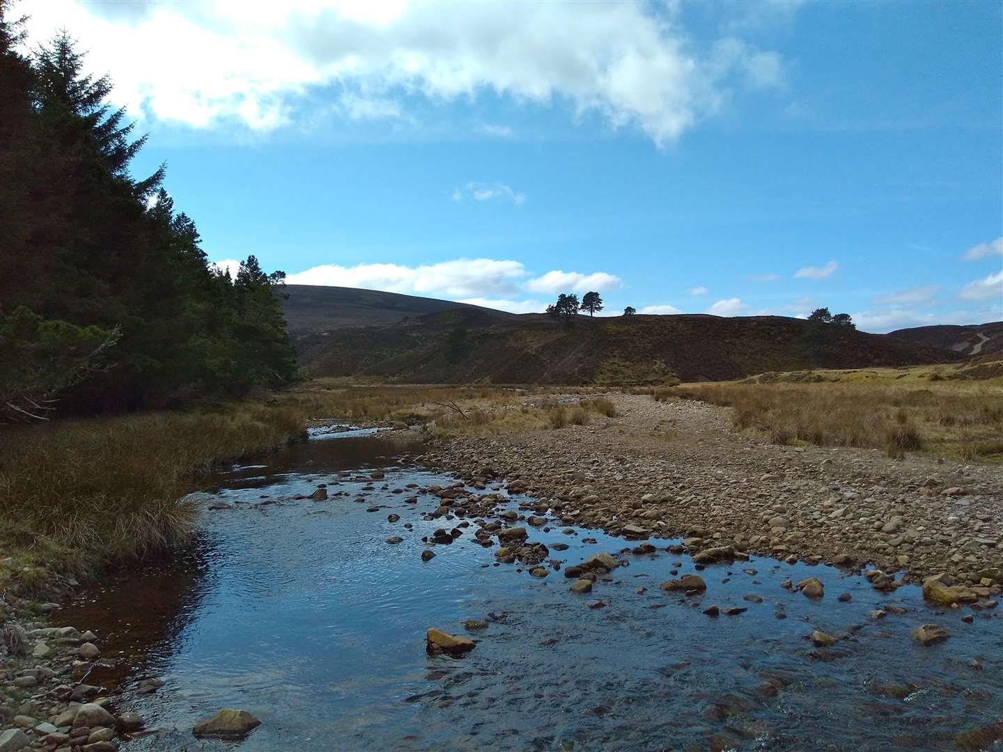
I had been a bit of a geek and checked the river levels online before setting off as I noticed from walk reports that this section of the route uses the river gravels as a path – rough in dry weather, but probably making pretty miserable going with the added complication of ankle-deep water.
Thankfully for us low water levels made for the easiest possible going – bar the odd sharp prod from stunted pines that crowded into the trod we were following. The bleakness of the grouse moors gave this section an expeditionary feel and we stuck to the left side of the river, negotiating crumbling banks and trusting the wisdom of deer as we used their paths to pick out the best routes.
Rounding the corner of the hill a couple of shooting bothies came into view. After consulting the map, we crossed the stream to aim for a faint track leading up the hillside, then joined a more substantial one that led past the first bothy before climbing steeply to reach the second.
Now we were exposed on the hillside the wind picked up to give a distinct chill – despite recent warmth of the sun lower down in the glen, we were suddenly transported back to the chilly days of late winter.
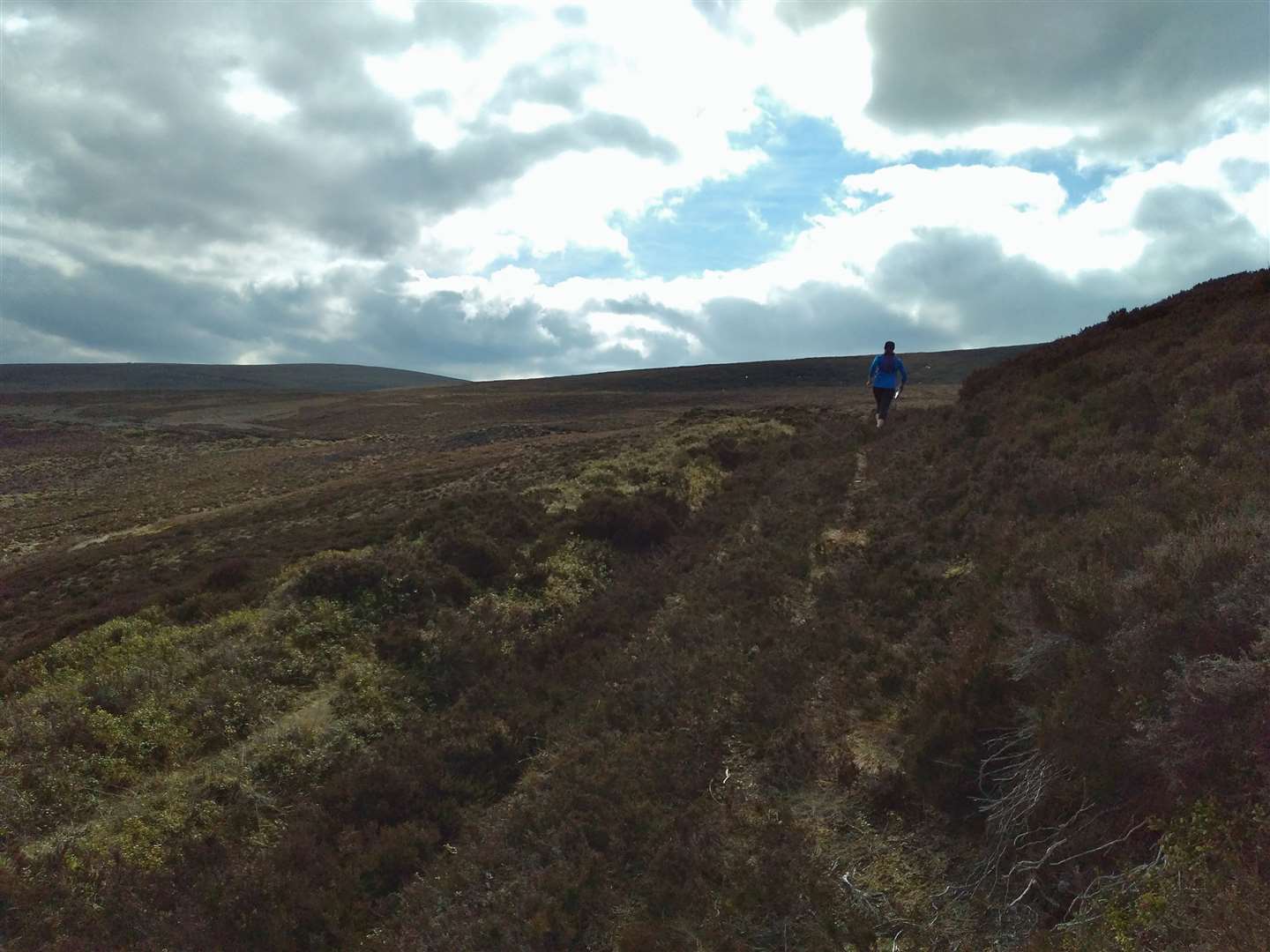
Following the track as it rose and fell around the side of the hill, we followed it to its end at a grassy turning circle at the top of gully. Our way now lay due east across rough, pathless ground to meet a track running along the highlight of the route, the Ailnack Gorge.
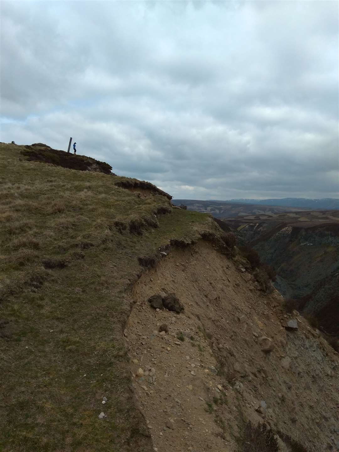
It was generally quick progress over the hillside, occasionally hampered by some very rough ground that caused at least one of us to end up headfirst in the heather. Despite this, we soon met the track and turned left to run along it and up to a lopsided pole at a high point. From here we were treated to our first, and very impressive, view of the Ailnack Gorge beneath us.
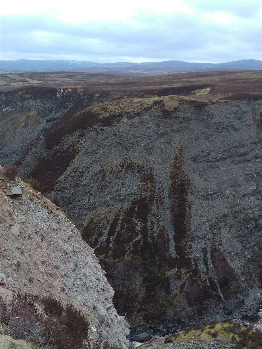
I wonder why this vast geological feature isn’t more widely know, even locally. The gorge is astonishing in its scale – the steep, unstable sides of the ravine falling hundreds of feet to the Water of Ailnack. The gorge has the honour of being Scotland’s largest glacial melt-water channel and, at 600ft wide and 300ft deep, it certainly looks the part.
It was Debbie’s first visit to the gorge so we took our time – following grassy paths along the gorge top to enjoy peering into the grey depths for as long as possible. Rejoining the gravel road, it was then a quick descent into the grounds of Delnabo House at the foot of the gorge.
The tree-lined drive leading away from the house towards Tomintoul started our route back to the village and the final hilly road section brought back painful memories of the end of the Touler 10k race for Debbie. From there onwards it was now a simple run back past Tomintoul games field and along one of the village’s many parallel streets back to the car park.
Route details
From Tomintoul to the Ailnack Gorge
Distance 12.5 miles / 20km
Terrain Hill track, rough moorland and short road section
Start/finish Main car park in Tomintoul
Maps OS Landranger 36; OS Explorer OL58
A varied and interesting route with the highlight of the Ailnack Gorge at the end