


From sea to summit as bikepacking journey heads along Moray Coast and over the Dava Way to Grantown
Register for free to read more of the latest local news. It's easy and will only take a moment.

If only more Monday mornings were like this one. Having enjoyed a full day in the sun and in the saddle on the Sunday, we’d set off from our camp site at Lossiemouth by around 9am, and after just a few miles on the B road we were able to head onto quieter lanes at Hopeman.
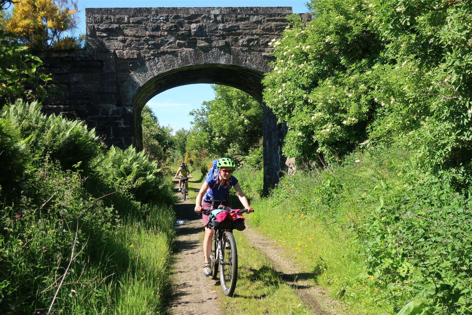
Our crew of five regrouped as we made our way through the pretty coastal village and soon joined the Moray Coast Trail, a 50-mile route between Forres and Cullen Bay, which led us towards Burghead.
What a spectacular morning for being out. As we rode along the smooth trail which passes beach huts and rocky inlets, the sea was almost mirror calm. I watched a lone kayaker slowly exploring this magnificent coastline as we did likewise from terra firma.
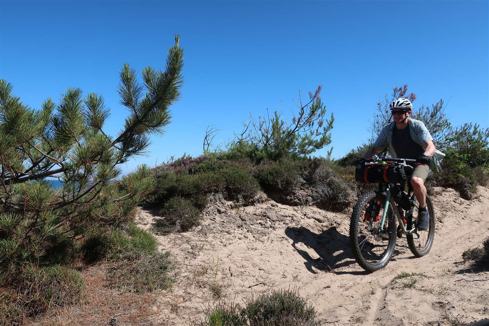
Passing through a camp site at Burghead, the route heads into the Roseisle Forest on wide, sandy tracks that make for challenging riding in parts, but it was nice to be in the shade of the trees as the day was turning into another scorcher.
It was all good fun as our leisurely approach to these two days of bikepacking meant we were in no rush to tick off the miles.

At one point, the route goes straight through the main parking area for the forest, continuing to the edge of the Kinloss airfield, where the path turns sharply right to follow the perimeter fence to the sandy coastline.
We paused here for a while, enjoying the view back to Burghead on this glorious morning. The route continued on a sandy path that wound its way over tree roots as Findhorn drew ever nearer.
We would leave the official trail in the dunes somewhere to follow a back route into the Findhorn Foundation, where we would spend a good few hours on our ‘early lunch’ that soon became a ‘late lunch’!
It was right in the heat of the day now, so after a good meal at the excellent Phoenix Café, there was time for more ice-cream – as well as our first and only puncture of the trip – before we finally got moving again, following the cycle path towards Kinloss then the national cycle route along minor roads into Forres.
Our return ticket to Grantown – where we’d begun our journey the day before – would take us along the Dava Way on the line of the former Highland Railway route.
We took a more direct route than I had used previously to get from the centre of Forres to the Dava Way, joining the route just before the Dallas Dhu distillery. Route finding would be easy from here on in, but there was still a bit of climbing to be done to make it up and over the moor.
The path rises to 1052ft (320m) above sea level as it passes through woodland and farmland to reach the moor. It was a great chance for us all to chat and appreciate this experience, this journey that had brought us together for two fantastic days.
The picnic table and inviting water at Scurrypool Bridge beside the old railway tempted us into another stop before we’d got too far along the Dava Way – and Sarah and Laura even took a dip in the cold water of the Altyre Burn.
Following the railway route for most of the way – barring the odd waterlogged cutting and one or two stretches where the land has been used for private houses – means that there’s plenty of interest to see as you pedal along. This includes remnants of the railway history, such as bridges and old buildings, plus the magnificent views that open up as the Cairngorms come into sight higher up.

At one point the route crosses the magnificent Divie Viaduct, where we bumped into a group of youngsters taking part in the Polar Academy training programme. This inspirational scheme takes teenagers with low self-esteem and helps them to redefine their own limits.
The youngsters involved take part in a 10-month training programme before going on an Arctic expedition, then returning to their communities where they help inspire more young adults. It is a truly life-changing experience and it is great to see these young people out pushing their limits and changing their outlook.
At this time of year there is also a plethora of plantlife to enjoy along the Dava route – at least for those of us who don’t suffer from hayfever. The path is lined with wildflowers and trees, providing welcome shade and a burst of colour.
The volunteer group that looks after the Dava Way has done a great job of adding further interest with aspects of history added at various points, too. One of my favourites is the dog at Bogeney which is reputed to have run alongside the train while the driver threw out the post for it to take back to the nearby croft.
A carving of the dog at the side of the trail tells the story and the now uninhabited croft house is visible further along a track.
We continued below the Knock of Braemoray as Jim told us about his family connections with the area – just as we bumped into his cousin who had been up on the moor doing some fencing work!
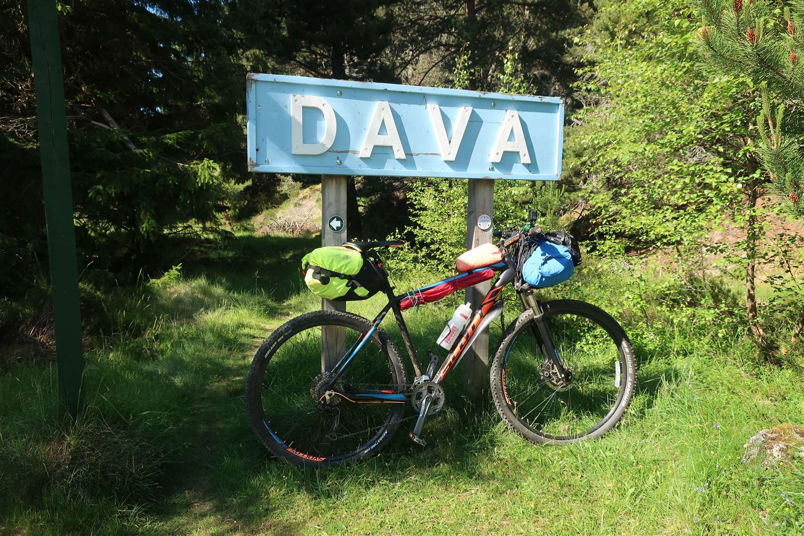
The route diverts briefly at Dava, where the old station building is now a private house, before the final climb to the high point of the railway line, marked with a ‘1052’ sign.
Instead of following the last section of the Dava Way, Jim took us on a great detour along estate tracks past Castle Grant as we dropped into Grantown to end our amazing two-day journey through Moray Speyside.
Route details
The Moray Way – Day Two
Distance 45 miles / 72 km
Terrain Cycle paths, minor roads, paths, former railway route
Start/finish Lossiemouth/Grantown
Map OS Landranger 27, 28 & 36
Following on from last week’s bikepacking trip from Grantown to Lossiemouth, the riders continue along the Moray coast and over the Dava

Read more
Bikepacking on the Moray Way – from Grantown to Lossiemouth via the Speyside Way and NCN