Following the Dirty Dozen route at Glenelg from the Lochalsh Dirty 30, with views over the sea to Skye from the Skye ferry slipway
Register for free to read more of the latest local news. It's easy and will only take a moment.

The Lochalsh Dirty 30 is an annual event that challenges walkers and runners to complete a 30-mile circuit that explores the coast and mountains of Glenelg and Glen Shiel.
Not only is it a good day out, but it also raises money for local charities. As well as the main event there is also the Dirty Dozen, a shorter circuit heading out along the coast from the ferry landing at Glenelg, and returning to the village over the hills.
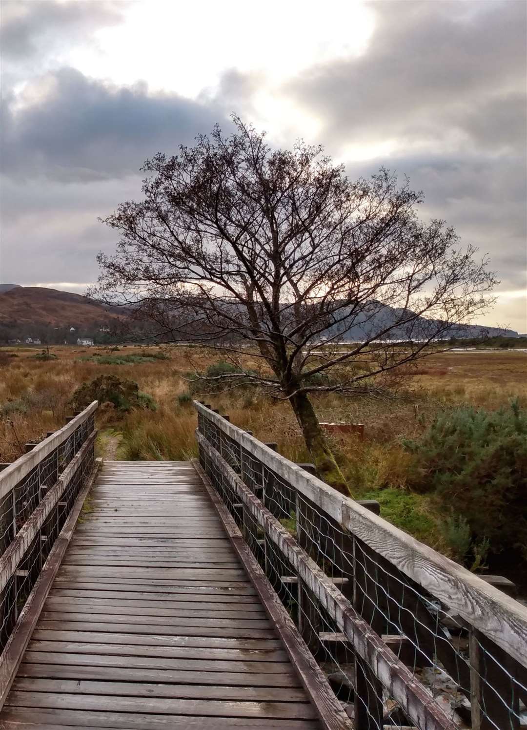
It was this shorter route I set out to do on a cool winter morning, the full Dirty 30 one to save for a time when the days are not quite so brief. Being winter, and out of the Easter to October ferry sailing season, the parking area near the landing slip was quiet and it was easy to find the large signposted path behind a new building.
The wide path passed through a gate and began to gently climb the hill alongside Kyle Rhea, the narrow stretch of water separating Skye from the mainland. As the sun finally appeared over the ridge behind, grey birch tree trunks and remains of the summer’s bracken were lit up silver and orange, colours that stood out brightly against the clear blue sky.
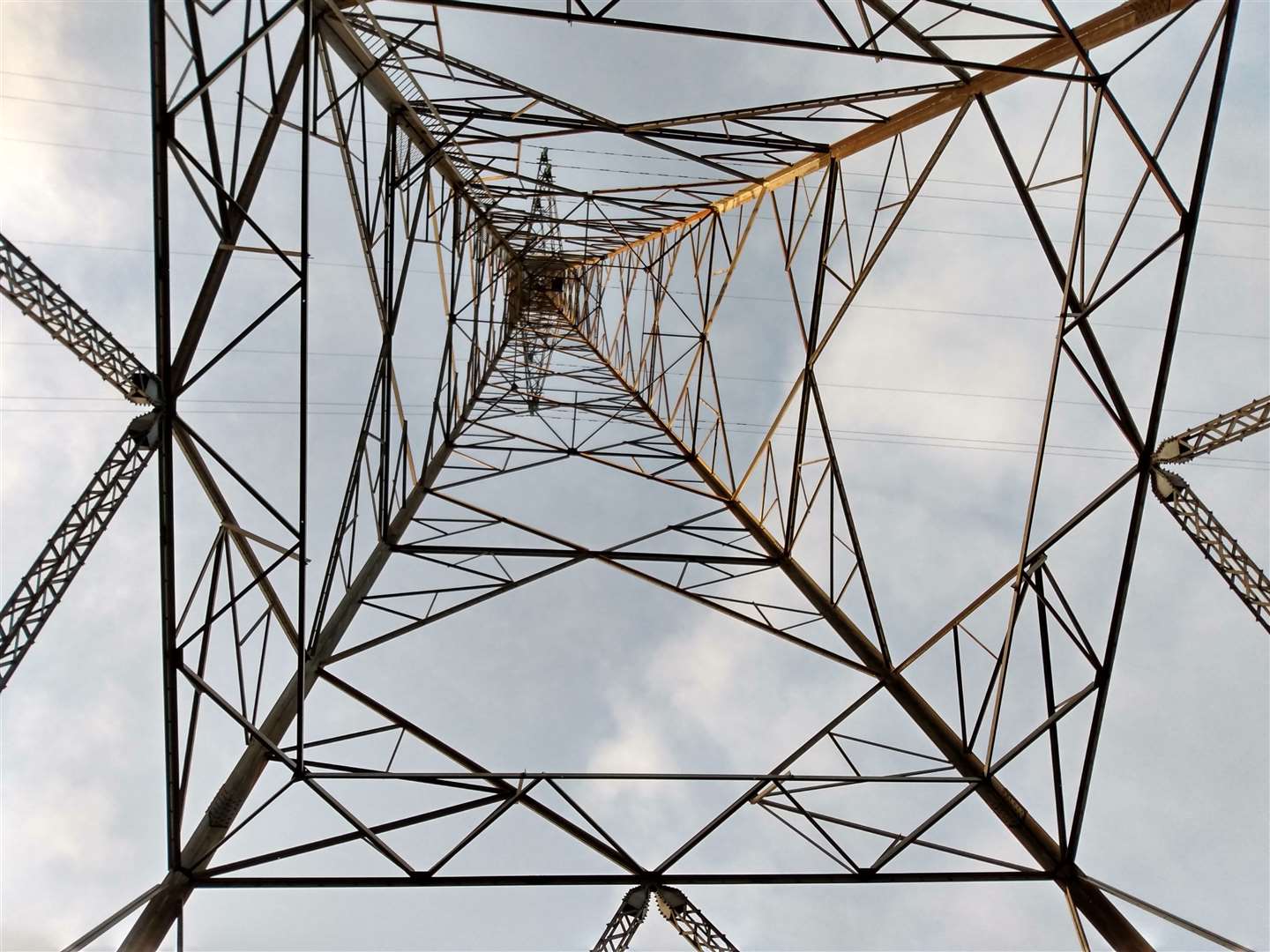
The path passed under one of the large pylons taking electricity across to Skye and, stopping to look upwards, the view through the vast lattice structure gave an unusual geometric perspective on the sky.
At one point the path splits, with a signpost pointing the way left down towards the water where a fabulous single track path winds alongside the loch. At one point it descended into a small gorge where large icicles hung in spiky groups from fragile earth walls above a burn.
With no sunlight reaching in, the air suddenly felt chill, with the wintry feeling accentuated by hoar frost still clinging to the vegetation.
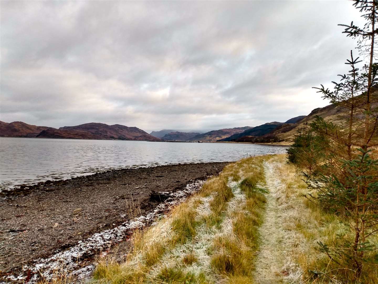
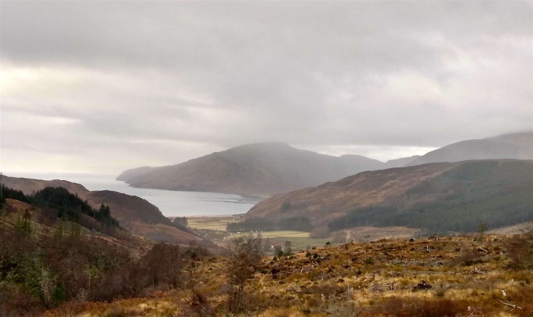
Climbing back up onto the more open hillside, a territorial robin began to track my progress, making his feelings known with loud song, unusual at this time of year when most birds fall quieter. Reaching the edge of the woods, the path now joined the shoreline, running alongside the pebbly coast towards the mountains rising up above the waterline of Loch Alsh.
A large salmon farm just offshore was a hive of activity with boats arriving and leaving the large pens, servicing the tens of thousands of fish contained within them. The running here looked easy but the off-camber path, with holes concealed under the rusty mops from leftover summer grass, meant some concentration was needed to make sure my ankles remained intact for the rest of the route.
Reaching a wall running parallel to the shore I followed this for a short distance before reaching a track heading inland alongside a fence. This soon reached another junction just in front of some barns, the first of the outbuildings of Ardintoul House.
Here I turned left to reach the ruins of the house itself. Only the shell of the house remains after a fire in 2012 that managed to destroy the building that had survived since the 1700s, when it was built to rehouse the MacRaes after the destruction of their previous seat, nearby Eilean Donan Castle.
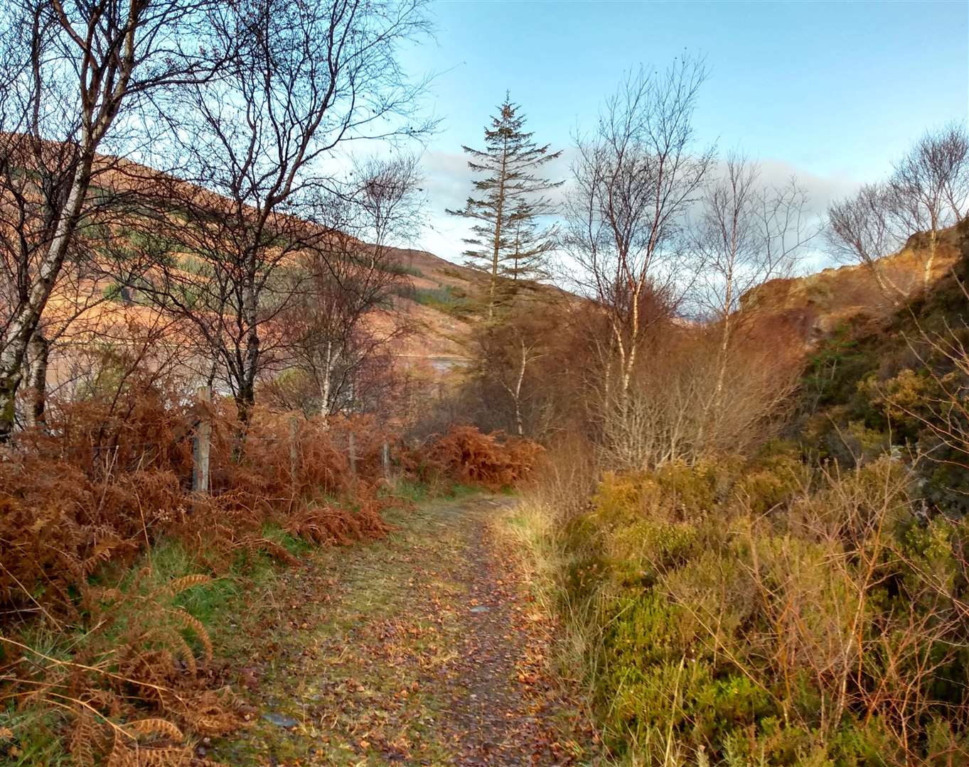
The house sits on the shores of the loch and I turned right along the shore before going right again in front of a house, to start following a track inland. This turned a corner and started climbing surprisingly steeply uphill. Hearing the sound of a toiling engine behind me I stepped to the side of the track to allow a car in low gear to pass, reminding me that this is the only way, apart from by the sea, into the houses sitting out on the shoreline.
The land dropped away on my left, with a spectacular view down Loch Alsh towards Shiel Bridge. A way-marker here indicated where the Dirty 30 route continues eastwards to join the road to Ratagan, but I carried on along the track continuing to climb upwards, and steadily gaining on a couple walking ahead.
I like to say a hello in warning before reaching walkers, but as I did, I was informed my laboured breathing and brisk footsteps had been audible for a while!
Finally reaching the top of the ascent, the view opened up across newly felled hillside back down towards Loch Alsh. Above the grey waters of the Atlantic Ocean, showers shrouded the southern hillsides of Skye, giving the scene a veiled look.
It was then a fast and easy descent on wide forest tracks, and I slowed to a walk only when reaching some skittish cows, not wanting to startle them. The track reached the road by some houses and, if you’d like to return to the ferry terminal, turn right here and finish the route along the road.
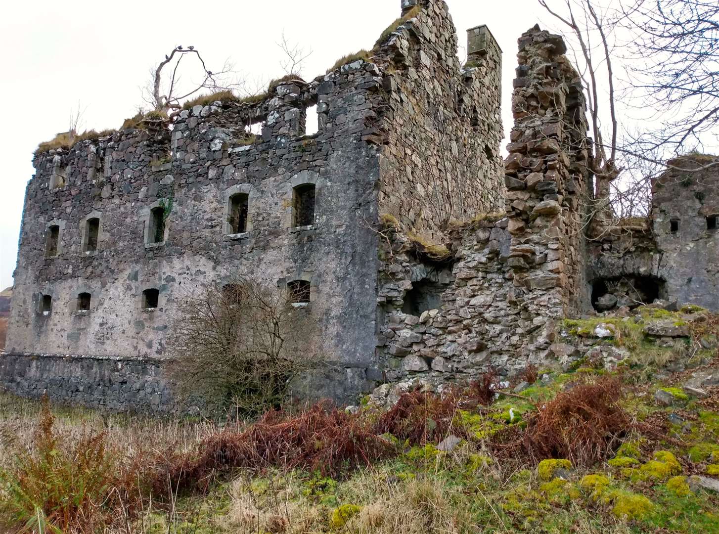
I was lucky enough to have someone else to recover the car and could turn left here to enjoy the run back to the centre of Glenelg. After a short road section I followed a green signpost indicating the way right, crossing a bridge onto the low-lying land close to Glenelg Bay, with the substantial ruin of Bernera Barracks ahead.
These barracks were built after the 1715 Jacobite Uprising to house government troops whose job was to ensure that the route to the Isle of Skye and further westwards to the Outer Hebrides remained out of Jacobite hands. By the end of the 18th century they had already fallen into disrepair, the risk to the Highlands from the rebels now subdued.
The track leads past the unstable ruins, a couple of cottages, and then back onto the main road through Glenelg. Even for the off-season, this remote village excelled in hospitality with the choice of café, pub and shop all open for refreshments to warm up after this superb circuit in the west Highlands.
- The Kylerhea to Glenelg ferry is under community ownership and operates the MV Glenachulish over the summer season to take you over the sea to Skye – see www.skyeferry.co.uk. This year the Lochalsh Dirty 30 takes place on Saturday June 13, and entries are open now at www.lochalsh-trails.co.uk
- For more events, see our Active Outdoors events list for 2020.
Route details
Glenelg and Ardintoul circuit
Distance 9 miles / 15km
Terrain Clear paths and forest roads
Start/finish Parking near Glenelg ferry slipway, GR NG795214
Maps OS Landranger 33; OS Explorer 413
A varied circuit along shorelines and over hills with a great variety of views and interest