


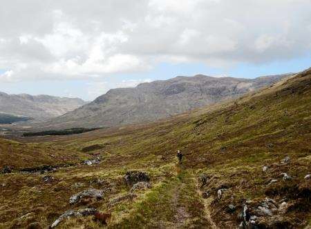
Descending on the Rough Bounds
Register for free to read more of the latest local news. It's easy and will only take a moment.

THE Rough Bounds of Knoydart – it’s a phrase that has always fascinated me since the first time I came across it in The Big Walks – a book published by Diadem that I’ve returned to time and again to fire up ideas for walks.
The book describes a linear route from Kinlochhourn, through the Rough Bounds to Inverie on the shore of Loch Nevis, taking in one of Scotland’s finest peaks – Ladhar Bheinn.
One of these days I’ll follow that route, though clearly it needs some planning from a transport point of view to get to the start point and back out from Inverie to Mallaig by boat.
It has the benefit of viewing Ladhar Bheinn’s magnificent Coire Dhorrcail from Barrisdale Bay.
But on a day out with my mountaineering club I planned to reach the summit from the south, using a mountain bike to take the sting out of the 5km approach.
After taking a boat from Inverie to Mallaig, 24 of us set off in different directions depending on our targets for the day, aiming to be back at the pier by 6pm.
Bill, Charles and I took to the vehicle track that runs steeply up through the Mam Uidhe, then levels off for the last part of the ride through Gleann na Guiserein to a bridge over the Allt Coire Torr an Asgaill.
We left the bikes and began walking on a rough path round a forestry plantation and on towards An Diollaid, at the north-western end of a long ridge that forms the spine of Ladhar Bheinn and includes the summit, at 1020 metres.
A good stalker’s path runs east beside the burn, up into Coire Torr an Asgaill. We’d use this for our return to the bridge.
The path up An Diollaid is not marked on the map but is well-defined enough on the ground. What started as a fine, sunny day deteriorated as we climbed higher and rain moved in to envelop us in cloud.
By the time we reached the summit ridge there was little to be seen so we turned east and continued climbing, with glimpses down Ladhar Bheinn’s impressive north face where snow still lay unmelted.
The ridge narrows before a trig point at 1010 metres, with the summit just a little further on. By now the rain had eased but there was still no view.
Our next move was to descend on a bearing into Coire Torr an Asgaill and we were joined by a young couple from Edinburgh who had ascended the same way and were happy to trust our route-finding.
Picking our way down, avoiding any outcrops, we dropped clear of the cloud into the corrie and took time for food and drink before locating the stalker’s path.
It provided easy walking over 3km to the bridge, where we met a few more of the Oban Mountaineering Club party who had gone up Ladhar Bheinn behind us but returned the same way.
The sun had come out again and at least we could console ourselves with a fine view of the mountain from this level.
We were glad of the decision to bring bikes and set off on the ride back to Inverie, arriving in time to get a drink in mainland Britain’s remotest pub, The Old Forge, and sit out in the sunshine before the boats departed.
A 20-minute delay for three members of the party late coming back from a circuit over two more Knoydart Munros, Meall Buidhe and Luinne Bheinn, didn’t bother us too much, it had been such a good day.
Back at Mallaig we ended the outing with a slap-up meal at the Steam Inn. Perfect!