


Setting sights on journey in Cromdales hill run
Register for free to read more of the latest local news. It's easy and will only take a moment.

The start of 2019 has given us a winter of extremes – it got down to nearly minus 10 degrees Celsius in Moray in January and by the end of February had topped plus 17. The temporary changing of the seasons has meant only one thing for me… time to head for the hills.
We are surrounded by people pushing boundaries, going faster, longer and higher and, even as someone comfortable in my own abilities, it’s sometimes hard to stop comparing yourself to others.
So, on one of late February’s fabulous sunny mornings I chose to head up into the quiet, rough hills of the Cromdales to clear my head and remember the reason I started running – the mountains and making a connection with the landscape.
From the minor road above the village of Cromdale I took a track heading up the hill, turning right at the top to head through a gate and out onto the open moor. Above me estate workers were tending to a muir fire, burning back the heather to encourage new spring growth.
The track climbed up the side of the hill and, once it began to level off, I turned left onto a hill path to continue upwards.
Just downhill from the track there are two pines and these mark the location of the Piper’s Stone, where a wounded piper stood during the Battle of the Haughs of Cromdale in 1690 to spur on the Jacobite force to continue fighting.
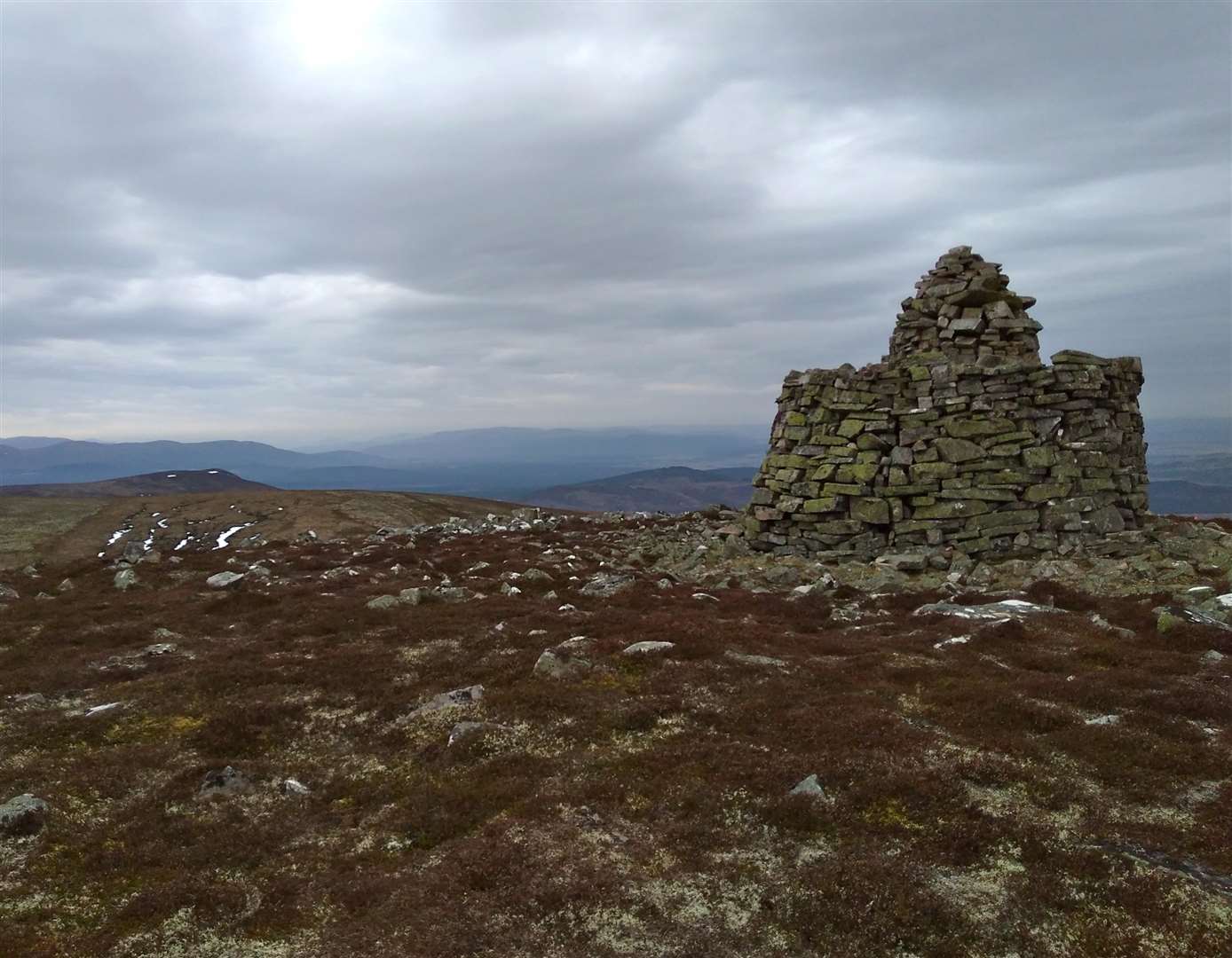
Although the drifting smoke from muir fires along the hillside made for a mystical atmosphere, the hills were otherwise quiet and springy peat underfoot made for a pleasant ascent. I soon reached the pyramidal Coronation Cairn and, looking southwards along the long steadily rising ridge, I could see my next objective: the Jubilee Cairn that marks the top of Creagan a’Chaise.
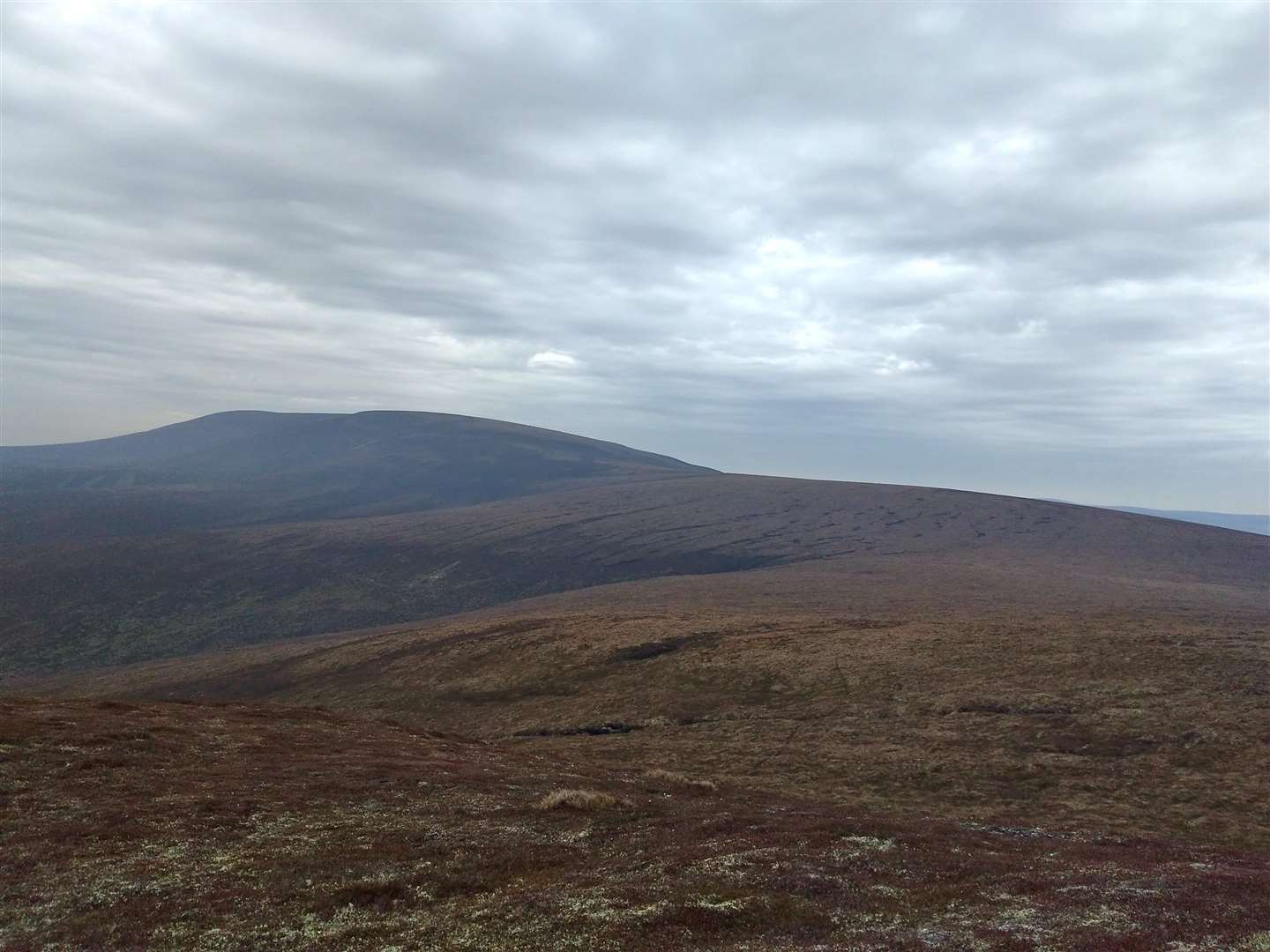
It is usually boggy along sections of this ridge but the dry winter has kept the underfoot conditions surprisingly good for the time of year. As I ascended the ridge I made sure to keep looking up as there is a point where, on a clear day, the whole of the Cairngorm plateau suddenly appears above the moorland. I’ve never been able to capture this sense of scale in a photo but maybe that’s a good thing, as it is a treat for the mind each time I see it.
With inspiration from the vista I was soon at the large cairn, stopping for water and to take off layers in the still, warm air. I usually run a route to this point as an out-and-back, but with adventure on my mind I set off north-east to reach a minor top before making a beeline through the heather towards the start of an estate track leading up from Strathavon.
All around me bright white mountain hares sprung from the heather, their sudden, striking appearance reminding me that despite my T-shirt we are still in the middle of winter. Luckily for them I saw no birds of prey all day, although this could be because they were already full from easy prey.
The hillside gave fast, enjoyable running and I soon reached the track that led down to the minor road on the west side of the glen. Beside the road the River Avon had a blue, cold hue and through the bare silver birch trees alongside the river I could see glimpses of Tomintoul distillery on the opposite bank.
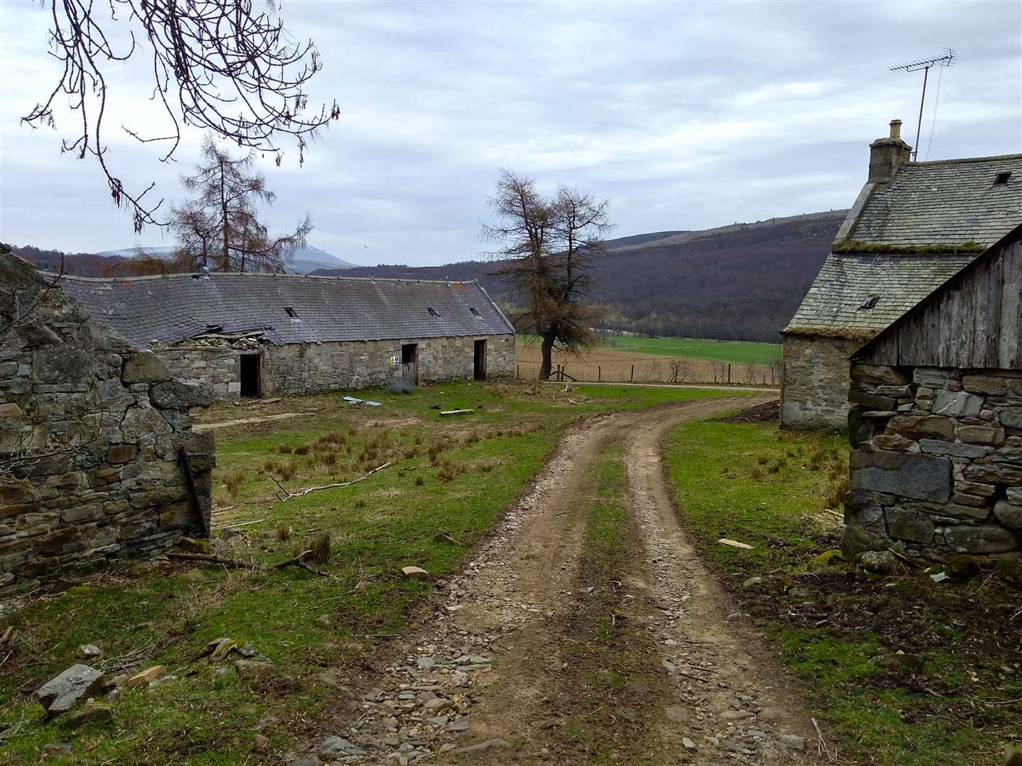
I followed the road northwards until it turned right over a bridge, where I carried straight on, now following Scottish Rights of Way Society signs for Cromdale. These led me up the farm track to reach Knock, a crumbling farm complete with mill wheel. If you carry on along the hillside rather than turning left up through the farm buildings you can visit the Knock Earth House – this is believed to be a Bronze Age souterrain that was adapted for use as an illicit whisky still during the 18th century.
Uphill from the farm house a still mill pond was a good place to stop for a quick rest. Above me the ridgeline of the Cromdales looked a long way back up and the map showed the track zigzagging unrelentingly upwards.
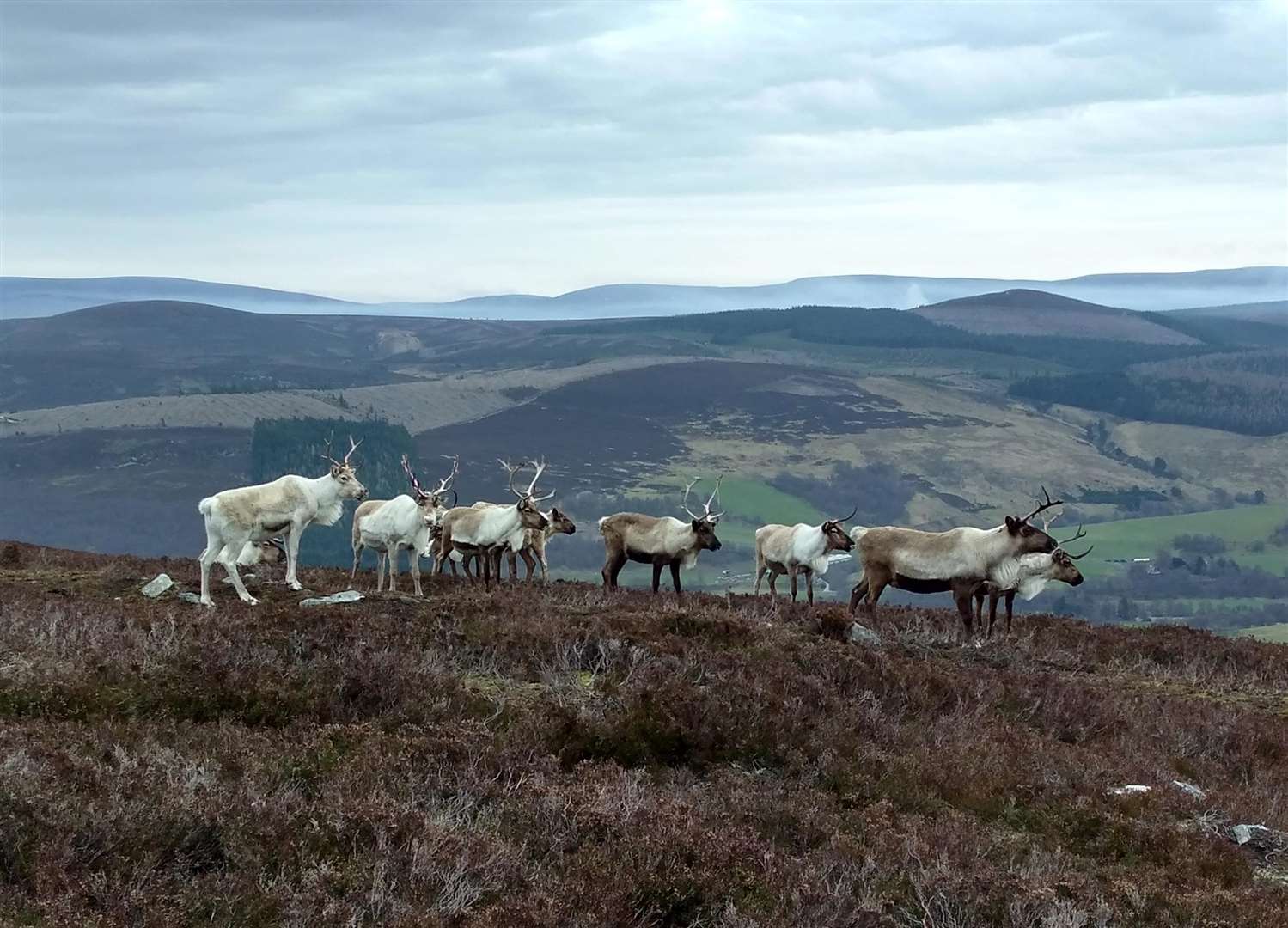
With my mind wandering as I ascended, an odd noise suddenly drew me back to the hillside and I looked up to discover I was in the middle of a group of reindeer. These are the main part of the Cairngorm reindeer herd, and I was glad to already know this otherwise I would have thought the heat had got to me! Slowing to a walk to avoid spooking them, I attained the ridgeline and turned right towards Carn a Ghillie Chearr, the Graham at the north end of the ridge.
I hadn’t appreciated the extra effort on the detour out to this second top, but the sight of the trig point spurred me on and I was soon enjoying the view towards Ben Rinnes. I retraced my route back to where I had ascended from Glen Avon and then carried on along the ridgeline back towards the Coronation Cairn.
It is the only really rough bit of going on the whole route. It’s pathless, undulating, tussocky, boggy… the adjectives go on, but is best summed up as unpleasant, frustrating and seems to go on far longer than the actual 2km the map shows.
From here I took my outward route back towards Cromdale. The descent is brilliant and easily makes up for the arduous going on the ridge. The fires on the hillside were still burning and I ran down through smoke-shrouded slopes, soon reaching the Piper’s Stone and turning right to descend back along the track to the road.
I realised I hadn’t looked at my watch for distance or pace throughout my entire run and it was a surprise to see I’d clocked up 27km and more than 1000m of ascent during the outing. Isn’t it amazing what we can do when we relax, enjoy ourselves and remember the reasons why we started going out into the hills?
Route details
Cromdale and Glen Avon
Distance 16.5 miles / 27km
Terrain Tracks, minor roads and some rough, pathless upland terrain
Start/finish Track starting at grid ref NJ101284. Limited parking on the minor road above Cromdale, please park in the village if you can’t find a considerate place
Map OS Landranger 36; OS Explorer OL61
Discover two glens on an up-and-over route of the quiet Cromdale Hills with plenty of ascent and some rough going