Cloudless skies inspire exploration of six Munros above Loch Callater
Register for free to read more of the latest local news. It's easy and will only take a moment.

Taking inspiration from the quote that it’s what happens between the summits of the Grampian Mountains that makes them fascinating, I planned a run out to the Munros of Tolmount and Tom Buidhe near Glenshee, accessing them via Jock’s Road beside picturesque Loch Callater and returning along the rim of the high corrie above it.
Arriving at the Invercauld Estate car park, the perfect weather forecast for the day lived up to expectation with a cloudless blue sky above and just enough breeze to keep the midges at bay.
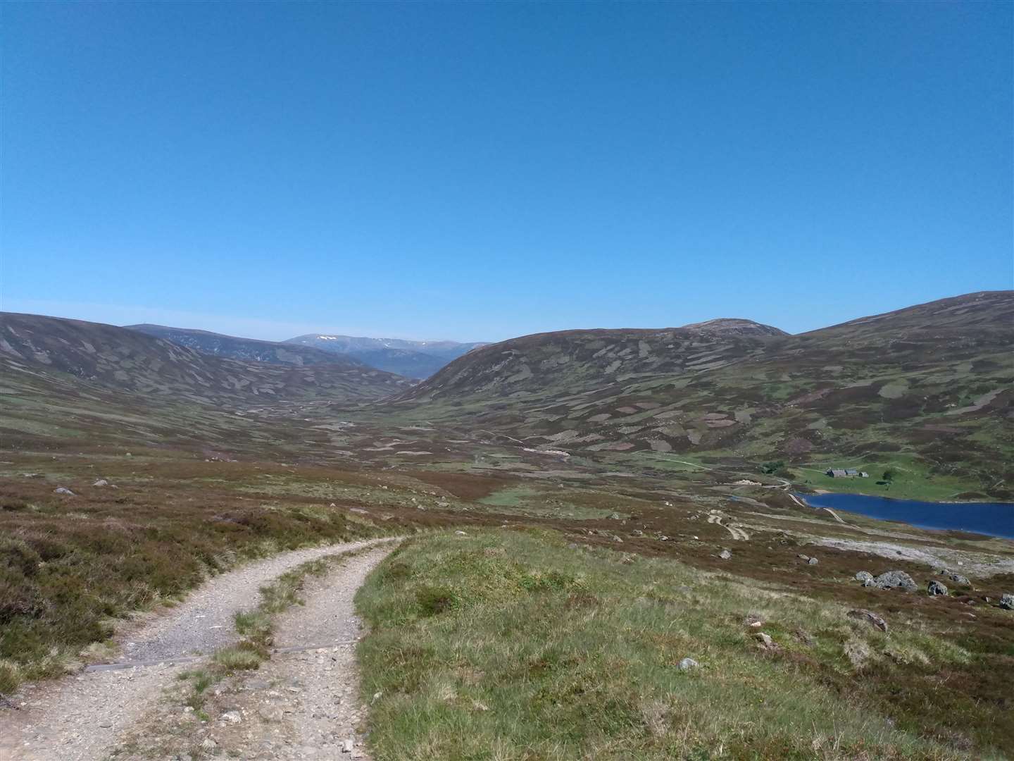
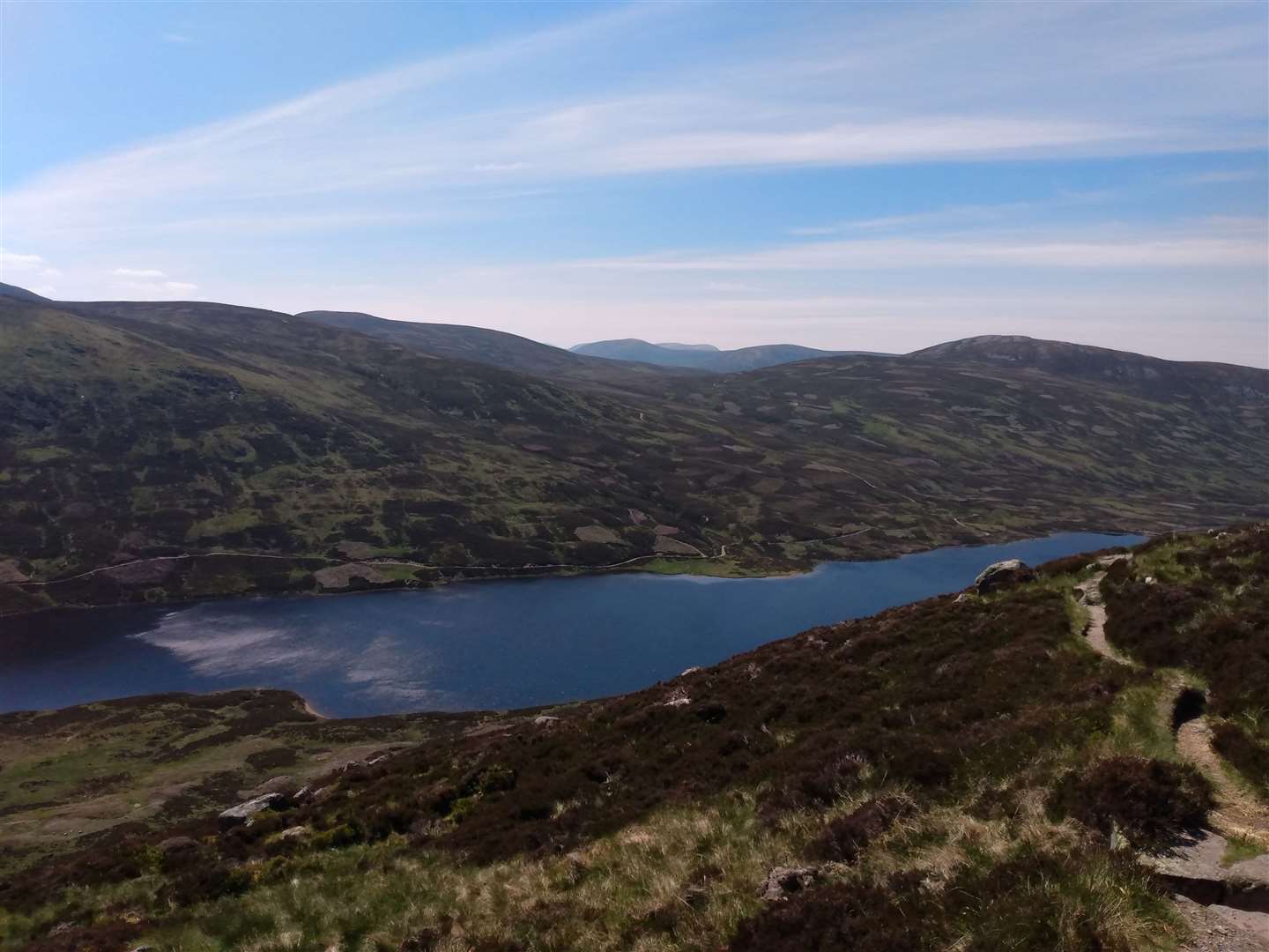
The track from the car park to Loch Callater is a bland estate track but the Callater Burn dropping from pool to pool beside me somehow eased the heat of the already high summer sun. Steadily the hills at the end of the glen began to inch closer and, at Loch Callater Lodge, I took the track around the right of the enclosure to cross a small burn to reach a beach at the head of the loch.
Despite the accessibility and picture-perfect background, I had the glen to myself and it was a tranquil place for a short rest. Looking towards the track to my right, the draw of the rounded mountains above was too much to resist and I decided to reverse the route to gain height first.
I overtook a couple of walkers and spurred on by this ‘victory’ I then set my sights on a mountain biker ahead, racing forward as the gradient eased. As the rider took to a steeper section ahead I suddenly clicked that I was chasing human power plus an extra 400W battery as the e-bike accelerated upwards at an impressive speed for an upland track. I finally gained ground as the stones underfoot became loose enough for the wheels to lose traction.
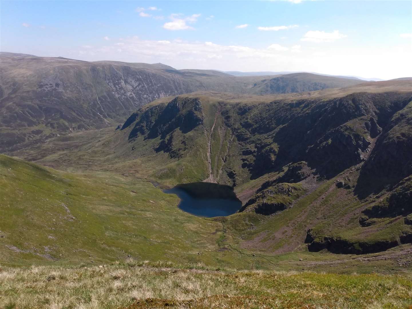
Passing the rider, the track was empty again and a cool breeze kept the strong sun from becoming too intense. The track began to contour around the top of Coire Loch Kander, the steep and dramatic cliffs hiding the high and secluded Loch Kander from all apart from those perched on the cliff edge.
This was the moment my route plan got tossed aside and fluttered away in the light breeze. There was no doubt that I would turn west, away from the corrie rim and my original route, towards the Munro of Carn an Tuirc. The easy short heather line became rougher as I neared the twin cairns along the summit ridge and, reaching the first, I could see walkers converging on the summit from several directions.
From this sociable cairn, the view across the plateau opened up towards the south and west and, in the slightly hazy conditions, row after row of peaks gradually faded towards the horizon.
If you are familiar with the terrain it’s easy to guess what happened next. Rather than head back towards the corrie edge, the shallow cone of Cairn of Claise called, beckoning me like a siren in mountain form.
The initial rough ground soon became grassy, fast and very runnable, and even the pull up towards the summit was enjoyable. Unlike the previous top, this summit was deserted apart from a pair of large solitary bees. They evidently thought my lavender and rose deodorant was the best thing they had smelt for months and spent the entirety of the stop trying to crawl companionably into my armpits. A new and unusual reaction to my summer running body odour...
From here it was onwards almost directly east towards Tom Buidhe, a quick compass bearing confirming that there was only one reason why such a large path would form up a “pudding of a hill” (Cameron McNeish’s words, not mine!).
The space on this vast area of high ground is incredible, especially on a clear, still summer’s day. In all directions the land rises and falls as Munros rise up above the plateau. Following a faint trod across the high plain, it was dry underfoot and with a single walker in the distance giving scale to the panorama, I got a euphoric sense of place in the vast expanse of the Grampian Mountains.
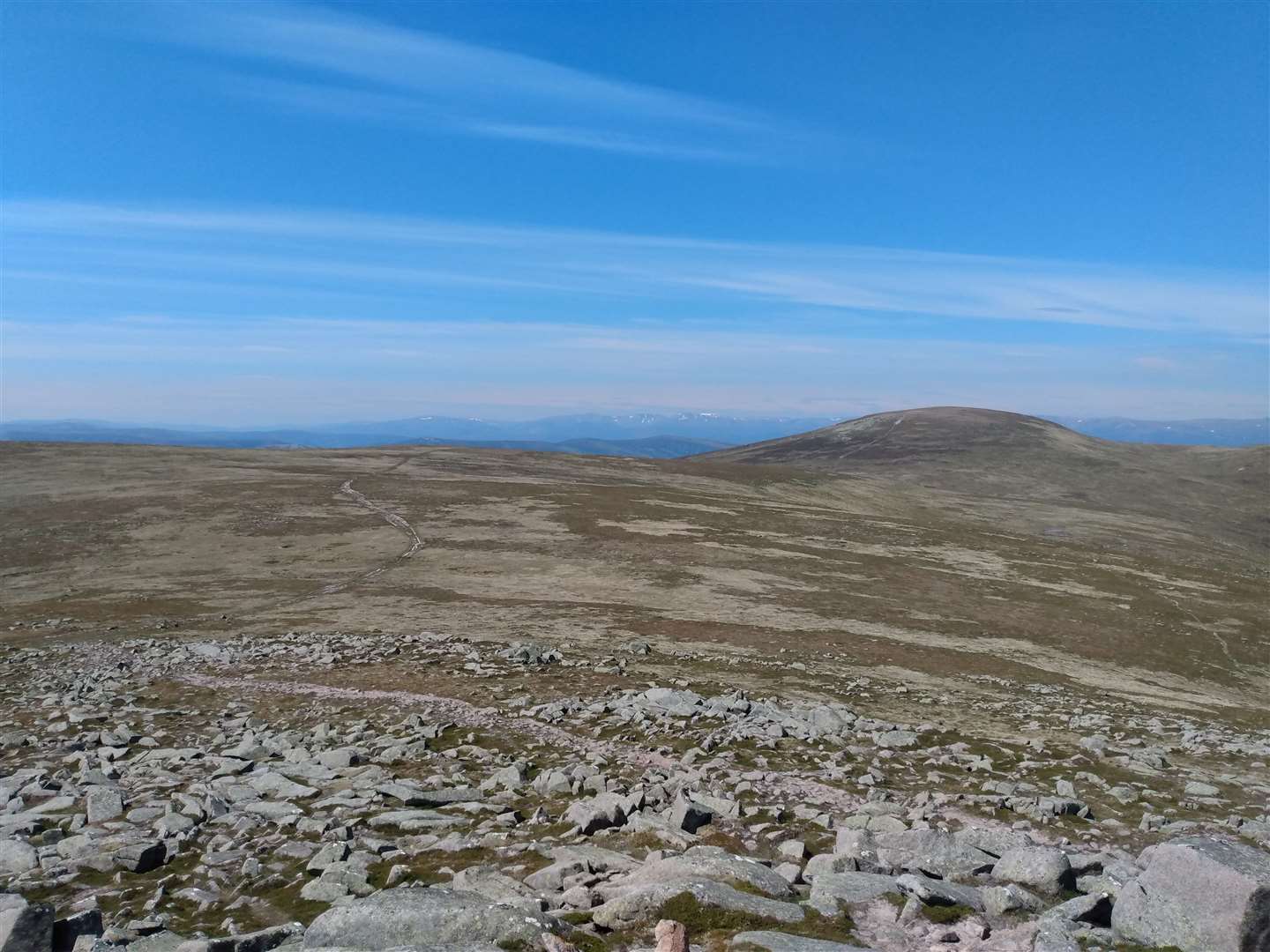
Photos always fail to do justice to this landscape – the photos always come out too flat, too brown or too grey, but it is within this emptiness that the beauty lies. The crowds at the car parks melt away into the hollows and rises of the grid of paths linking tops in endless permutations and despite the perfect weather I only saw a couple of other solitary walkers before reaching the summit of Tom Buidhe.
From here it seems an unfeasibly small distance to the neighbouring Munro of Tolmount, most notable for the view down into Loch Callater. After two quiet summits, I reached this cairn simultaneously with two walkers. Talking, we discovered we had all started many miles apart, converging on a point in the middle within hours of setting out on foot but, by car, it would be a day trip to circumnavigate the hills to visit all our car parks.
From here I consulted the map, and spied Carn-an t’Saigairt Mor, sitting proudly above Loch Callater and an outlier of the Loch Muick Munro circuit. I was not ready to descend from the plateau so decided to head for it.
After making a bee-line down from Tolmount to cross directly over Jock’s Road, I began ascending the slopes to join a ridgeline on the other side. I was almost surprised to encounter some less than perfect ground underfoot but the slowing of pace allowed me to enjoy the company of dotterels, chattering to raise the alarm while remaining close as I passed by.
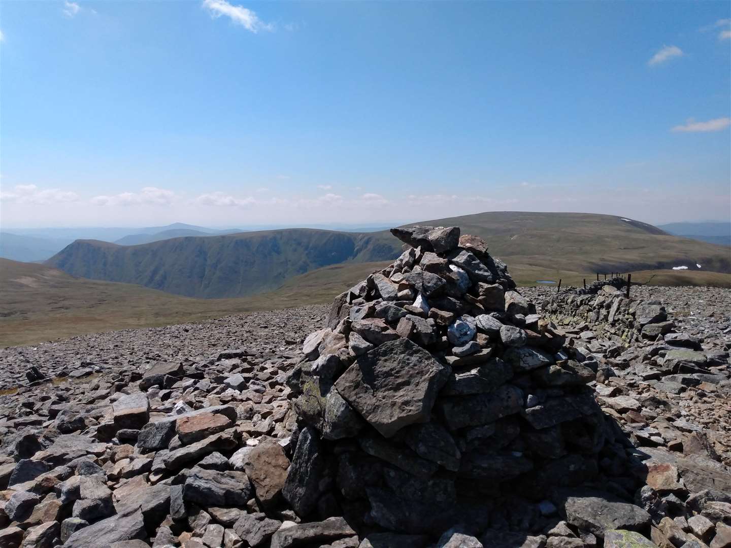
The busy path of the main circuit above Loch Muick was easily identifiable on the skyline as walkers where silhouetted against the sky. Another brief consultation of the map told me it would be positively rude not to make the short detour to the summit of Carn Bannock’s blocky summit which rises mere tens of metres above the main plateau. Despite my legs now starting to feel a little weary, the top seemed an effortless climb – probably because it was!
From here I could survey the other mountain summits, and looking westwards from the instantly recognisable Lochnagar, the next notable summit was that of my final hill, Carn-an Saigairt Mor. Fitting with the rest of the day, the clear path stretched like a high level yellow brick road toward my conical objective, and it was still with a slight spring in my step that I reached the top.
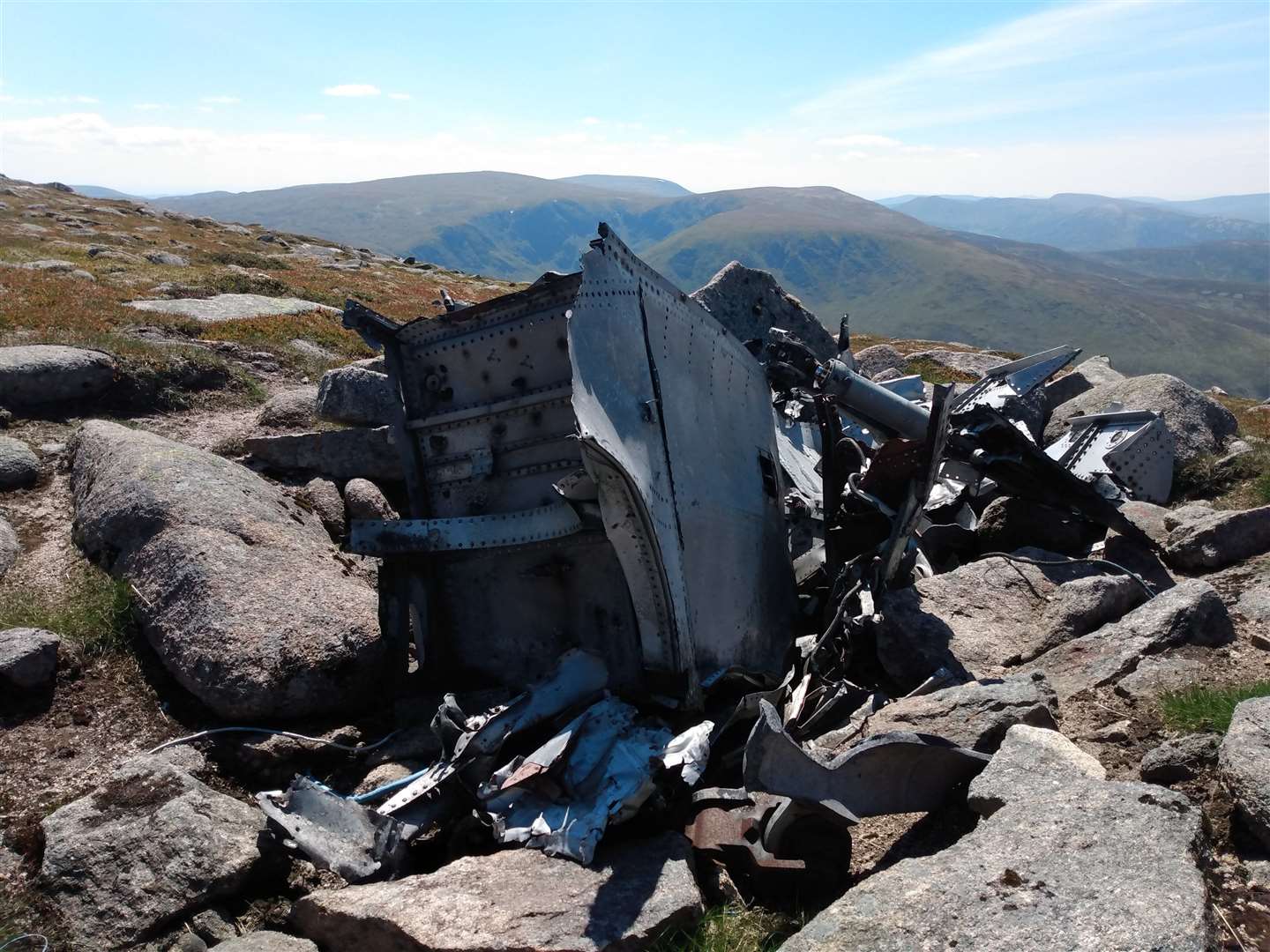
After a final exhilarated twirl to soak in the view from the top of Scotland, I started the steep descent down the western side of the hill, passing large pieces of aircraft wreckage. Despite knowing this was the resting place of a 1950s Canberra, the un-corroded nature of the debris looked un-unnervingly recent, and it was hard to believed these fragments of aircraft had been on this exposed hillside for well over half a century.
A steep descent along a fence line dropped me down to a clear path leading up from Loch Callater, amazing views down to the sparkling water below threatening to distract me from the technical ground underfoot. Losing height quickly I was soon contouring along the hillside above Callater Lodge, finally dropping steeply to join the outward route at the estate buildings.
The gentle downhill of the track helped the kilometres back to the car seem easier than they should have, and I was still in high spirits when I reached the final gate. This wasn’t the route I expected to do – an exploration of the spaces between the hills became a journey over six Munro summits – but this day was one for the high hills and I look forward to the day when Loch Callater calls across the mountains and the exploration of the route still to come.
Route details
Loch Callater Munros
Distance 20.5 miles / 33km
Terrain Hill tracks and paths, some rough and pathless ground
Start/finish Auchallater car park, south of Braemar on A93 at grid ref: NO156882 (charge applies)
Map OS Landranger 43 & 44; OS Explorer OL52 & OL53; Harvey Superwalker, Lochnagar, and British Mountain Map, Cairngorms and Lochnagar
A high-level circuit of six Munros surrounding Loch Callater. Good terrain underfoot almost throughout but difficult navigation in poor conditions