


Take your time to enjoy a walk along the Speyside Way and explore the new Rothes Way
Register for free to read more of the latest local news. It's easy and will only take a moment.

Summer has arrived with a bang and although I’d intended to run, it seemed a waste of this linear, low-level route to race along it; far better to meander in shorts and T-shirt, admiring nature as it accelerates from the browns and yellows of the prolonged winter into luscious greens.
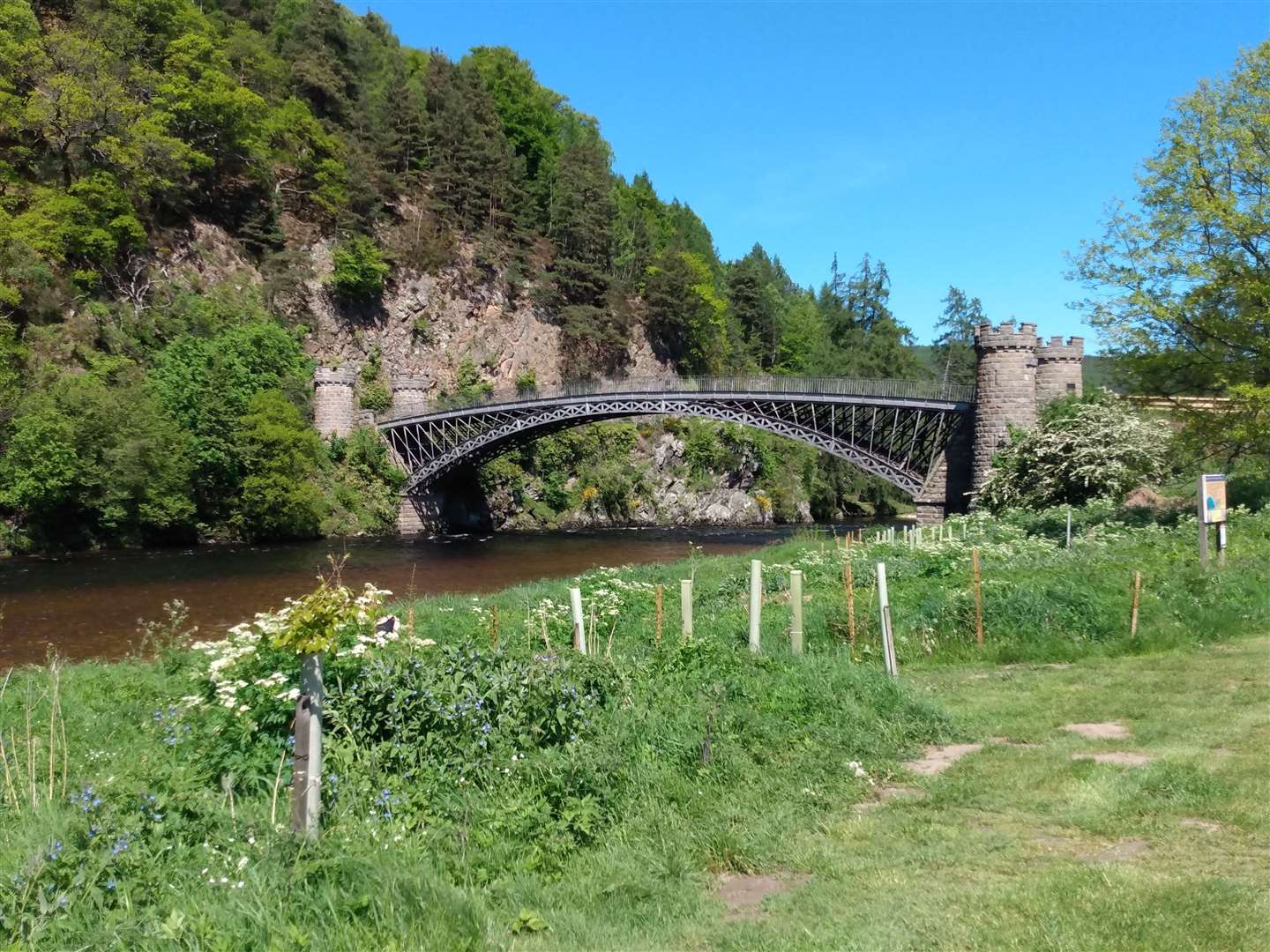
Starting in the centre of Aberlour, I set off uphill along Queen’s Road, soon passing the Fleming Hall and Fleming Hospital. Both these buildings are named after philanthropist James Fleming, best known for founding Aberlour distillery, and alongside funding community buildings his legacy also includes the Victoria Bridge across the Spey.
Turning left after the hospital, I followed the quiet road as it bore right and upwards between trees, passing some secluded houses before becoming a track and continuing to climb beneath dense pine trees.
The path deposited me on Allachie Drive and I turned left, squinting in the sudden light after the relative darkness amongst the pines. With a warm wind at my back I soon reached an old metal kissing gate leading left onto a path. The explosion of plant life meant I was soon walking down a narrow aisle of tall grass and trees finally adorned in leaves sashaying in the blustery wind.
Entering woods, I followed the left fork of the path onto a clear route above the Walker’s Shortbread factory. The gorgeous smell of baking sweet biscuits drifting through the trees made me regret not bringing provisions.
Staying right at a junction, the path leads to Aberlour House, a surprisingly grand building if you haven’t seen it before. It is now the headquarters of Walkers, who have extensively restored the house and grounds.
Passing the back of the building, along the back drive and over a bridge, I turned right onto a forest track, shortly turning left to follow the track as it made its way up the hill.
The extra bit of effort under the hot sun was noticeable, and I was pleased to have an excuse to stop as the gradient eased out and spot the whisky barrels surrounding the Speyside Cooperage, their geometric pyramids contrasting with the rolling Speyside hills and moors behind them.
The path finishes at a viewpoint above the River Spey, the aptly named Queen’s View.
The river shone blue, a ribbon of reflected cloudless sky winding through the green fields surrounding it. After soaking in the bold colour contrast below, I turned to descend back the way I had come, enjoying the views of Ben Rinnes on the skyline ahead. At the bridge I very carefully descended the steep path to the road below and then crossed the A95 to join the Speyside Way towards Craigellachie.
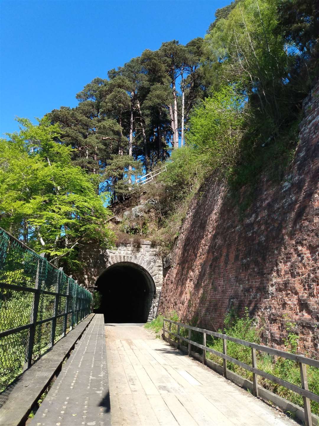
The upgraded Speyside Way is very well used and I passed walkers of all abilities, cyclists and runners, everyone out enjoying the sunshine. The highlight of this section is always the railway tunnel; welcomingly dark and cool today, it was a vast change from mid-winter when large icicles hung from the arched roof for weeks on end, occasionally crashing down alarmingly in any milder spells.
Shortly after the tunnel a set of steps leads down towards the river and it’s impossible not to stop and enjoy the sight and sound of the water as it chatters across the gravels in the sweep of the bend here.
The path winds through gorse and broom bushes adorned with their honey-scented yellow flowers. At a fishing hut the path becomes a track and my eye was drawn across the large open field to the unmistakeable span of the Telford Bridge ahead. Striding along the solid track, I soon reached the bridge.
After taking time to watch the clear water flowing under my feet, I then followed the old road, climbing the hill on the line of the old road as it diverges from the main road at a layby. Reaching the Archiestown road, I turned downhill to walk along a narrow verge back towards the main road – with Macallan Distillery just uphill, there was no shortage of lorries to keep an eye out for!


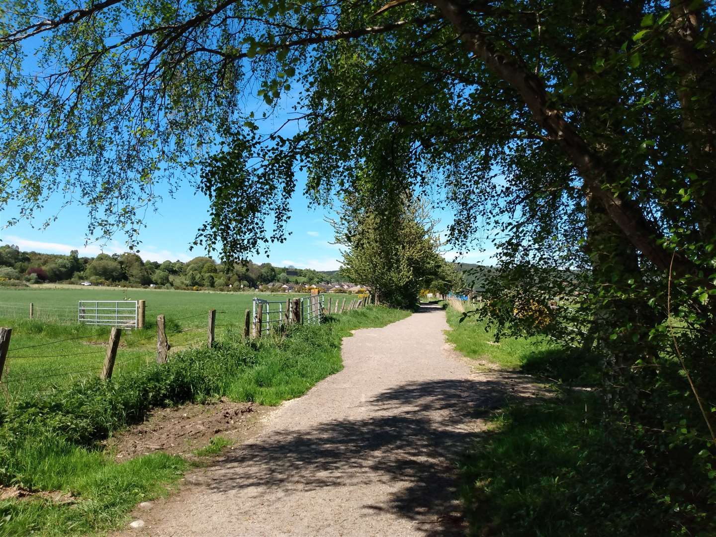
At the far end of the large layby, I crossed the A941 and dropped down the banking to join a path that treads the course of the old railway line. Despite being close to the road I was shielded from the traffic by a line of deciduous trees, including a particularly large rowan, branches weighed down with dense clusters of flowers. The path crosses a track and then rises to run alongside the road behind an Armco barrier.
It’s hard to deny that for this short stretch the rush of the River Spey to the right is sometimes drowned out by the rushing vehicles on the busy road only yards away to the left, but it’s brief and I was soon heading away from the road on a track to the right of a house.
Just past the house there is a pedestrian gate that leads onto a very well surfaced path, newly constructed as the first part of the Rothes Way to be completed. This is a community-led project whose aim is to provide a multi-use path linking Rothes with Craigellachie, giving a safe, off-road route for walkers and cyclists to travel between the villages, and link in with the Speyside Way.
The last few miles of the route back to Rothes passed quickly on the easy surface, and soon the solitary wall of Rothes Castle on the hillside above the village came into view.
Keeping on the track beside the fields and then between houses I reached Seafield Square slightly ‘sun-kissed’ and very glad I had decided to take my time and enjoy the journey for as long as possible.
To find out more about the Rothes Way project, including how to get involved and more about the route, visit www.rothesway.com
Route details
Aberlour to Rothes
Distance 6.5 miles / 10.5km
Terrain Clear paths, short sections of road walking
Start/finish Aberlour/Rothes (No.36 bus runs between the villages or an alternative walk return to the east of the main road)
Maps OS Landranger 28; OS Explorer 424
A low-level route through Speyside with plenty to see and easy walking