


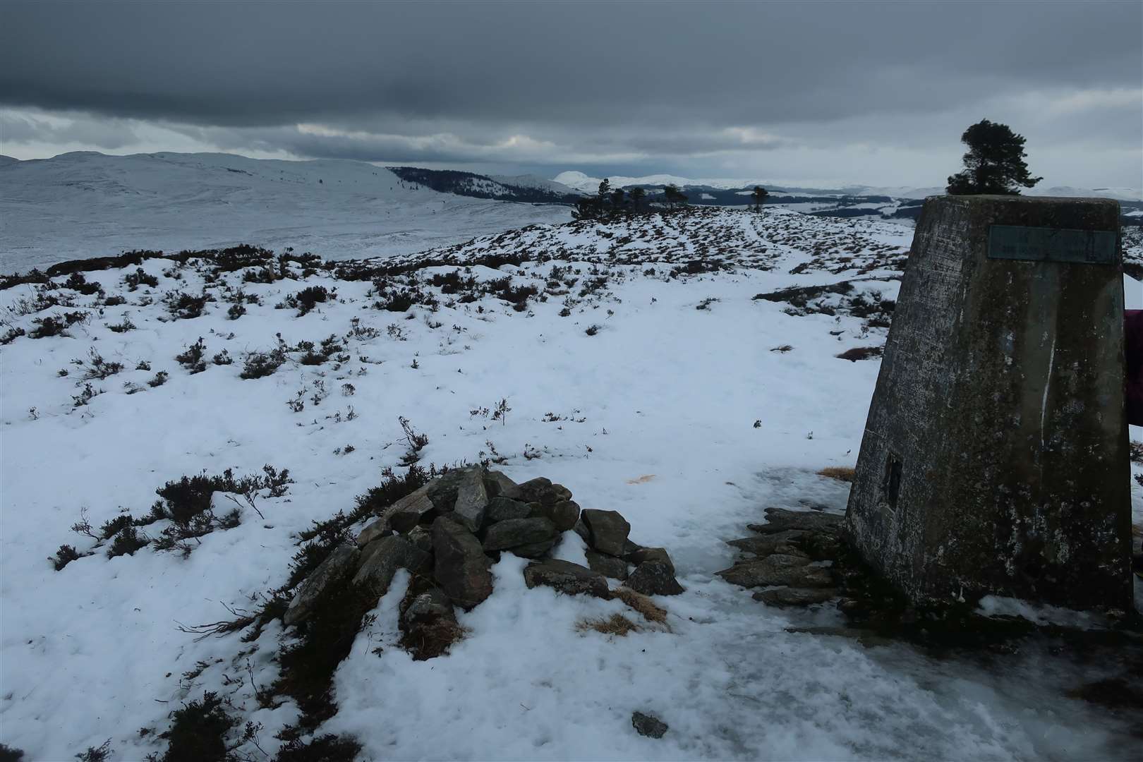
Climbing to the trig pillar at An Leacainn from Blackfold, near Inverness
Register for free to read more of the latest local news. It's easy and will only take a moment.

A ferocious wind turned what would probably be a fairly straightforward walk, in better conditions, into a character-building adventure.
An Leacainn is a small hill just above Blackfold, between Inverness and Abriachan, and is marked by a trig point at its 414m summit.
Missing the bigger mountains thanks to the ongoing lockdown, I thought it would be good to try something close to home but with a definite target to aim for.
With plenty of snow still on the ground at the time, it was also a bit of a winter outing for my daughter Clara and me. In fact, we spent quite a bit of the time wishing we’d brought the sledge – though in truth I’d probably have spent a lot of the walk dragging her along if we had!
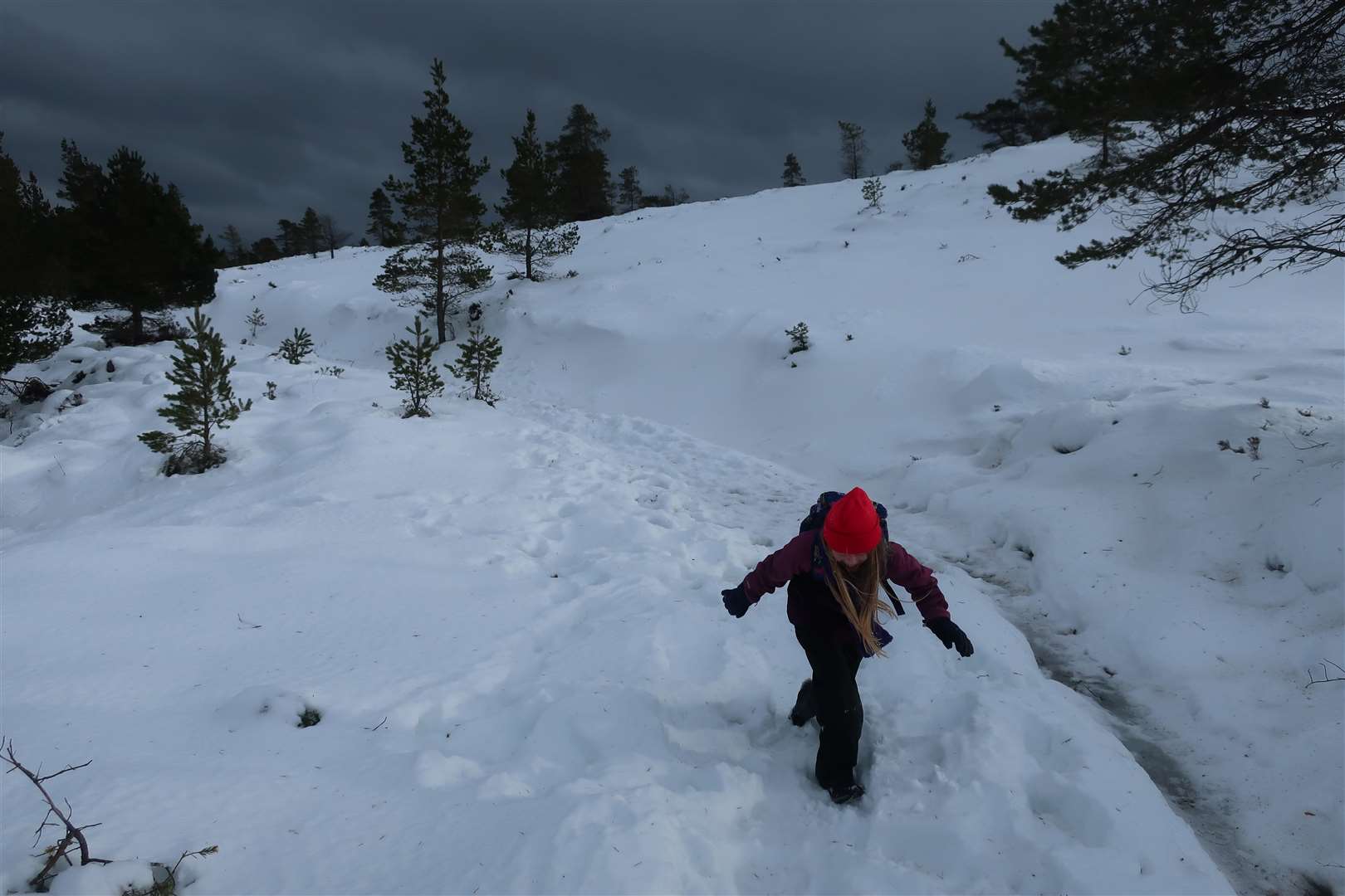
There was no need, thankfully; she faced the fearsome wind – which was strong enough to knock all 6ft-plus of me off my feet on the exposed moor – with good humour and a sense of determination.
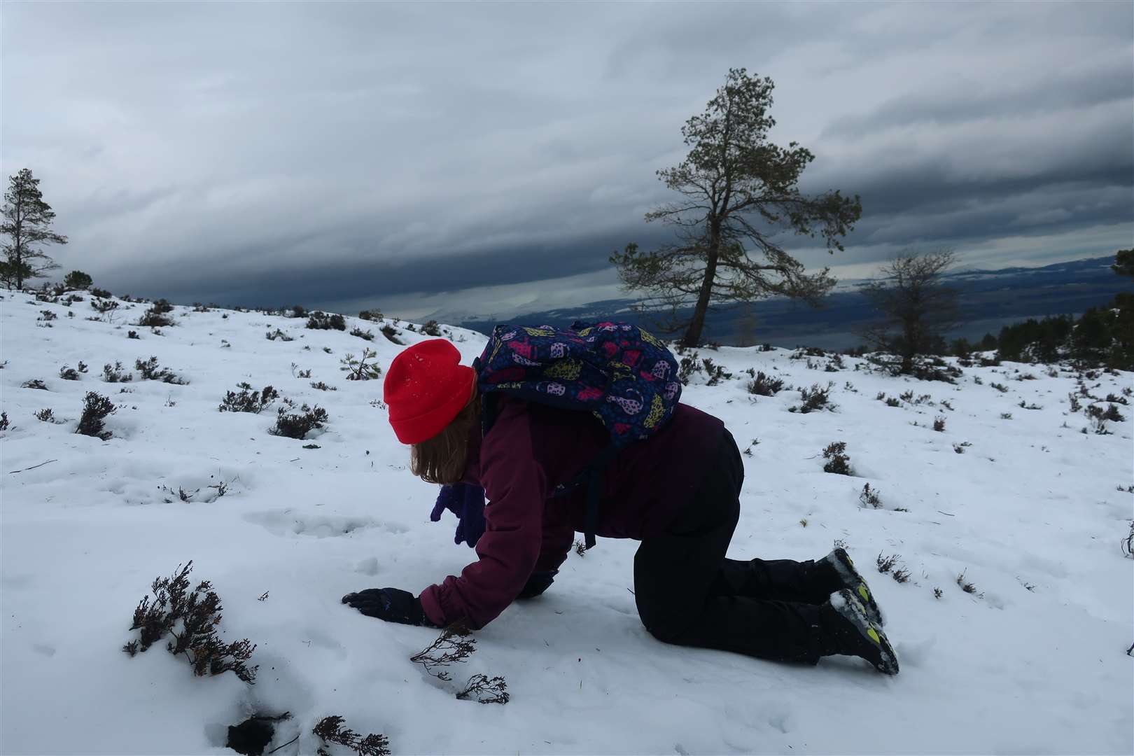
She dug herself little snow shelters, fell into the drifting snow (usually intentionally), hid behind the trig point at the top and even crawled some of the way, all while laughing about the challenge.
The really exposed part of the walk must have only covered around 600 horizontal metres, but it was akin to many a winter mountain blast I’ve experienced on the high tops.
We started at the small parking area at Blackfold, heading briefly left along the Great Glen Way path then turning right up a track that winds up past a gate through the plantation pine forest.
The wind was pretty strong down here, but the trees offered some shelter as we made our way up through the snow and ice. The track is extremely wet in places at the best of times, so some stretches were like sheet ice and needed avoiding by following vegetation at the side or minor detours behind trees.
At one point we could see down through a gap in the trees to the frozen Loch Dionach. It was covered with a layer of pristine white snow, the only thing giving its cover away being the perfect flatness among a more undulating landscape.
Shortly beyond this point, we reached a fork in the snow. More footprints headed right, leading downhill on the main track, but our route followed the few souls who had gone left here, climbing gently on a snow-covered path that rounds the southern edge of a lochan that is unnamed on the OS map.
There was plenty of fun for Clara – ok, and me – along here as high snow drifts lined part of the route, giving us no option but to slide down on our waterproofs.
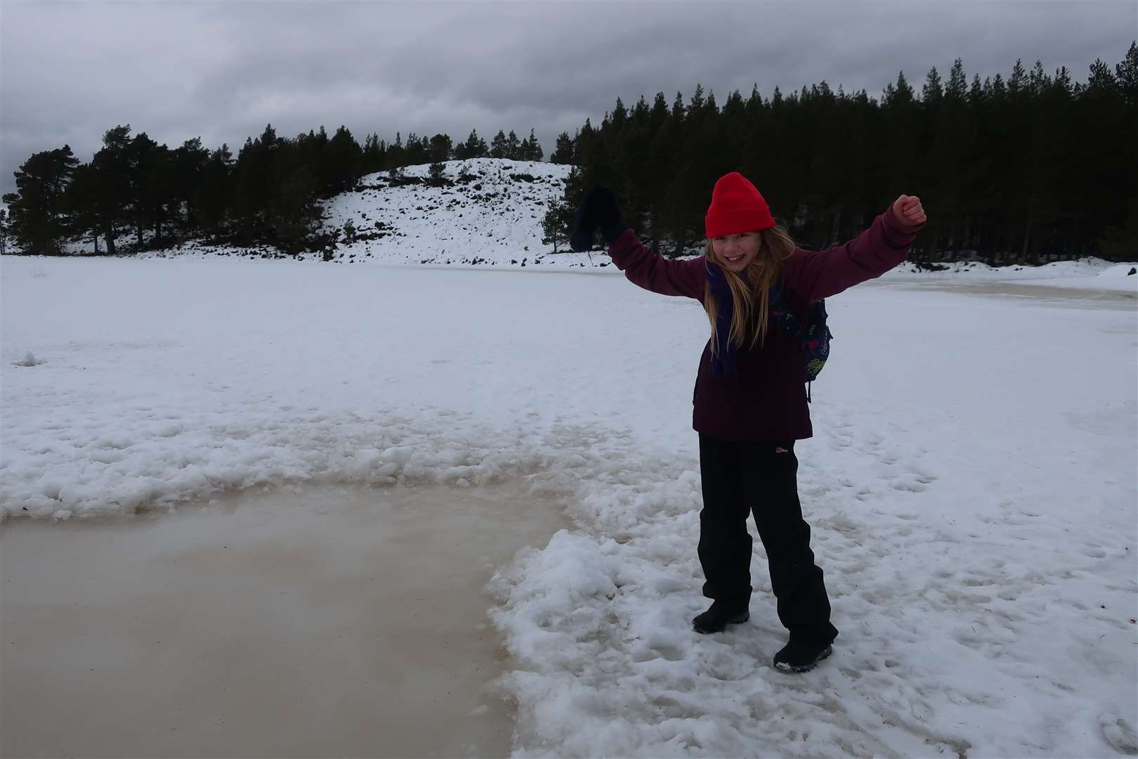
I noticed a little route down to the water’s edge – or the edge of the ice at least – and we followed it down to take a closer look. Others had been here before and when we got closer we realised why. A whole curling sheet had been cleared of snow on the frozen lochan.
The ice was still visibly thick for some distance out, so I headed out to take a closer look and Clara tentatively followed me – having quite rightly listened to us tell her never to walk out on frozen water. There were plenty of boot prints around the curling sheet and even one or two ski tracks going right across the lochan.
We returned to the path, continuing along and messing about in the snow. We passed the spot I thought might be where we should leave the path for the open hillside, but footprints continued and I wanted to see where they went, so we ambled a little further until we reached a fairly new deer fence. There was no way over, so we returned to the point and began the climb on a compass bearing roughly south-west to the summit.
As soon as we went over a little rise, the wind hit us. We could see we were on the right path as a route seemed to snake up to a gate in the fence above.
But battling the wind, we literally made our way from tree to tree, hiding behind their narrow trunks to get our breath back. Clara decided to crawl to the gate and was laughing so loud I could somehow hear it over the howling gale.
Opening the gate against the wind was another challenge, and I held it tight as Clara made her way through, followed by me, then tried to let it close as gently as possible. We made for the next tree and ducked down for a break – and a chance to gulp down a packet of Haribos to give us some energy for the battle to the top.
It must only have been a couple of hundred metres to the summit from here, but the challenge was real. I held onto Clara as we fought our way across the exposed moor, any words uttered between us lost to the air.
The trig point soon came into view. There was a short dip then a rise to reach it as we struggled to place our feet where we wanted to.
Finally reaching the summit, I told Clara to crouch behind the trig pillar as I snapped a very quick few photographs of the magnificent view – if only we’d been able to fully take it in!
The pillar itself has a sign: “An Leacainn (The Place of Flagstones)”. I confess my Gaelic doesn’t stretch to critical assessment, but as I’d not heard of this translation, I looked it up later and there does appear to be some doubt over this interpretation. Another suggestion is that the name means ‘broad hillside’, which certainly seems more appropriate to me.
It was a hillside we needed to get off quickly, with the wind sapping our strength and warmth. A path is marked on the map skirting the western edge of the hill and striking south towards the farm at Easter Altourie.
Obviously if the path did exist it would be under snow, but nevertheless I took us around the western side of the hill and tried to follow the rough route. A fairly clear line of snow seemed to lead in roughly the right direction, so we followed it, falling through the deep drifts one leg at a time as we laughed our way off the hill, the worst of the wind now behind us.
We only really knew we were on the right path when we saw the gate at the bottom, leading out onto the Great Glen Way. Pausing for a slurp of warm Vimto, we knew we now just had the walk back along the trail to Blackfold.
Snow covered the way again but mostly it was an easy walk back, disrupted only by a few snowball fights and some wildlife spotting – a red kite and a couple of deer that caught our attention and made for an interesting end to an exciting winter walk.


Route details
An Leacainn
Distance 3.4 miles / 6km
Terrain Forest tracks and paths with some exposed pathless moor
Start/finish Blackfold
Maps OS Landranger 26; OS Explorer 416
A wild wintry adventure to find a trig point summit
- Follow all Covid-19 guidance – stay at home except for essential travel. Exercise is classed as essential but you should stay close to home and avoid busy areas.