ACTIVE OUTDOORS: Torr Wood and Dores beach on a circuit that skirts Loch Ness
Register for free to read more of the latest local news. It's easy and will only take a moment.

Even at this time of year, Dores beach can be a busy spot with people heading down to Loch Ness, whether it’s for a walk, a play or even a cold-water dip in the bay.
This nice little circuit through the Torr woods takes advantage of an alternative start to avoid the busier part of the beach, while still getting all the benefits of the spectacular views.
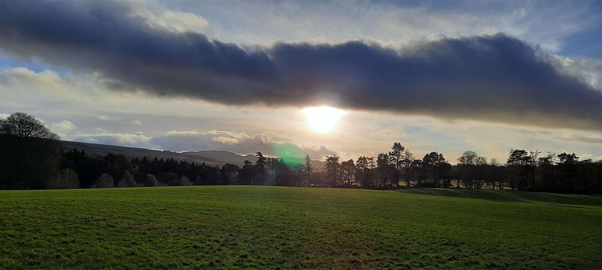
There’s a peacefulness about a wander through the woods here, despite its popularity. I began at the informal parking area beside the Aldourie primary school – it was a Sunday so there was no danger of it being full.
Parking at Dores beach is only for customers of the Dores Inn, but there’s a car park at the village church that can be used by the public when there are no services on. Here at Aldourie, the estate has provided a small parking area just a few hundred metres down the dead-end road that begins opposite the school.
From the school parking area, I crossed the road and started by following this single-track road, signed for Aldourie, to the estate car park. Cutting through that area, which lies off the road to the left, I went through the gap in the fence and cut diagonally across the field towards the woods.
A very boggy track must be crossed close to the car park – a result of heavy vehicles coming and going due to ongoing work at the castle and surrounding estate grounds.
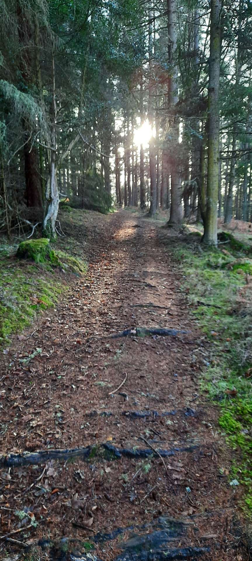
It was mid-afternoon and the low sun was creating a beautiful light through the tops of the trres and I looked south in the direction of Loch Ness. Soon you enter the woods and reach a recently upgraded forestry track.
Turn left and follow this track through the woodland as it wiggles its way alongside the edge of an open field.
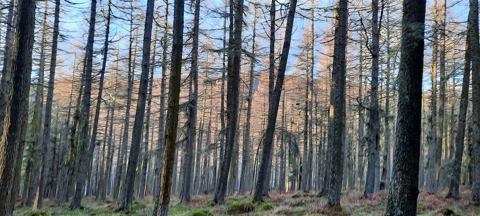
At a junction there are a few options, two of which split and rejoin just beyond the top of the low hill marked as An Torr on the OS map. I opted for the furthest right, leaving the newer surface for one of roots and earth, which follows a level route along the hillside, with views to the northern end of the loch seen through the tall trunks of pine.
After passing the high point of the 62m hill, the track bends left and two options are available again. The first left just heads back to the last junction, so take the second left that drops more steeply.
There are a few ways you can shortcut down to the right although the track does continue to a junction where you cut back on yourself to the right. Whichever of the vague paths you end up on – I was cutting through a narrow route through the gorse at one point – aim roughly for the gate at the edge of the forest. If you’re going downhill, you won’t be far off!
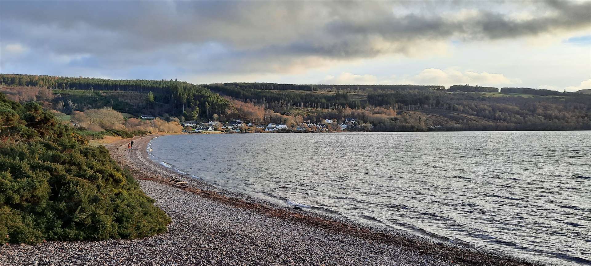
Instead of going through the gate, our route turns right onto a path around Tor Point – but first I headed straight down onto the western end of the beach. You can’t get much further on the pebbles so it’s usually relatively quiet at this point, and that was certainly the case today.
I paused on the beach to admire the view down Loch Ness, with Meall Fuar-mhonaidh prominent as ever as it sticks its top above the surrounding hills to capture the attention.
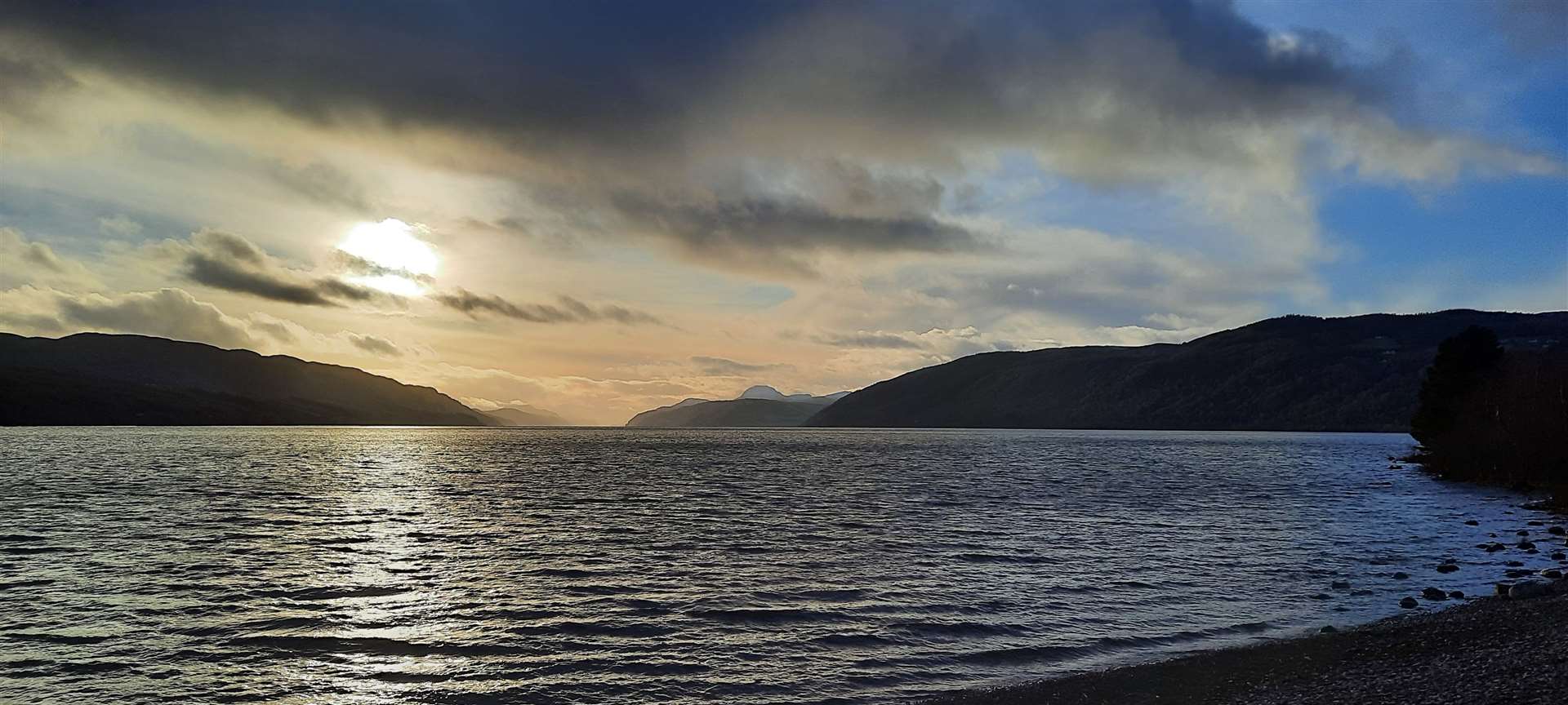
To the left is a view of the sweeping curve of Dores beach to the village beyond. Dog walkers and others were meandering along the stones further along, but I turned back up to the path and headed left to continue on my way around the point.
This track follows the line of the shore to the north, eventually dropping right down to almost touch the water, with plenty of opportunities to nip between the trees onto small beach areas and look out over the water to the steep screes opposite.
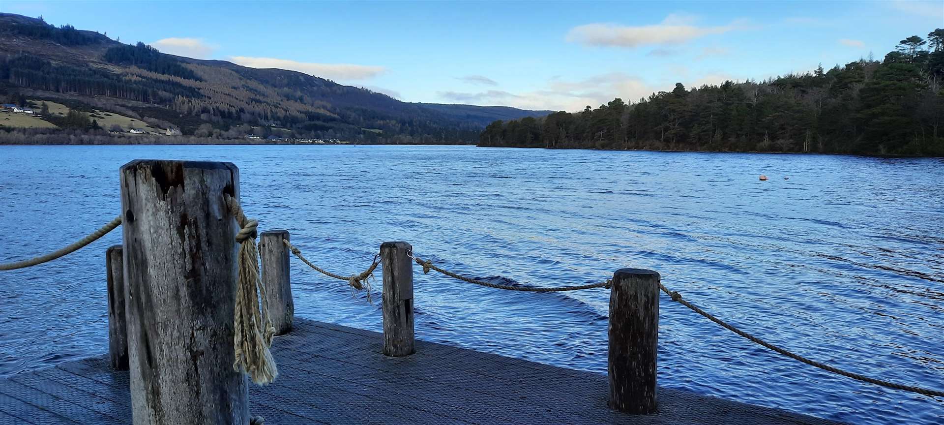
Go through a gate at Aldourie Pier, where you can wander out onto the old jetty to get another view across the boats moored in the little harbour to Lochend across the water.
The route continues uphill on a track past a house all the way to a gateway into the castle grounds. These are closed off due to the works, so you can turn off to the right just before reaching the gateway, and follow a good track diagonally through the trees and back to the little cut into the field close to where you began.
I crossed the field – and the muddy track – before following the minor road and crossing at the school to complete this pleasant circuit of the Torr Wood.
Route details
Aldourie run
Distance 3.75 miles / 6km
Terrain Paths and tracks mostly through forest, muddy in places
Start/finish Aldourie school, near Dores
Map OS Landranger 26
A circuit through woodland on the edge of Loch Ness