


ACTIVE OUTDOORS: Run to Loch Ness beach makes fine loop from Holm
Register for free to read more of the latest local news. It's easy and will only take a moment.

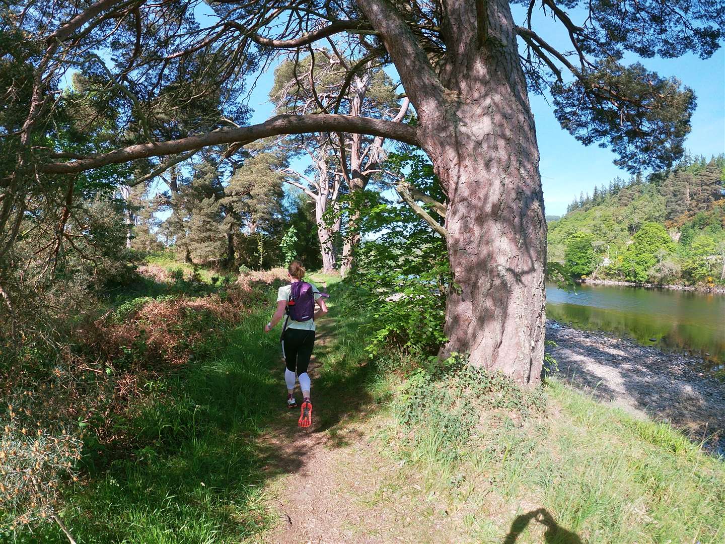
People travel from all over the world to see Loch Ness, so given it’s only a stone’s throw from Inverness, it seems sensible to enjoy it as a local too!
This loop is one I have enjoyed as a run and on the mountain bike, and in these current dry conditions it is made slightly easier on the sometimes-flooded riverside path.
I’ve often thought that with a few more paths to link things up, and one or two improvements here and there, it would make a great trail to promote between the centre of Inverness and Dores beach.
To continue reading
Subscribe now!
Use the code 4MONTHSFREE and pay nothing for the first 4 months of a Digital + subscription.
Digital
£3.99 per month or
£37.88 per year!
Subscription benefits
- Unlimited web access
- Cancel anytime
Digital +
£4.99 per month or
£49.88 per year!
Subscription benefits
- App access
- E-edition access
- Unlimited web access
- Cancel anytime

Print & Digital +
£74.99 per year!
Subscription benefits
- Vouchers for print version of one chosen newspaper (except Inverurie Advertiser, Ellon Advertiser and Turriff Advertiser)
- App access
- E-edition access
- Unlimited web access
Digital
Monthly
Yearly
Save £10 compared to paying monthlyDigital +
Monthly
Yearly
Save £10 compared to paying monthlyPrint & Digital +
Yearly
Frequently Asked Questions
Subscriptions
How do I download my app?
How do I download my app?
- The app is available for iOS and Android. Once subscribed, search for the app (HNMedia) in the Apple or Google Play store to download it. You will be able to find links to it on our website as well. Log in to your app using the email and password you have set for your subscription account.
How can I reset my password?
How can I reset my password?
- Please click on the Login button and at the bottom of the box you will see a link for resetting your password. Click on this link, type in your email address and click on Reset. You will be sent an email with a password reset link. Via that link you will be able to type in your new password.
I subscribed to the Print & Digital + package. How many newspaper titles do I get vouchers for?
I subscribed to the Print & Digital + package. How many newspaper titles do I get vouchers for?
- You get vouchers for one newspaper title of your choosing.
How can I change the email address that you send my emails to?
How can I change the email address that you send my emails to?
- Once logged in to your account, click on “My Account” above the Logout button, where you will be able to edit your user details as well as cancel your subscription.
Can I purchase the app by itself?
Can I purchase the app by itself?
- No, the app is not available as a standalone product. It is only available as part of our Digital + and Print & Digital + packages, however, these packages offer greater value for money.
Does my subscription renew automatically?
Does my subscription renew automatically?
- If you choose a monthly membership, your subscription will automatically renew on a monthly basis without you having to take any further steps. If you have chosen an annual membership, your subscription will automatically renew for 12 months when your current one expires, without you having to take any action. For details about cancelling, please check our Terms & Conditions.
Can I switch my subscription package after purchase?
Can I switch my subscription package after purchase?
- Yes, you can cancel your subscription, and then purchase a different package. Digital subscribers can upgrade to Digital + or Print & Digital +. Similarly, monthly subscribers are able to upgrade to an Annual package.
How can I view my subscription details?
How can I view my subscription details?
- Once logged in to your account, under the “My Account” tab you will be able to edit your user details and view your subscription information. You can see your subscription type, cost, billing history, purchase date and renewal date.
How can I cancel my subscription?
How can I cancel my subscription?
- Cancelling your subscription is simple. Once logged in to your account, click on “My Account” above the Logout button, where you will be able to edit your user details as well as cancel your subscription.
How can I unsubscribe from the email marketing list?
How can I unsubscribe from the email marketing list?
- At the bottom of the emails we send you, you will see an unsubscribe button, which will automatically remove you from our mailing list, once clicked.
What are my subscription login details?
What are my subscription login details?
- Your login details will be the same as you have provided when registering to our website. If you have forgotten your password, you can reset it by clicking on the Login button on the top right of the screen and then at the bottom of the box on the “Reset Password” link.
What will happen to my previous e-edition subscription?
What will happen to my previous e-edition subscription?
- You will be sent a link to access your edition by email. You will be able to access your e-editions until your subscription expires. After that, you can subscribe to our new digital packages!
Further Questions
Further Questions
- Should you have any further questions, please contact us at readers@hnmedia.co.uk.