ACTIVE OUTDOORS: Ousdale Broch path is like stepping back in time
Register for free to read more of the latest local news. It's easy and will only take a moment.

Five years ago I visited Ousdale Broch on a wild walk along the John O’Groats Trail between Helmsdale and Berriedale, one of the most exciting stretches of that route.
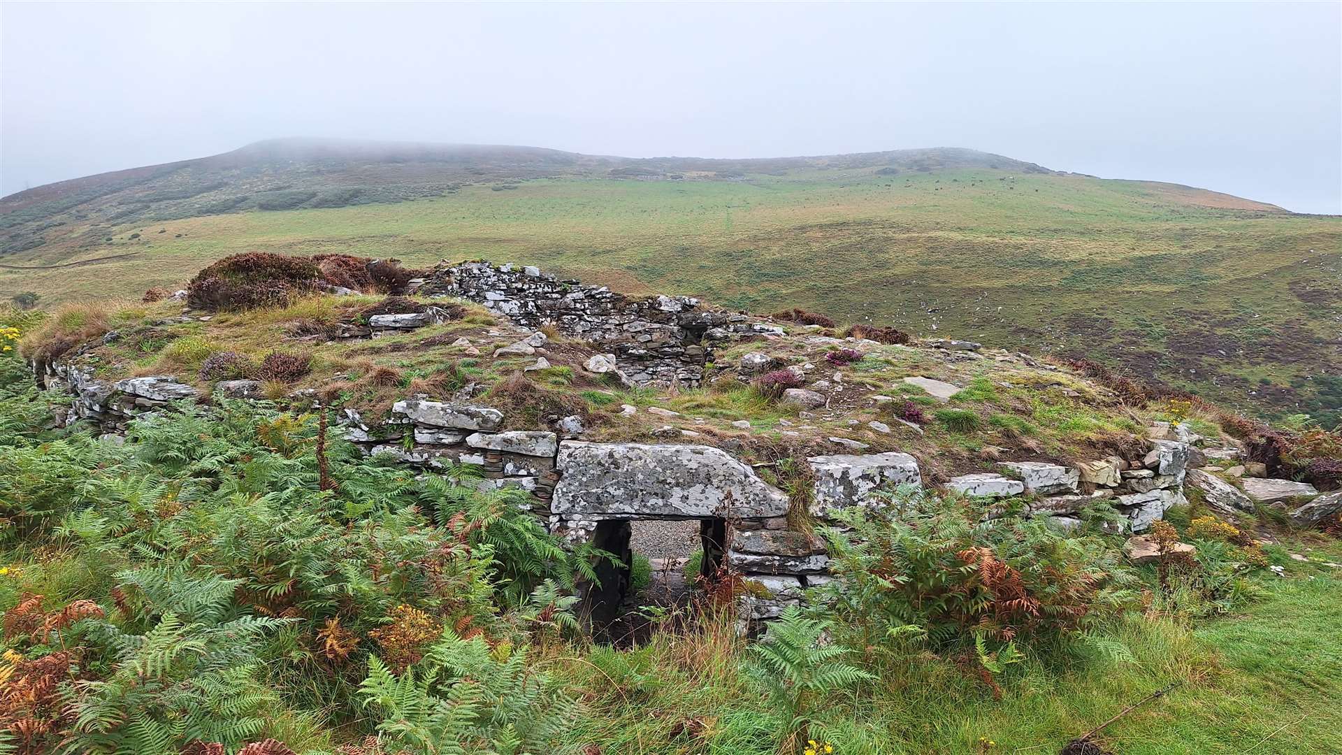
What a lot has changed in that time! Back in 2018, the remains of the broch’s walls were bulging and in danger of collapse, while a decades-old rowan tree was growing sideways through the stonework.
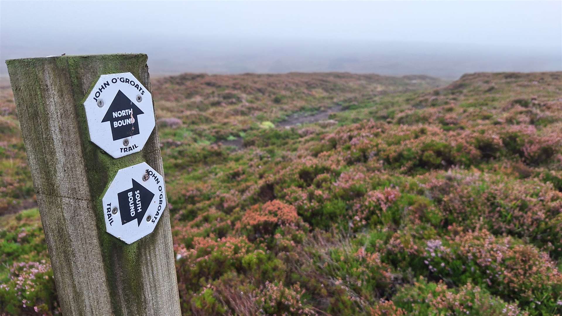
The path that got us there wasn’t much of a path. It led along the old Ord Road which was designed in 1802 for horse-drawn carriages, then diverted off through the moors to reach the lonely broch.
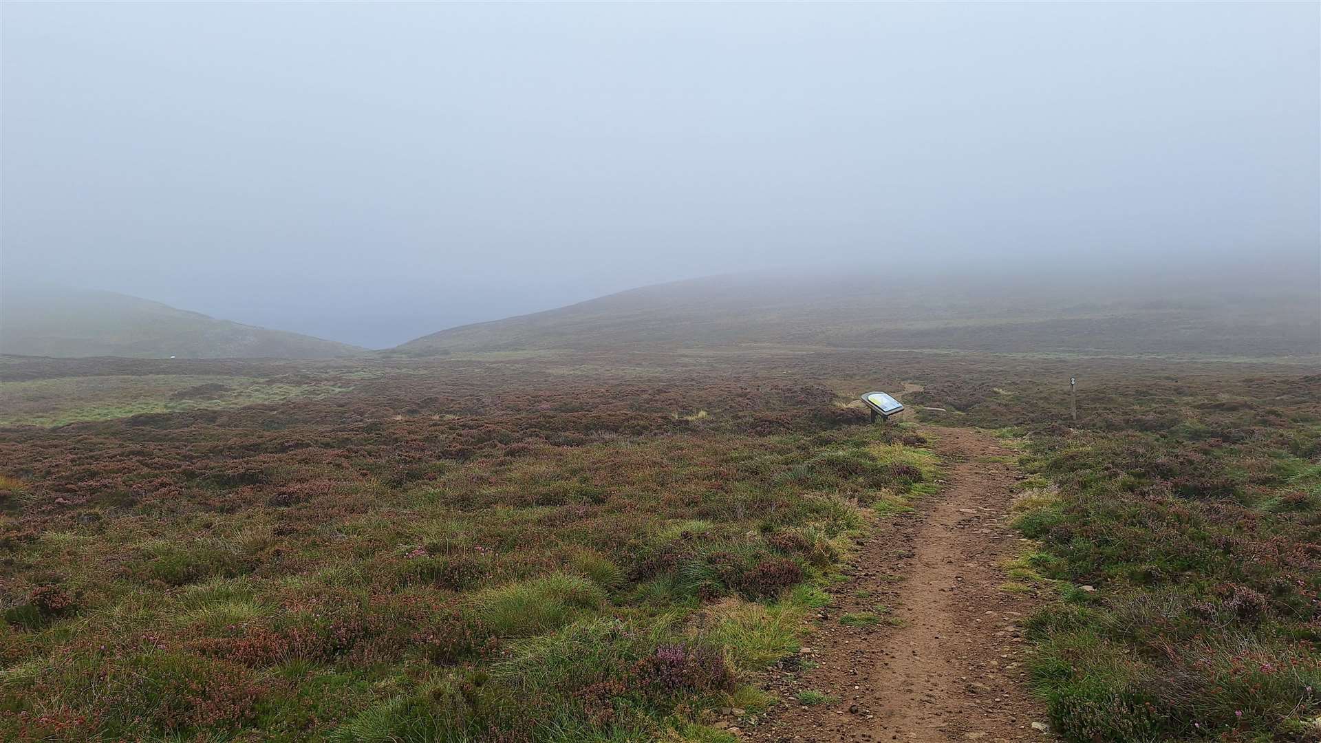
Now a newly built path leads you from the modern A9 down to the Iron Age structure, thanks in no small part to the Caithness Broch Project.
The broch project is a Scottish charity dedicated to the promotion, preservation and conservation of Caithness archaeology and heritage sites. It has grand plans to build a full-size replica broch and is close to selecting a suitable site in Caithness.
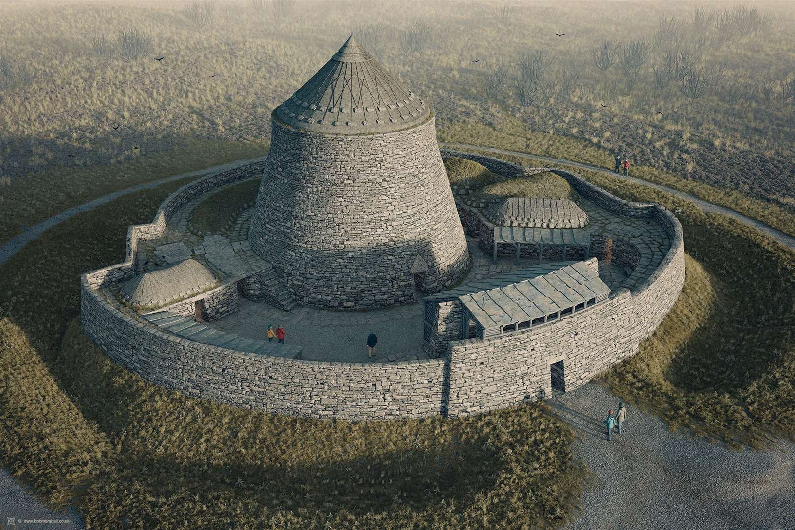
The work would be done using traditional methods as closely as possible, to help increase the understanding of how these incredible structures were made.
As well as becoming a premier visitor attraction, it will also give an insight into the past and offer employment and skills training in Iron Age crafts. It’s an exciting and ambitious plan, but what a fantastic vision to have – and the determination to see the idea through to fruition is clearly there.
I was interested to see what they had done to the broch at Ousdale because, as well as creating the path and car parking area, the broch itself had been conserved by the charity, too.
On the short walk down to the broch, there are a series of information panels full of fascinating facts not just about the broch and its renovation but also about the history of the area.
The path crosses the former Ord Road, and the old horse-and-carriage route can be clearly seen – in fact, the John O’Groats Trail south from here still follows that route to enter Sutherland.
The crossing of the Ord is described as an “emotional experience for Caithnessians” and is one that has clearly been a challenge for road builders over the last few centuries.
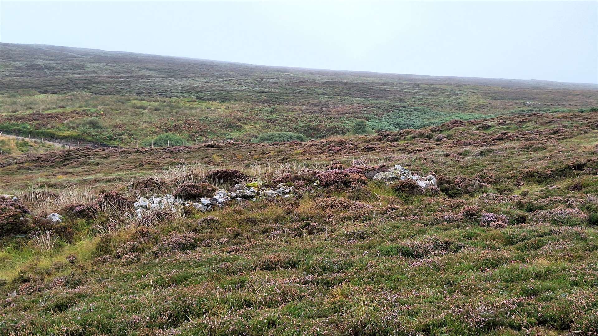
Further down the path you reach the remains of Borg village, which was built with stone taken from the ruined broch. The remains of various homes can be seen among the thick heather and a stile leads into the field for anybody interested in taking a closer look.
This crofting community was cleared in the early 19th century, like so many others. Those with an adventurous spirit might be interested in continuing this walk beyond the broch, across the deep ravine that carries the Ord Burn and along to Badbea Clearance Village. However, that part of the John O’Groats Trail is particularly steep and great care is needed.
On the approach to the broch, another information panel tells you more about the various excavations and finds at Ousdale, which is described as one of the most spectacular prehistoric buildings in Caithness.
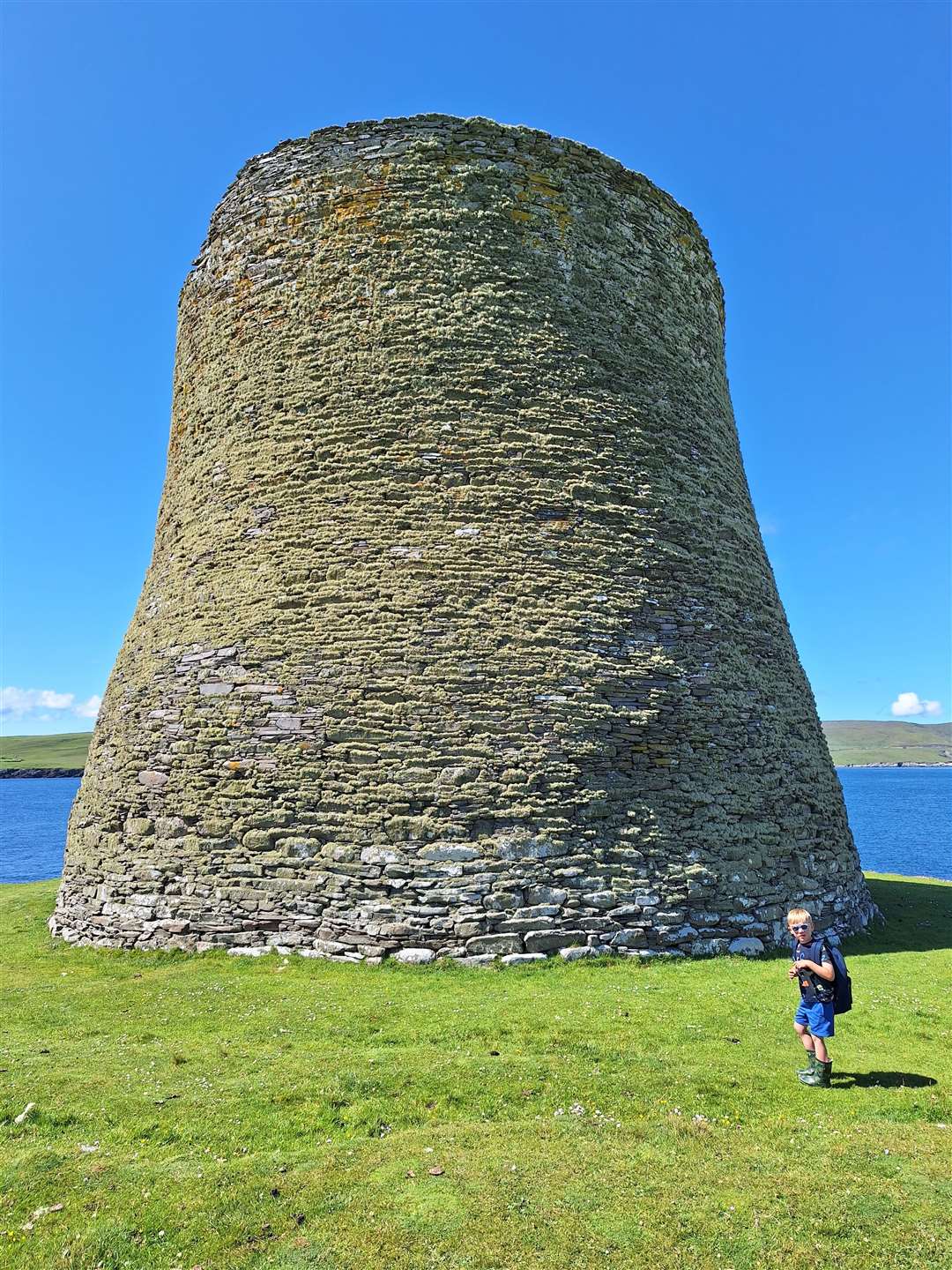
Such interpretation of these Iron Age structures can be hard to imagine, but I was lucky enough to visit the best-preserved broch anywhere this summer when I was in Shetland. Mousa broch rises to 13 metres high and visitors can – at their own risk – climb the internal staircase between the walls to reach the open top. You need a head for heights for that one, but it is well worth the trip.
Arriving at Ousdale Broch, the contrast to what I had seen five years ago was clear. Inside, after ducking under the doorway, you can access a few of the cells and see other recesses that would have been used for storing domestic items.
The staircase leads up just a few steps into the open air, and across in the opposite wall the trunk of that rowan tree – now cut off in line with the stones – remains in place. Caithness Broch Project worked with Historic Environment Scotland to repair and stabilise the broch, with an absolute minimum of new material used in the conservation works.
It was decided to leave the tree trunk in place as it had become one with the stonework – just another bit of history added to the thousands of years of time that has passed while this broch has been here in this seemingly timeless landscape.
After exploring the broch for a while, I headed back up the hill to the parking area. This little excursion is really interesting, and easily accessed on any journey up or down the A9.


Route details
Ousdale Broch
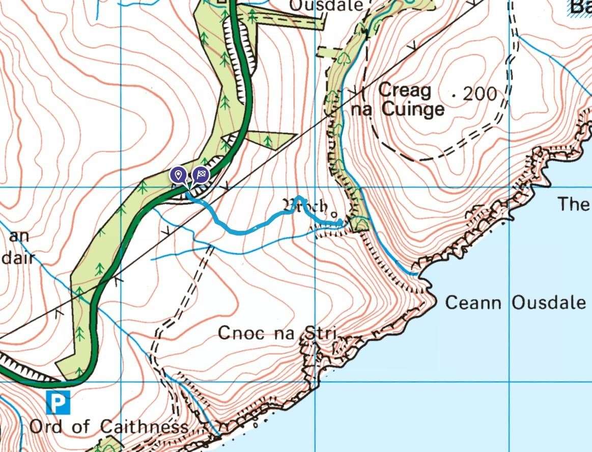
Distance 1.5 miles / 2.5km return
Terrain Path, muddy and steep in places
Start/finish Ousdale Broch parking area, off A9 north of the Ord of Caithness
Map OS Landranger 17; OS Explorer 444
Taking a closer look at Caithness’s best-preserved broch
Click here to see the route in OS Maps