ACTIVE OUTDOORS: Exploring a promontory fort and sea stack on walk from Scrabster to Holborn Head, near Thurso
Register for free to read more of the latest local news. It's easy and will only take a moment.

Defence is the best form of attack, they say, which suggests this remarkable fort must have been a place to be reckoned with in its day.
On all but one side it is surrounding by high, precipitous overhanging cliffs, battered by waves day after day and night after night. On the other, the remains of a thick linear wall can still be seen, with natural chasms and ditches ahead of it making the land entrance a formidable challenge too.
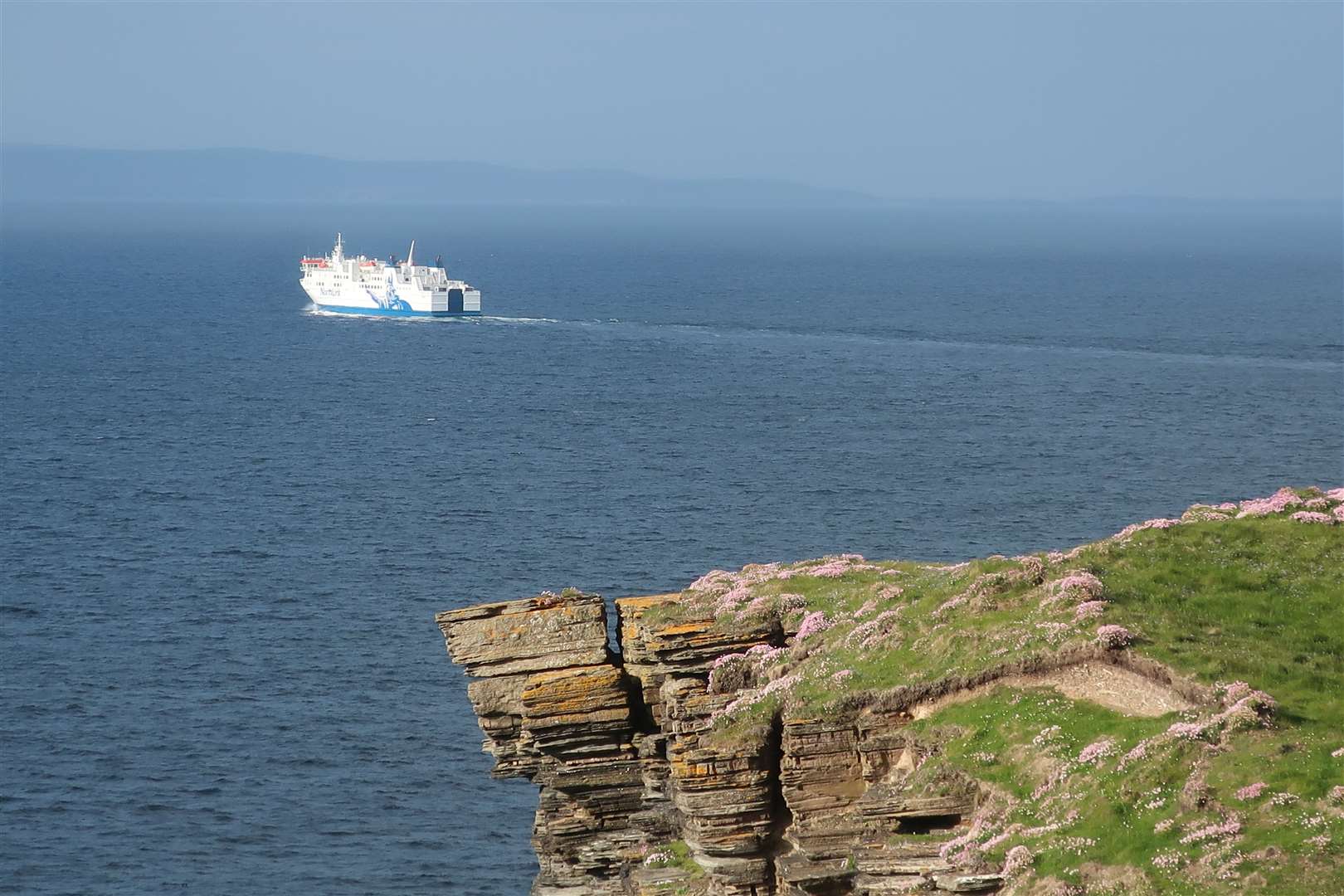
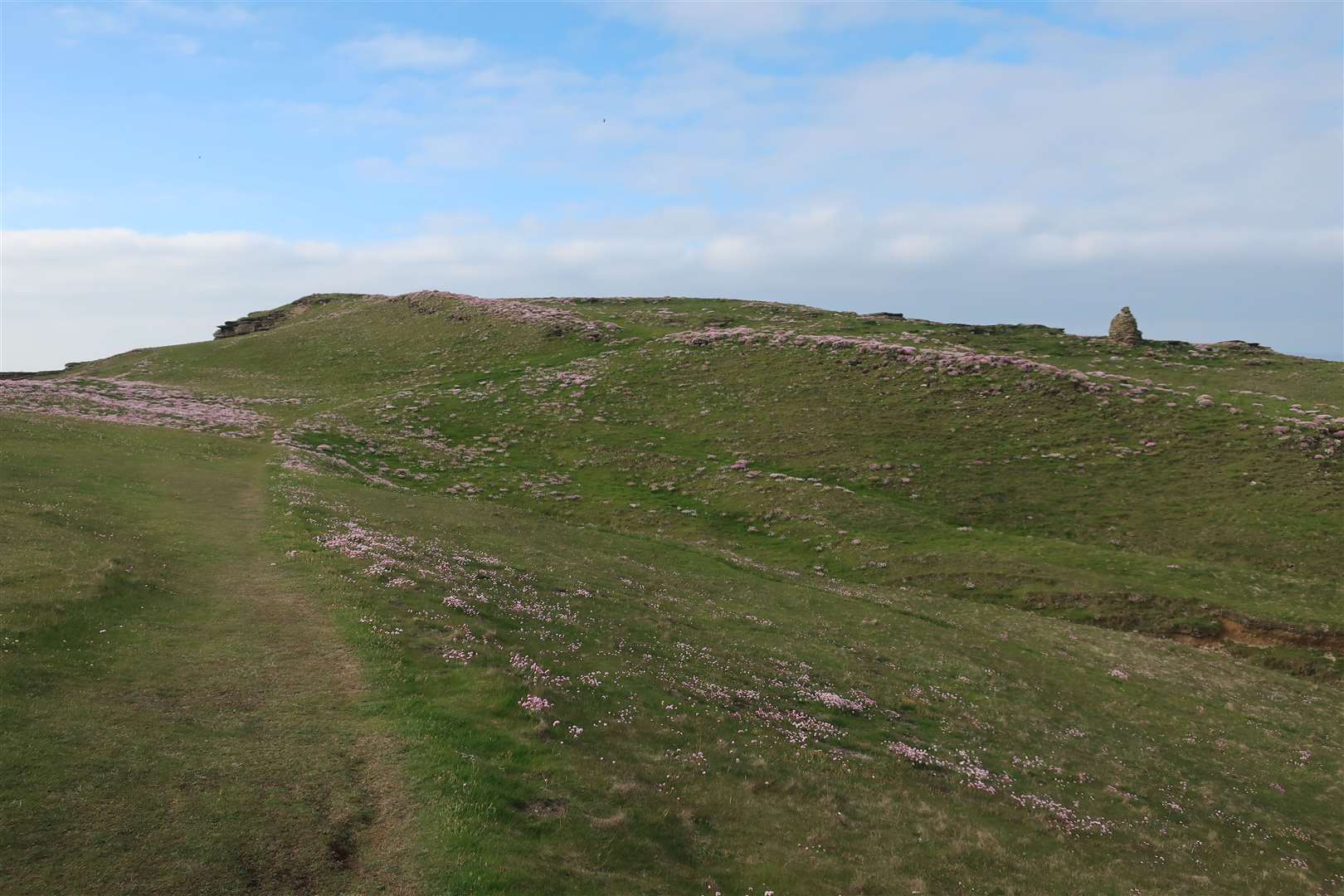
This ‘promontory fort’, thought to date from the early Bronze Age, gives an impressive view across Thurso Bay and the Pentland Firth to Dunnet Head, the most northerly point on mainland Britain, and the Orkney island of Hoy.
It would have been a great vantage point to spot threats from the sea well in advance. On this fine evening, all we spotted was the shining beacon of the NorthLink ferry as it headed out of the bay towards Hoy, heading for Stromness on the Orkney Mainland.
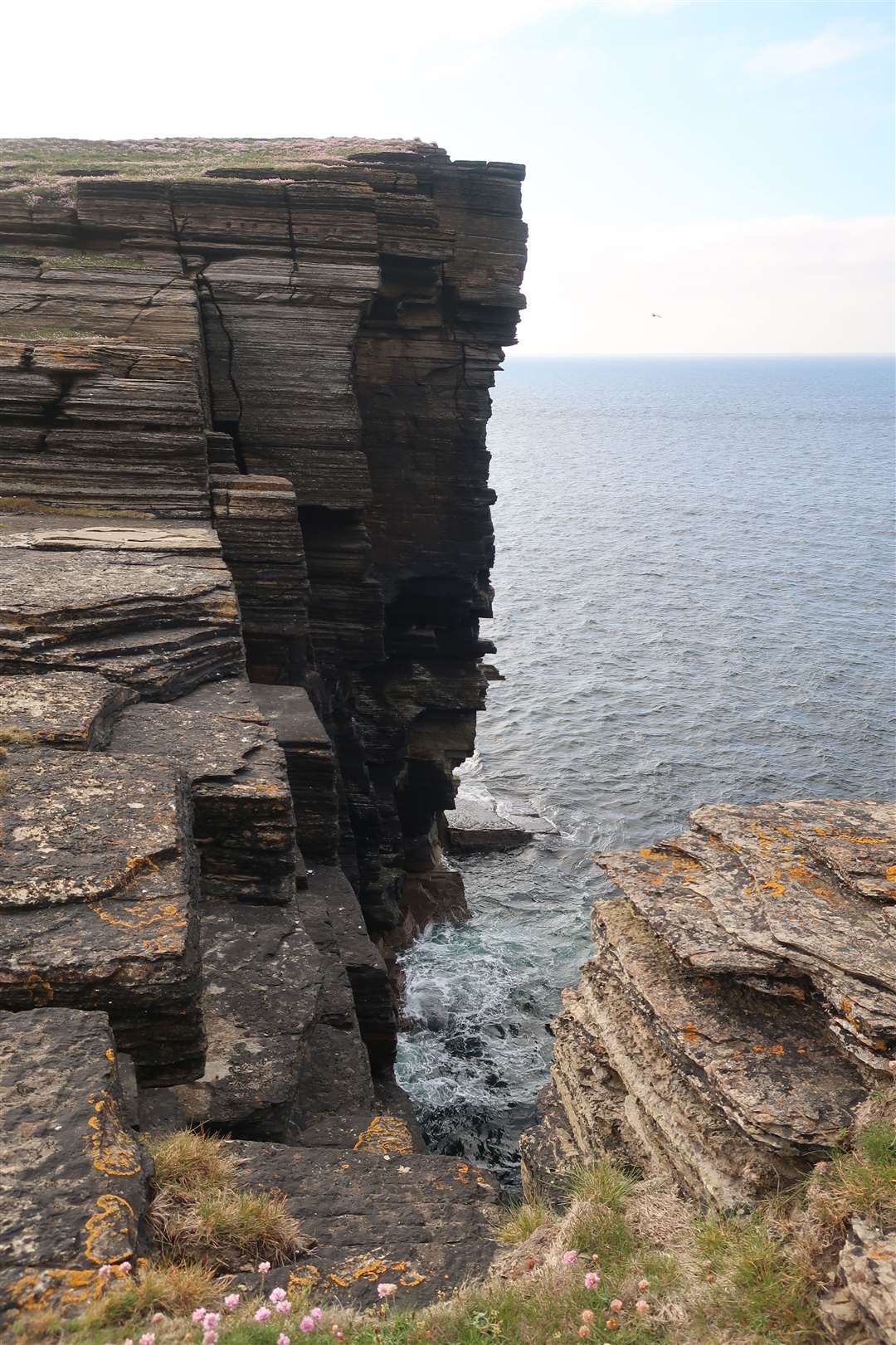
The walk to the fort is an easy one, but it helps if you have a good head for heights. At points you go close to the unfenced edge of some pretty dramatic cliffs, composed of the famous type of local sandstone known as Caithness flagstone.
You can see the layers of rock built up over millennia then battered by waves and wind. Some blocks look ready to drop into the sea at any moment.
Heading along the road from Scrabster towards the lighthouse and ferry terminal, the walk is signposted along the narrow route – it’s perhaps best to be here when the ferry isn’t loading or unloading though.
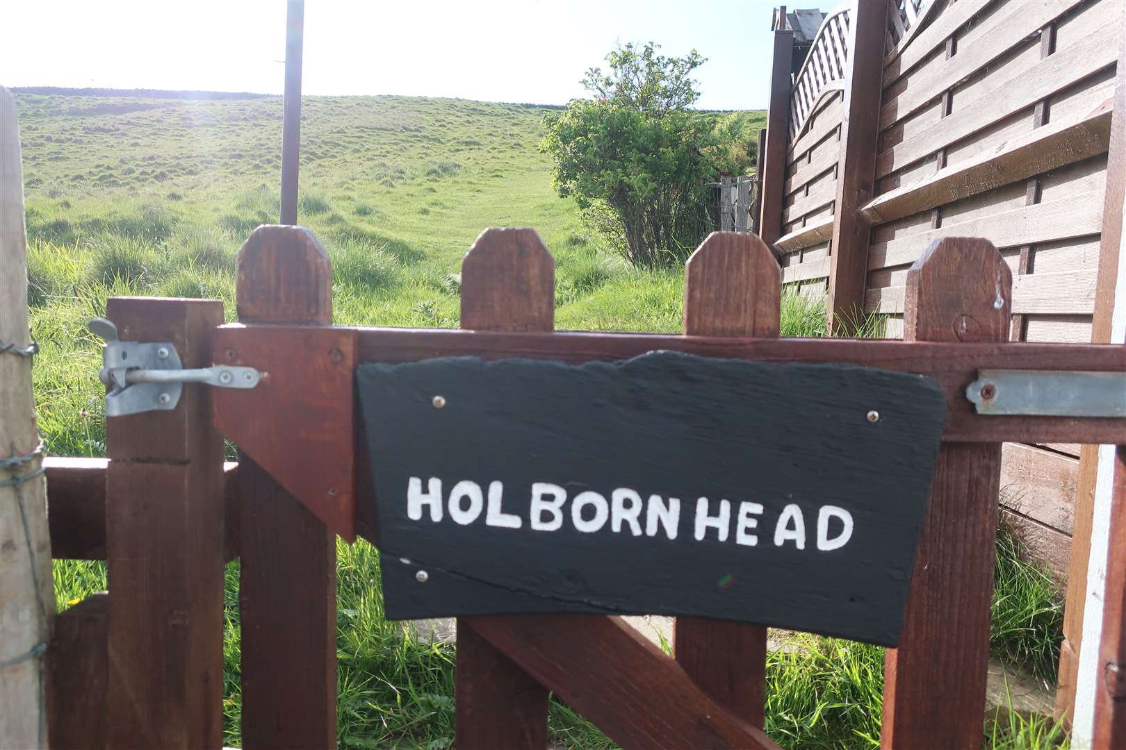
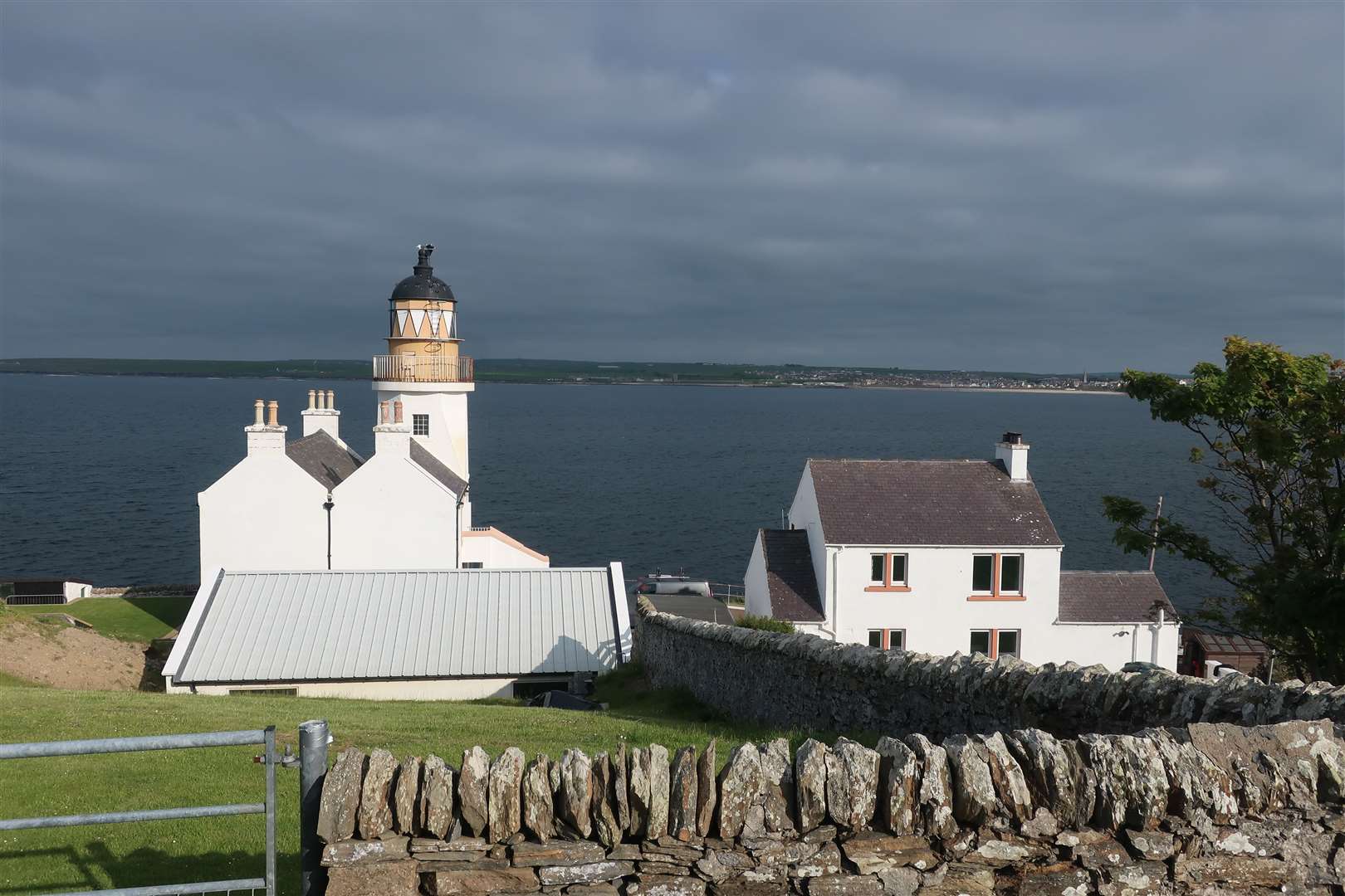
The lighthouse, which first operated in 1862 but is no longer in use, is now a private family home, so the walk goes left immediately before the gate, through a small side gate marked ‘Holborn Head’ on a slate.
The views on this fine evening were particularly spectacular, with a dark, gloomy cloud contrasting with the bright sunshine hitting the white walls of the lighthouse and the ferry, as well as painting the flowers and rocks in a wonderful light.
We followed the path through a couple of gates, which were closed to keep the sheep in their enclosed fields away from the cliffs, heading just east of north. The route is not marked from here but is easy enough to follow, with a few concrete slabs aiding passage when the ground is wetter than it was on this visit.
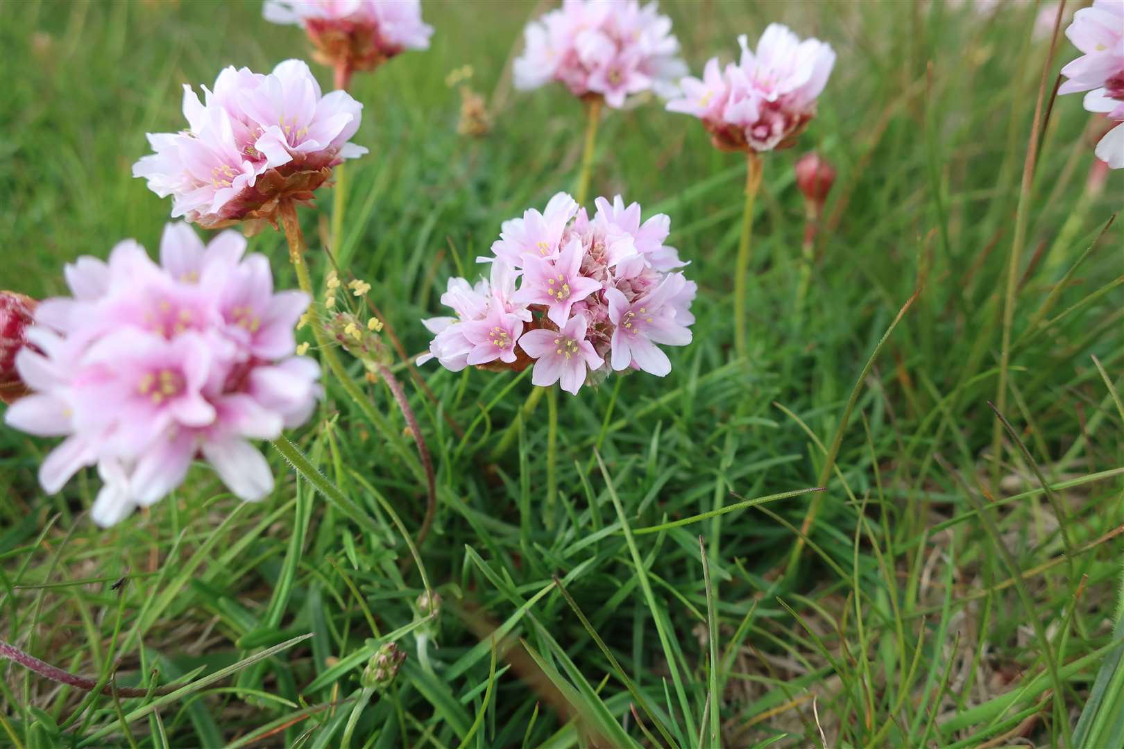
The grassy ground was covered in beautiful pink thrift, and we followed the path down a dip and past a few sea holes to reach what was once the defensive wall of the fort.
An extract from the Ordnance Survey Name Books of 1871-1873 reads: “All that now remains of this ‘Camp’ is an embankment which extends across the promontory from the ‘Loops’ on the east, to the ‘Rumbling Goes’ on the west side.
“Torfeus mentions, that in the beginning of the eleventh century, Count Moddan quartered his army at Thurso, ‘the town of Caithness’, and that they were plentifully supplied by spoil from the neighbourhood, until subdued by Thorkel.
“He adds, that Moddan had his camp on the promontory of Thurso, ‘promontorio Thorsnesia’, (i.e. Holburnhead,) where parts of a wall fortifying the camp alongst a hollow extending to the whole breadth of the head or promontory, are still to be seen.”
We stood in the old ‘camp’, admiring the remarkable cliffs of Dunnet Head and the outline of Hoy through the haze. A large cairn on the headland looks like it has been in place for a long while, with beautiful orange lichen growing on its southern edge.
We dropped down to a large area of exposed flagstone, where the sea could be heard smashing intimidatingly against the rocks somewhere far below. A huge hole through the middle of this outcrop goes all the way down there, but I couldn’t see the water from my position – as close as I dared get to the edge.
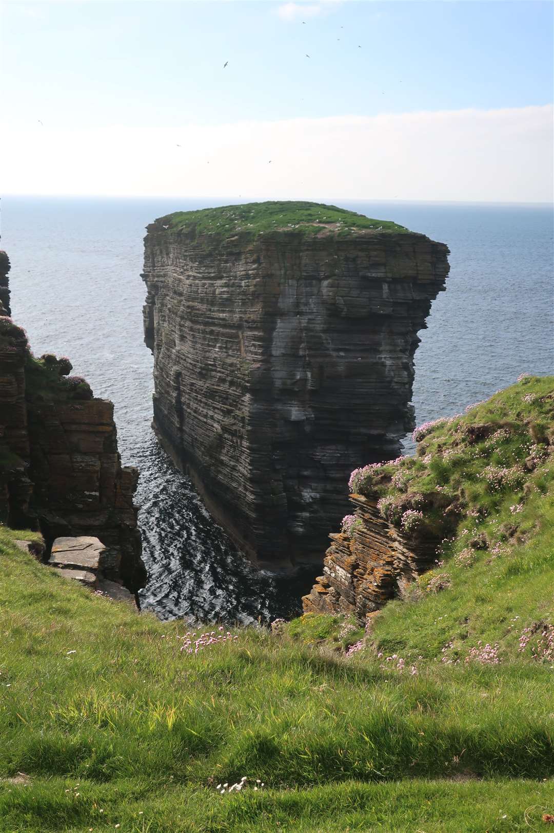
Heading back up above the rocks, our walk continued, now heading roughly west and getting closer to the edge of the cliffs. We soon reached the point where the Clett Rock can be clearly seen. This huge sea stack is an impressive sight and at its western edge it has a thin leg that looks for all the world as though it is about to give way.
We continued a little further to another gate, from where it is possible to continue along the cliff tops beyond Holborn Hill to the old quarries, returning by a track.
However, with the evening pressing on we decided on this occasion to return the way we’d come. We wandered slowly back, enjoying the views once more across Thurso Bay, Scrabster Harbour and to Thurso itself.
The longer circuit could wait for another occasion, with more time to explore this fascinating spot on the far north coast.
Route details
Holborn Head
Distance 3 miles / 5km
Terrain Grassy path, runs close to some very steep cliffs
Start/finish Scrabster (car park opposite Ferry Inn)
Map OS Landranger 12; OS Explorer 451
Visiting an ancient fort overlooking the Pentland Firth