ACTIVE OUTDOORS: Making a Meall of it above Loch Ness
Register for free to read more of the latest local news. It's easy and will only take a moment.

Whether it’s a clear day or a clag, a long walk in the hills can do wonders when life gets a little too hectic. I don’t think I’ve been up a Munro all year, so this short outing was a case of trying to cram in a quick trek in between other commitments – a far too familiar tale at the moment!
The ascent of Meall Fuar-mhonaidh is a relatively straightforward one that is popular with visitors, but it is a real hill climb and in poor visibility navigation skills are required.
This day very much fell into the ‘clear’ category and, given more time, it would have been perfect for a fuller round taking in the lower summit of Glas-bheinn Mhòr which lies to the north-west.
The 699m summit of Meall Fuar-mhonaidh rises prominently above the west side of Loch Ness, south of Drumnadrochit, and is accessed via the minor dead-end road to Grotaig. A small parking area can be used here for the hill walk as well as for the Great Glen Way, which follows the minor road much of the way to here as well.
Setting out on foot, a track continues from the road end, with the hill path diverging from the Great Glen Way route shortly afterwards to head towards the pottery. Just before a bridge, the path is signed through a gate to the right.
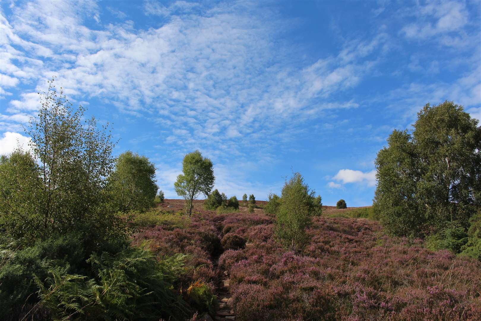
This leads pleasantly along the edge of a wooded burn then alongside fenced fields before crossing a newly upgraded track. There are some old boardwalk sections along the path which climbs steeply in places on a heavily eroded route.
It was bone dry today but it can get pretty slippery up here in wet conditions. Further up, the new track has been extended beyond Inchtellach House – to form a timber extraction route – and you have to cross it again, following a path up through the purple heather.
The Gaelic meaning of Meall Fuar-mhonaidh is something along the lines of the Hill of Cold Slopes, although on this day it was the absolute opposite. The sky was beautifully blue and the heat was intense – definitely a day when suncream was required.
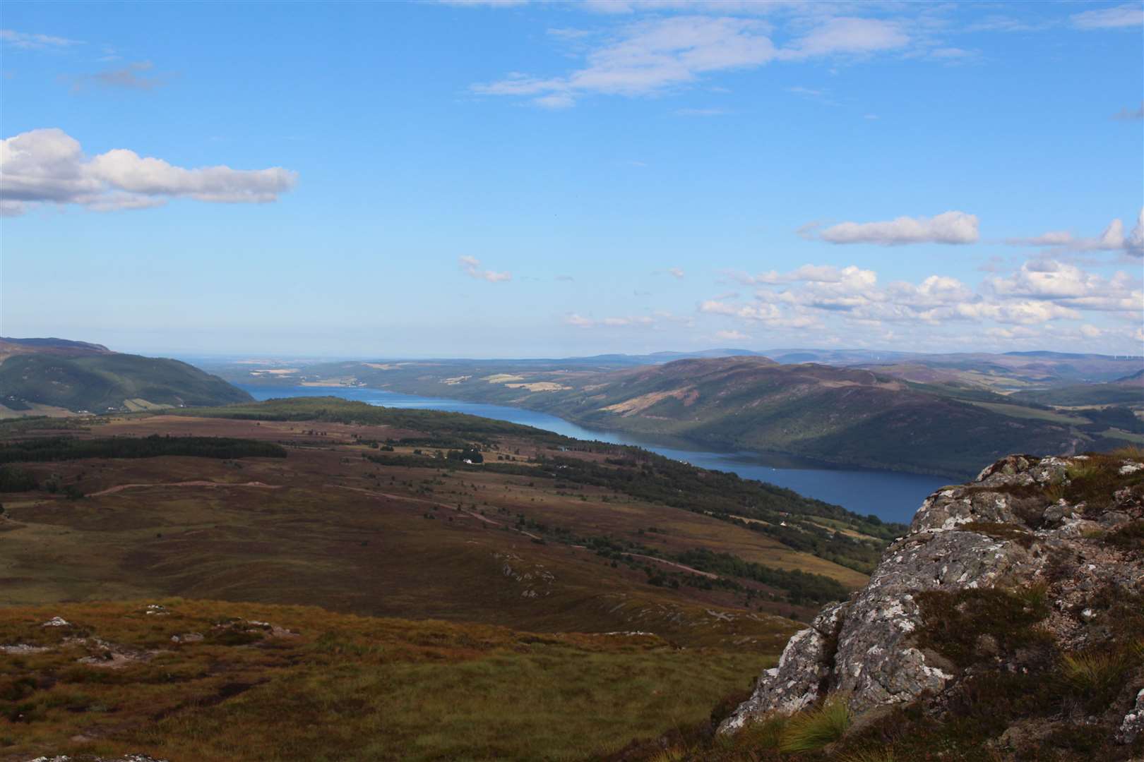
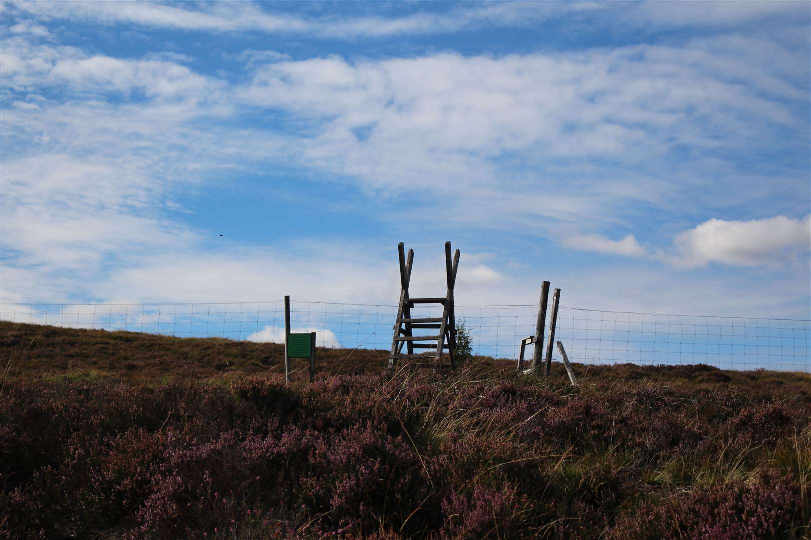
As you get higher the view back starts to open up, with Loch Ness soon visible far below. Just before reaching the north-east ridge of the mountain, a high stile allows you to cross a deer fence before the path bends left to follow the ridge.
An estate sign beside the stile rather misleadingly asks people to stay on the paths for the entirety of the red deer stalking season, from July to February each year.
In fact, the Scottish Outdoor Access Code allows responsible access to all open land and requires landowners and managers to give more specific information about stalking so that access takers can act responsibly with regard to stalking based on when and where it might be taking place on a particular day.
The busiest part of the stalking season is usually the stag stalking season, which runs from July 1 to October 20. Walkers should take account of information from estates – such as on the Heading For The Hills website or on signs giving on-the-day details – and plan routes to minimise the chance of disturbing stalking.
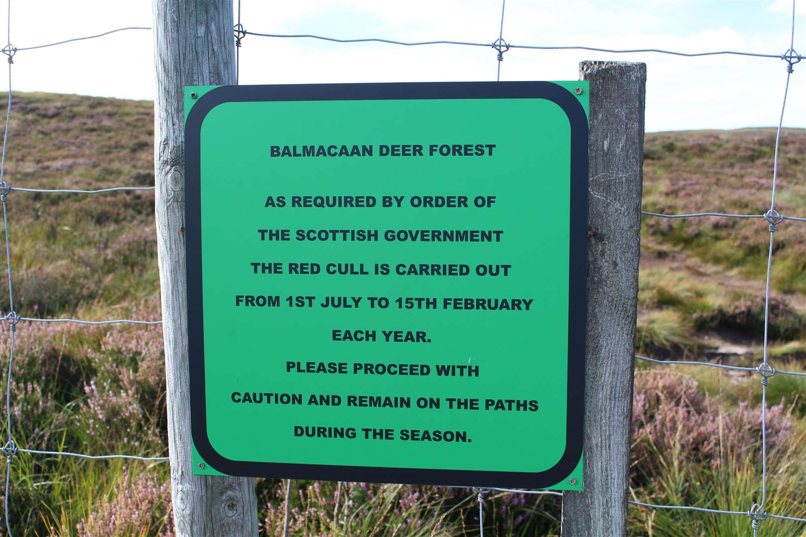
Unfortunately, vague signs like the one here do nothing to help walkers avoid places where stalking might be taking place because they don’t provide any useful information whatsoever.
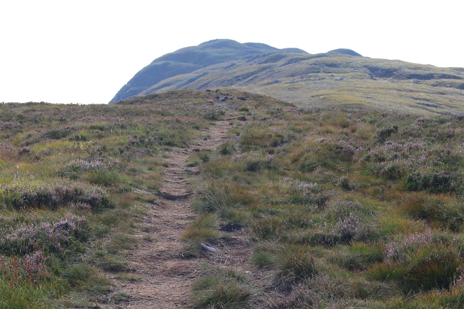
Back on the route, I was now heading south-west up the lumpy ridge. The eroded route of the path is well defined most of the way, sometimes with a couple of options around small rocky outcrops.
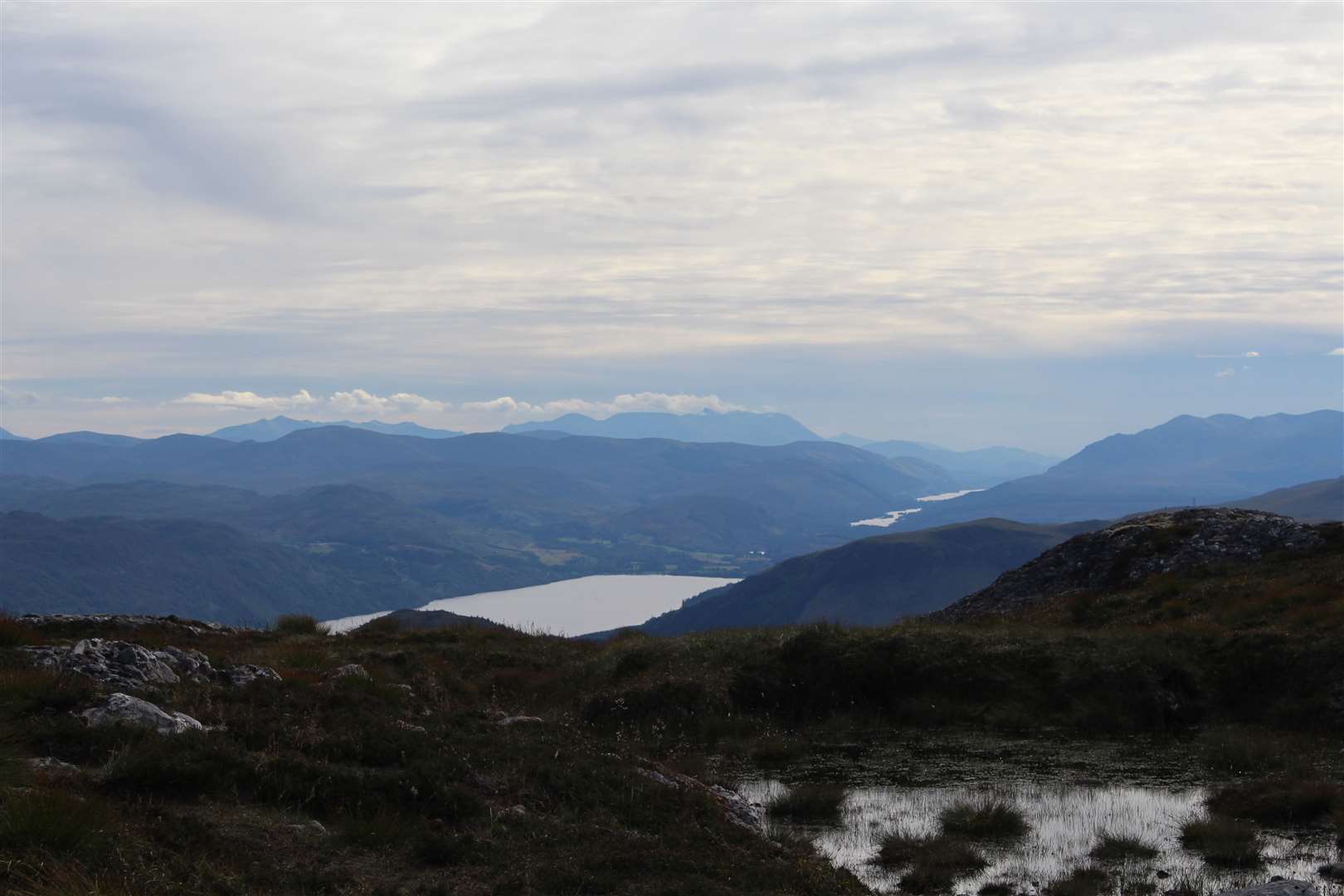
Heading up here in the dry made the going much easier, as this route gets seriously boggy in more normal conditions. As I got higher, the view up Loch Ness got more spectacular, with the water visible from Dores Bay to Foyers.
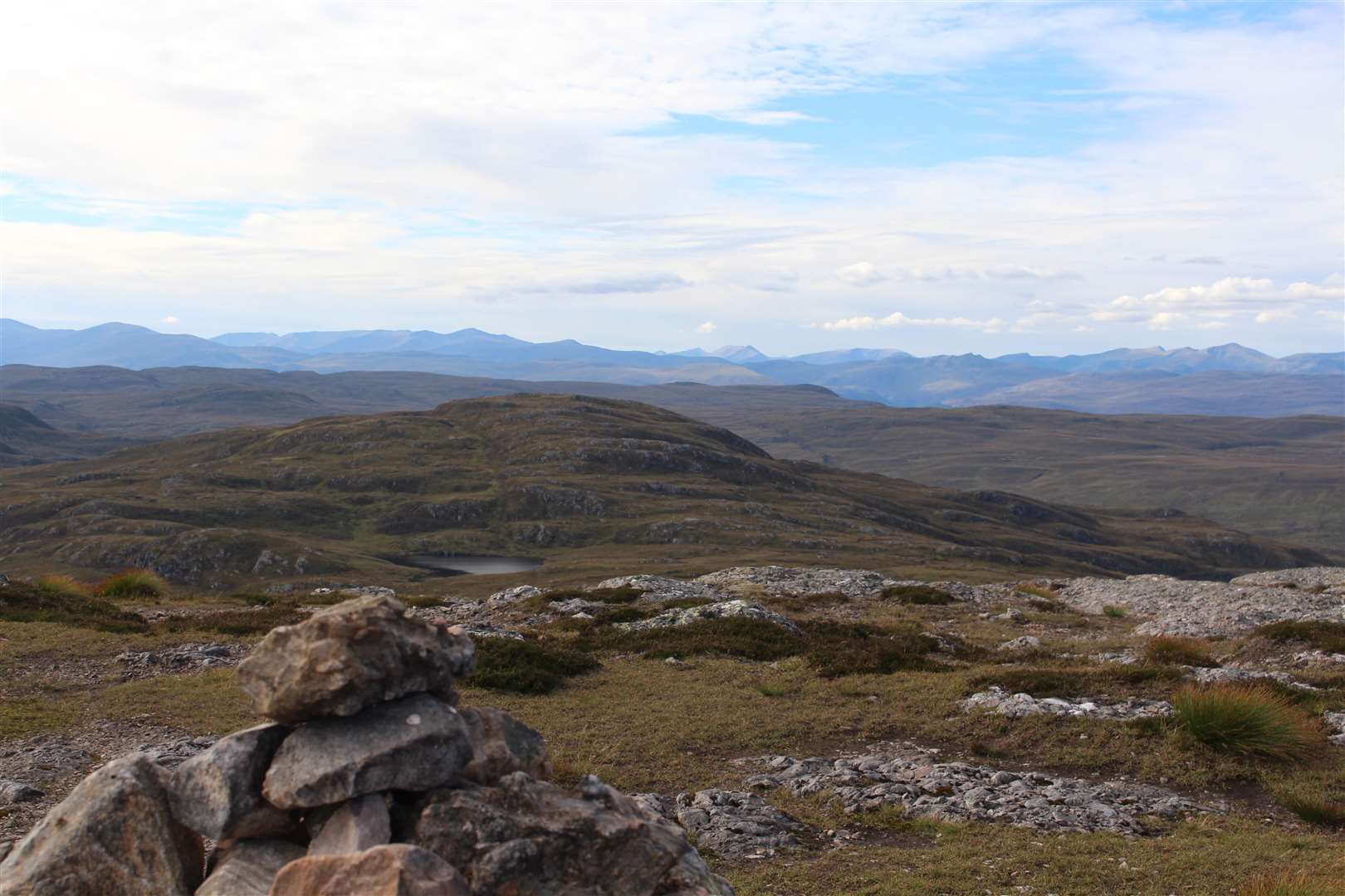
A few short, steep rises nearer the top give this hill the feel of something bigger, and a clear cairn marks the route. There’s still a drop and re-ascent to go before the summit plateau, though, with the high point being the furthest and largest cairn. The OS map also shows a trig point here, but there’s no obvious sign of it on the ground.
The highlight of this walk has got to be the view from the top – I could see the length of the Great Glen to Ben Nevis, the only summit in a 360-degree view to have any sign of cloud clipping its highest point on this wonderfully clear day.
There were so many peaks in view it was difficult to identify them all, but they included the Affric hills to the west and the Strathfarrar Munros. On the way back down, heading north, Ben Wyvis stands guard while across Loch Ness several wind farms are dotted along the Monadhliath hills.
After tearing myself away from this excellent vantage point, I enjoyed a quick walk - with a little bit of jogging - on the way back to the car. It may not have been a long trek in the mountains but at least it had given me a brief taste of the hills.
Route details
Meall Fuar-mhonaidh
Distance 6 miles / 10km
Terrain Woodland and mountain footpath, open hill
Start/finish Grotaig, near Drumnadrochit
Map OS Landranger 26; OS Explorer 416
A quick up-and-down walk on a prominent hill above Loch Ness, offering panoramic views