ACTIVE OUTDOORS: Hope leads the way on ride north
Register for free to read more of the latest local news. It's easy and will only take a moment.

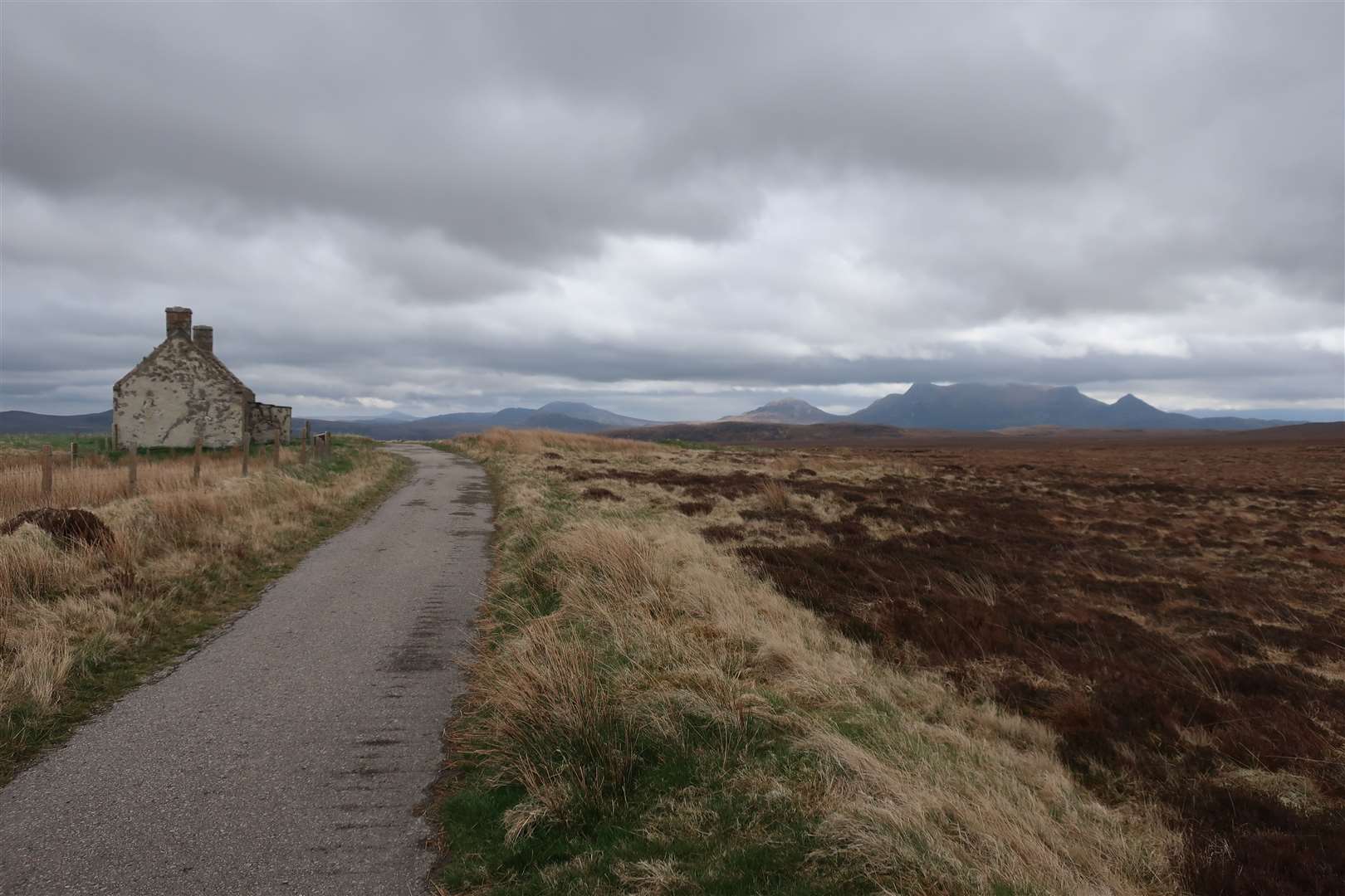
“This house, erected for the refuge of the traveller, serves to commemorate the construction of the road across the deep and dangerous morass of the Moin, impracticable to all but the hardy and active native; to him even it was a day of toil and labour.”
The exposed location of the Moine House, high up on a bed of blanket bog in the Flow Country between Loch Hope and the Kyle of Tongue, is apparent to anybody who pauses at the small parking spot and wanders to the ruin.
The old road, built in 1830 on the orders of the Duke of Sutherland, gave the first safe passage across A’Mhoine – the Moss – and was the only means of travelling the north coast until as recently as 1993, when the modern road replaced it.
Standing outside Moine House and looking along what remains of that old single-track road, stretching out, it’s hard to imagine the rolled heather still sitting below the tarmac surface to stop it sinking into the bog.
The inscription on the side of the house, quoted in part above, shows that the house was provided as a means of shelter – but it was also a family home. And one with a fabulous outlook, taking in many of the hills of the far north, not least the eye-catching Ben Loyal.
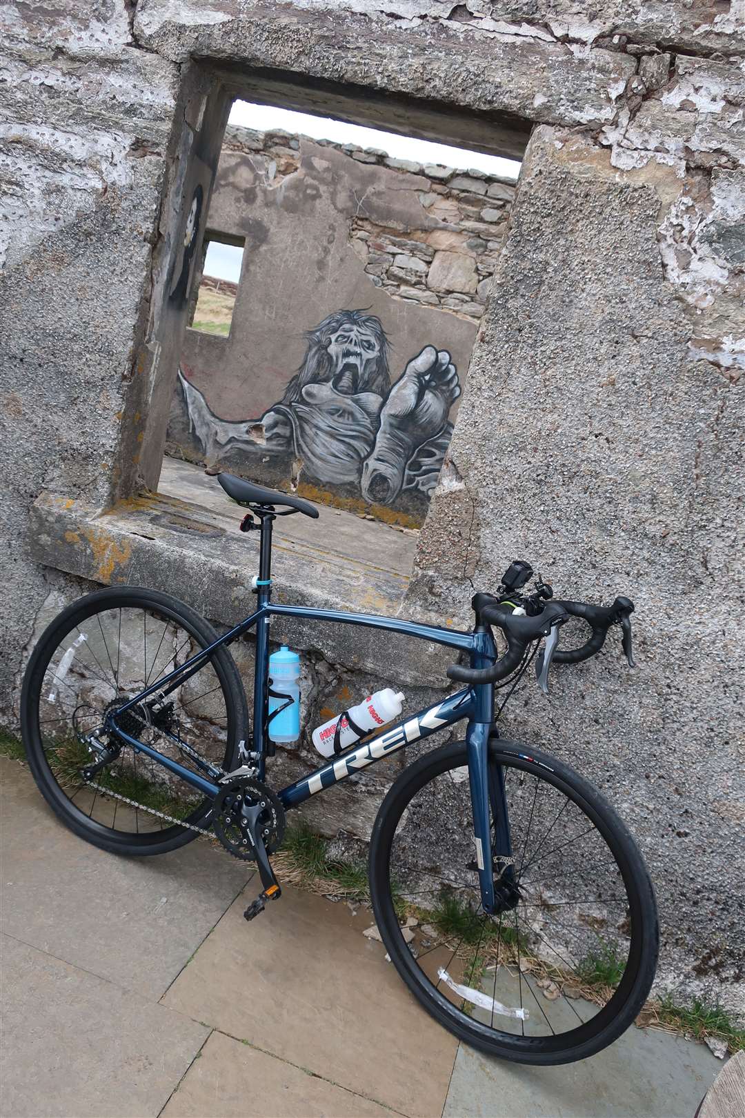
Today the ruined, roofless house offers little in the way of shelter and is adorned with some interesting graffiti.
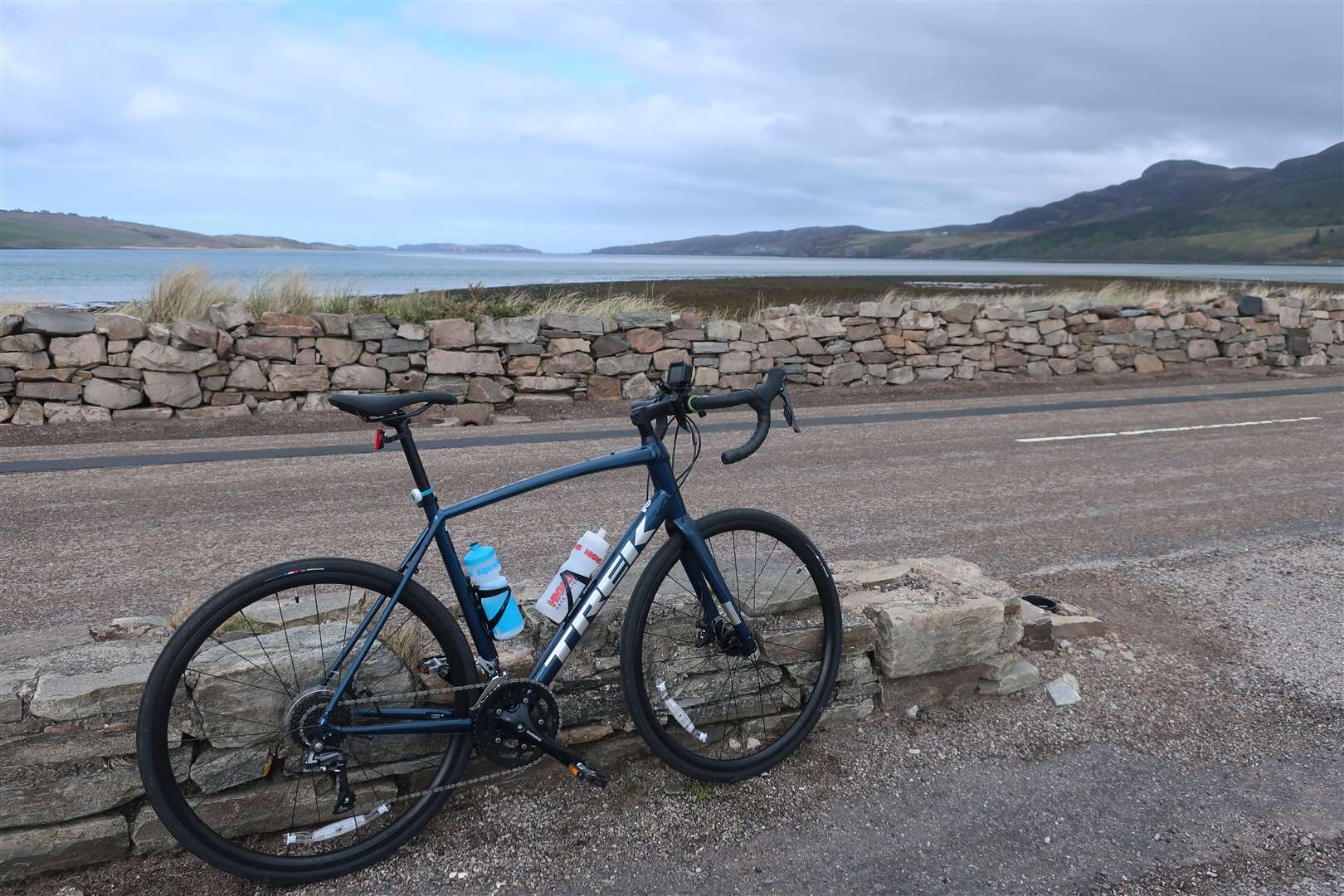
I stopped here on this bike ride around some of the stunning roads of north Sutherland, which passes the most northerly Munro as well as an excellent example of a ruined broch, a spectacular causeway and lochs and mountains galore.
I’d started the day at the Altnaharra Hotel, pedalling north to reach the crossroads. A left turn here took me onto the beautifully quiet road that leads 21 miles to the next junction at Hope. Navigation wasn’t going to be an issue today.
A fierce headwind on the exposed route made it slow going, but other than a few anglers finding their way to the next beat, I saw very little in the way of traffic.
That’s great as a cyclist today, but Strathmore wasn’t always this deserted. There is evidence of habitation here from more than 2000 years ago when the brochs were built until the 19th century, when the land was cleared of its people to make way for sheep.
Today, there are only two inhabited farmhouses between Altnaharra and Hope.
I made my way north-west past Loch Meadie on this narrow single-track road, which bends north into the heart of Strathmore to drop downhill shortly before reaching the broch of Dun Dornaigil.
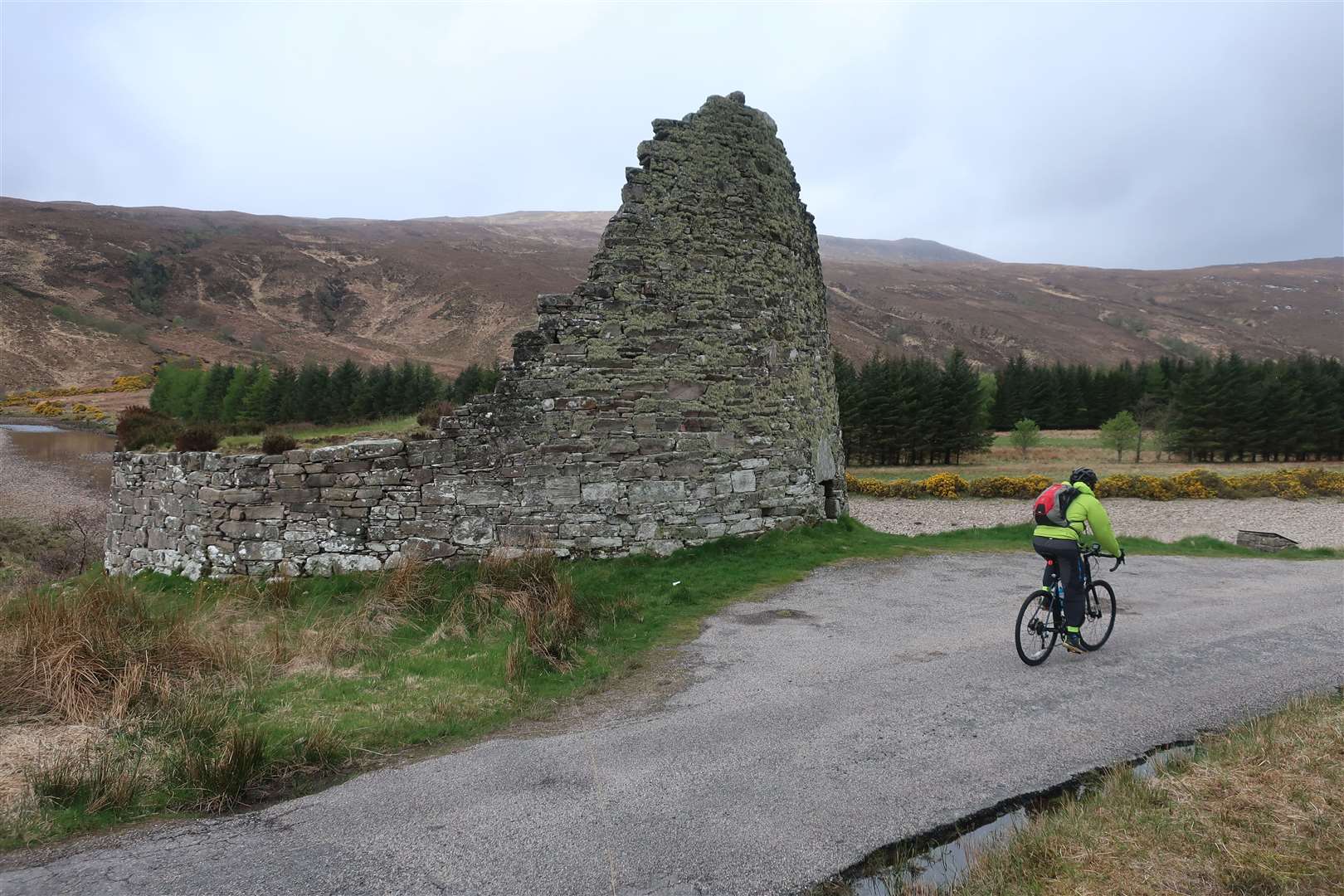
You can’t miss the broch, which stands immediately to the western edge of the road, its round wall still partially climbing to the sky, despite the passage of time meaning the rest of the stone work has collapsed into the centre of this mysterious building, keeping its story hidden.
I remember passing this broch on a bike ride many years ago, before I really knew what a broch was. What a discovery it was to find this Iron Age structure still sitting so prominently just beside the road! It remains a fascinating spot to me now, wondering just how different life would have been here at that time.
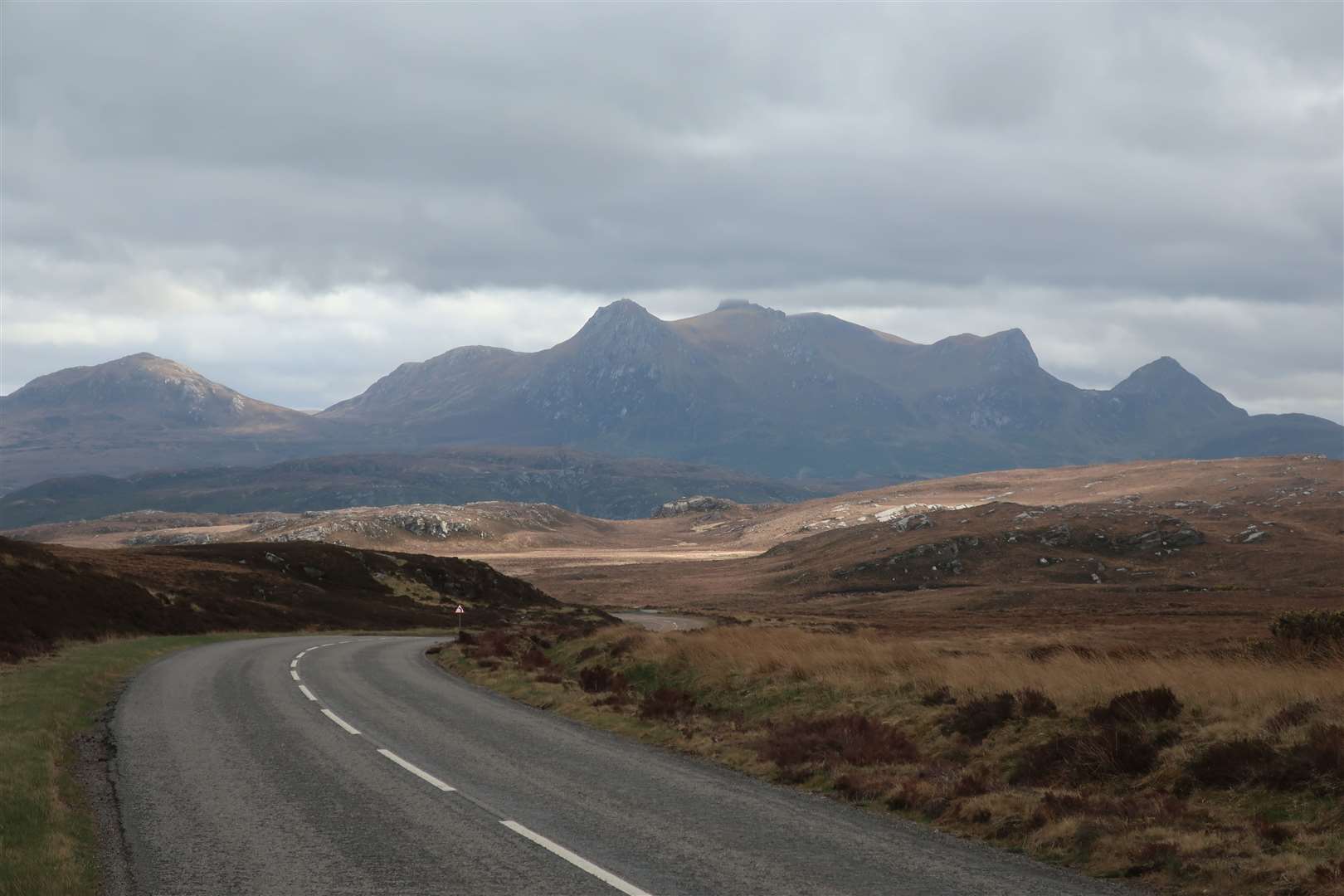
Riding on further north, the cliffs of Ben Hope dominate to the right. A huge bird soared high along the edge of the cliffs, possibly an eagle, as I paused to take in the scene. A small informal parking area is soon reached, where a sign points up the path to Ben Hope – at 927m above sea level, this Munro looks dark and imposing from this side.
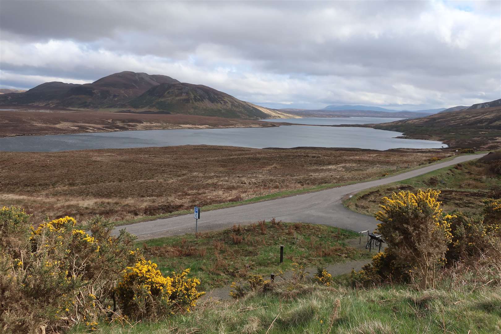
Soon I reached Loch Hope and enjoyed a brief stretch of lovely deciduous woodland before emerging to do battle with the wind again. The road is reasonably flat, but that all changes once you arrive at the junction above the village of Hope.
Turning right to join the A838 towards Tongue, now part of the North Coast 500 route, the main road climbs steeply to A’Mhoine. Once the height is gained, the wide road undulates gently, and the Moine House is reached at a signed viewpoint and parking space off to the right.
As you continue eastwards, the vast space to the north is the proposed location of the UK’s first spaceport, Space Hub Sutherland, which could see 12 rockets a year launch from the site.
Approaching the Kyle of Tongue, the view to Ben Loyal to the south-east steals the attention, before you cross the causeway and admire the beautifully turquoise water and golden sands on either side. Beyond the crossing – built in 1971 to shortcut the 14-mile circuit around the kyle – the road climbs again, and you ignore a right turn to the village centre, instead keeping left round a tight bend to stay on the main road.
A shortcut onto the Altnaharra road is possible here but it is steeper than just plugging away at the climb you are already on, so I carried on to the signed junction with the A836, which leads back south to the starting point.
There’s a little more climbing to do to reach the viewpoint over Loch Craggie and Loch Loyal, which you cycle past, hugging the shore in places, on this spectacular road below the eastern slopes of Ben Loyal.
Just beyond the end of the loch, the road bends sharply left to cross a bridge at Inchkinloch, and there’s a sting in the tail with a final climb over the shoulder of Cnoc Staing before you can enjoy the last downhill to the crossroads at Altnaharra.
Route details
North Sutherland explorer
Distance 45 miles / 72km
Terrain Single-track roads and busier main road on NC500 route
Start/finish Altnaharra Hotel
Map OS Landranger 16, 9 & 10
Seeking shelter on an exposed but exhilarating road ride to the north coast