


ACTIVE OUTDOORS: Embracing autumn on run on the Great Glen Way
Register for free to read more of the latest local news. It's easy and will only take a moment.

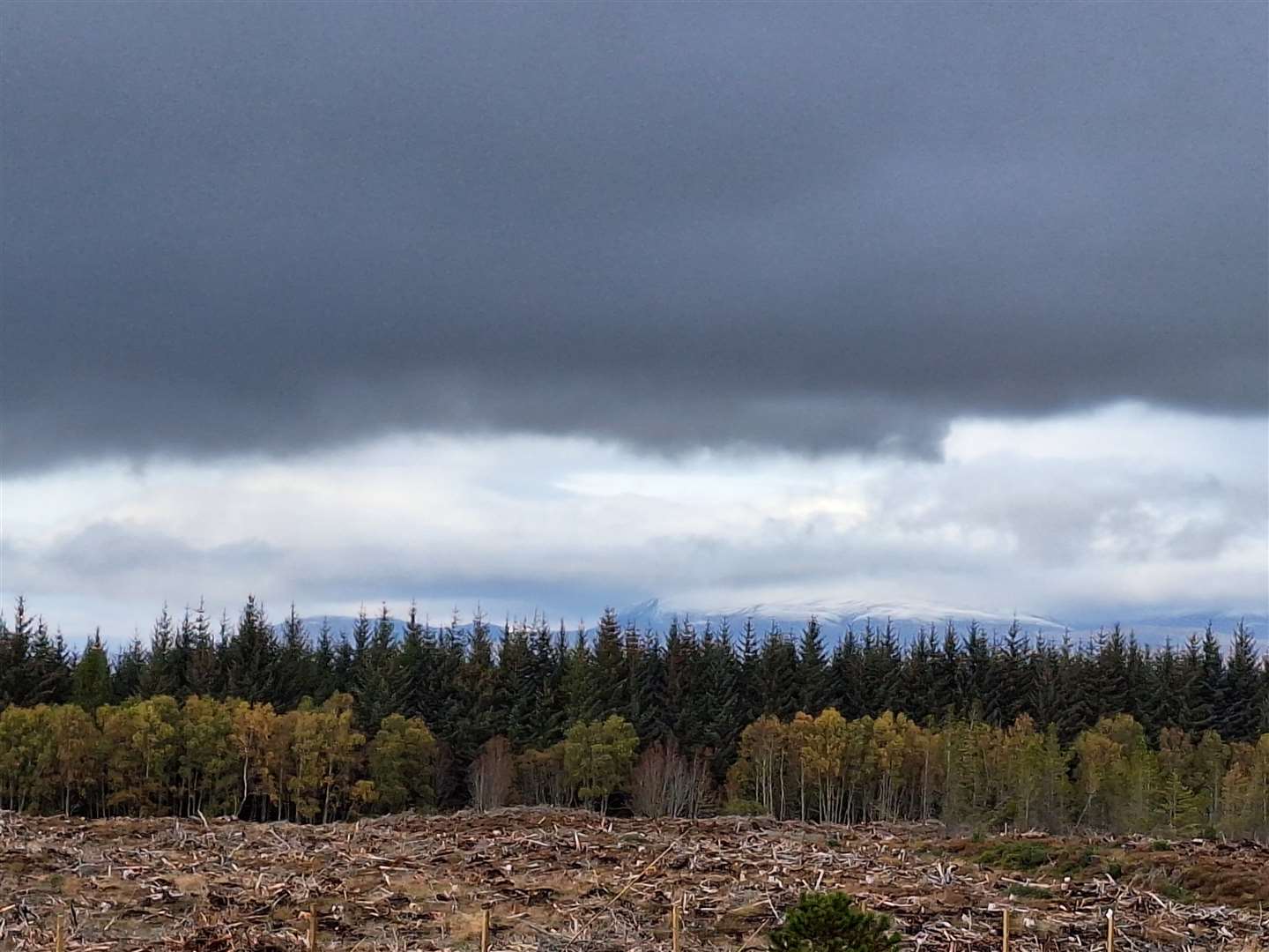
Autumn brings with it a mix of bright and beautiful colours along with a turn in the weather.
We’ve been lucky in Inverness to avoid any significant impacts from Storm Babet while other parts of the Highlands and further afield have been badly affected.
There have even been a few days with some sunshine which has shown the changing colours of nature in their full glory.
While there are some glorious places to visit to see these splendours, such as the enchanting Glen Affric, I just haven’t had time to get down there for a while, so I’ve had to stick closer to home.
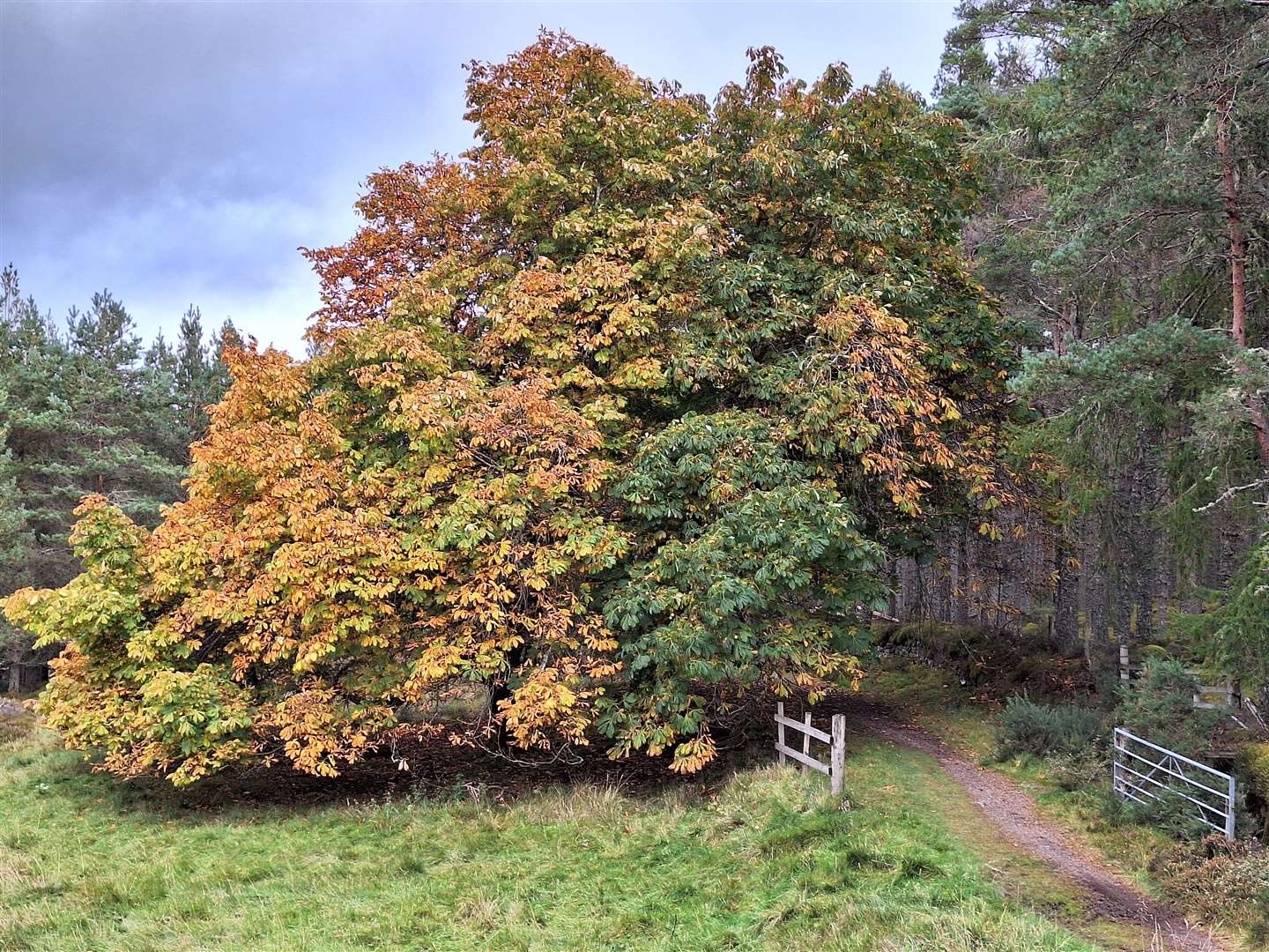
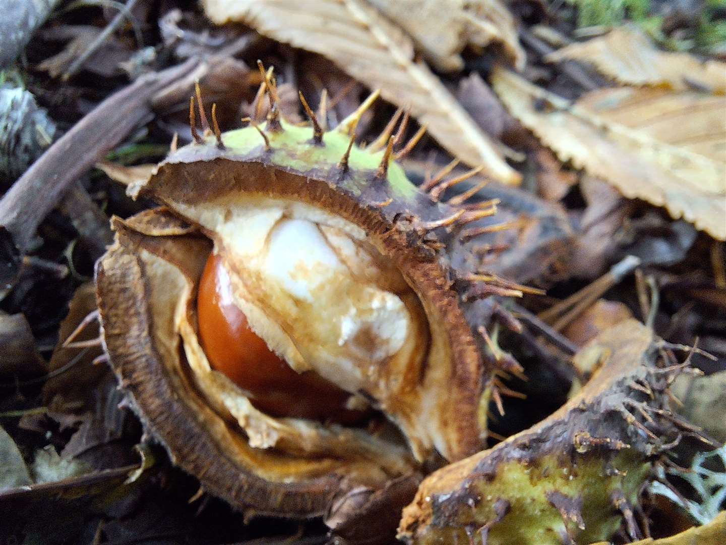
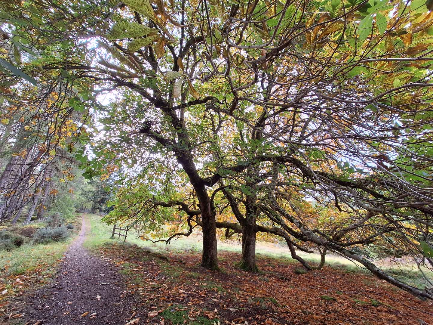
And there’s a spot I like to head to each autumn, where two ancient horse chestnut trees produce an abundance of their fruits – and well away from the urban conker collectors!
I decided to take a long run out to the trees this time, starting from the parking area at Torvean, beside the new park and swing bridge over the canal. It wasn’t going to be fast, but it would be a chance to breathe in the autumnal air.
The route starts by entering the park on the surfaced path beside the bike shelter, veering right in front of the pond and heading through the underpass that takes you below the A82. On the other side, take an informal path left then go left onto a whin dust path.
This leads through a narrow section between broom and gorse then makes its way alongside the golf course, before turning right to pass right through the course. The path has been designed so you are never in the firing line of any golf balls, unless they have gone well awry!
Following the subtle posts that mark the through route, you emerge at the bottom of the “Nurses” path. Turn left and climb the steep hill that leads to Great Glen House and continue ahead past the car park to meet the road.
The Great Glen Way route has altered here as more new houses have been built, but at the minute the best way is to go left and follow the road a short way, then turn right up a cul-de-sac with some steps at the far end. These lead up onto a newly made path – going right then bending left leads you onto the old path that climbs higher still.
At a gate further up, I like to follow the “official” route and turn right to zigzag past a lovely viewpoint then drop slightly to pass the reservoir. At a pylon, turn left and follow this vehicle track to another gate – marking the start of the excellent drove road section.
These routes were used for walking cattle to market in the 18th and 19th centuries, as well as for more nefarious means.
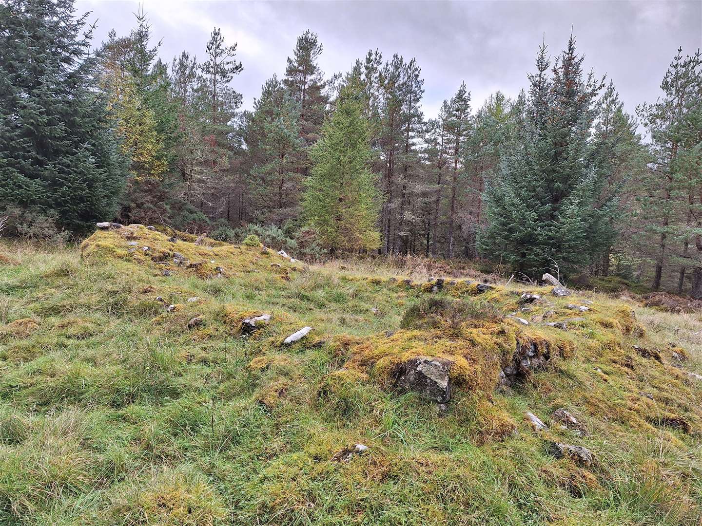
Two old walls can be seen on either side of this ancient route, now thick with moss and supporting a whole ecosystem that has built up over the last couple of centuries. It’s fascinating to think how different life would have been here when these walls were first built.
An excellent path continues for a couple of miles along the edge of the forest, with occasional glimpses out over the Beauly Firth. It was still fairly busy with backpackers, mountain bikers, walkers and runners as I made my way south.
The two horse chestnut trees are located at an old drove stance, where cattle would have been rested for the night on their journey. The rectangular remains of an old shelter can be seen a short way beyond, and the Great Glen Way continues past here to Blackfold.
However, after collecting a few horse chestnuts, I turned left just before the wooden gate onto a narrow path that meanders through the woods and eventually comes out on a clear forestry track.
Go left here for easy running, sticking to the main track until a junction just after a double pylon line. Taking a right turn here, you are heading down the intriguingly named “Vomit” path – concentration is needed on the steep descent on sometimes loose and uneven stones.
After bending left and passing through a narrow gap beside a gate, the route levels out for a while to reach a house at Balnacraig. Head right here, going downhill to pass some old cottages and fields of horses.
A lovely old track descends from here to the A82 trunk road, which this time must be crossed. Traffic travels at high speed here, so take care crossing over and then find the path on the far side, that leads alongside a fence into the old quarry.
There are so many muddy paths and trails here which are also well used by trails bikes – which you hear coming easily enough. Just after an old log across the path, turn right to drop down towards the canal. A rough descent drops you out close to the cattery and kennels.
Taking a left turn here, it is about a mile back to the swing bridge at Torvean to complete the route.
Route details
Great Glen drove road
Distance 9 miles / 15km
Terrain Mostly on good paths and tracks, some sections on tarmac
Start/finish Torvean car park, Inverness (off A82)
Map OS Landranger 26; OS Explorer 416
Following in the hoofprints of cattle on this run from Inverness
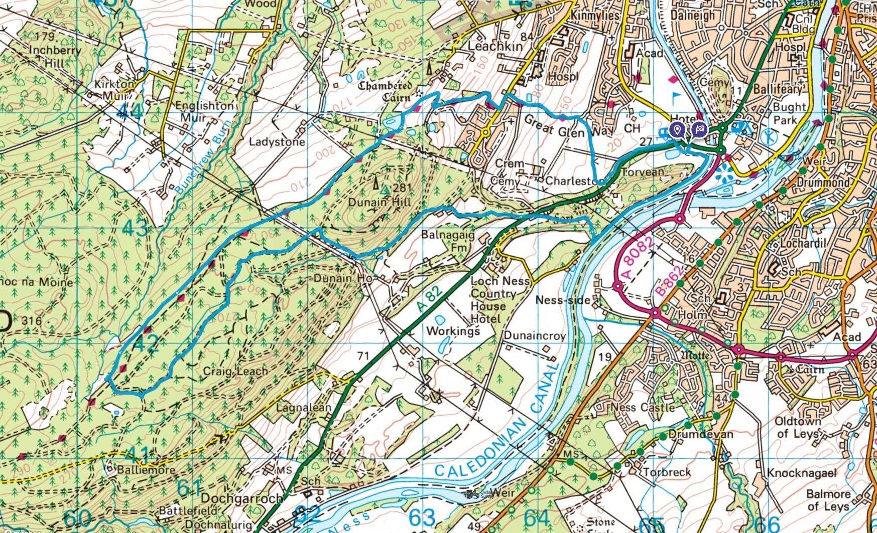
Click here to see the route in OS Maps