


Cycle ride around Inverness highlights shortfalls of network as well as best new bits
Register for free to read more of the latest local news. It's easy and will only take a moment.

Taking in the old and the new, this little loop of Inverness gave me a chance to look at how the city is developing from a two-wheeled perspective.
Perhaps one small thing we can do to cut our fuel costs is to reduce the amount we use – and walking and cycling for some shorter journeys is a great way to start when it comes to transport at least. Given the cost to fill up my car with diesel just now, I really have to justify using it for anything other than essential long journeys.
But if you’re not used to following the network of bike trails through the expanding city, things can get a little confusing. After decades with a lack of investment, cycle routes – and sometimes footpaths – don’t quite link up like they really should.
The secret, for now, is knowing the best way to get from A to B – then demanding improvements! For years, I’ve been lugging my bike up the awkward steps from the Raigmore Interchange, through the small gate at the top and onto the now well established shared-use path at the top.
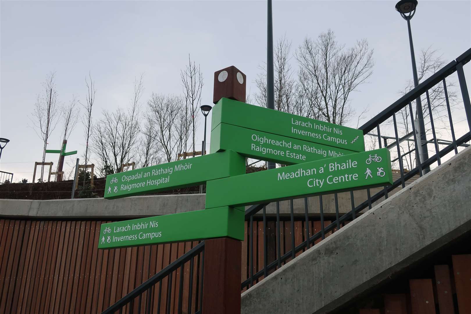
But recently the Raigmore active travel link has opened, zigzagging its way up to meet the Golden Bridge to access the Inverness Campus and retail park. I hadn’t had a reason to venture this way since it opened a few weeks ago, so I decided to take a little trip around the city one lunchtime.
From the High Street – easily accessible from the railway station – head past the pedestrian entrance to the Eastgate Centre to the end of the pedestrian zone and cross at the crossing, going left under the concrete mass of the Eastgate, then round to the right onto Millburn Road. There’s no real link here to the bits of remaining cycle lane that came about after the first Covid lockdown, so following the pavement is a necessary evil.
Just before the next junction, the coned-off cycle path begins – but with no drop kerb to access it. I nipped on a short way ahead at the crossing point, finally able to go against the flow of traffic on the green strip of paint as far as the Farm and Household store. The cycle lane is painted as two-way at this point, but there’s no traffic control at the lights, so you need to carefully judge when it’s safe to continue, then join the shared-use path which the cones guide you onto.
So far, so complicated! Thankfully, the cycle path along Millburn Road is fairly straightforward to follow, assuming you can avoid the wheelie bins, cars exiting the pub where it joins a back road briefly and the out-of-line raised crossing of Diriebught Road.
Over another controlled crossing, you carry on to pass the entrance to the Raigmore estate, from which point the cycle route peters out to an ageing pavement – but it continues around the edge of the rather intimidating Raigmore Interchange (the speed limit on the road here has been reduced to 30mph, so it’s better than it was) to reach the new active travel link.
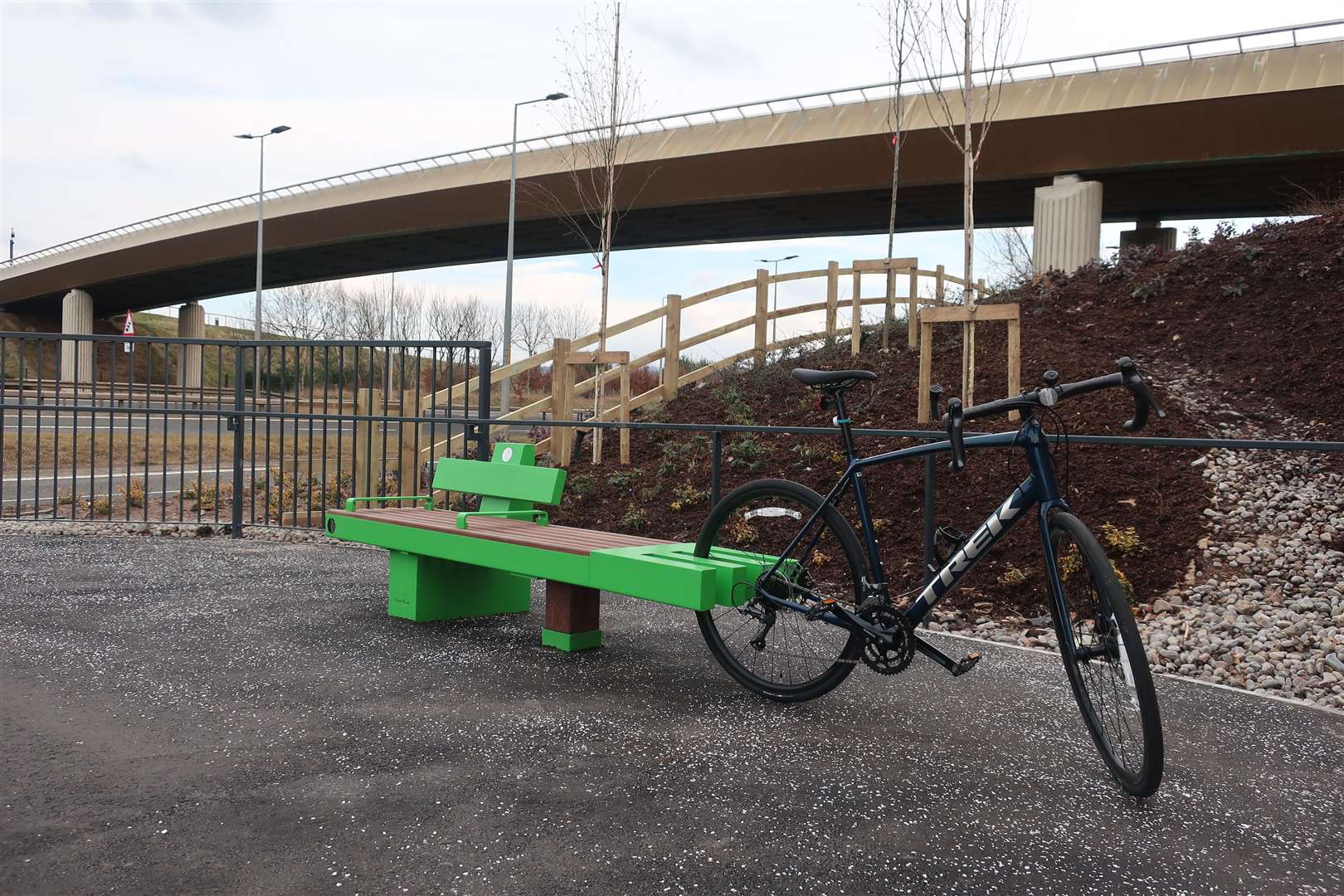
This new piece of infrastructure is like a different world, with a three-metre wide smooth surfaced path, benches tucked away off the side of the route rather than obstructing the way and large sweeping hairpin bends to reduce the gradient of the climb.
The link ties in nicely to the Golden Bridge, which I then crossed to pass through Inverness Campus. When you drop right off the bridge, you need to aim roughly straight on to join the newer bus-gate bridge which leads to the back of the retail park and cinema – and is only open to buses, cycles and pedestrians.
At the end, bear right to a roundabout and go straight on towards a dead-end. You can aim for the small drop kerb on the right to follow a shared-use path onto a link path that leads up and over the railway, back into the campus.
Go across the track and turn right at the end, following the high-spec surface towards the green-topped university building, then go left at the bottom along to a roundabout. It’s easier here to cut across to the shared-use path on the right and cross straight over, so you are on the right-hand side heading up to the junction.
Going right at the top, you head back over the A9 on the Inshes overpass. With the notorious Inshes roundabout ahead, stop at the first crossing point and wait for the lights, then cross at the small crossing near the filling-station, going right along a short stretch of pavement that merges into the proper shared-use cycle path on Sir Walter Scott Drive.
A two-metre wide shared-use path leads all the way round the southern edge of the city now, although you have to give way multiple times at each roundabout – cyclists and pedestrians are still not quite top of the tree when it comes to priority.
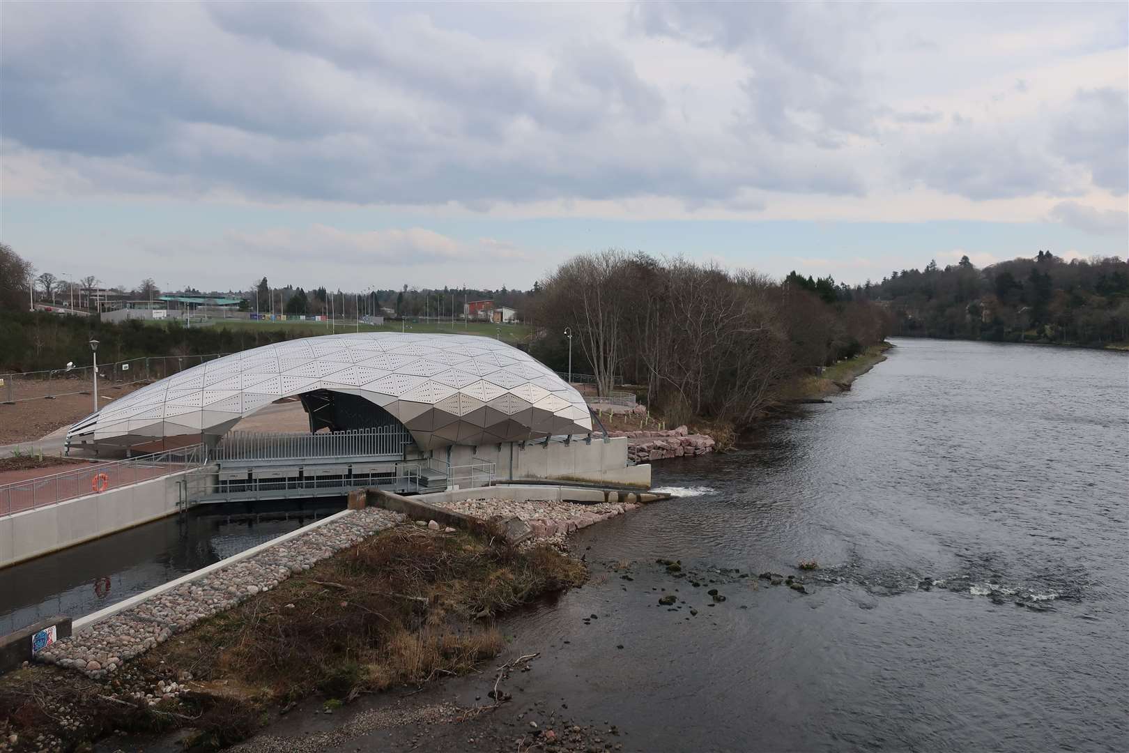
Eventually, after the Holm roundabout, the route continues to the bridge at the West Link. I crossed the road to get a closer look at the Hydro Ness scheme below, which looks like it is nearing completion.
A bit further on, after the rugby club building, fork right down a slope towards the leisure centre but follow the path sharp right to follow a road straight down towards Whin Park, where it bends left (watch out for the potholes!) to pass the skate park.
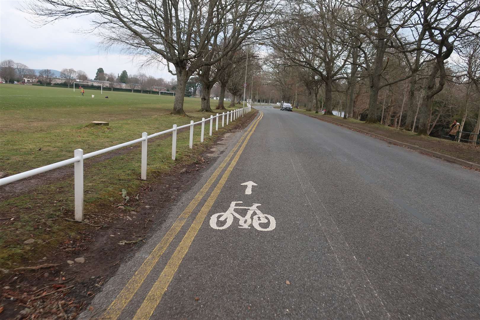
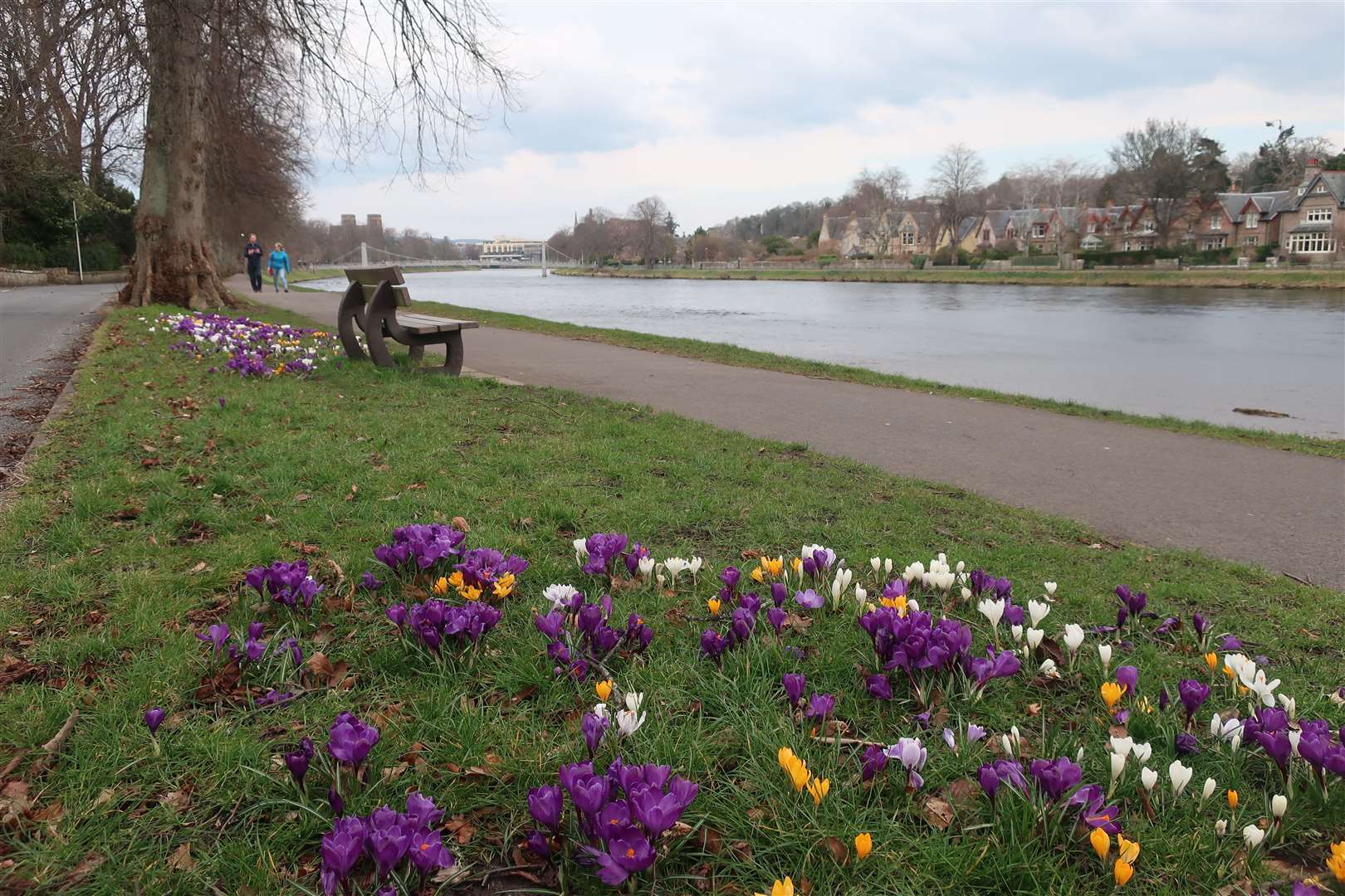
Opposite the Ness Islands, cyclists can go straight ahead on a contraflow cycle lane. The white line had faded to nothing but it has been repainted even since I did this ride – but that doesn’t stop some drivers encroaching over the solid line to avoid the speed humps, so watch out.
There are proposals for more impressive changes alongside this so-called Riverside Way route, including the possibility of a segregated two-way cycle path, which could be the first one in the city if it is approved.
The final stretch of this little circuit is sometimes the most awkward. After turning right to pass Eden Court and the cathedral, cyclists are allowed to turn right at Ardross Crescent to go against the one-way flow – but if my experience is anything to go by, not all motorists coming the other way bother to look at the six signs indicating that legal right…
Some cyclists prefer to avoid the conflict and use the path here, but that can be narrow and awkward, especially when the tourist season picks up again and the streets are busier.
My little circuit had been a little stop-start, but certainly highlighted the best and worst of getting around by bike. There are plenty of other routes in and around the city, including the canal towpath and the signed national cycle network routes, but there is still a very long way to go before we can claim to have a real cycle network in Inverness.
Route details
Inverness cycle circuit
Distance 10 miles / 16km
Terrain Cycle paths, roads
Start/finish Inverness city centre
Map OS Landranger 26; OS Explorer 414
Finding the best and worst of cycle ways in the Highland capital