


A fair wind blows on easy ascent of Sgor Gaoith in the Cairngorms
Register for free to read more of the latest local news. It's easy and will only take a moment.

It has been 20 years or so since I was last at this summit. That day a friend and colleague at the time – at a Glasgow-based evening newspaper – and I had booked a few days at the youth hostel in Aviemore to do some hill walking in the Cairngorms.
Unfortunately, the weather was atrocious for the length of our stay, but we resolved to get up one mountain before heading back south, at least. Sgor Gaoith can be relatively easily approached from Glen Feshie, so we aimed to reach the ‘windy summit’ despite more torrential rain and blustery conditions.
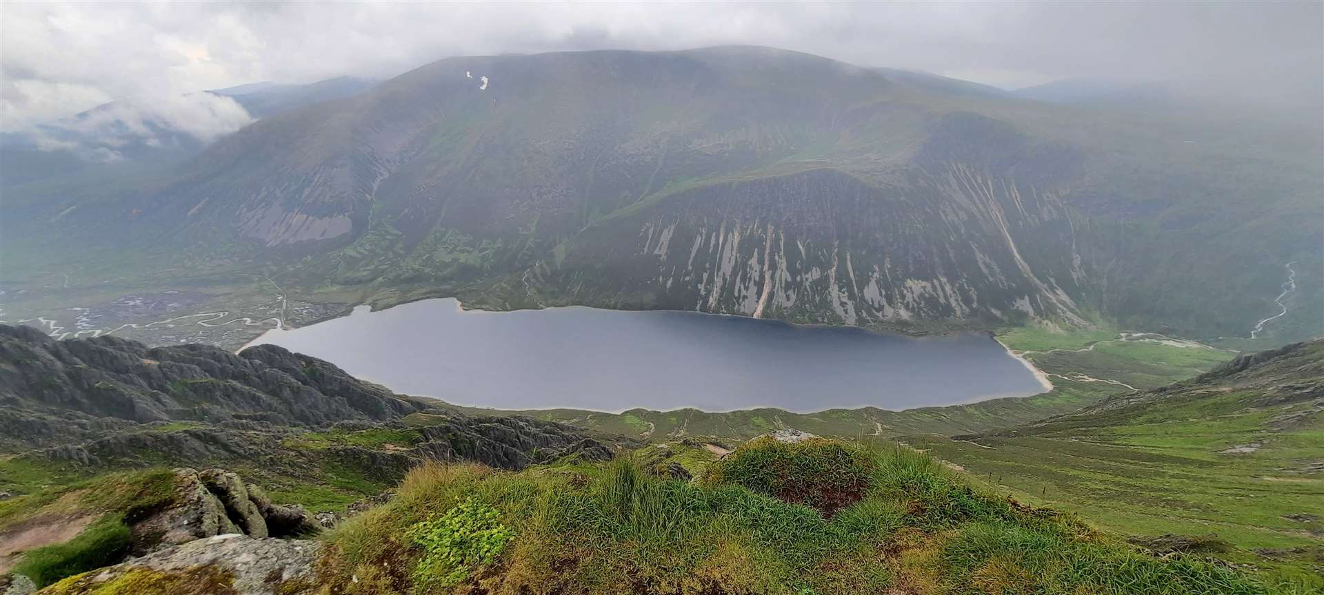
I remember little of the walk, and we probably saw even less, but the peak is certainly memorable for its dramatic summit which gazes over the precipice into Glean Eanaich far below.
This time I had better luck. The mountain forecast wasn’t promising for clear conditions at the top but I was keen to get back on the hills, which I’ve not been able to do as much as I’d like recently between Covid restrictions, family commitments, injuries and a busy work schedule.
The walk is relatively short for a mountain day, which suited my need for a quick fix and a speedy return home. I nipped down the A9 and headed towards Glen Feshie, where there’s a hidden parking area off the dead-end road to Achlean, up a track to the left, not far after the glider landing strip.
There were only one or two other cars here and the hills, at least on this side of the Cairngorms, were quiet. I headed into the forest, through a gate along the continuation of the track that gives access to the car park.
As you make your way beyond the plantation forest, the route gives way to remnants of the ancient Caledonian pinewoods. I kept left at a fork to follow the more obvious path as it climbed up through gnarled Scots pine high above the gorge that hosts the Allt Ruadh.
A well-made path makes for easy walking but, as I made my way up, the cloud clung to the slopes, making me think I’d be in the mist once I got onto the plateau. Instead, I focused my attention on working out where I would descend from my planned return route along the ridge over Meall Buidhe and Geal-charn.
It was also an opportunity to take a closer look at some of the beautiful montane flora that makes walking in the hills at this time of year extra special. The blaeberries made for a tasty treat while I spotted orchids, heathers, tormentil and one of my favourites, cloudberry in fruit.
There were even what I assume are twinflowers – and an information panel for the Invereshie and Inshriach national nature reserve does suggest they are present in the forest here.


The path forks right to drop to the Allt nam Bo, which was easily forded, before climbing again across the lower slopes of Geal-charn.
At the next ford, an easy hop over the Allt Coire na Cloiche, is roughly where I would rejoin the route on the way down, all going to plan. I had thought the path might start to fade by this point but no, it had clearly had fairly recent work done to maintain its excellent quality as it rose gradually below Meall Tionail, a western spur that juts out from below Meall Buidhe.
Before reaching the next burn crossing, the way ahead starts to become clearer, and I could see the cloud was lifting off the bealach to the south of Sgor Gaoith.
I hadn’t remembered the walk being so straightforward, which makes me think that perhaps the weather was really bad on that previous visit! Unusually for me, I was plugged into a podcast while I walked along the easy path lower down, but with the show over and my concentration required on the high tops, I took out the earphones and immersed myself in the hills once again.
The Allt a’ Chrom-alltain is the last of the fords along the path and is where that path seems to run out. However, an obviously eroded – and quite muddy in places – line continues up the hillside beyond, aiming for a slight flattening in the slope above.


Unfortunately, the route here is becoming wider as people spread out to avoid the mud, so walkers are asked to keep to the centre line as much as possible to reduce the erosion.
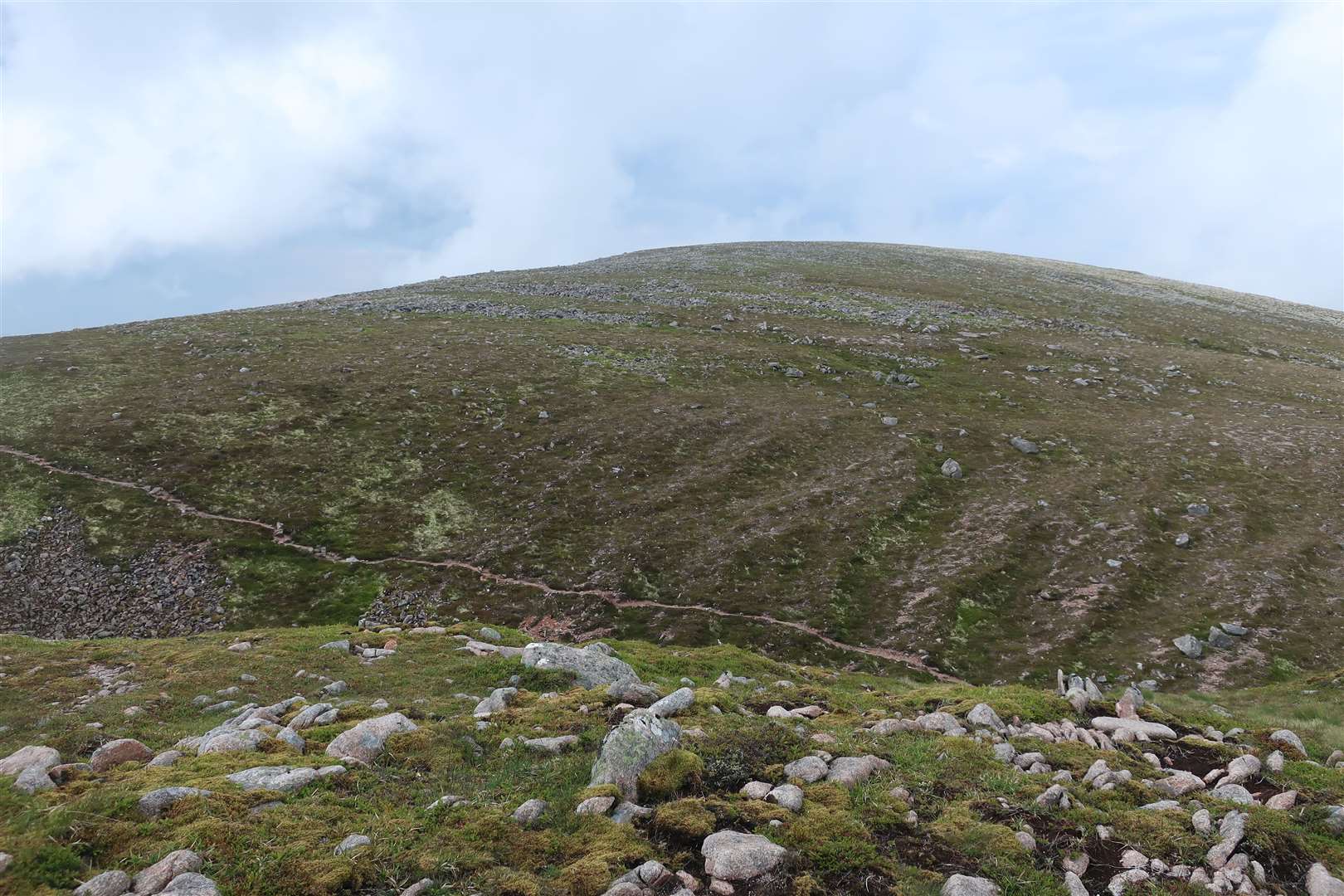
A cairn marks the flatter area and a clearer line winds its way up to the bealach, from where you head roughly north-east towards the summit.
Care is needed along the edge of the cliffs that plummet to the loch below, but the stroll to the top is nothing more than a gentle rise, and a couple of paths lead there – one right on the edge and the other a little further inland.
With only a gentle wind today, I plodded along the edge, looking down as well as across to the Braeriach plateau, home to the source of the River Dee.
I continued from the Munro summit northwards along the wide, grassy ridge to Sgoran Dubh Mor, which was once itself one of five Munros dotted along the ridge from this top southward across the Great Moss to Mullach Clach a’Bhlair. Today it is only classified as a Top of the Munro, Sgor Gaoith, but its huge cairn offered a nice wind break for me to sit and enjoy a bite to eat while taking in the unexpected and impressive views.
Descending south-west from here, I joined the ridge to Meall Buidhe, where a small cairn marked the high point. Then it was north-west around a small rise and through a gap to reach the rocky top of Geal-charn.
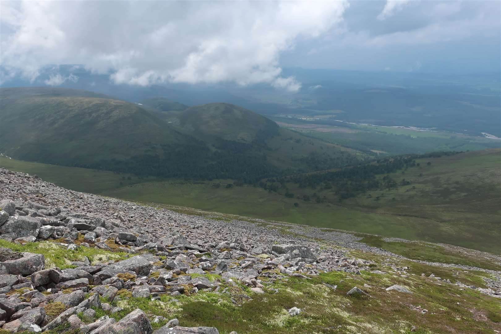
I continued past the top, marked by a large shelter, to the edge of a spur that overlooked the Spey valley and Inshriach from a cairn.
All that was left was the descent to the Allt Coire na Cloiche. With steep drops all around, I double-checked the direction on the compass and headed down to meet a slight ridge, zigzagging around small boulder fields before heather-bashing lower down.
The path was welcome relief for a pleasant stroll back to Glen Feshie.
Route details
Sgor Gaoith
Distance 10.5 miles / 17 km
Terrain Well-made mountain path, pathless mountain, rocky, steep slopes; navigation skills required
Start/finish Forest car park on Glen Feshie road to Achlean at grid reference NH853013
Map OS Landranger 36; OS Explorer OL57; Harvey British Mountain Map, Cairngorms
A fairly straightforward hill walk with a summit to remember