


A hill walk up Beinn Bhuidhe in the Monadhliath using the access route to Dunmaglass wind farm
Register for free to read more of the latest local news. It's easy and will only take a moment.

With the high mountains still largely out of reach to the majority of us, I’d been hit by some inspiration on last week’s bike ride.
Cycling past the entrance to Dunmaglass wind farm intrigued me, so when I got home I had a look at the map.
There are plenty of tracks here leading up to the turbines, but also a few hills that I’d guess are seldom climbed.
At 711m, Beinn Bhuidhe doesn’t even reach Corbett status, so I figured it wouldn’t be the type of hill that would have a clear path to the summit, despite the fact there is a trig point on top.
Even the trig baggers’ website suggests most people who do venture up here take a different route to the top of this one than I was looking at.
I would use the access track to pass the lodge, then cross the river before going over the top of Beinn Mheadhoin, a 556m hill with a cairn marked close to its summit on the map. Dropping back down to the track, I would then take Beinn Bhuidhe’s south-west ridge above some crags.
My return route was less certain, but the 1:25,000 scale map suggested a number of footbridges that meant I should be able to cross the burn and regain the track back out.
It was a grey day, but the cloud was high enough that it was above the tops I was aiming for as I set off from the track leading to the wind farm.
The track soon forks right, following a sign to the wind farm before it bends right to cross the burn then left where it meets the private road leading to the lodge. It’s also possible to start the walk a little further down the B851 at the start of this private road and continue along from here.
The walk along the track was a gentle introduction to the day, with the views of the hills ahead enticing me along. There were some snow patches on the higher hills and as yet the turbines were out of sight.
A handful of houses are passed, and I ignored a track off to the left that leads to the substation. This clearly dropped down to cross the river and meant my return route should work out.
Continuing past a sizeable pond, I stayed on the track towards the wind farm – marked as 9km further on – to walk along the edge of an area of woodland.
Approaching a fork in the track I was met by some noisy dogs followed by their owner, a friendly lady presumably from the estate who was very welcoming. She was the only person I saw on the whole walk – one advantage of heading for lesser-kent hills such as these!
I kept left at the fork – and a sign somewhat hidden under a tree suggested a path through Conagleann to Aberchalder on Loch Mhor. I went this way, though my route would diverge from that through-route soon enough.
This was a nice part of the route, running alongside the River Farigaig. As I plodded peacefully along, I saw red kites overhead and heard lots of bird life, including a woodpecker hammering away in the wood.
The track leads past a footbridge before crossing the river itself a little way further on. The map suggests that the path to Aberchalder heads off to the right before the bridge, but my eyes were fixed on the hill ahead and trying to assess the best way up.
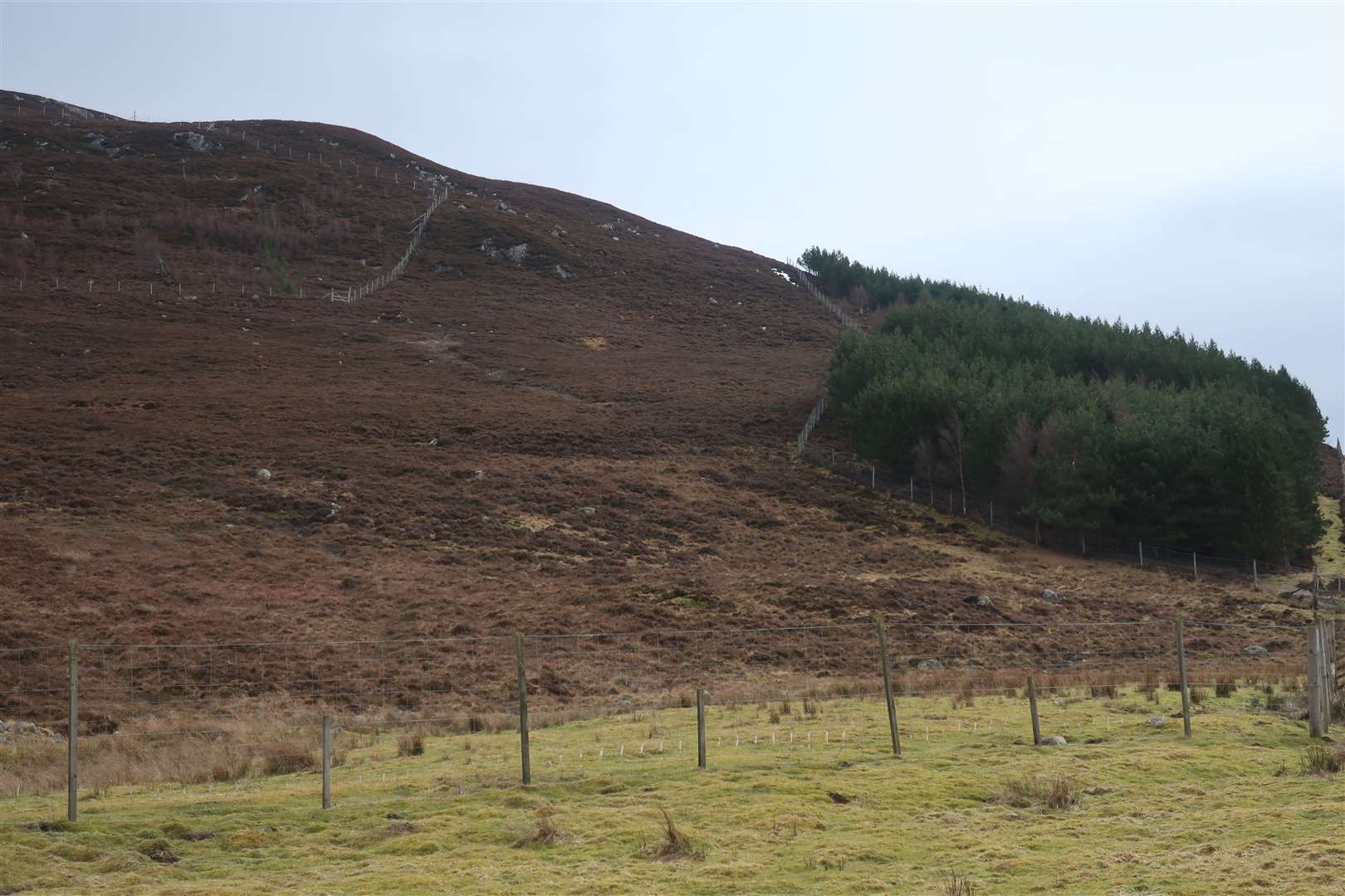
I plumped for leaving the track at the very start of a fenced plantation on the left, climbing steeply through the heather and zigzagging my way up to find the west ridge of Beinn Mheadhoin. Animal tracks helped but it was a pretty rough climb all the same.
Just before reaching the ridge, I got a bit of a fright when I almost stood on a mountain hare. It leapt out of the tall heather below my feet when it realised I was there and shot off up the hill.
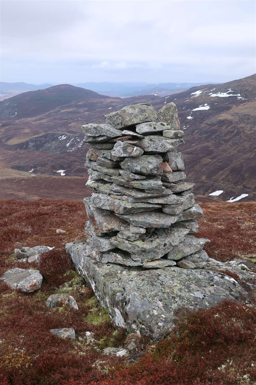
The ridge made for a nice walk, with less heather and more rocks and grass to make my way through before the summit cairn came into view. A small informal cairn marks the high point while a more substantial one sits off slightly to the north, with an impressive view beyond it over Strathnairn.
From here, Beinn Bhuidhe’s steep western flank makes it look like an impressive hill, which I would argue it is. I headed off the south-east ridge, which starts gently enough but gets steeper – until the very end when it appears to drop off suddenly.
Turning to the south a little, I headed round the outside corner of a new fencing enclosure and made my way down to meet the track.
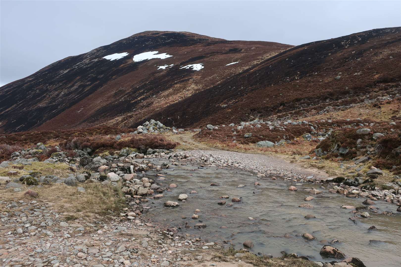
The ford of the Allt Cailtidh looked like it should be straightforward enough, despite a fair amount of water coming down through the pretty glen above, but I still managed to get water into my boot by wading just above the ankle level.
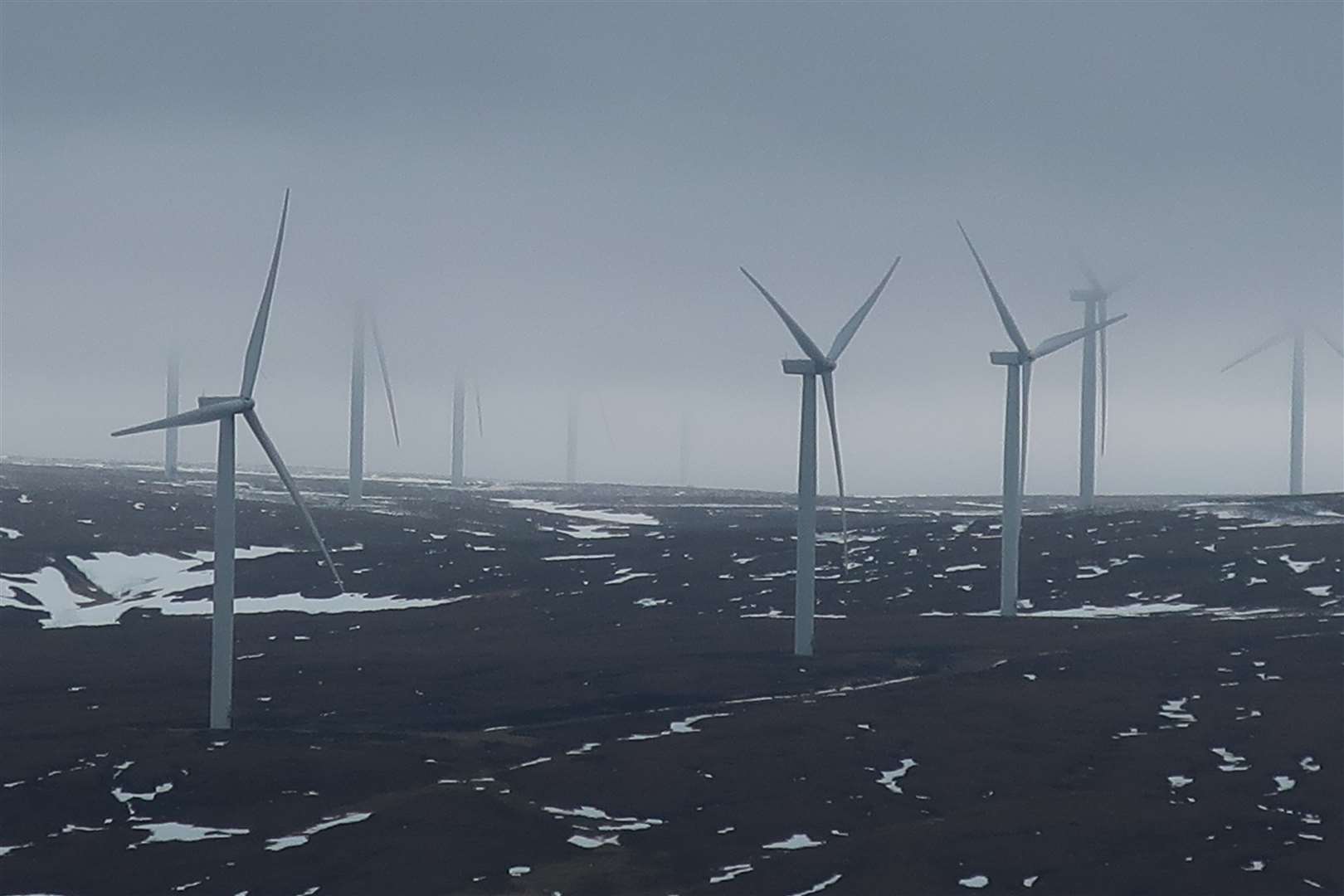
From the other side, the track climbs steeply above the gorge with the turbines getting closer and closer now. The cloud hung low over them, their blades slicing into the greyness with each rotation.
I was looking for the best place to leave the track again after gaining enough height to give me a head start on the ridge. I opted for a spot just before a right-hand turn on the track, heading into the lingering stench of recent muirburn.
My feet dragged through the black, dead heather as my nostrils filled with the smoky remnants of the fire. Thankfully, I soon gained height and left the area behind as cloud began to wisp over the top of the hill.
After a steep section the grassy ridge eased and curved to the right, and it was a pleasant walk up to the trig point and shelter at the top, despite walking into the cloud.
I took a compass bearing off the top, heading for an area of flat ground to the north of the summit and avoiding some crags to the north-west. Once below the cloud and approaching this part of the ridge, it was easy to see the route back – including a bridge over the Allt Cailtidh far below.
My descent took me immediately to the north of a fascinating geological feature which is home to Lochan Uaine. The hollow drops a good 30 metres or more from the 350m contour, with lichen and moss covering a mass of boulders suggesting this is an Ice Age relic, perhaps a kettle hole left over from glaciation.
I wandered along the edge of this abyss then crossed an old dry-stone wall that leads right into its entrance to reach the footbridge ahead. From here it was a short stroll to a large gate that opened onto a track which soon joined the main route from the substation.
Turning right onto this newer track, I followed it over the river and past the back of the houses I’d seen earlier in the day, before reaching the junction with the private estate road and turning right to follow my outward route back to the start.


Route details
Beinn Bhuidhe (711m, Monadhliath)
Distance 8.5 miles / 14km
Terrain Estate tracks, pathless mountain, navigation skills required
Start/finish Dunmaglass (parking available on verge close to entrance to wind farm on B851)
Map OS Landranger 26
A short hill day offers a fine outing with some fascinating features and wildlife to see