'Wetting' the appetite on winter run around Carrbridge in the Cairngorms, including a crossing of Sluggan Bridge on General Wade's old military road
Register for free to read more of the latest local news. It's easy and will only take a moment.

It had been a good few years since I’d done this full circuit that starts in the beautiful setting of Carrbridge on the edge of the Cairngorms.
The route makes a great long walk with plenty of variety, but Meg and I decided to run it this time, in an effort to keep up the winter fitness levels.
Maybe our choice of timing could have been better, though, after a long night of heavy rain had left the burns flowing fast and the puddles full to bursting on some of the tracks.
It would be interesting to see the one big ford that needs to be crossed roughly halfway through the circuit, I pondered as we set off on a dry but chilly morning.
We started at the car park in the centre of the village, initially turning right to pass the old packhorse bridge. This much-photographed crossing of the Dulnain was built in 1717 and, though it survived the famous flood of 1829, its parapets and side walls were stripped and today the bridge is unsafe to walk on.
Our route continues on the pavement round the corner, towards Inverness on the road sign, before forking left just before the end of the 30mph limit down a single-track road past a few houses. After the last of the buildings, the private road goes under the railway and climbs to meet the A9, which must be very carefully crossed.
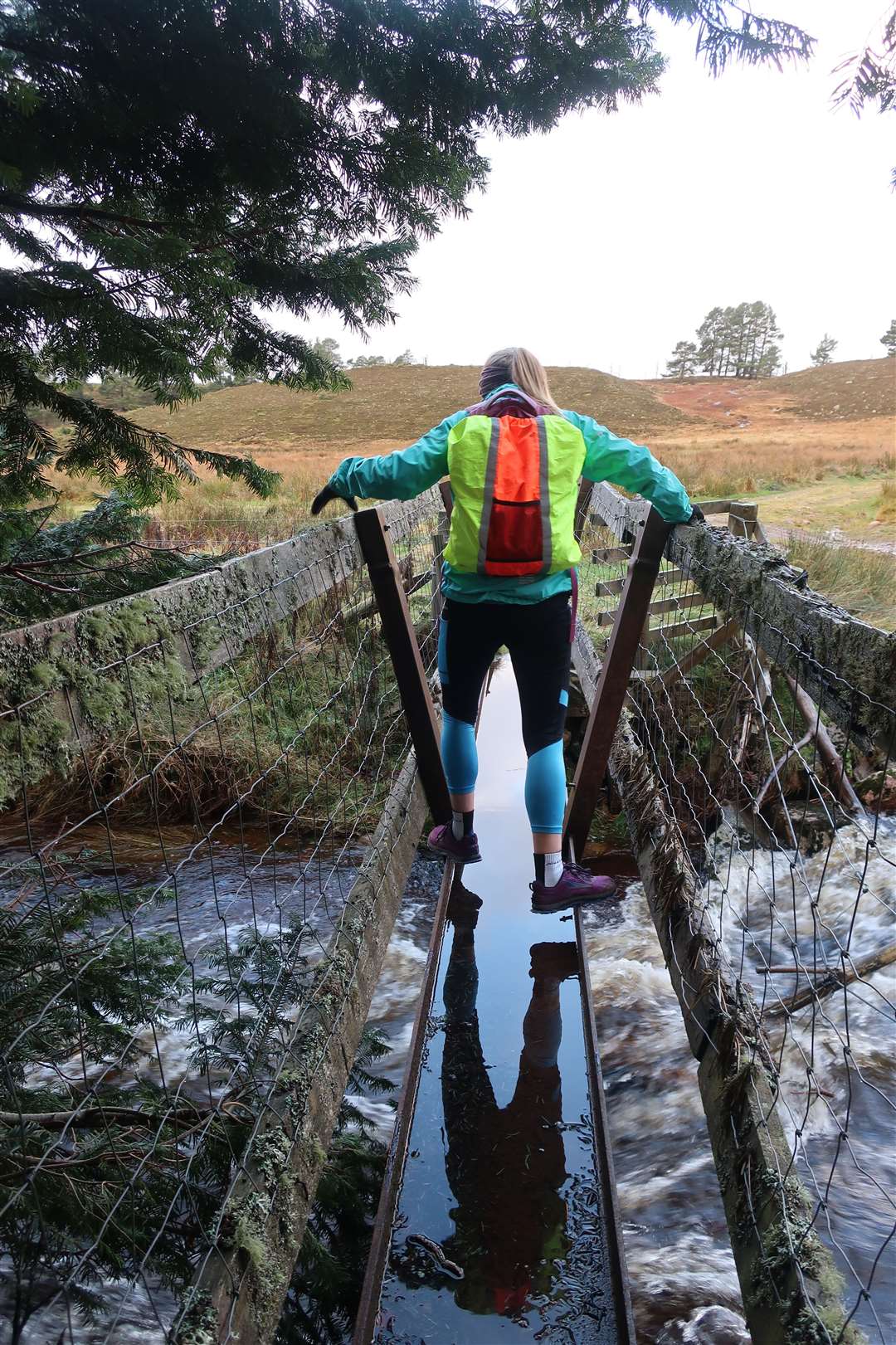
Continue ahead on the other side to Dalrachney Beag to reach a ford and rickety footbridge. The water was battering through this tributary to the Dulnain and gave us our first indication of just how much rain must have fallen the previous night.
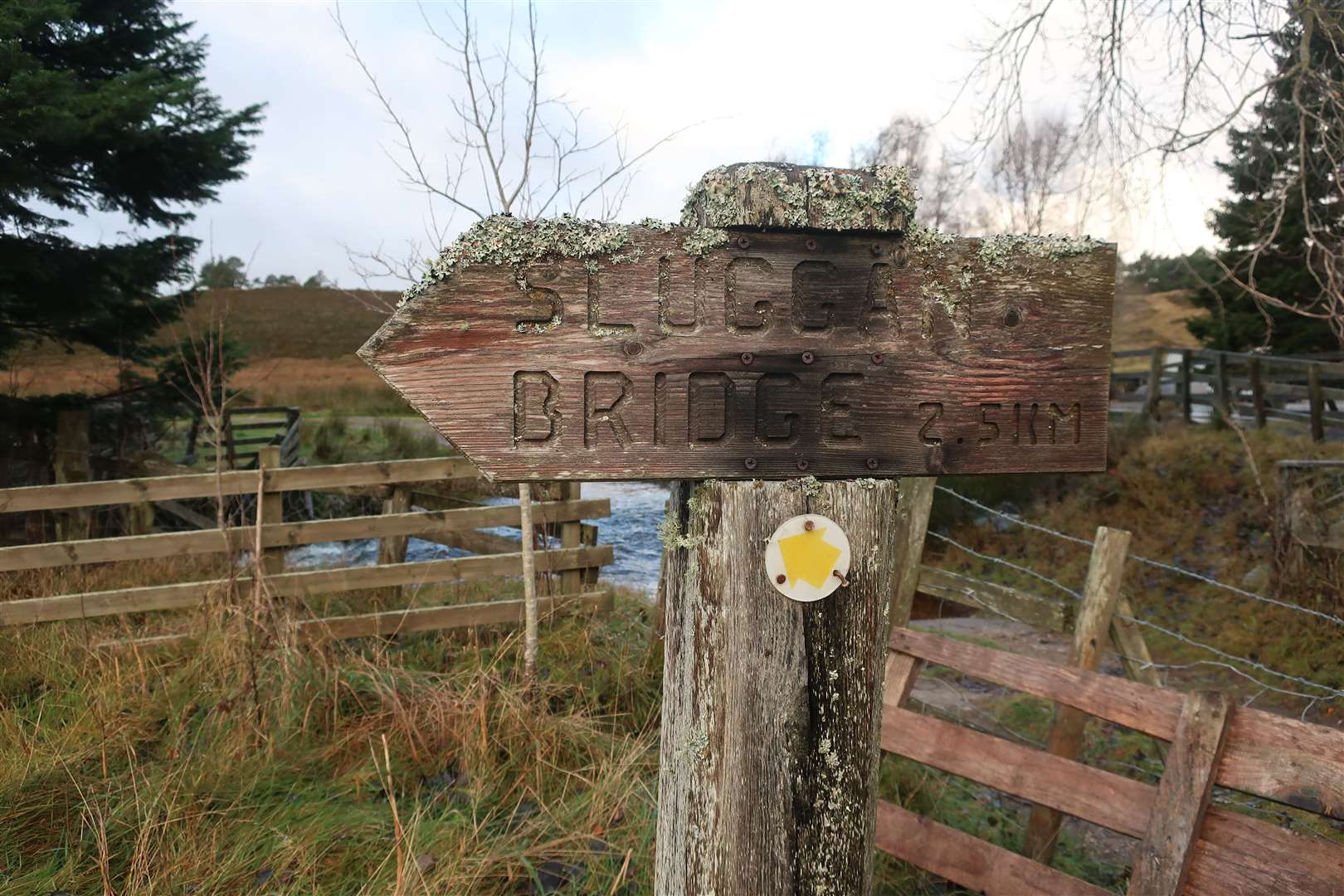
Following a wooden sign to Sluggan Bridge, even this little footbridge was one long puddle, so we edged along it to reach the track that bends left and follows a sodden section towards the river.
After touching the edge of the water, the track eventually improves as it starts to rise slightly but we soon reached another burn crossing that provided a bit of a challenge. We detoured off the track to find a safe place to leap across the water before returning to the track and a gate.
I tried to do this next section after the gate from memory and went the wrong way, ending up following a rough route along the edge of a fence rather than following the easy vehicle track. For the avoidance of doubt, the best way from the gate is to take the track to the right that climbs steadily to meet a fork – easy to miss – where a small, aged wooden sign to Sluggan Bridge points left down an older track.
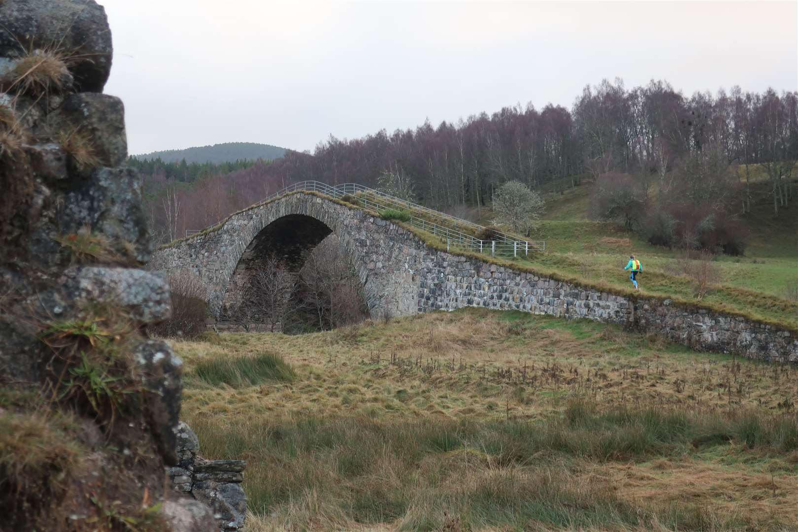
You pass another gate then emerge to a view of the bridge on the old military road between Dunkeld and Inverness. A little ruin is passed before turning left to join the old Wade route and crossing the bridge, which is now part of the National Cycle Network.
The track continues through pleasant open woodland and, where it starts to climb a little steeper, go right to zigzag up to the back road. Cross straight over and continue on the old military road that goes initially dead straight through the Beananach Wood. There is some ongoing forestry work here through December and January, but it was quiet on our visit with no sign of anything that would affect access.
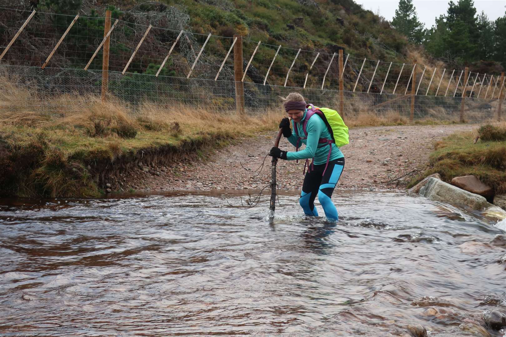
The track bends left then forks right shortly after a crossroads to descend to the big ford over the Allt Lorgy. This usually entails getting wet feet at the best of times, but the area looks very different now to the last time I was here. A fence makes it difficult to wander upstream to find an easier spot to cross, so we eyed up the flow and decided a wade was a safe option.
Grabbing a large stick that had been left nearby to support ourselves, we took the plunge and made it across easily – if a little cold! An uphill stretch after this soon helped us warm up before dropping downhill.
When approaching the A9 ahead through the trees, take a right fork and keep to the top track towards Kinveachy Lodge, then a sharp left turn to drop to the main road. Another careful crossing is required before following a private road under the railway again on to meet the Carrbridge road close to a junction with the A95.
Follow the cycle route towards Boat of Garten, which crosses the A95, then at the junction towards the osprey village, cross back to the other side to follow an access road with a sign for Chapelton Steading.
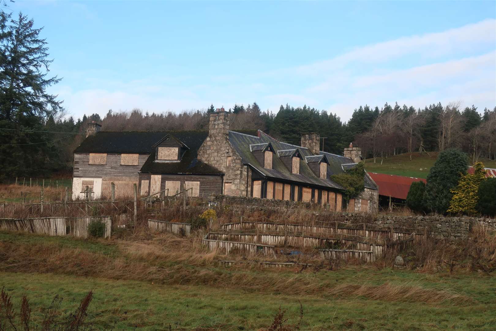
After passing a few houses this track rises to reach an abandoned farmhouse at Docharn. With a grand outlook and surroundings that were clearly once well cared for, it is a shame to see the boarded up buildings here.
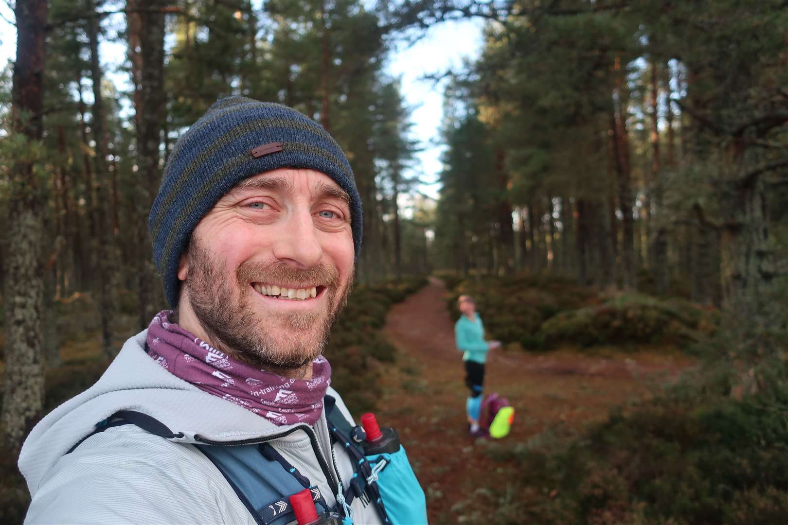
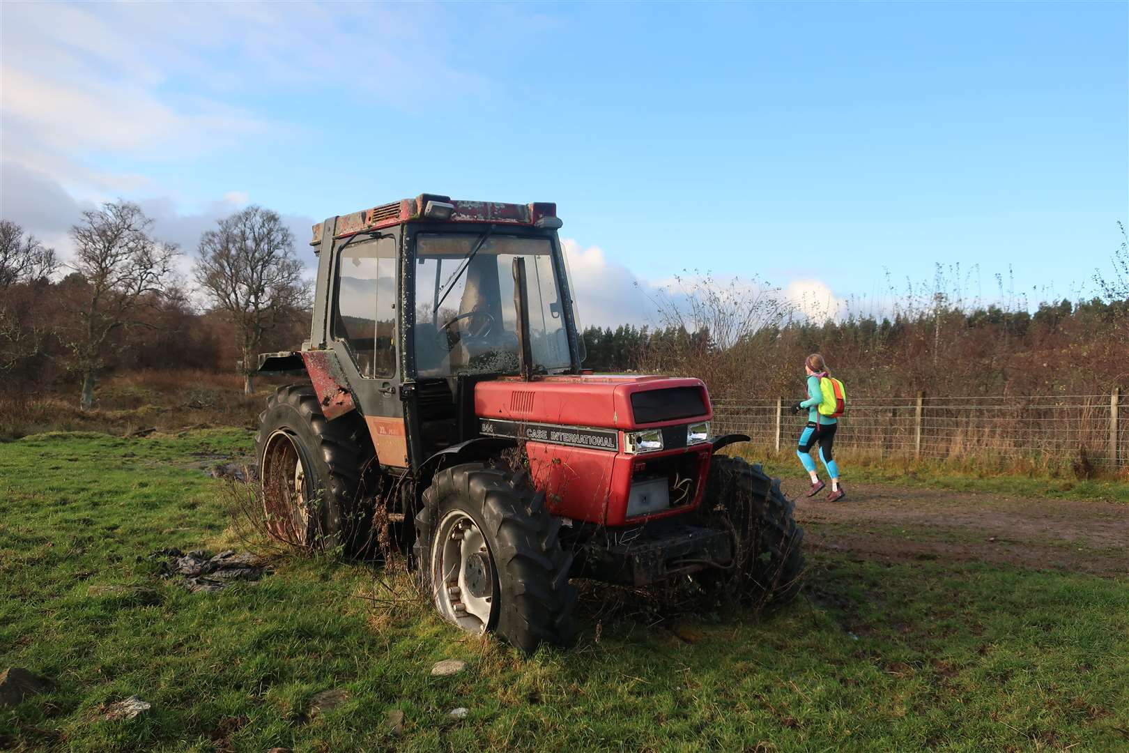
The route swings left round the back of the main house and makes its way – past an old tractor – into the shelter of the forest. The soft pine-needle floor makes for pleasant running for the rest of the way, as we headed through Docharn Wood to a point close to the road.
Here, take a right turn – ignoring the green sign for the Carr Plantation Trail to the left – and continue on what used to be part of the National Cycle Network. Old Route 7 markers can be spotted here and there along the way and we knew it wasn’t far to go now.
As the track nears Carrbridge, follow a sign labelled Carr Bridge – not the left turn to Ellan Wood Road - to emerge at a turning point. Just before the gate that exits the plantation, we found a long row of painted stones that brightened our spirits as we had tired legs by this stage.
Continue ahead after the gate to reach the road and go left to return to the main road through village, where you turn right to very soon reach the car park.
Route details
Carrbridge run
Distance 12 miles / 19km
Terrain Pavement, estate and forestry tracks, paths, several fords and trunk road crossings
Start/finish Carrbridge village car park (public toilets available here)
Map OS Landranger 36; OS Explorer OL57 & OL60
Revisiting an old favourite route that takes in a historic bridge and some fabulous scenery