


Two's company on tandem cycle tour of the Snow Roads in Cairngorms and the eastern Grampians
Register for free to read more of the latest local news. It's easy and will only take a moment.

Mike Dennison, marketing and tourism development co-ordinator for Sustrans Scotland, shares his experience of a tandem tour of the Snow Roads
So called because it follows many of the gated roads which criss-cross the high passes of the eastern Grampians, the Snow Roads is a spectacular ‘bucket list’ route for many an aspiring cyclist.
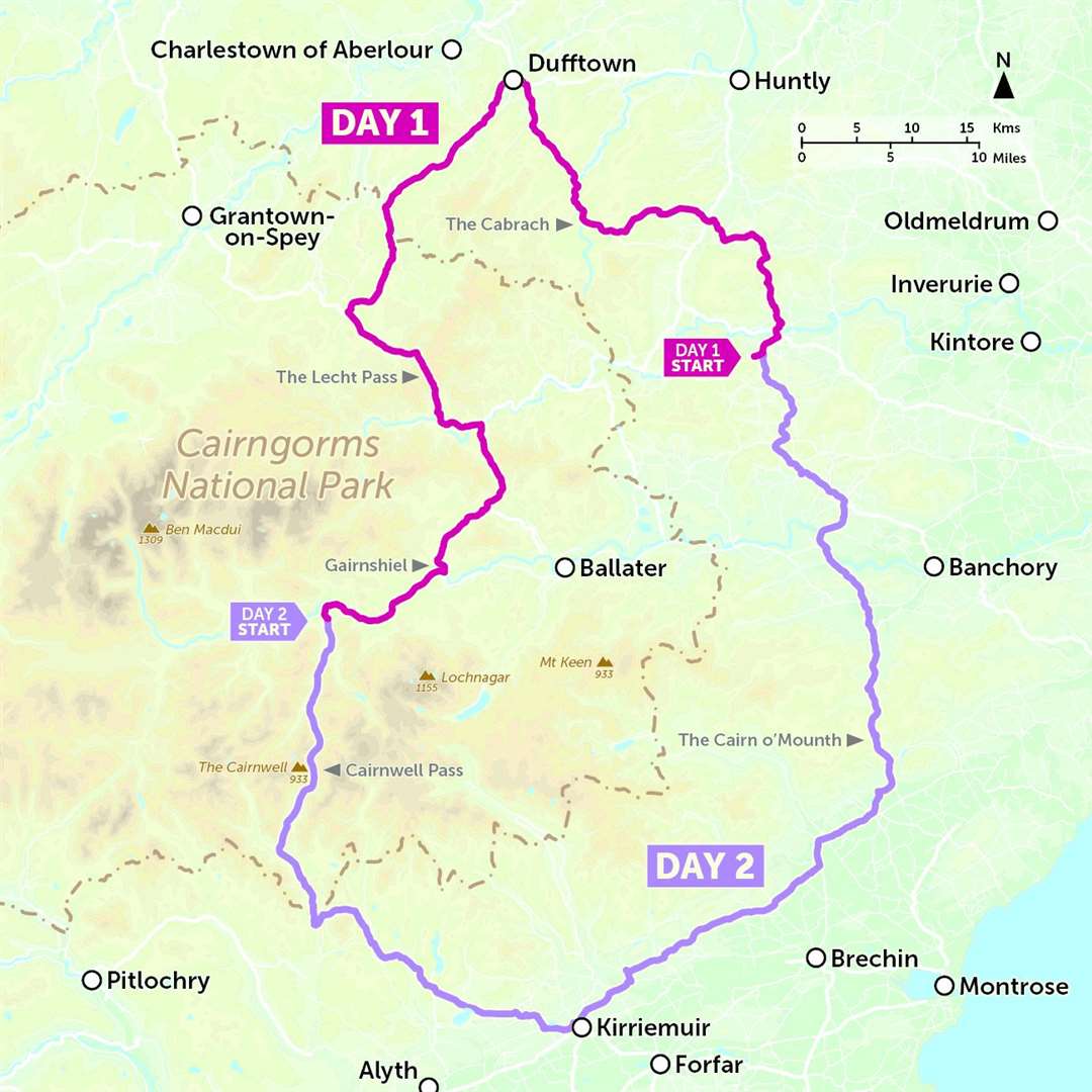
The classic challenge is to ride the 185-mile circular route in one long day, either with friends and club mates, or perhaps as part of the official Snow Roads Audax.
But it also makes a fantastic two-day mini-tour when ridden at a more leisurely pace, and given that the route passes within a few miles of our house near Alford in Aberdeenshire, it was this latter approach that appealed to our sense of adventure.
We’ve been ‘riding tandem’ for a number of years, having bought the bike when my wife was recovering from an illness; we figured it was a good way of getting out together, enjoying the fresh air and scenery, while Kate re-built her strength.
Short trips to local coffee shops morphed into longer adventures further afield, as we built the confidence to tackle our first major ‘tandem tour’ – Lands’ End to John O’Groats, successfully completed in just under two weeks. But with more than 12,000 feet of climbing packed into just two long days, we knew the Snow Roads would provide an altogether different type of challenge!
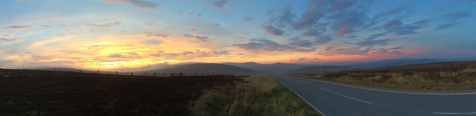
An early alarm call saw us set off with the sunrise. Travelling light, the climb over our local hill, the Suie, provided an early warm up for the legs, before we tackled the remote and eerie Cabrach. A prominent landmark is the memorial cairn which stands testament to the disproportionately high number of young Cabrach men who failed to return from World War I; the numerous abandoned crofts and steadings that you pass here are a reminder of the impact this loss had on the local community.
With the early morning sun now on our backs, we pressed on and were soon rolling into Dufftown for our first coffee stop. From Dufftown, the route skirts the northern edge of the Cairngorms National Park on undulating minor roads, first to Glenlivet with its famous distillery, and then on to Tomintoul, notable for being the highest village in the Highlands.
Refuelled after a ‘second breakfast’ in the quirky Old Fire Station Tearoom, our thoughts quickly turned to the ascent of the Lecht – all be it from the north, or ‘easier’ side…
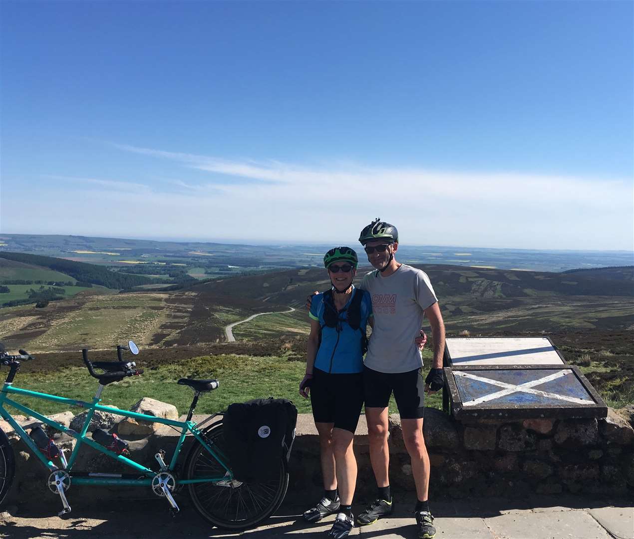
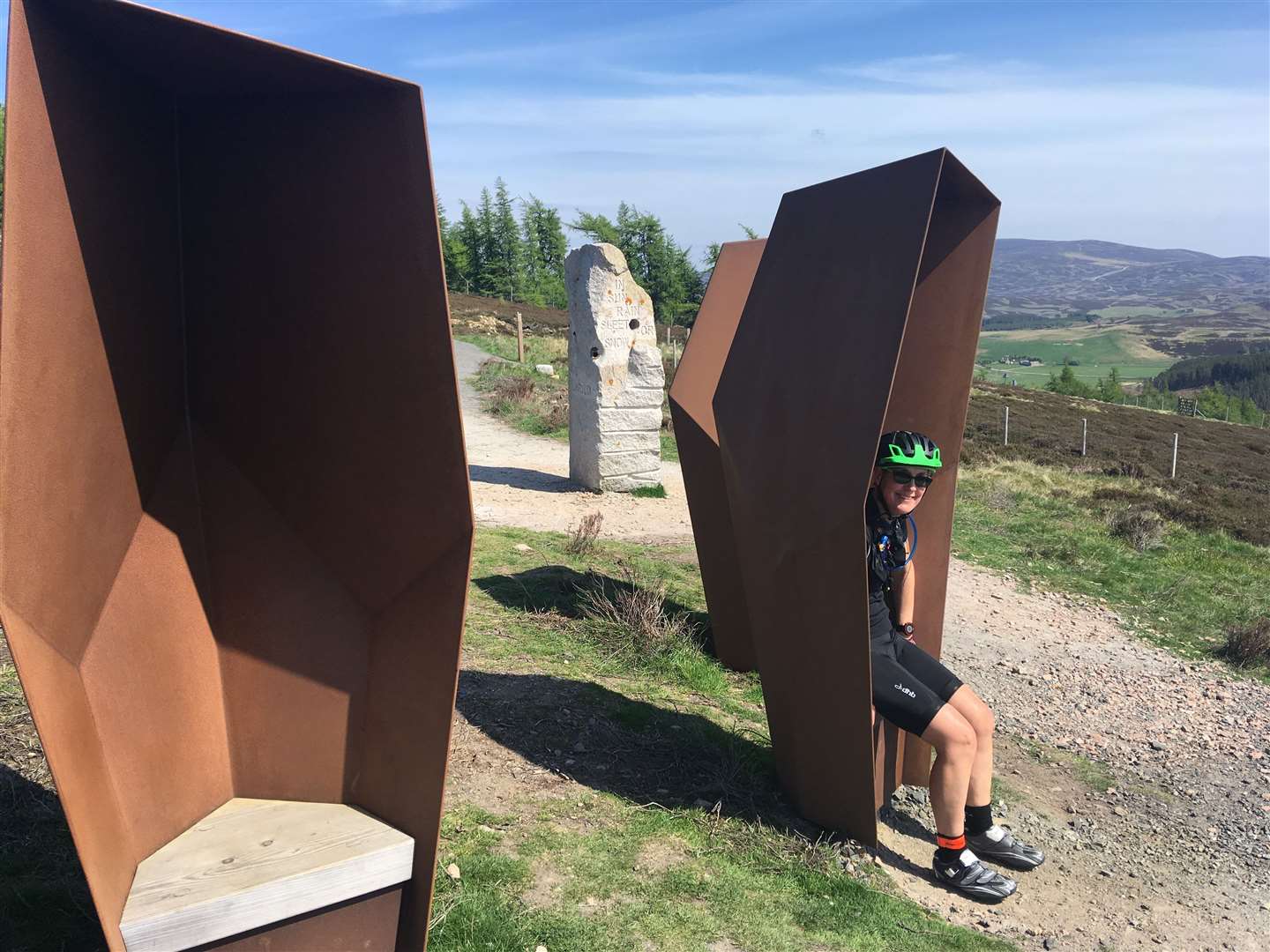
On a crisp morning with blue skies overhead, the climb up and over the Lecht pass had a positively alpine feel about it. It is home to The Watchers, one of two scenic art installations that you’ll pass on this route. Four sculptural ‘seats’ encourage passers-by to pause and reflect on the spectacular views over historic Corgarff Castle, and into the heart of the Cairngorms… and why wouldn’t you?
An adjacent stone obelisk sculpture bares the words: "Take a moment to behold, as still skies or storms unfold, in sun, rain, sleet or snow, warm your soul before you go.’ Appropriate for any cyclist who has made the ascent – especially on a tandem!
Some caution was required through the hairpin bends as we barrelled down an otherwise exhilarating descent into Donside, before a right turn signalled the start of another challenging climb, this time over Gairnshiel. This remote section of road is often the first to close in winter, and can remain impassable for weeks after heavy snowfall.
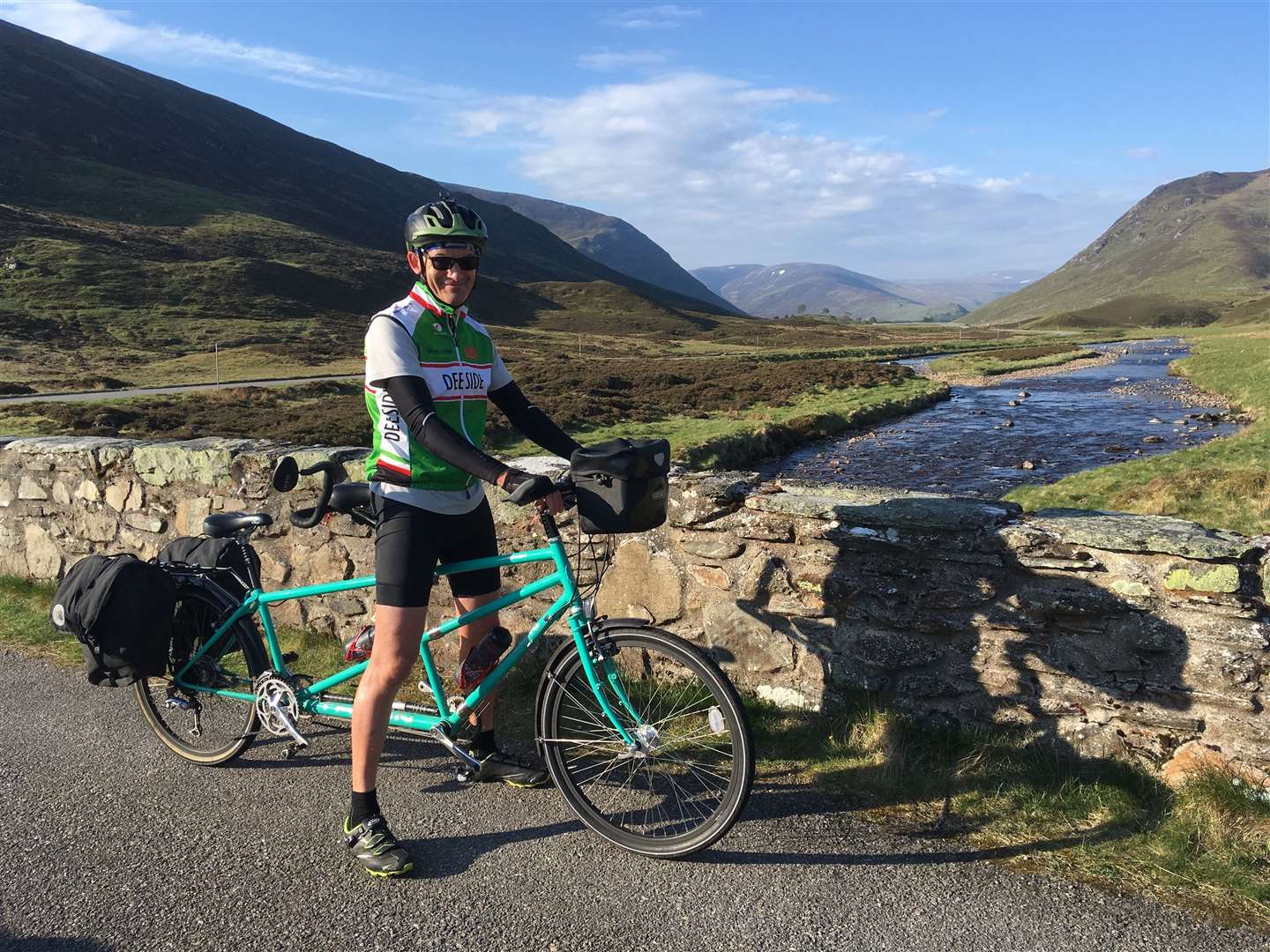
For the rest of the year, it provides a spectacular if somewhat improbable shortcut between Corgarff and Crathie, following the alignment of a historic military road past landmarks such as Gairnshiel Bridge and its neighbouring hunting lodge, and affording dramatic views up Glen Gairn into the heart of the Cairngorms National Park, and south to Lochnagar and beyond.
With fatigue building in our legs, the final stretch for day one follows the thankfully relatively flat A93 to Braemar. Although a busy road by comparison, the dramatic scenery provided a welcome distraction as we made our way up Royal Deeside past Balmoral Castle, the Old Invercauld Bridge and nearby Invercauld House, before arriving in Braemar.
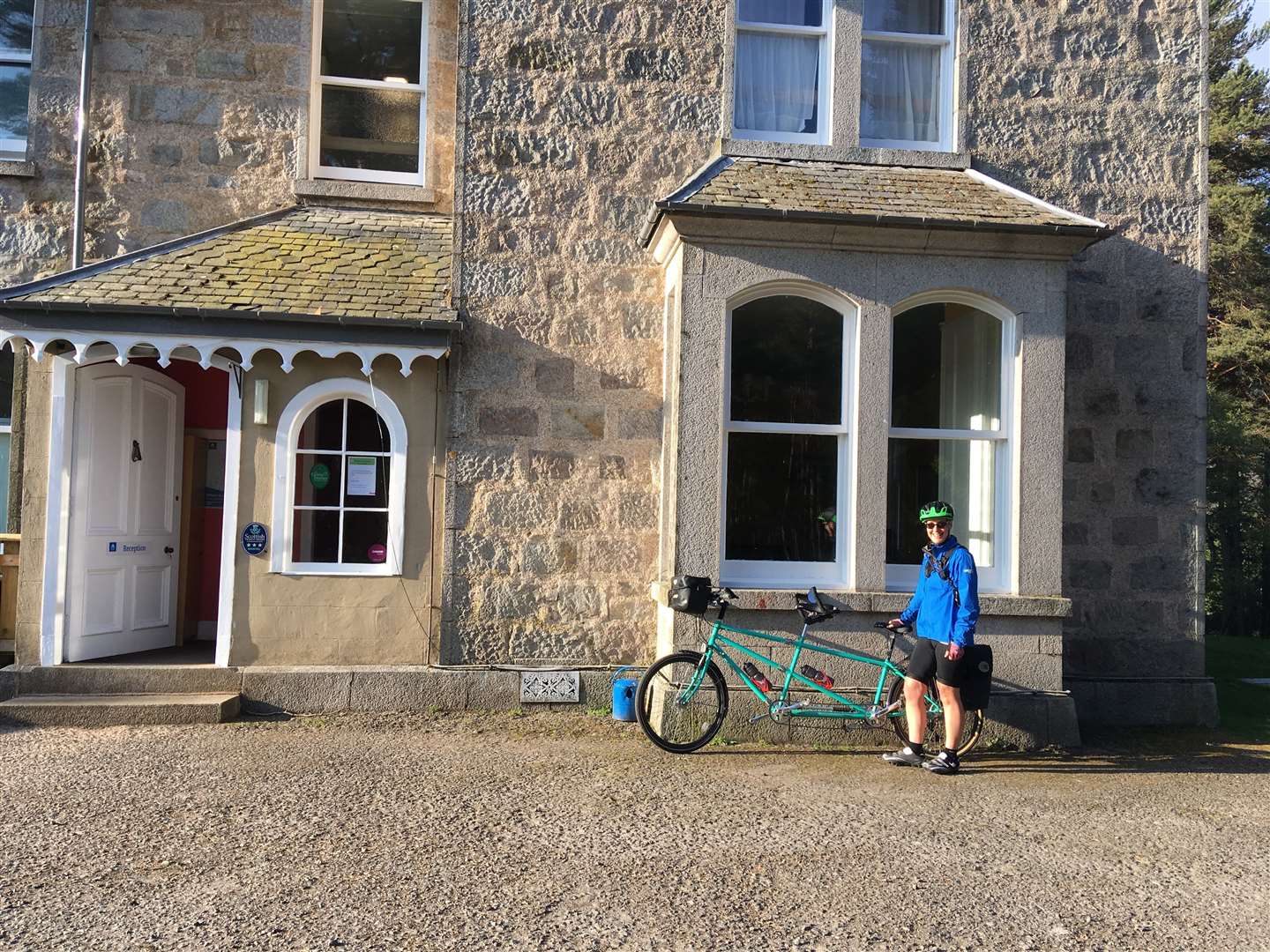
We’d opted to stay at the Braemar Youth Hostel, located in a characterful old shooting lodge – on account of our need for a generously sized bike shed to accommodate the tandem!
They say a good test of the strength of any cycling couple’s relationship is to put them together on a tandem! Reflecting on a fantastic days riding over a pint or two in beautifully restored nearby Fife Arms, we both agreed… ‘So far, so good!’
With another big day ahead of us the next morning, we were up early and on the road before 7am. We made sure to stock up on supplies in Braemar the night before, as café stops are few and far between on the next section.
Our route now followed the A93 over the Cairnwell Pass in Glenshee. At an altitude of 670 metres, the Cairnwell Pass is the highest public road in the United Kingdom, and a good climb to add to our tandeming ‘Palmarès’!
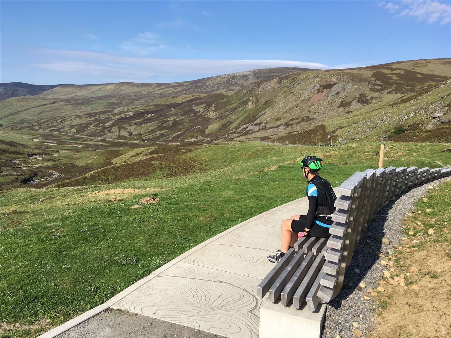
A discrete sign on the descent towards the Spittal of Glenshee marks the turn-off to another art installation and scenic viewpoint at the Devil’s Elbow – the notorious double hairpin bend on what remains of the old A93.
Connecting Contours is a stylish bench seat with engraved slabs, reflecting and emphasising the dramatic contours of the surrounding landscape – as good a place as any to take a moment and soak up the views.
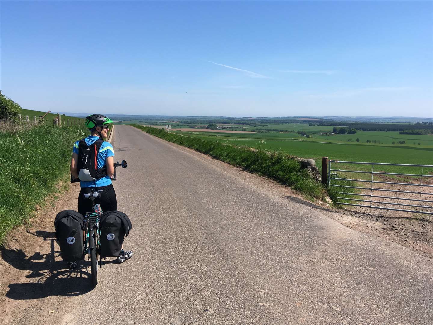
From Spittal of Glenshee we continued on as far as the Glen Isla turn-off. From here, it was an undulating ride through a much softer, more agricultural landscape, to the market town of Kirriemuir – known as the Gateway to the Angus Glens, and famous for being the birthplace of Sir JM Barrie, creator of Peter Pan – though on this occasion it’s more notable for being our first opportunity in five hours for a well-earned coffee and scones at Expresso 88!
Traversing east across the foot of the Angus Glens from Kirriemuir, the rolling roads offer fine views across open countryside towards Brechin and Montrose. It almost felt like this particular challenge was ‘in the bag’, but for one thing… the ascent of the Cairn o’Mount!
Don’t be deceived by the signposts which warn of a 16 per cent gradient. Passing the Clatterin Brig Café, the road ramps up to as much as 20 per cent in places, for a sustained two-mile climb up the Cairn o’Mount – with a particularly nasty sting in the tail through the hairpins near the top.
Each time we shifted down a gear, so seemingly did the gradient, and it took everything we had to grind out this climb. Tandems are great on the flat, fast and exhilarating on the descents, but they are definitely not built for climbing.
At close to 1500ft above sea level, the view from the top of the Carin o’Mount is breathtaking – a just reward for the effort we put in to get there. We were blessed with a clear bright day, and a view which stretched as far as the Fife coast.
Traversing the heather moorland of Glen Dye, with the sun dipping below the prominent granite tor of Clachnaben and the scent of pine on the evening breeze, we agreed we would be hard pressed to find a better mini-tour in the north-east of Scotland. With challenging climbs, exhilarating descents and breathtaking views across some of the most remote landscapes of Scotland, cycling the Snow Roads circuit really did deliver on every front.
Route details
Snow Roads
Distance Day one – 81 miles; Day two – 97 miles
Ascent Day one – 6300ft; Day two – 5750ft
Terrain Mix of minor and main roads with multiple steep, sustained climbs
Start/finish Alford
Maps OS Landranger 28, 36, 37, 43, 44, 53 & 54
A tandem tour following the scenic Snow Roads route through the Cairngorms and north-east
Read more
- Improvements to Drumochter pass cycle route
- Scotland's cycle network 'could be the envy of Europe'
- More from Active Outdoors