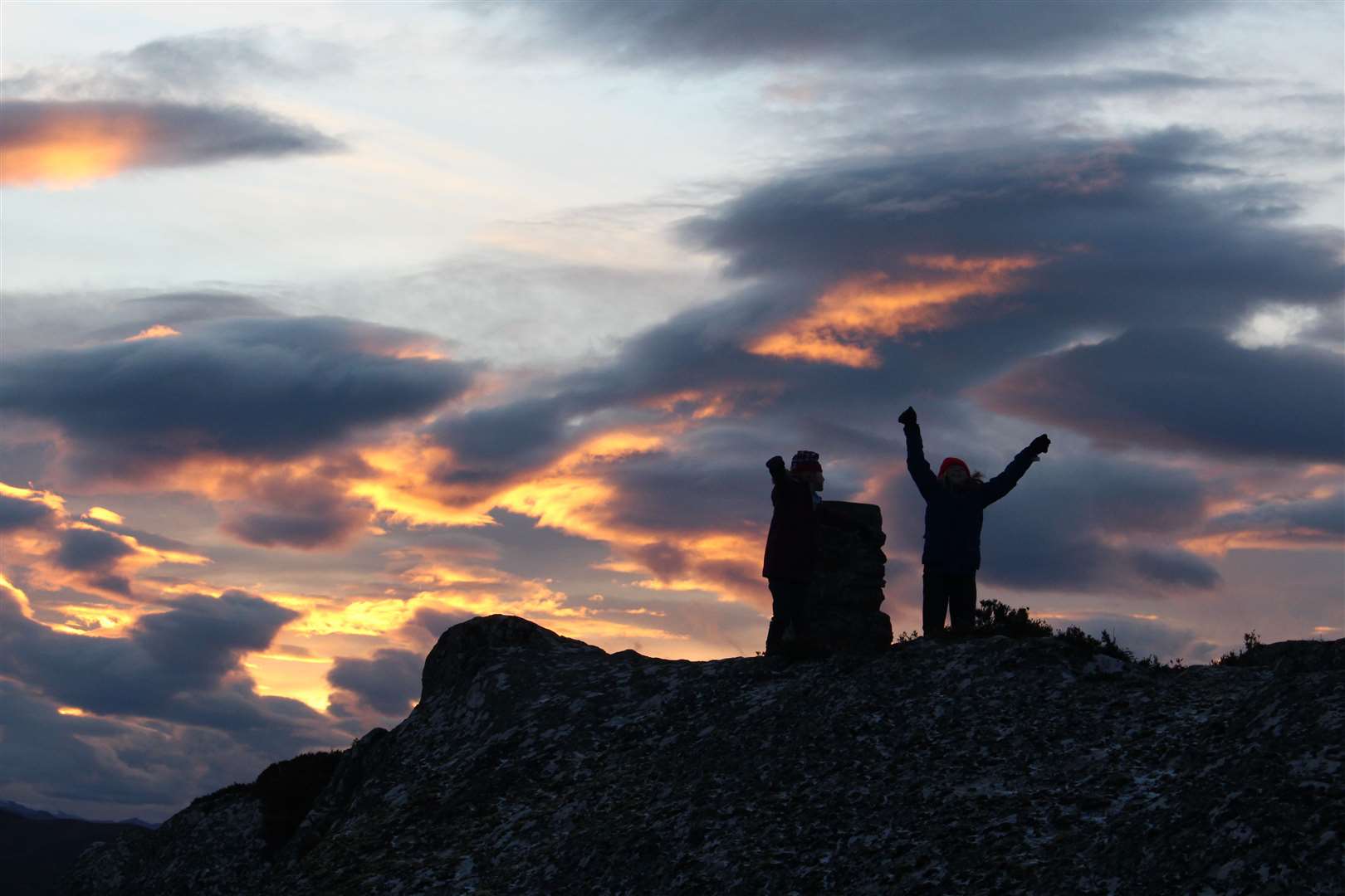
Sliding and climbing up Stac Gorm to reach trig point above Loch Ruthven
Register for free to read more of the latest local news. It's easy and will only take a moment.

Climbing this rocky hill turned into a bit of a race against time as we aimed to get up and down with the children before darkness fell.
They all had new head torches for Christmas, so I think they secretly took their time hoping to give them a proper test.
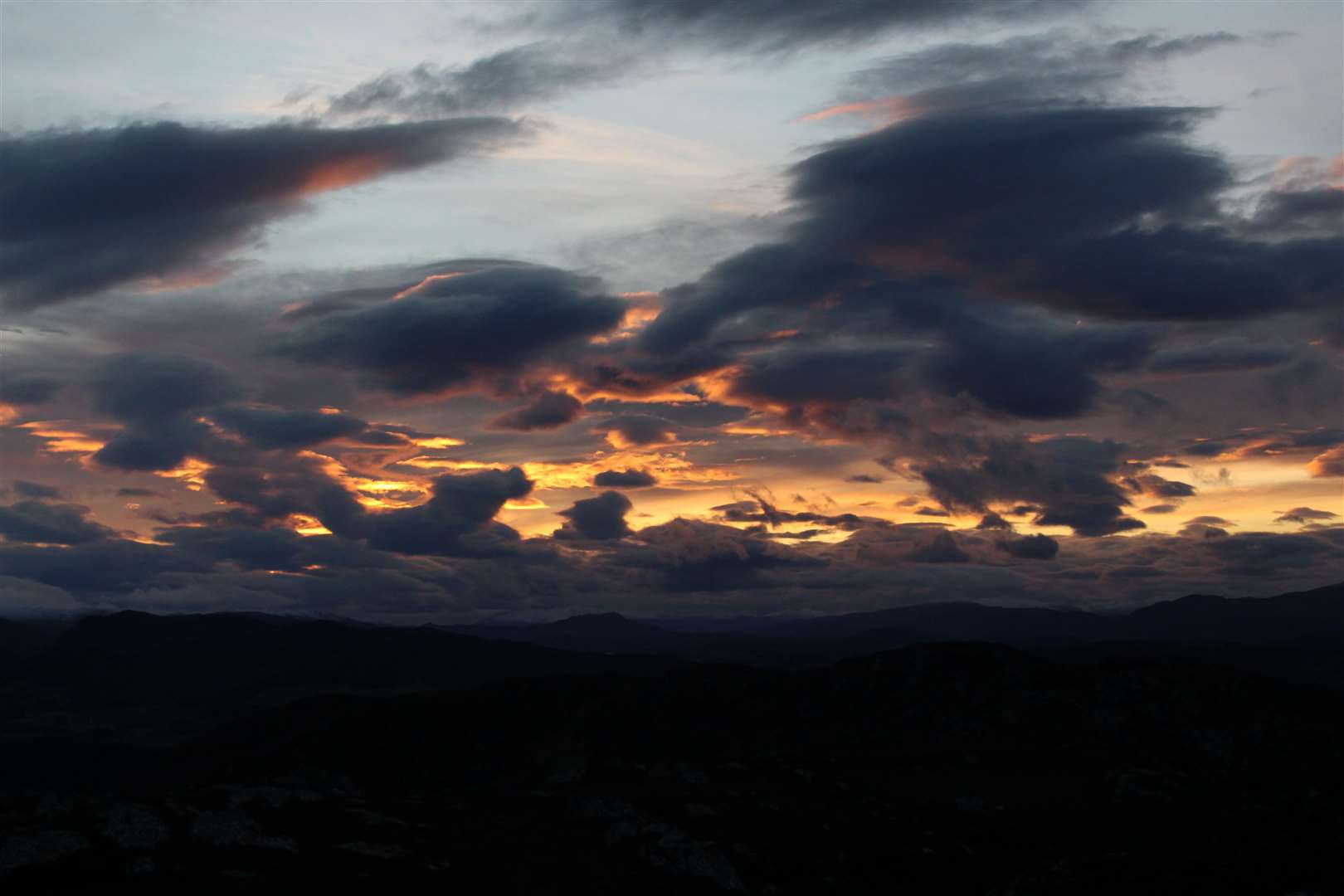
When I finally made it to the top with the two girls, we were rewarded with what Clara described as an amazing sunset. The orange glow beamed through a rough sky of grey clouds on the horizon, while the blue evening light remained clear higher up in the atmosphere.
Stac Gorm is a low hill at just 430m above sea level, but I knew the interesting – if horribly boggy – path would be sure to keep the young ones more interested than an easier walk on a boring path!
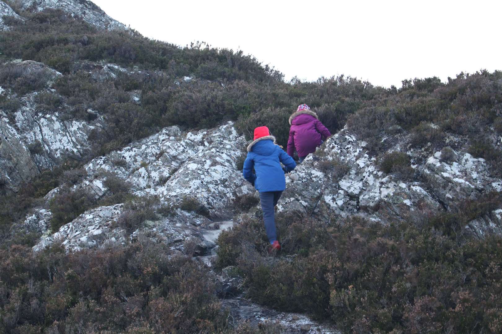
With the temperatures still low, much of the path was sheet ice, which helped avoid the worst of the bog but added its own difficulties in making progress – largely because they all wanted to stop and slide at the best bits.
An obvious path heads up towards the east ridge from behind the RSPB car park at Loch Ruthven, necessitating an easy hop over the fence to begin with.
We got as far as the prominent boulder it leads to, Clach na Boineid – which I think translates as the Bunnet Stone, though I stand ready to be corrected. This is well used by climbers, as the chalk marks will contest.
For little ones, there is a segment that has split from the original stane that offers some easy scrambling onto the top. Jennifer was soon at home climbing the rocks and the youngest, Matthew, was determined to follow, though he needed a bit of help to get up safely.
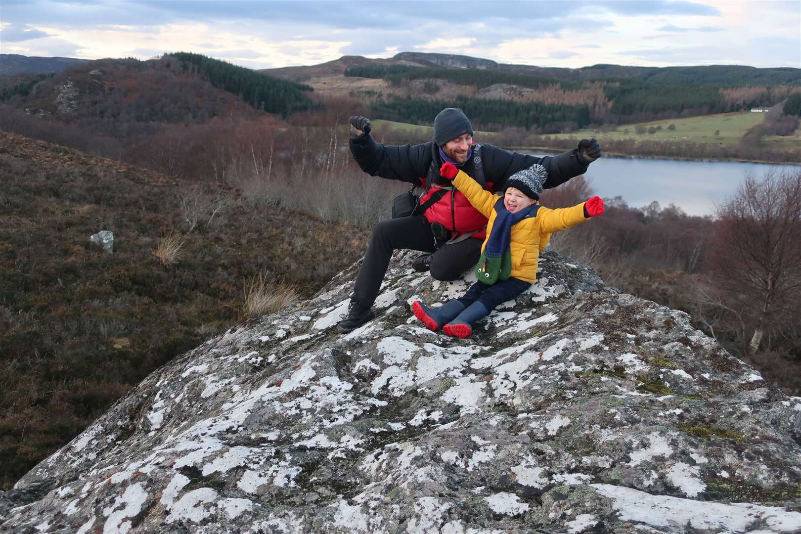
There are other boulders dotted here and there which make for great little rest spots or picnic places when it’s a bit warmer for stopping for a longer break.
When we finally dragged them away, we followed the frozen path higher up towards the ridge, before Meg decided to plod down slowly with Matthew while I took the girls up to the top.
After crossing an old fence, we gained the ridge after negotiating some frozen waterfalls on the path that show just how wet this route is when the temperature is higher. This walk is probably best done below freezing or after a long dry spell, by the looks of it!
The straightforward route winds its way up along the rocky ridge, but the wind was picking up a bit, so the girls wanted to stop for shelter here and there to take a break from it.
A single Bourbon – the biscuit, not the whiskey – was all it took to keep them going as we made our way round, over and through the icy patches.
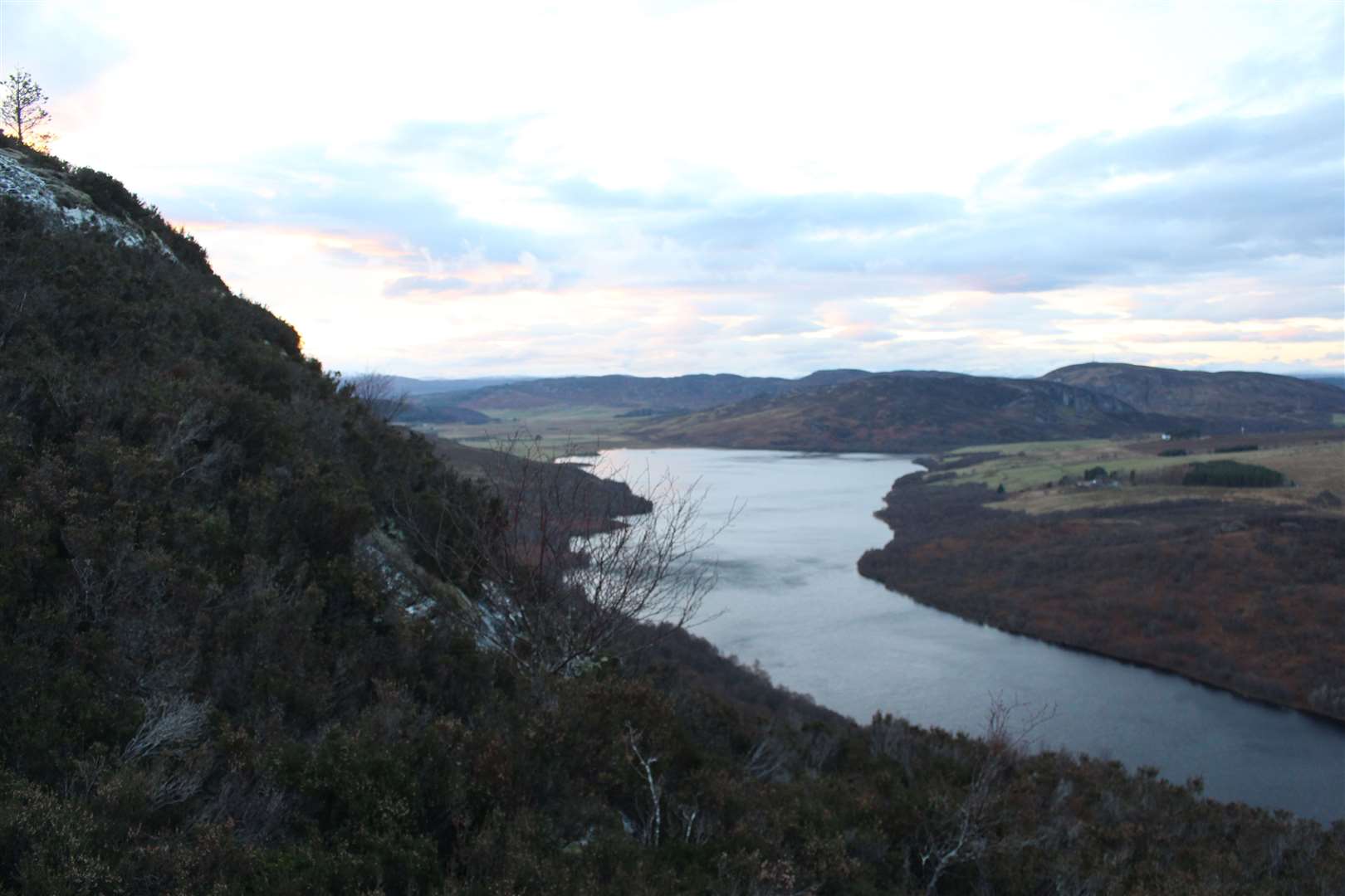
At one point a good view down the length of Loch Ruthven emerges. I pointed out the small island at the far end, believed to be the remains of an Iron Age crannog, which was once connected to the small mound of Tom Buidhe, an old fort, on the southern shore line.
Today, Loch Ruthven is a nature reserve and the main breeding place for the beautiful Slavonian Grebe, which is on the red list of endangered species. Only around 30 pairs of these attractive birds breed in the UK, with this being their favoured spot.
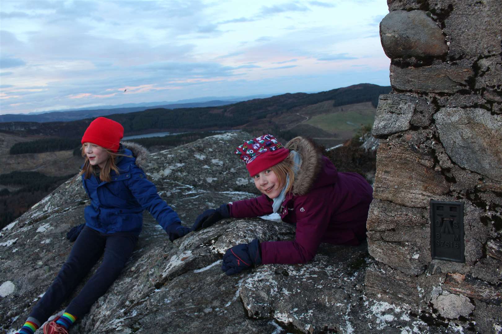
Soon we came over a little rise and spotted the silhouette of the trig point ahead. The girls raced ahead along a cool rock that leads to the top.
With the dramatic sunset behind them, it made for a stunning sight as they celebrated their achievement. Jennifer said it was hard to climb but lots of fun, and Clara sat taking in the beautiful view, captivated by that orange sky.
There is plenty to see in all directions from here and there was just enough light to take it in before making our way carefully back down the icy route. You can go a little further along the ridge but there isn’t much scope for a circular route here, so a return by the same way is the best bet.
We made faster progress going down, with the wind at our backs now, and as well as it feeling like a big achievement for the girls to get to the top, it was nice for me to get up a hill again after too long at ground level!
Route details
Stac Gorm
Distance 1.5 miles / 3km return
Terrain Very boggy path, rocky, steep in places
Start/finish RSPB car park at Loch Ruthven
Map OS Landranger 26; OS Explorer 417
A short climb to a trig point on a rocky hill above the Loch Ruthven nature reserve