


Ready to rock on Beinn Fhada scramble
Register for free to read more of the latest local news. It's easy and will only take a moment.

ACTIVE OUTDOORS: John Davidson is joined by Peter Evans on a Kintail Munro that offers an interesting hands-on ridge route for a more challenging day
The Hunter’s Pass is a strange name for a spot on National Trust for Scotland land where no commercial stalking takes place, but it’s easy to see why this was such a good location for them in the past.
The bealach, on the ridge leading from the Munro summit of Beinn Fhada to the top of Sgurr a’ Choire Ghairbh, has a wide view into the coire below and across to the Bealach an Sgairne which leads into Gleann Gniomhaidh and on into Glen Affric.
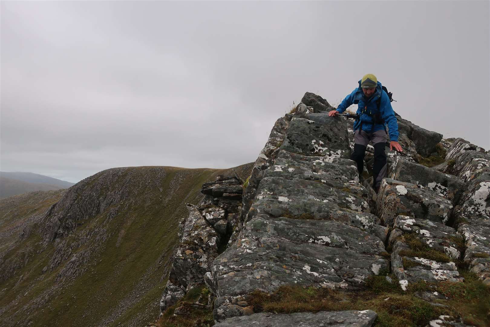
On this scramble, Bealach an t-Sealgaire – to give the spot its original Gaelic name – leads to the crux of what is otherwise a straightforward and fun bit of hands-on walking.
Peter and I looked up at the near vertical mess of grass and slabby rock that was the continuation of the long ridge. We also looked at the route down into into grassy coire below in case it would be needed as an escape route.
According to the scrambling guide, this was the only section where “some care is needed”. These guides have a language of their own that you learn to interpret over time!
It began easily enough with a very steep climb up grass and vegetation, then a couple of rock moves, but the difficulty for me came at a larger slab near the top. A couple of footholds gave a good start but I paused for too long at one point, where you need to lodge your right foot in a crack and trust the grip of the rock with your left as you reach up to a better hand hold.
With a few quick pointers from Peter who was already past the difficulty, I finally managed to get a grip and got to the top, adrenaline pumping on both our parts.
We’ve both done more technical scrambles in the past but it has been a good few years since we’ve done them, so it was back to basics for us on this grade 1 outing.
Our target for the day was Beinn Fhada, also known by the anglicised name of Ben Attow, one of the few Munros in this beautiful area I hadn’t climbed. It’s possible to scramble the north ridge either in ascent or descent – we decided to do it on the way down as the difficult bit would be an up-climb rather than an even trickier down-climb to the Hunter’s Pass.
The route starts by following the road to a bridge over the River Croe. Go straight on, up a track, then follow a small walkers’ sign right that leads you through a field (where cattle are sometimes kept) and then through a nice birch woodland and on into Gleann Choinneachain.
The path gradually climbs high above the burn until crossing it close to the confluence of two streams tumbling down from the high coires on the north side of Beinn Fhada.
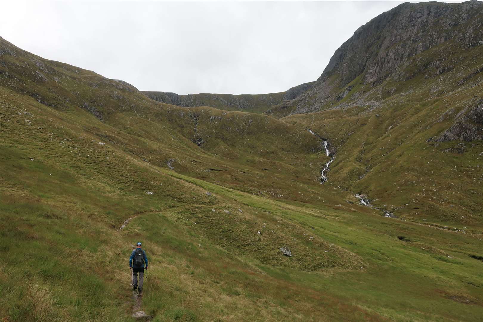
Glimpses of the later scramble can be seen above but for now the path continues east as it zigzags up before splitting at a small cairn. On a previous visit we’d gone left to the Bealach an Sgairne on our way to A’ Ghlas-bheinn but today we turned right into the Coire an Sgairne.
A young couple overtook us as we plodded up this huge bulk of a mountain. The well-maintained path continued right up to the north ridge, where a view down Loch Affric suddenly opened up. I could see the tiny dot that is the youth hostel down there, while summits stretched for miles in every direction.
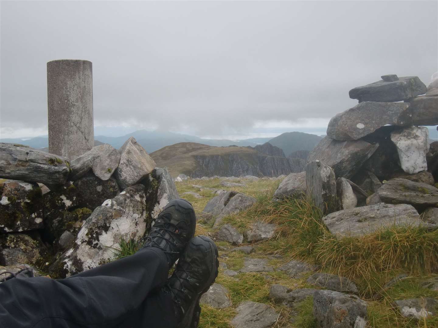
The breeze had picked up now, so we each donned another layer before we made our way along the rather featureless plateau towards the trig point and shelter at the 1032m summit.
The cloud was drifting in and out, skimming the tops now and again, but in between times we could clearly see the jagged edge of the scrambling route. After a quick discussion about whether to follow the couple back down the same way or opt for the scramble, we chose the inevitable one.
Of course we were going to give it a go! I may have become more risk averse these days and Peter may be getting used to life with a pacemaker, but our sense of adventure remains as strong as ever.
I checked the compass bearing across the Plaide Mhor in case the cloud base dropped but in clear conditions it was an easy plod to the cairn on top of Meall an Fhuarain Mhoir, where the nature of the route changes.
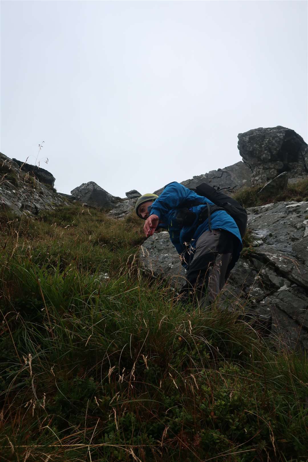
We could see the ridge suddenly become narrow with grass and rocks from this point. Much of it is a sensational walk and hands are needed here and there.
I looked down at the river and track through Gleann Lichd far below as we passed gullies, with the outline of the Five Sisters of Kintail across the far side.
There are some places where a bit of thought needs to go into the moves, but there was nothing technical as we headed over the top of Ceum na h-Aon-choise and followed the ridge as it bends left and descends to reach the Hunter’s Pass.
Once we’d got ourselves over the tricky bit up to Sgurr a’ Choire Ghairbh, all that was left were a few rocky knolls until we descended the Faradh Nighean Fhearchair to Beinn Bhuidhe.
A long and direct descent through rough heather, bog myrtle and rocks led us – via a couple of gates – to the end of a track close to a cottage south-east of the bridge over the River Croe at Inchnacro, from where it was a more gentle walk back to the NTS centre.
Our final task for the day was to help jump-start somebody’s car after they had returned from a day on the Five Sisters to a flat battery! The day had certainly taken a fair bit of energy from us too, but what an invigorating time we had on a fantastic circuit of this fine hill.


Route details
Beinn Fhada
Distance 11 miles / 18km
Terrain Excellent stalkers’ path; pathless mountain; narrow ridge with scrambling. Navigation and mountain skills required
Start/finish NTS centre at Morvich, Kintail – parking available beside activity centre towards end of road
Map OS Landranger 25 & 33; OS Explorer 414; Harvey British Mountain Map, Knoydart Kintail & Glen Affric
A massive Munro is easily climbed on paths but a grade 1 scramble on the return makes for a more interesting and challenging circuit