Off-road fun on mountain bike trail from Inverness, taking in Daviot, Tomfat and south Loch Ness tracks
Register for free to read more of the latest local news. It's easy and will only take a moment.

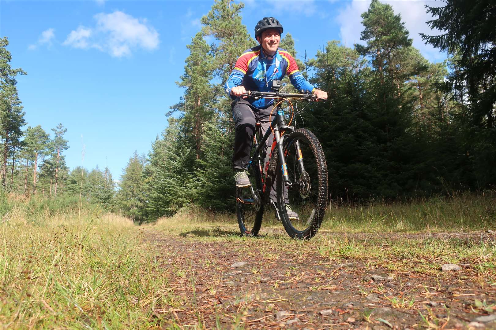
Sometimes you’re in need of a little bit of inspiration, not to mention motivation. A casual scroll through my Strava feed sparked the idea for this ride, a mountain bike adventure I could do from my doorstep.
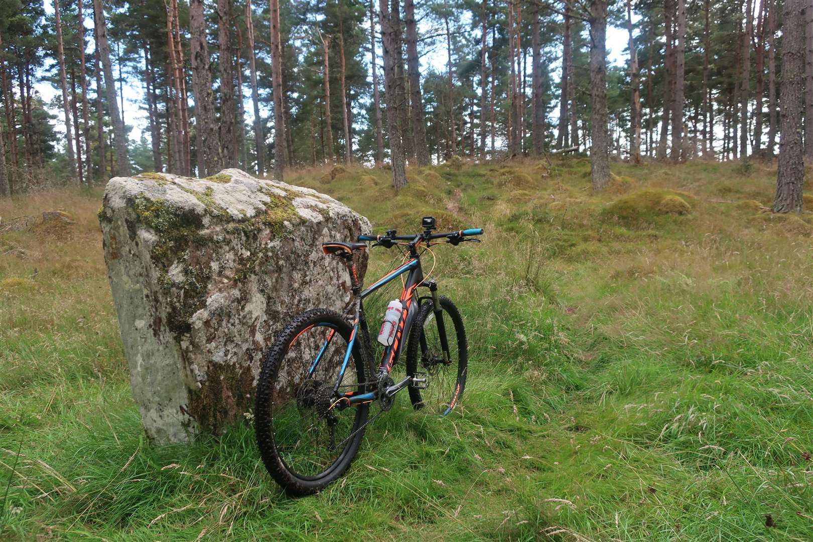
My friend’s Sandy’s mountain biking is usually a tad more advanced than mine, but this route looked well within my capabilities, sticking mostly to straightforward forest tracks on the outskirts of Inverness.
I sketched the route roughly onto the OS map and then, the next day, dusted off the mountain bike. I’ve been neglecting the off-road biking recently so wanted to get some decent rides in before the last throes of summer fade into a distant memory.
The first few miles were a good warm-up, following tarmac on the Southern Distributor Road cycle path to the Wade’s roundabout. From here you briefly follow Stevenson Road then take a right turn to take the old military road which is signed as a public footpath to Moy.
At first this is a surfaced road that climbs steeply up past Druid Temple Farm towards Milton of Leys. I dropped into a low gear and took my time spinning up to the end of the road, where the Wade’s road continues ahead on a path.
I was planning to take the easier route into Daviot Woods, though, so headed left into the housing estate. The way from here is to continue straight ahead along a little path then follow the road to a T-junction. Turn right, away from the nearby main road, and follow the road up to Castletown, where you turn right to go away from the houses and past a gate onto a track.
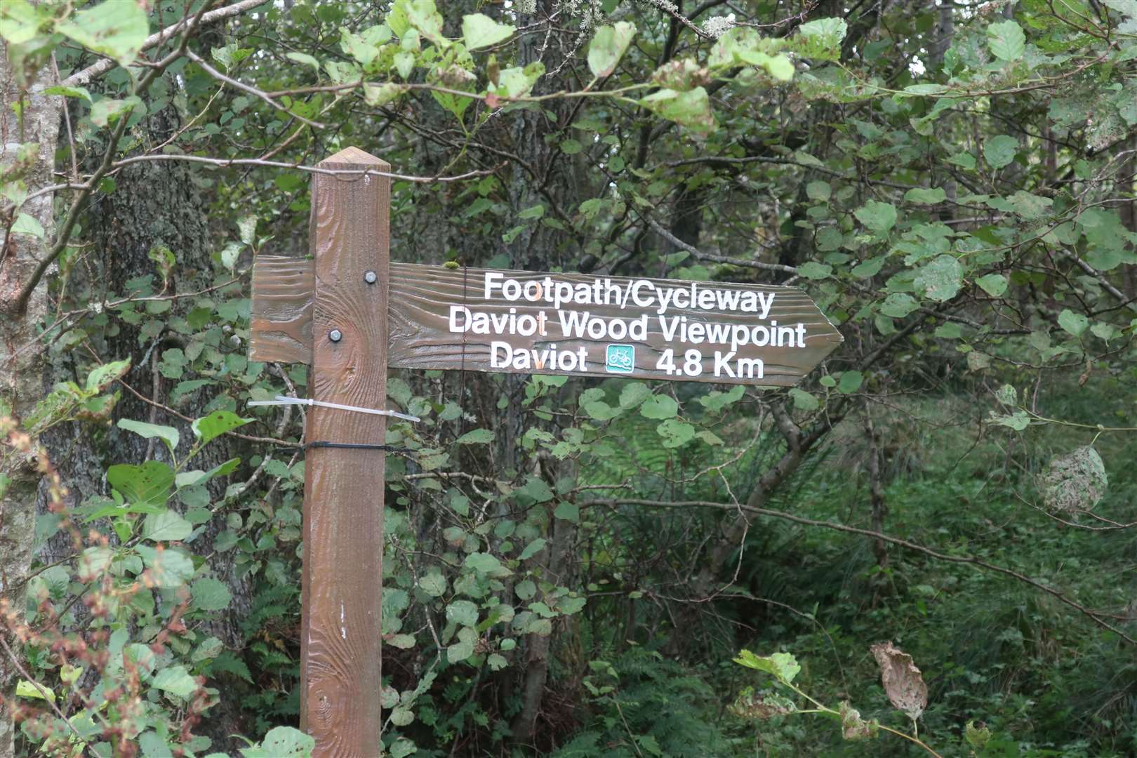
Soon, take a right turn at a wooden footpath/cycleway sign pointing to Daviot, and follow this excellent link into the woods, going right when you reach the main forest track. Follow the track left at a corner and continue to almost the high point of the track before following a sign right to Wade’s road.
It felt a bit like this was the start of the route proper, as a lovely but easy bit of singletrack winds down to meet the historic route at a muddy intersection, where I went left then immediately right onto a better forest track.
Somehow, I’ve never explored these tracks through Tomfat Wood, so I was guided by Sandy’s twists and turns, which seemed straightforward to follow. At the first T-junction, I went right, then took the first left to follow a long straight track which at one point goes past a gate via a flooded stretch of path that was just about avoidable.
Eventually you drop down to a T-junction, where again I followed the trail left onto a beautiful little section that rises and twists through a slightly narrower section before joining a wide track that soon drops nicely down the hill.
I was aware I needed to turn right at some point so had to be on the brakes to make the turn when I spotted it, a clear track at first that then narrowed to little more than a simple path. The route should have taken me back up to the right not that far ahead, but for some reason I hesitated at a fork in the path and kept straight ahead on the more obvious route.
It proved to be a nice detour, as a great path wound its way along before bending right and out of the trees, climbing on a lovely open track. I was enjoying being out among the blooming purple heather, even knowing I’d gone off the line of Sandy’s route.
Coming to a junction with a better path heading off to the right, I figured that a more direct route to the road may lie straight ahead. I investigated behind a gorse bush that looked to be blocking the way ahead and, sure enough, a narrow path continued between the pine trees.
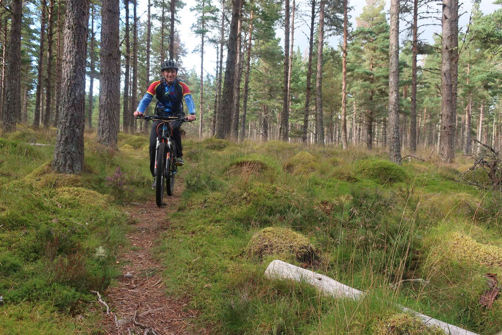
The singletrack looked tempting, so I decided to see where it led me. Following the narrow trail was great fun, as it meandered between tree trunks on a soft bed of pine needles, with roots and rocks to negotiate here and there.
I noticed there were occasional waymarkers – pointing along the route in the opposite direction to the way I was going – presumably for some local woodland walk, though I didn’t see anybody else in the woods here.
The path clearly wasn’t taking me in a direct line to the B861 Inverarnie road, which I was ultimately aiming for, but it would eventually come out somewhere I knew, so I just went with it – and it turned out to be a real highlight of the route.
Soon enough, I could see the road, but it was the other side of some overgrown bushes and a wire fence. I followed the line of the path a little further then headed left towards the road. There is a faint track leading to an opening in the fence, but it’s not that easy to locate.
My exciting detour actually meant less time on the tarmac than the planned route, so I went left down the road for just 200 metres or so before turning right back onto a forest trail.
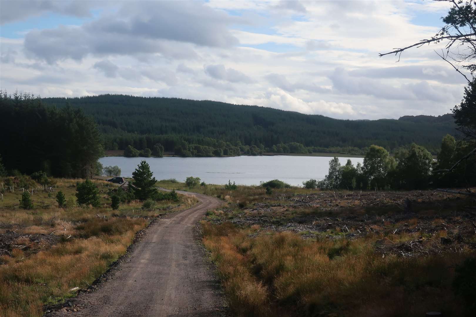
After passing a gate, this wide vehicle track takes you uphill for a while before dropping nicely to the shore of Loch Bunachton, which it skirts to the left to continue away from the water.
A line of new pylons near here makes following the map a little confusing, but to take the necessary right turn to reach the Bunachton road, you go right onto the new track alongside the pylon route then very soon go right again onto an old track, marked by a blue Trail of the Seven Lochs (T7L) post.
It’s so good to enjoy all this off-road freedom just a stone’s throw from the Highland capital, and there was still more to come. At the road, I turned right to follow it half a kilometre or so to a corner, where another track headed off to the left. Some heavy forestry work had been going on here but it was all quiet today, so I followed the route which heads towards Easterton on the map.
Again, this track has been massively bulldozed, with new unmarked routes added to cause potential confusion to the avid map reader! The thing to look out for here is where the new track bends left after just over a kilometre to climb up a ridge, you need to go straight ahead onto a narrow, grass path that seems insignificant after the motorway-style forest road you’ve been riding on.
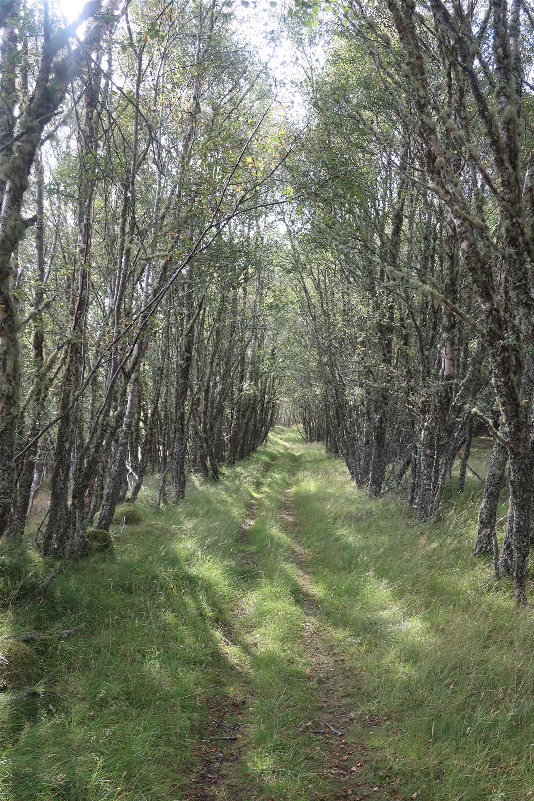
Back on that old route, it’s a fun downhill on a sometimes wet and narrow path. Towards the bottom it goes through a lovely little avenue of birch trees above the houses, then skirts round to a gate to bypass the last of them.
Go through the gate and past a rusty older gate to reach the access track, going right here to drop down to the road with magnificent views over Loch Duntelchaig and the crags on its south-eastern shore.
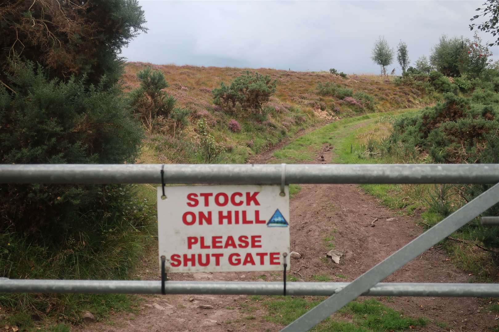
There was a spell of tarmac to come now before a final flurry of off-road on the return to Inverness, so I turned right onto the road and followed it past Loch Ashie to the crossroads. Going straight on here, I dropped down the zigzags of the MacBain hill, watching out for the spot where a track intersects the road above the memorial park.
Take a right turn onto the track, soon passing through a gate that warns of livestock on the hill. Thankfully there weren’t any cows about today as I enjoyed what can be a particularly wet stretch in reasonably dry conditions, reaching another gate before continuing along an improving track which further on has views back to the city and the Kessock Bridge.
Keep following the little squirrel markers on the blue posts for the South Loch Ness Trail as you continue to Cullaird, where the track bends sharply left to pass the farm buildings. Take a sharp right before the end of this track, going into the woods at Cullaird and following the trails which emerge at a small parking area on the Torbreck road outside Inverness.
Go right onto the road then take a left at the T-junction to reach the Essich roundabout on the Southern Distributor Road, from where you can follow Route 78 back into the city centre.
Route details
Daviot and Dunlichity
Distance 25 miles / 40km
Terrain Off-road forest tracks, paths and easy singletrack, with stretches on surfaced cycle route and minor roads
Start/finish Inverness
Maps OS Landranger 26 & 27; OS Explorer 416
A mountain bike route exploring forest trails near the Highland capital