


On the right path – Glen Tilt
Register for free to read more of the latest local news. It's easy and will only take a moment.

In the latest in our series on historic routes, John Davidson takes a journey through Glen Tilt, site of an acrimonious 19th-century access dispute
This classic route into the heart of the Cairngorms is a challenging journey into remote country, and one that should only be attempted by experienced hill walkers and mountain bikers, once coronavirus restrictions allow.
It also involves some logistical complexities, with a long journey by road to link up the two ends at Linn of Dee and Blair Atholl.
However, the sense of wilderness and feeling of human history through the Tilt is awe-inspiring, while the journey is one to savour.
Distance: 20 miles / 33km
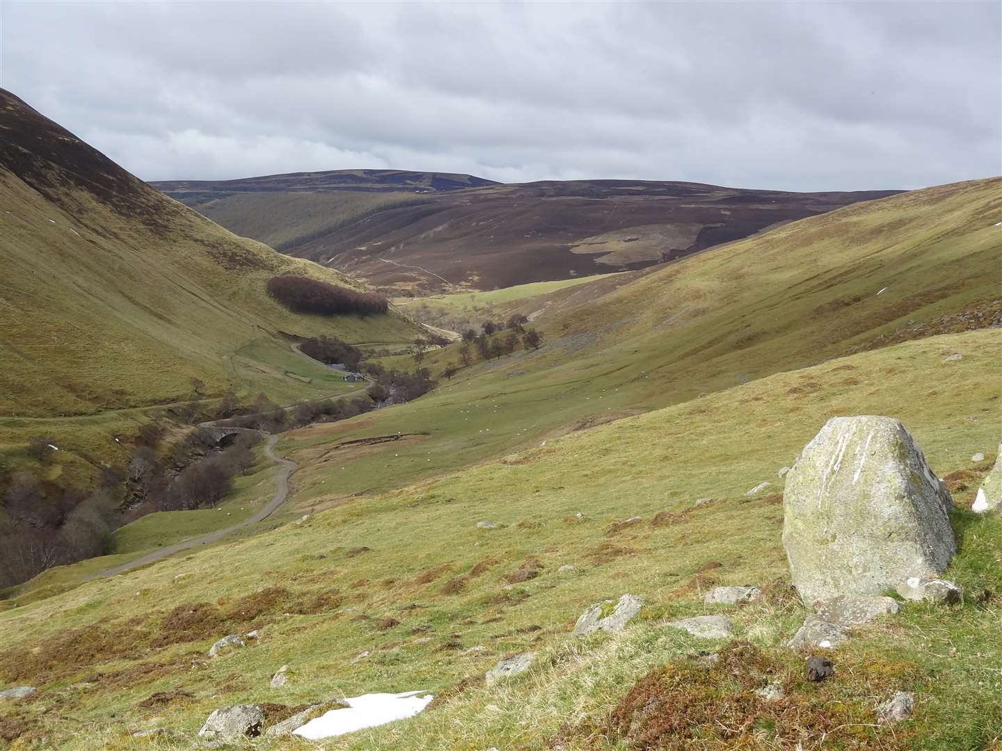
Route and terrain: Fenderbridge, Blair Atholl (alternative: Old Bridge of Tilt) to Linn of Dee.
Starting at the southern end at Blair Atholl, this hard-fought-for right of way technically starts a little way up the minor road from the popular car park at Old Bridge of Tilt.
Fenderbridge marks the official start point, though most people these days would likely take the main estate track from opposite the car park – certainly, this is the best way to go on two wheels, in any case.
From Fenderbridge, the advice is to continue uphill on the road to the farm track at Kincraigie, from where a path continues north towards Croftmore and on to Auchgobhal where it joins the estate track.
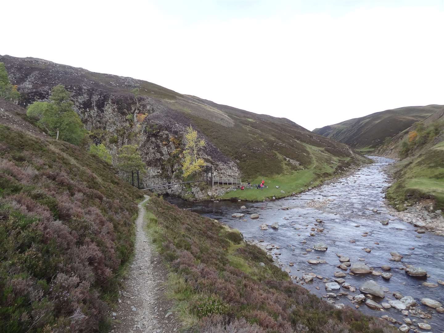
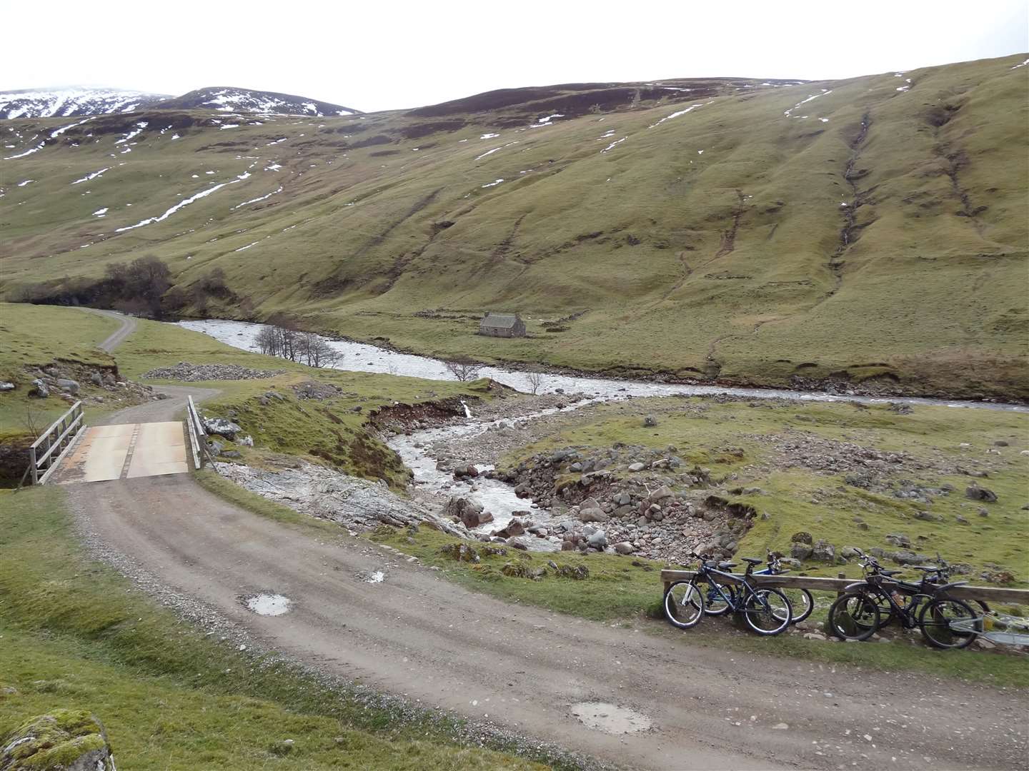
The track heads past Marble Lodge then over the River Tilt, up to Forest Lodge and then deep into the remote heart of the Cairngorms. As the track bends left to climb steeply, fork right onto a narrower path leading to the Falls of Tarf.
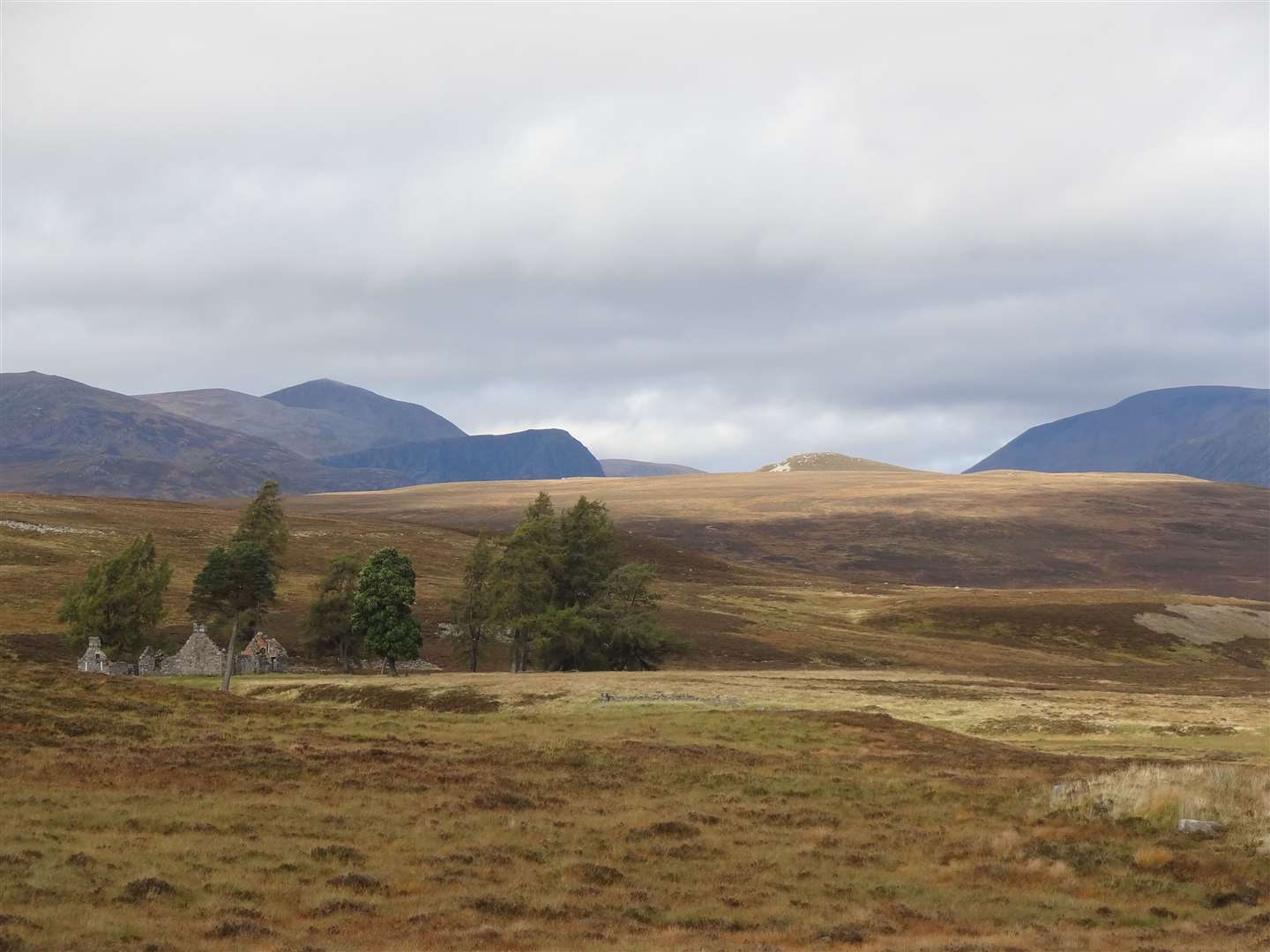
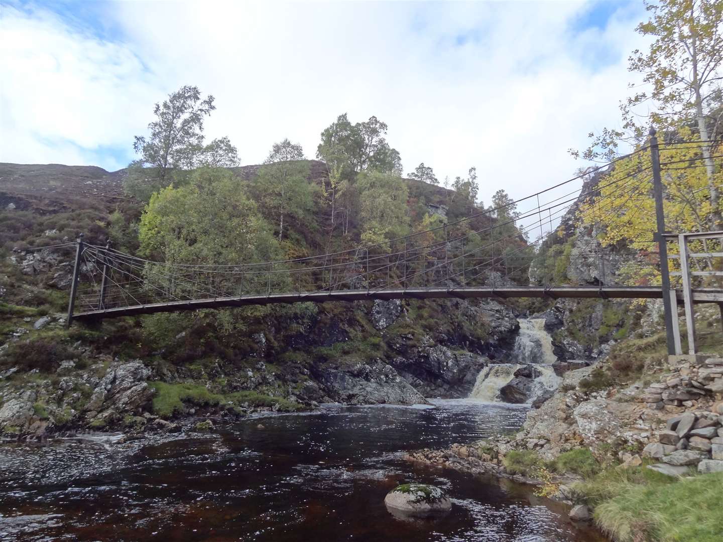
The impressive Bedford Memorial Bridge crosses the dangerous waters here before a path leads through the narrow defile of the Allt Garbh Buidhe to the ruins of Bynack Lodge.
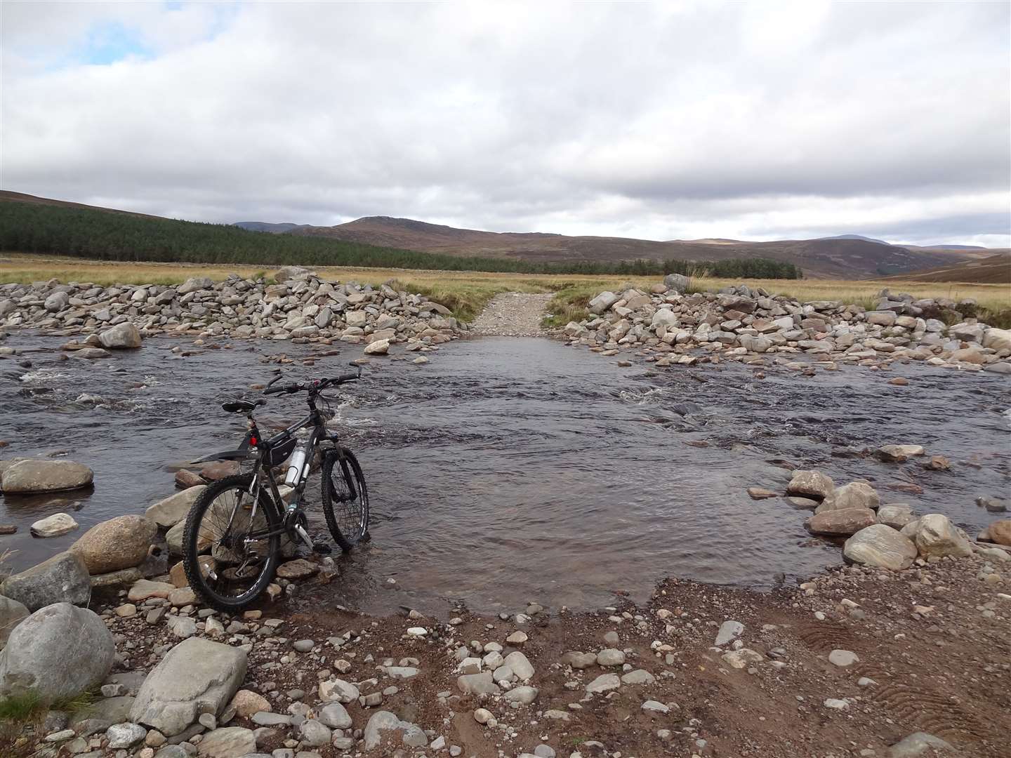
A little way further north comes the crux of the route – the ford of the Geldie Burn. This can be highly dangerous as the huge catchment area means the water can rise rapidly, making it impossible to cross.
From the north side of the burn, turn right and head the couple of kilometres on a good track to the White Bridge, then continue in a broadly easterly direction on the track to reach the Linn of Dee.
Map: OS Landranger 43 (Braemar & Blair Atholl)
Access: At the southern end, access from Blair Atholl (railway station) on foot or car park at Old Bridge of Tilt. Car park at Linn of Dee, approximately six miles from Braemar at the northern end.
Be aware of the potentially impassable river crossing at the Geldie Burn, towards the northern end of the route.
And, of course, do not attempt this or any other such route until coronavirus restrictions allow.
- Fond look back on Lejog cycle memories
- On the right path – Corrieyairack
- More news, reviews and features from Active Outdoors
History: This ancient route through Glen Tilt is one of the great historical rights of way in Scotland.
In 1847, a party of University of Edinburgh botany students led by John Hutton Balfour had an acrimonious encounter with the Duke of Athole and his ghillies.
This resulted in a lengthy legal battle between the Scottish Rights of Way Society and the duke to establish the route's status, a dispute which ultimately went to the House of Lords, where the society won the case.
It is likely that this case did more than any other to raise public awareness of rights of way.
In 1785, Glen Tilt had been the first of the key sites which evidenced geologist James Hutton's Plutonism theory – that igneous rocks are formed from cooling magma below the Earth’s surface – and revolutionised our concept of time.
Hutton's findings meant the glen was famous to scientists around the world. The behaviour of the Duke of Athole in denying public access led Cromarty’s Hugh Miller to write in 1847: "There is scarce in the Kingdom a better-known piece of roadway than that which runs through the glen" and that "if the Scottish people yield up to his Grace their right of way through Glen Tilt, they will richly deserve to be shut out of their country altogether".
The route is said to have been a drove road. However, due to the narrowness of Glen Tilt, although it was used as such, other nearby routes may well have been better suited to this type of traffic.
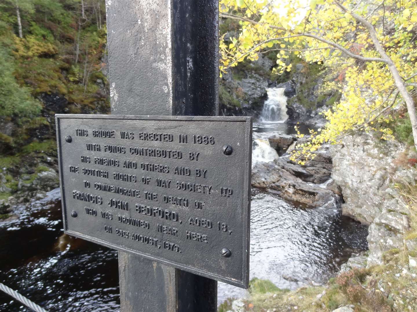
The Tarf Water is crossed just below the Falls of Tarf via the Bedford Memorial Bridge. On the bridge, a plaque reads: "This bridge was erected in 1886 with funds contributed by his friends and others and by The Scottish Rights of Way Society Ltd to commemorate the death of Francis John Bedford, aged 18, who was drowned near here on 25th August 1879".
This young man had died trying to ford the Tarf. Queen Victoria did the same crossing in 1861 on a pony – those who led her steed had been almost up to their oxters in the water.
- Thanks to ScotWays for the use of heritage information relating to this route. www.heritagepaths.co.uk