


Eight Munros on a backpacking weekend taking in the Cairngorms 4000ers
Register for free to read more of the latest local news. It's easy and will only take a moment.

John Davidson recalls a memorable trip from last spring when he headed to the hills with his tent to climb a series of high Cairngorms summits
The Cairngorms 4000ers is a classic backpacking trip, taking in Cairn Gorm, Ben Macdui (the second highest mountain in the UK), Cairn Toul, Sgor an Lochain Uaine (better known as the Angel’s Peak) and Braeriach.
Last spring, as I was preparing for my Mountain Leader assessment, I decided to take on this route over the course of a weekend, but with a few extra hills just for an added challenge.
Bod an Deamhain – the Devil’s Point – is easy enough to add to the round, but if I could do an out-and-back to Derry Cairngorm and nip over Carn a’ Mhaim at the end of day one, that would mean climbing eight Munros instead of the usual five.
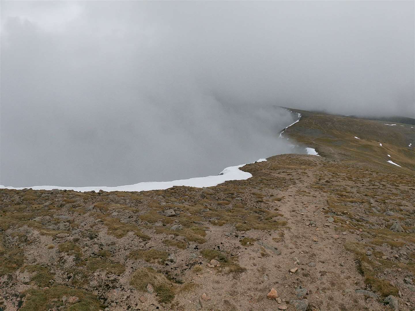
It was set to be a long weekend, and even more so when I set off from the Sugarbowl in the pouring rain. I was soaked before even reaching the Ptarmigan, let alone the top of my first Munro, Cairn Gorm.
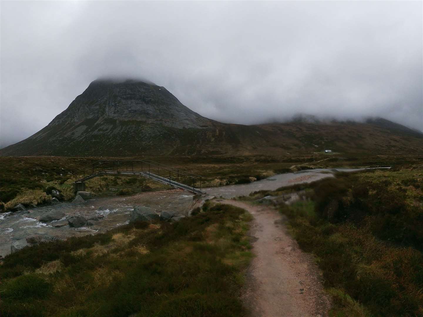
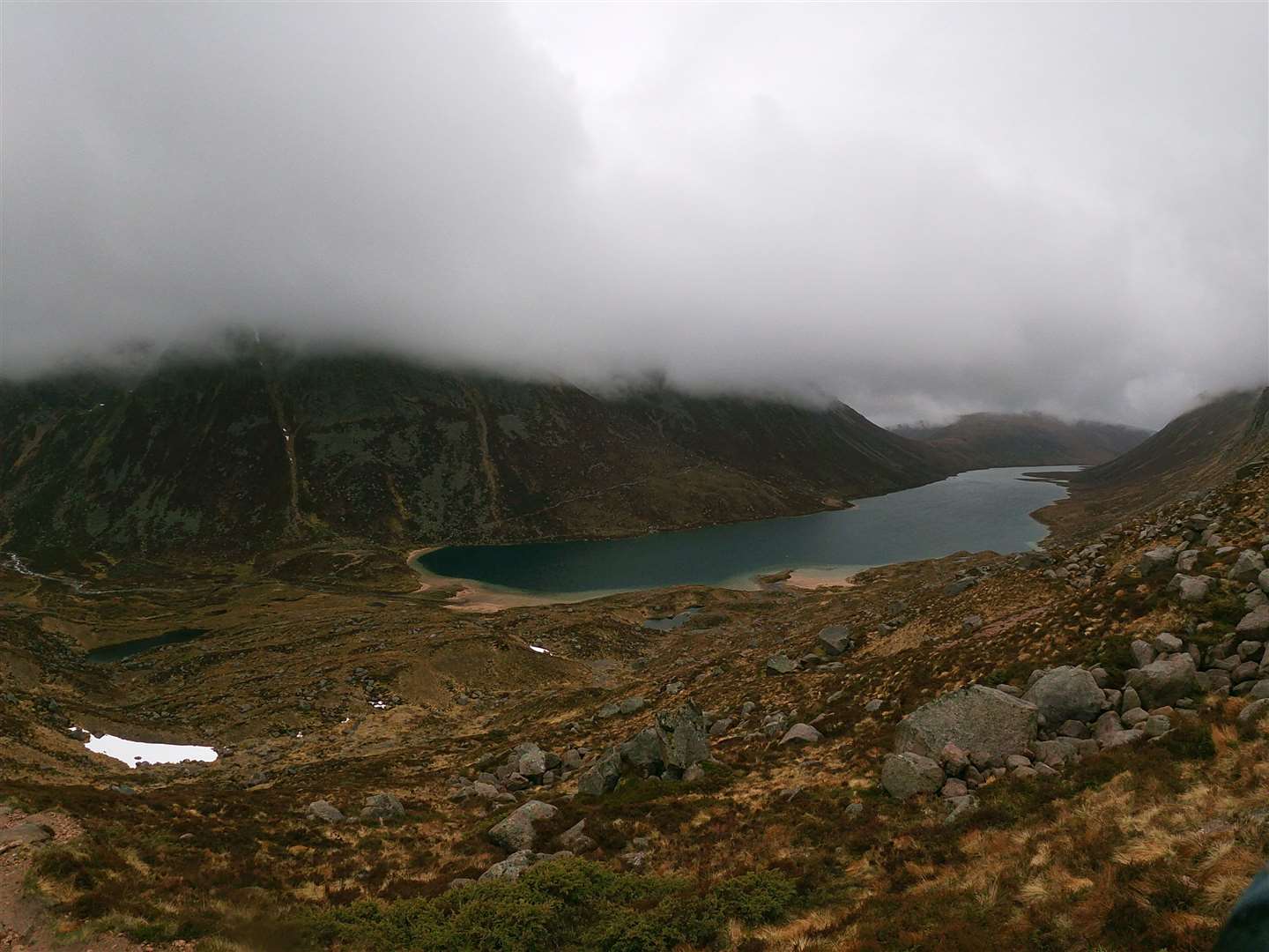
But after shaking the early temptation to turn around and head home, I headed upwards into the cloud and over the first summit before taking a bearing down into Coire Raibeirt. Carefully making my way down towards Loch Avon, I crossed the burn before stopping for a break at a huge boulder overlooking the Shelter Stone Crag.
Water was fairly pummelling down the Feith Buidhe, making the next river crossing less straightforward than I’d remembered, though it didn’t involve getting wet feet in the end, thankfully. I plodded slowly up towards Loch Etchachan, taking in the view of Loch Avon stretched out below the cloud.
From the outflow of the mesmerising Loch Etchachan, I headed up the path towards Macdui, timing my ascent to work out where to break off to pass around the western edge of Creagan a’ Choire Etchachan and onwards to Derry Cairngorm. This was virgin territory to me and with zero visibility I was on the compass and checking the contours to make sure I was heading in the right direction.
The rocky summit was a welcome sight after clambering across the boulder field on top of the 1155m Munro. Returning the way I came, I picked up some sort of path that led west then south-west to gain the ridge above the cliffs. I followed the ridge itself for a while then decided to drop lower down, away from the edge, knowing there was a good path that led past the lochan before the summit plateau of Ben Macdui.
The plateau can be a disorientating place, so I stayed on a tight bearing to pass the Sappers’ bothy and reach the summit trig point. Descending to the bealach below Carn a’ Mhaim was also a tricky prospect but, after one minor mistake, I reached the bealach below this final top of the day.
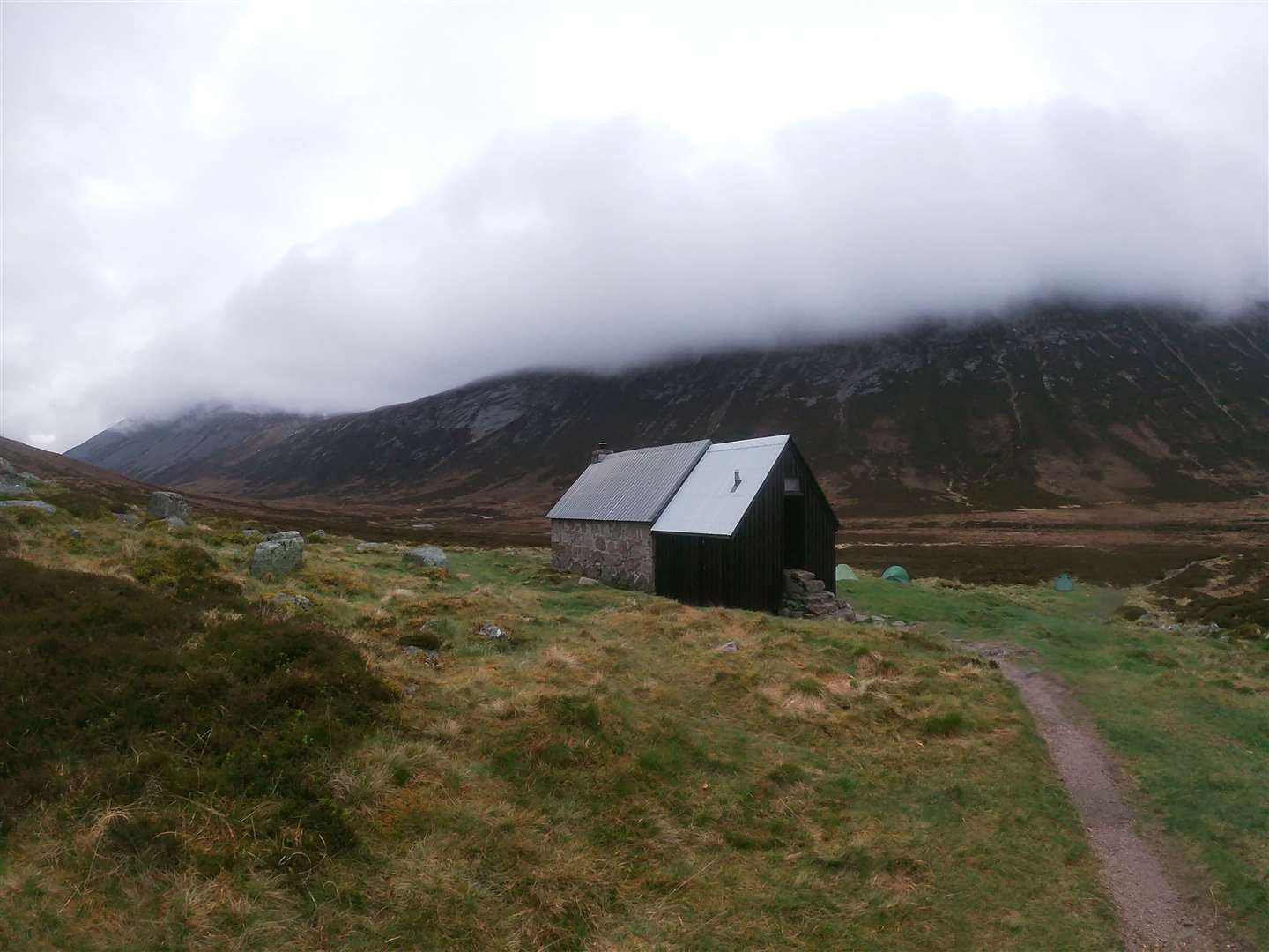
A narrow ridge led to the summit, back up in the cloud, and it was a long and tiring descent after all this time on the move. The path down eventually met another path that reaches the Lairig Ghru from Derry Lodge, and I turned right for the last few kilometres to my overnight stop at Corrour.
The small bothy was full and there were plenty of us camping in the vicinity too. Most of the others headed through the Larig Ghru the next morning as I ascended again, up into Coire Odhar, with a plan to walk the four Munros on this side of the plateau and fine-tune my navigation on the way.
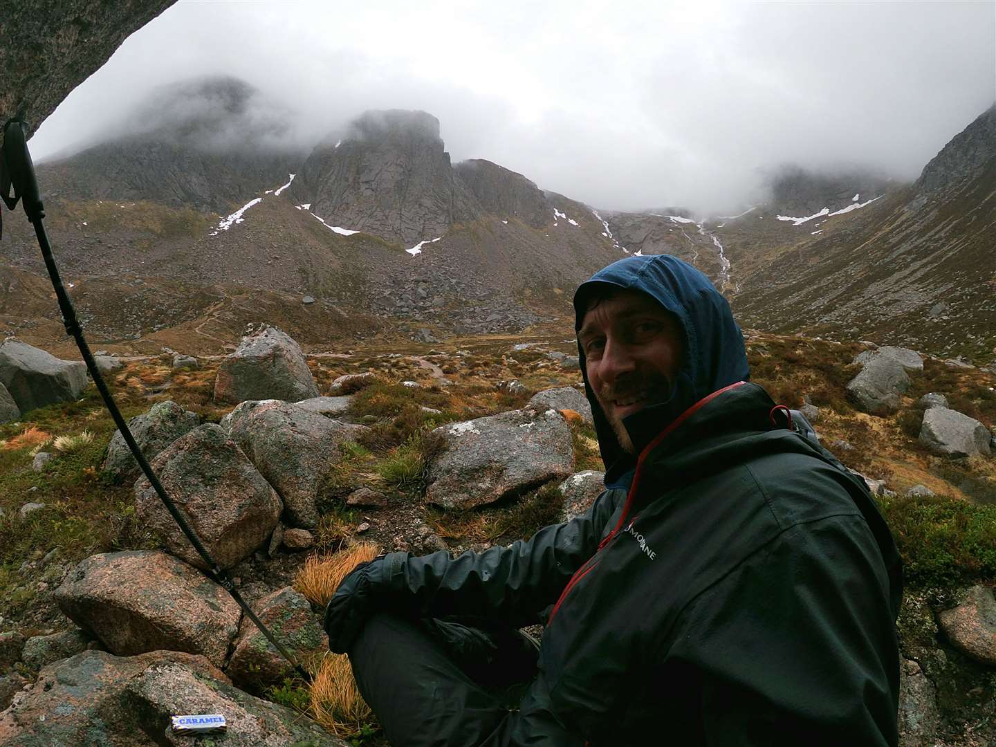
The first ascent from the bealach to the Devil’s Point was a short climb through scattered rocks and occasional vegetation, ending on a prominent summit which must have a magnificent outlook on a clear day. My fifth Munro of the trip followed the same pattern as yesterday, though, so I took a quick picture in the cloud and turned to retrace my route to the bealach.
A bouldery route follows the ridge, over the subsidiary top of Stob Coire an t-Saighdeir before the next Munro, Cairn Toul, is reached.
My spirits were high despite spending the best part of a day-and-a-half in the cloud, and as I carefully made my way down to the next bealach I finally enjoyed some views into the captivating Coire an Lochain Uaine. A decade or more ago I had climbed Sgor an Lochain Uaine – my next Munro today – by its north-east ridge, an exposed but technically straightforward scramble that tops out right on the summit.
When I reached the cairn this time it was hard to see how that ridge offers a route onto the top of the so-called Angel’s Peak – any way off the top seems to just drop down into the great abyss below. Another Munro done and just one to go now, though a serious distance still lay ahead of me.
My next target was Carn na Criche, where the ground levels into what can be a confusing and featureless plateau. I was lucky to be enjoying some better visibility now but still used the compass in case the cloud came back in. From the cairn at the south-west edge of Carn na Criche I took a bearing across the outflow from the Wells of Dee – the remarkable source of the mighty River Dee – and filled up my water bottle with this most pure of water as I crossed.
The burn fell rapidly through snow tunnels and it showed no reluctance to reach the Falls of Dee that plummet into the mighty Garbh Coire before joining the River Dee in the Lairig Ghru. Once over the burn I took a bearing to the cliffs beside the summit of Braeriach, my final Munro of the weekend. Sticking to it like glue, I had one of those satisfying mountain moments as I climbed the last few metres and saw the giant summit cairn directly in my direction-of-travel line.
I stood on this final summit of my expedition and looked across Coire Bhrochain and the Garbh Coire down into the Lairig Ghru. I could see people on Ben Macdui, figures reaching Angel’s Peak and the ridge to Carn a’ Mhaim stretching away in the distance.
It felt like just reward for my efforts of the weekend, though it’s fair to say the effort wasn’t over. It’s a long walk out from Braeriach, especially given the descent into the Lairig Ghru then the climb back to the bundle of huge boulders that makes up the Chalamain Gap.
Such a satisfying end to a mentally and physically tough trip. I had stood on eight Munro summits, and from that last one had enjoyed an expansive view across this vast tract of wild land that makes up the high Cairngorm mountains.
After months away from the hills during lockdown, I think I might start with something a little gentler than this once I pull on my walking boots again.
- For a full account of John’s backpacking trip, visit his website at johndavidsonoutdoors.com
- My Outdoors Q&A: Cameron McNeish
- More from Active Outdoors
Route details
Cairngorms 4000ers – plus a few!
Distance: 19 miles (day one) plus 14 miles (day two)
Terrain: Hostile mountain environment – excellent navigation and mountaineering skills required
Start/finish: Sugarbowl car park, Glenmore ski road
Maps: OS Landranger 36; OS Explorer OL57; Harvey British Mountain Map: Cairngorms
Looking back on a two-day backpacking trip taking in eight Munro summits including all the 4000ft mountains
- Please follow all public health advice and guidance with relation to Covid-19