Exploring General Wade's military road south of the Slochd
Register for free to read more of the latest local news. It's easy and will only take a moment.

Sluggan Bridge is surely the highlight of a wander or a bike ride on these parts of General Wade’s military road, but there are other fascinating remnants of these early routes to discover.
The stretch from south of Slochd at Insharn over to Kinveachy outside Aviemore is an interesting route, some of which follows the National Cycle Network – including the impressive bridge over the River Dulnain at Sluggan.
However, for years I’ve been interested in exploring the Wade’s road between Insharn and Slochd summit. It’s only a short section on the old road, which has been dissected by the railway line, but there are some ruins marked on the map that look worth exploring.
A track leads off the old A9 road route, which is now also part of the cycle network that uses the closed road to reach the narrow summit at Slochd, where the railway, road and cycle path squeeze between the rocks.
I started my walk at the ski centre and hostel at Slochd, where there is a large informal parking area. I wanted to finish on the nice forest track that climbs up from Insharn, so first I went back to the public road and turned left out of the car park to follow the single-track section past a couple of houses.
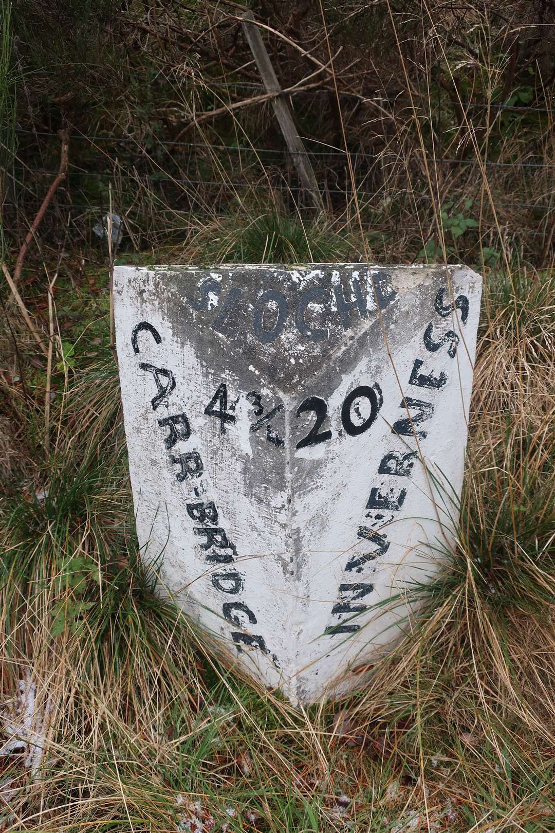
Opposite these is an old stone mile marker, repainted and kept in good condition. It was a blustery day and there were even a couple of snow showers as I made my way north-west along the road.
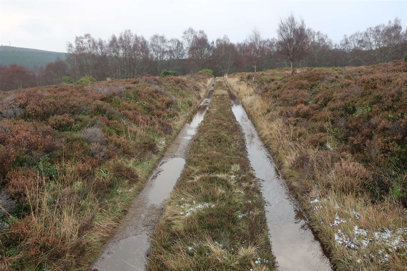
Where the road bends sharply right to meet the A9, our route turns left to follow the cycle signs towards Inverness. The road-cum-track is straight at first but soon veers left then right on an embankment, with the central white lines still clearly visible.
I love this old section of the cycle route, which reminds me of one of my dad’s favourite stories of following the snow plough up the old A9 one Hogmanay evening in the 1970s to my Grandma’s house in Balloch. He just about managed to follow the last plough over the top of the winding pass at the Slochd before making his way across the moor at Culloden.
Today’s light flurries were no match for those days of serious snow. Just after the S-bends, a track leads off the old road to the left. I followed this up towards the railway.
For years I’d seen this track from the modern A9 and from the cycle path and wanted to follow it, but somehow never found the occasion. So it was good to finally be exploring this part of the Wade road that once went between Inverness and Perth.
The road was constructed in around 1728 and it is wonderful when you get to walk on one of the well-preserved sections and imagine what life was like without the constant flow of motor traffic on the A9 and even before the railway line was built.
The route temporarily bends away from the railway before returning beside an underpass, which seems to lead up to a communications mast on the nearby hill of Torr Mor. From there the Wade route continues south-south-east, crossing a tributary of the Slochd Mhuic burn, then rising only to be interrupted by the Highland Mainline railway which itself was added to the transport options in 1897.
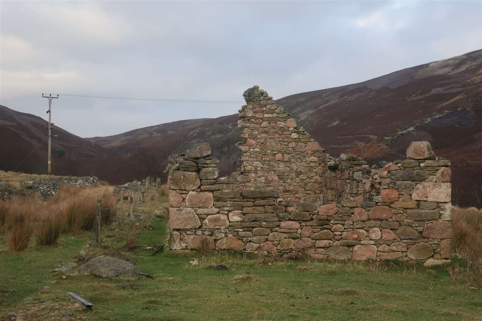
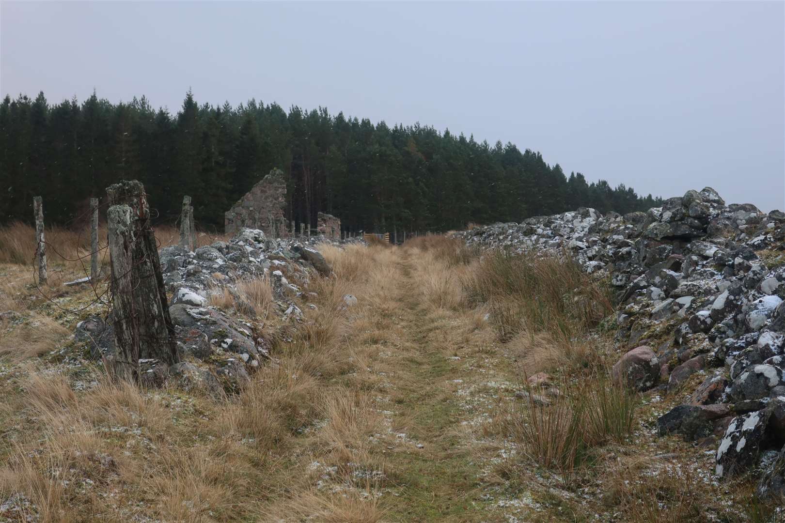
A path continues to a bridge over the railway then almost immediately you can rejoin the Wade road – and here is an excellent section to savour. It leads directly ahead on a clear line, with the first of two ruins at Ortunan clearly visible to the left of the old road due to its remaining half of one of its gable walls.
Naturally, I had to peek inside. An old bedstead, rusted to red, lay on the grass floor and one of the lintels over the doorway remained in place. These little finds give you a tingle of excitement as you are taken back in time to a very different world.
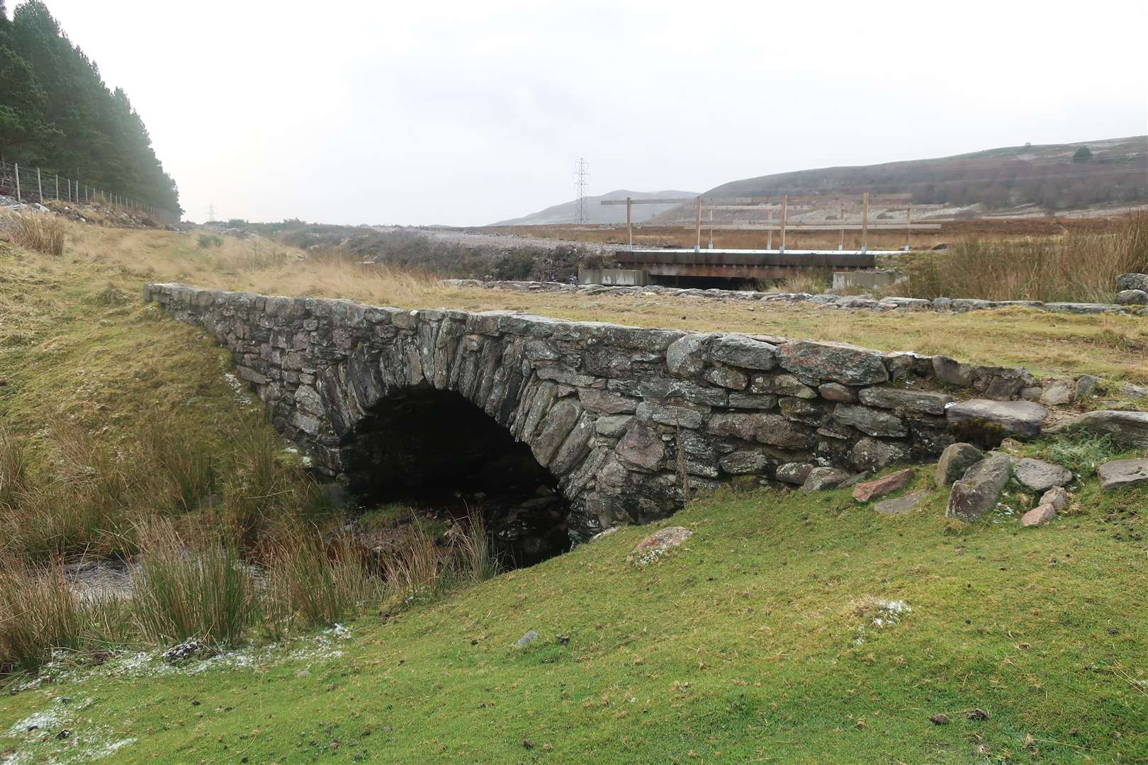
A short distance beyond this first ruin is a heap of stones that would have been a second building, then beyond that is an old stone bridge, believed to be a reconstruction of the original Wade bridge.
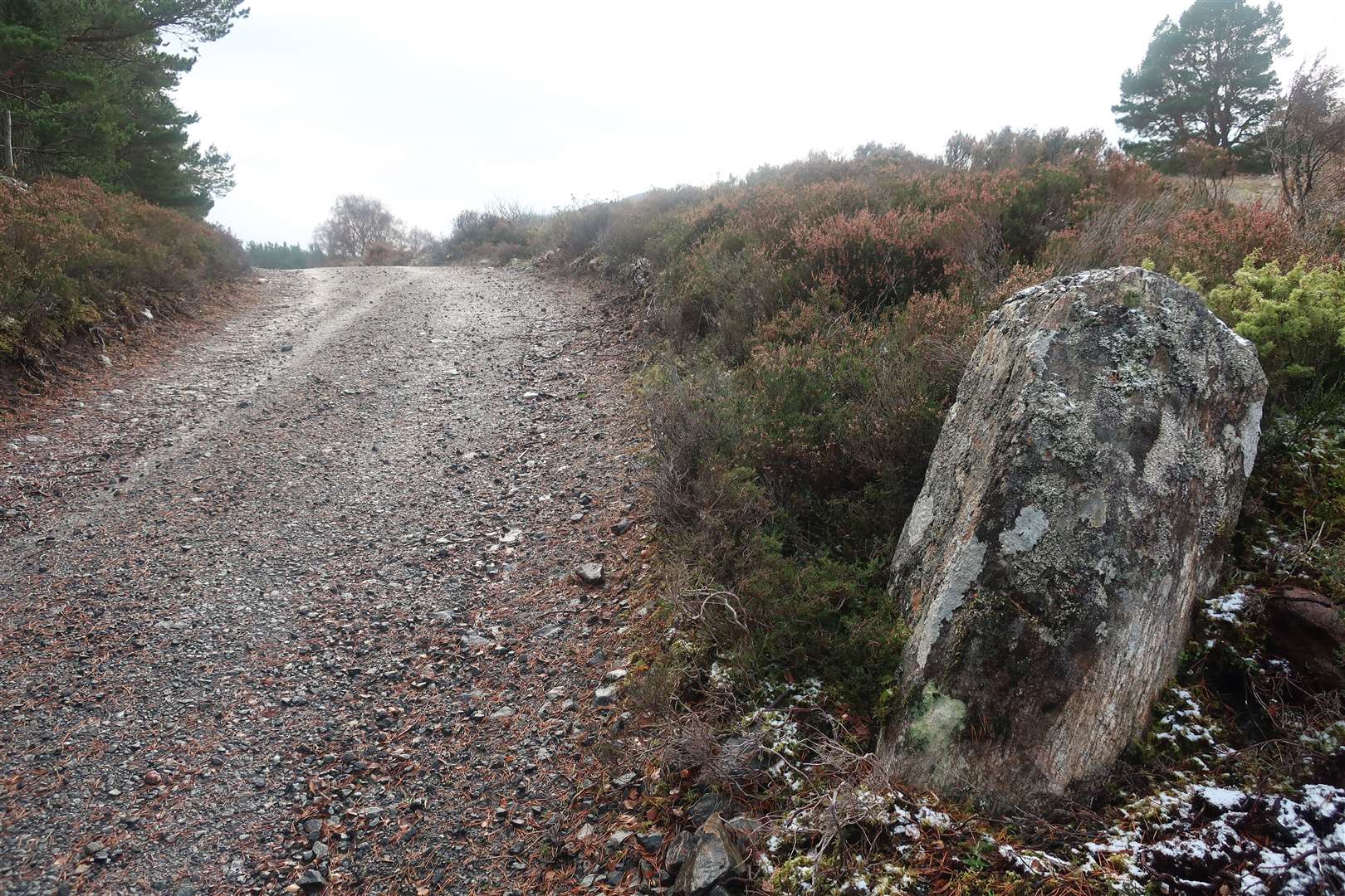
A very recent track and bridge runs alongside the route briefly here, presumably for timber extraction from the plantation forest that the military road now passes alongside the edge of. The two merge and the old Wade road is probably either buried or long gone, though hints remain, such as one large stone near Brackletterbeg that looks reminiscent of other Wade marker stones used in the construction of the route.
I ignored a new forestry track leading left into the woods, instead going straight ahead to an older gate and climbing the very high stile to continue on the line of the old road. The OS Explorer map has another old settlement marked a short way along here at Torbreck, but I’d passed the spot before I thought to explore among the trees for more evidence.
After that the route drops fairly steeply to emerge from the forest at a large gate. The Wade route would have gone left here, crossing another single-arch stone bridge at Insharn. There is some doubt as to whether the existing bridge here is the original Wade bridge but the style is certainly the same.
Wade’s road continues from Insharn on the cycle route, and you can follow it over Sluggan Bridge by going straight on from this point, and you will end up on the minor road outside Carrbridge.
However, my little exploration was over for today, and I turned left to return to the Slochd up the nice track above the Slochd Mhuic, listening to the birds and enjoying the surroundings.
One final piece of interest remains just as you arrive back at the parking area, where the track crosses a bridge overlooking the Slochd Mhuic Viaduct, an eight-span construction that carries the Highland Mainline. It was opened in July 1897 and remains in use for trains travelling to and from Inverness to this day.
The history of transport in the Highlands is a fascinating one, and these glimpses into the past offer us plenty of intrigue as we explore various ways through the region.
Route details
Wade’s Road at Slochd
Distance 4 miles / 6km
Terrain Tracks, minor road
Start/finish Slochd ski centre
Maps OS Landranger 35; OS Explorer OL60
Exploring an ancient route and associated ruins close to the narrow pass at the Slochd