Escape to the hills on Creag Dhubh near Newtonmore
Register for free to read more of the latest local news. It's easy and will only take a moment.

A mountain in miniature as John Davidson climbs a Graham with character above the Speyside village of Newtonmore
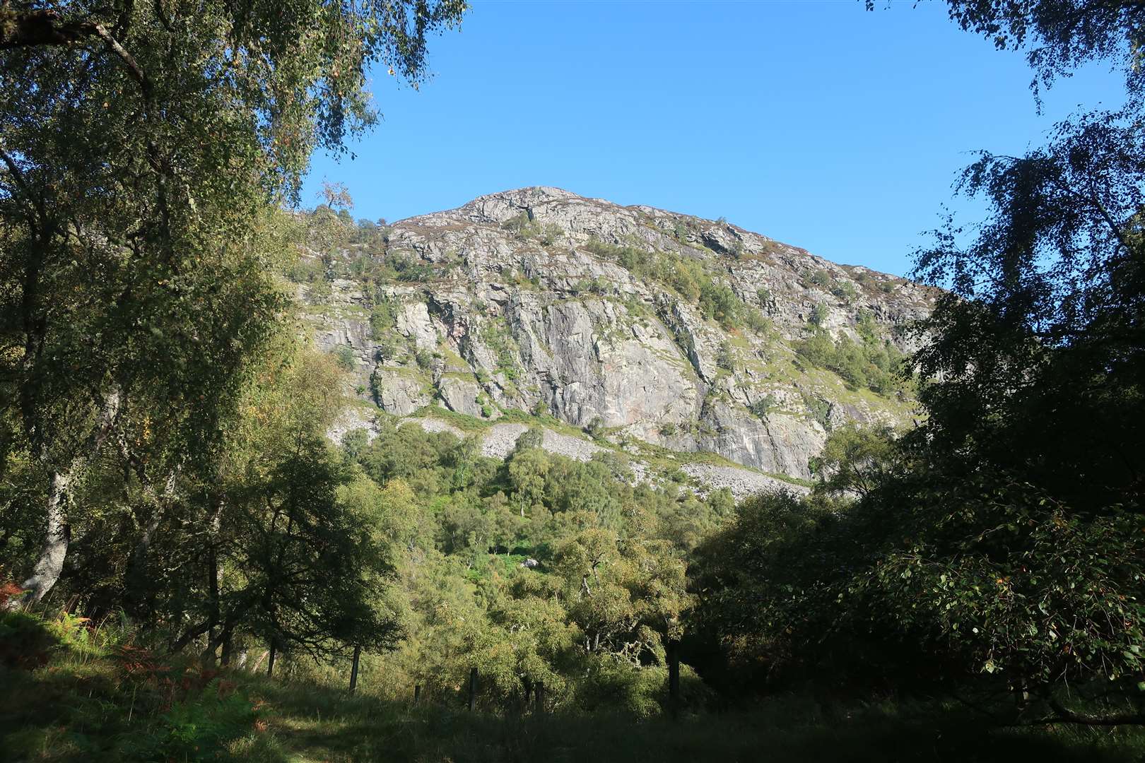
The sheer crags at the southern end of Creag Dhubh near Newtonmore offer a perfect escape for competent climbers – and they provided an even better escape for the chief of the clan MacPherson.
He is said to have hidden in a small cave among the crags for nine years after the battle of Culloden in 1746, despite a bounty of £11,000 on his head.
Some who come here today seek out the cave, which as you can imagine is tricky to find between bracken, steep slopes and broken rocks.
Peter and I were here to climb the hill itself, though. In terms of height, Creag Dhubh is a mere Graham at 756m (2350ft) yet its complex ridge and rocky terrain make it a true mountain experience in miniature – especially in poor visibility.
We had no such worries today – glorious sunshine greeted us as we met at the start point beside Lochain Uvie, south of Newtonmore on the A86. There is a very small parking area, popular with climbers, on the north side of the road.
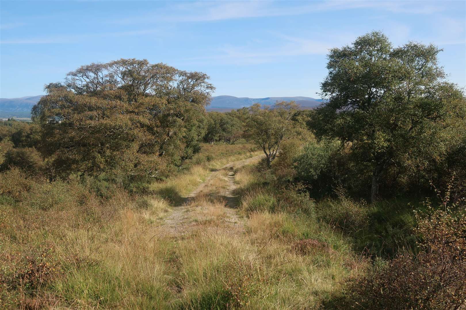
A gate in the fence here gives access to the crags for climbers, but we headed further along the road towards Creagdhubh Lodge. Just before the house on a short rise, a large gate on the right gives access to a path through the woods that stays above the Allt na Glaic.
It’s a lovely stretch and the sunlight made the early autumn colours shine through gloriously. It was a warm day and we were feeling the heat as we emerged on the open hillside, following a clear path that led to a fence.
Hopping over the other side, the route now turned right, roughly following the line of the fence towards the south-west ridge of Creag Dhubh, now clearly visible ahead.
The way ahead was boggy in places, even after a dry spell, and we had to hop over another meeting of fences where a simple stile would make life a lot easier! The way ahead is clear enough, continuing to follow the line of the fence straight ahead but now on the opposite side of it.
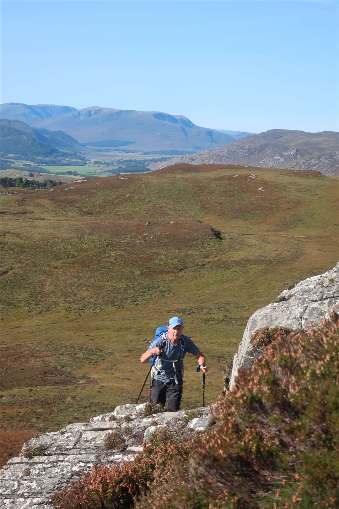
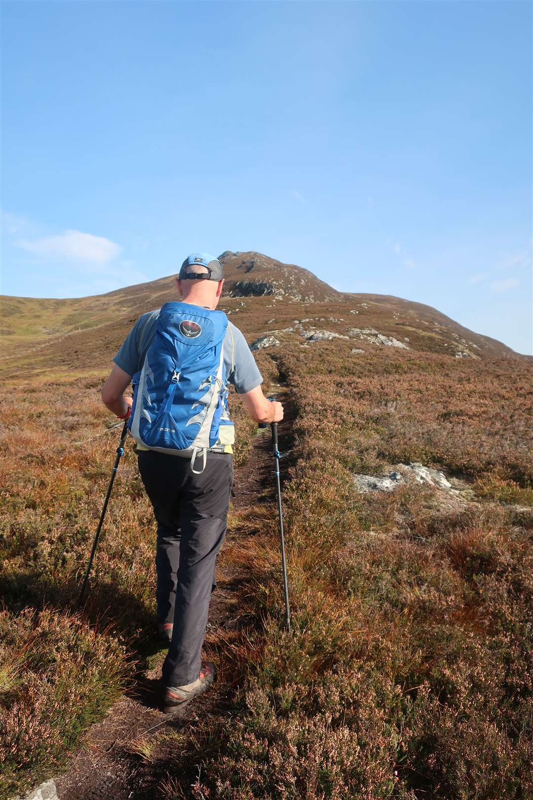
As we got higher along the heather-clad ridge, the views all around us opened up. We could see back towards the Corrieyairack and Creag Meagaidh, and forward to the nearby Monadhlaith hills, which are separated from Creag Dhubh by Glen Banchor.
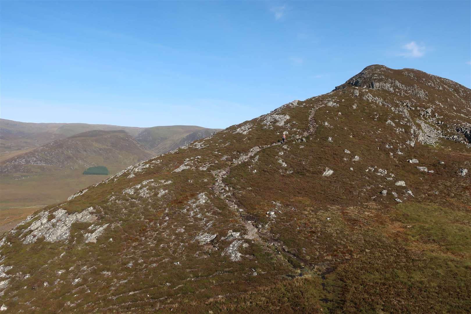
At one point there’s a drystone dyke running parallel to the ridge, slightly lower down above the top of the crags. Numerous paths fork off to the right, giving access to the top of the crags and some sheer drops, so sticking to the ridgeline is advised.
A good path winds its way up, reaching a nice rocky section with a few ways to make your way up, all of which involve using your hands for a little bit of very easy scrambling.
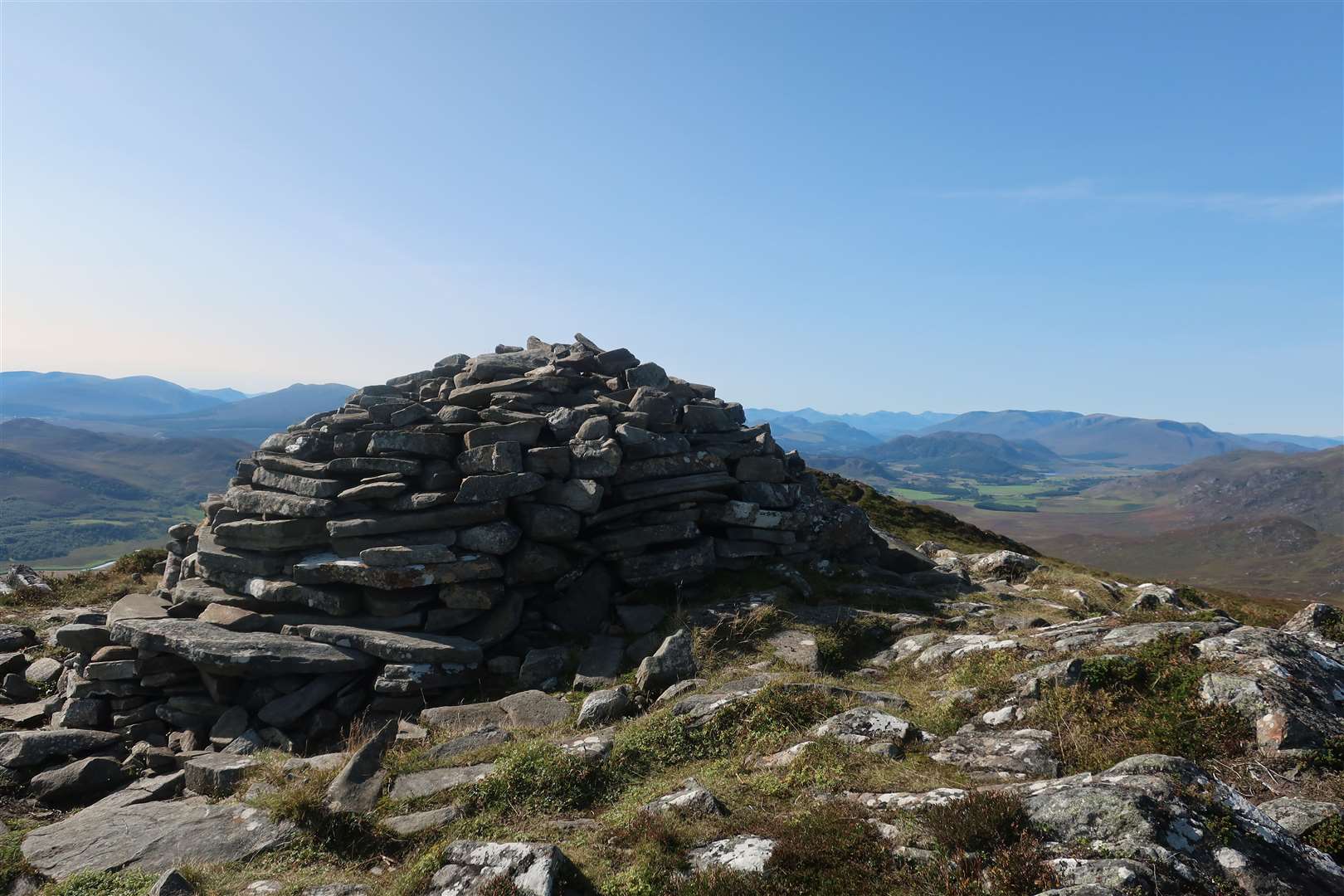
There is then a dip in the ridge before it rises on a good path to the summit, where there is large cairn marking the high point. The views across Glen Banchor are fascinating, looking down on farmsteads and old townships alongside the River Calder and across to the Munros and other hills that are accessible from the road above Newtonmore.
We continued down the ridge before stopping for a bite to eat and a socially distanced blether overlooking this view. What a spot on a beautiful clear day like this!
On our descent we followed the north-east ridge, looking ahead to the village of Newtonmore. After a significant drop in the ridge, we rose to the minor top beyond and continued down, heading almost directly for the parking area for the Monadhliath Munros at the end of the minor road in the glen.
There’s an obvious descent point where the path ahead fades and a route lower down to the right can be seen through a clearing in the trees. Peter had been this way in the past and reported a boggy trudge through the trees, so we decided to just follow the ridgeline as far as we could.
We could see a track far below, so knew our ultimate aim was to reach that for an easy walk down to Biallaid. Getting there was the problem!
Before a final little lump in the ridge, we branched off to the right, following what seemed a reasonable route that should land us just about at the track. It was ok at first, though pathless and rough compared to the well-trodden way we had followed up to now.
However, we soon reached a dense bit of birch wood which was difficult to find a clear route through. I ducked and dived, avoiding branches as best I could and disturbing insects that probably wondered what this strange creature was roaming through their territory!
Finally, I found a way out, but only into a clearing covered in bog myrtle which, not surprisingly, was a little wet underfoot, not to mention bumpy and uneven. We wobbled our way across, then found an animal trod or two and soon we landed bang at the end of the track.
Our vague plan had worked, but it was not the easiest part of the day. The track wound pleasantly down through the woods until it eventually reached a rather tired-looking wooden gate.
We followed the track ahead, which bends right at a house then drops to a parking area within the farm, going left past fields of horses to meet the main road. We turned left into Newtonmore to finish the walk in the village.
Route details
Creag Dhubh, Newtonmore
Distance 6 miles / 10km
Terrain Hill paths, complex ridge, rough descent
Start/finish Lochain Uvie (A86) / Newtonmore
Maps OS Landranger 35; OS Explorer OL56
A little hill with a big character