


Alarm call to tackle trio of Ardverikie Munros - Beinn a’ Chlachair, Geal Charn and Creag Pitridh
Register for free to read more of the latest local news. It's easy and will only take a moment.

Four-thirty in the morning is not a time I am familiar with, so it came as a bit of a shock when the alarm on my phone started blaring out its repetitive tune at this ungodly hour.
I’d opted for the early start so I could fit in a good hill day without being away from the family for the whole day, but I discovered it had other advantages too – once I’d woken up at least.
After the drive down to Loch Laggan, I arrived to low-hanging cloud and the midges were out as I grabbed my rucksack from the boot. The forecast had looked more promising, so I had a quick final check to see if the outlook had changed since the previous day.
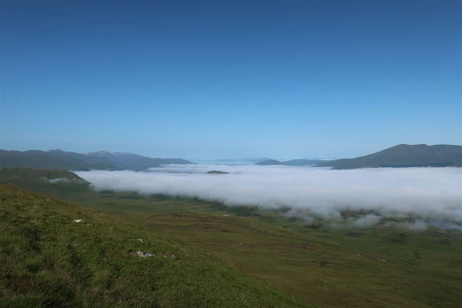
What I read gave me the motivational boost my tired body needed. The fog was hanging in the valleys, with the promise of a widespread inversion for those who ventured onto the tops.
I was aiming to climb three Munros here at the Ardverikie Forest, so if I could get up to the first one quickly enough, a spectacular view could await me. I took the bike to save a bit of extra time on the first few miles of estate track, so that gave me an advantage as I set off from the lay-by at Luiblea.
After crossing the bridge and going through a gate, the track bends left. The route to Ardverikie goes straight on here, through a high gate, and the track is flat for a while before climbing gently to a junction where you turn right towards Lochan na h-Earba.
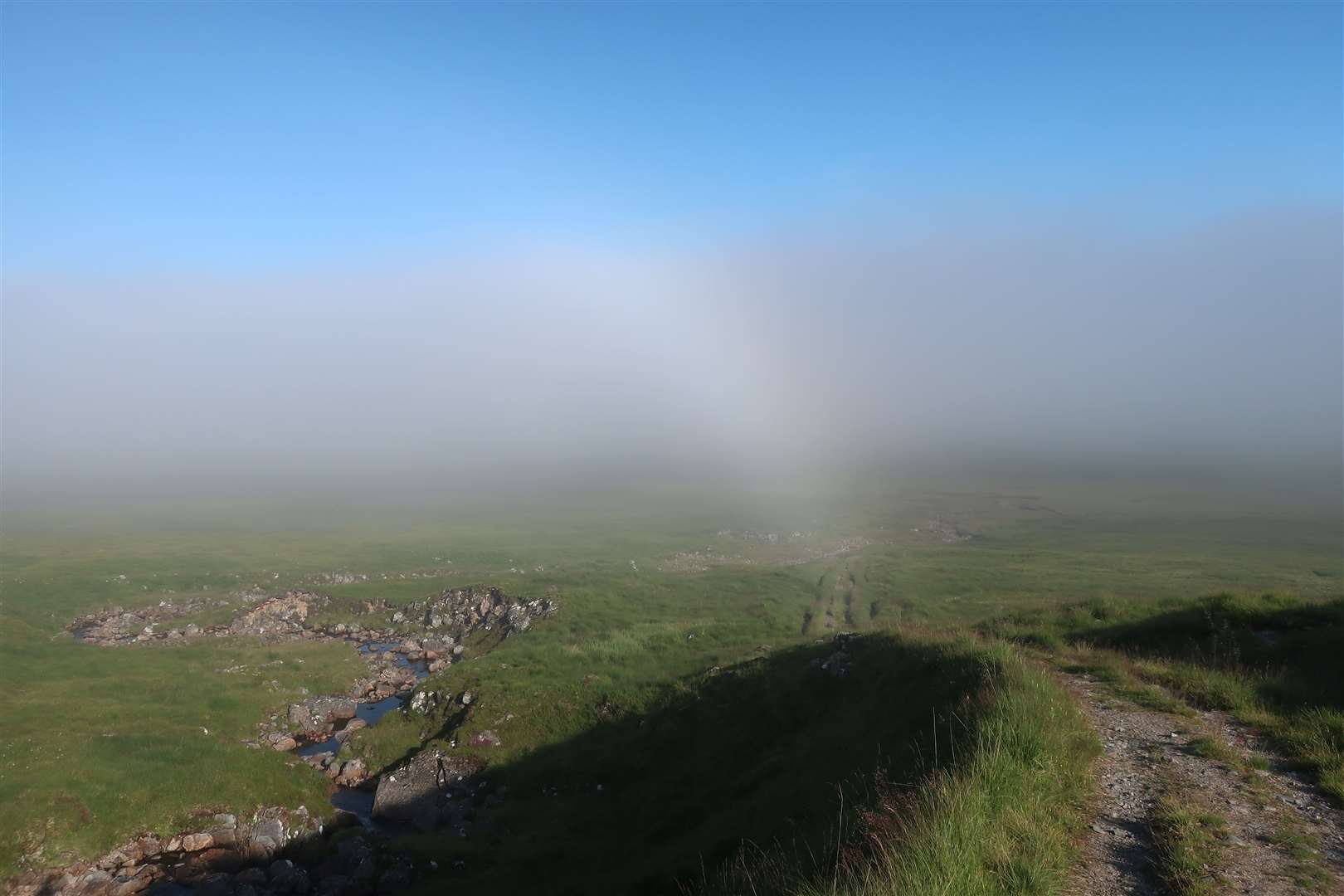
Another body of water is passed on the way, but I was up in the fog now, keeping left at the junction to pass the small reservoir. The Ardverikie estate is currently replacing a bridge over the inflow to the lochan, so until it is completed you have to make a cross-country detour to continue on your journey.
It’s not very far but the visibility was minimal, and the terrain was boggy, with peat hags, holes and watercourses along the flat ground. I left the bike beside the track and took a compass bearing, timing my walk to avoid the worst of the two burns that must be crossed, then took another bearing towards the path that would lead me partway up the Allt Coire Pitridh.
As I approached a ruined sheiling, the cloud was already starting to break up, and I was soon able to see my first target, the Munro of Beinn a’ Chlachair, rising magnificently above. Plodding up the excellent path, the heat of the early-day sun was already intense, and I was glad of my hat and the fact I’d packed plenty of water, including a bottle left with my bike.
I’d mountain biked up and over this route recently, but today I left the path quite soon to cut across the burn and traverse the low ground of the hill, aiming for the north-west ridge which sits above a steepening in the terrain.
I zigzagged up the steepest part to gain the ridge and follow the rim around Coire Mor Chlachair, the big corrie of the stonemason. Looking back to the glen below, my reward had already materialised – a fine view of the inversion stretching out for miles between miles and miles of magnificent Scottish summits.
Despite my early start, I was not the first person at the top, though. A hill runner was descending carefully through the boulder field as I approached, and we chatted briefly before he continued his circuit.
After taking in the excellent view from the summit, I followed his lead, albeit more slowly, down the wide ridge to the east-north-east that ends abruptly at a crag. Having pedalled past here recently, I knew there was a safe way down, and the top of the descent is marked by a small cairn, though the initial path soon disappears and judgment must be made as to the safest route until easier ground is reached below.
I joined the stalkers’ path, aiming left then soon forking right towards the bealach between my next two hills, Geal Charn and Creag Pitridh. I paused on a rock beside the path and guzzled some water first, enjoying the peace and the perfect conditions – and it was still only mid-morning.


Leaving the path again, I ascended the complex west ridge of Geal Charn, a long slog with little in the way of a path until the cairn eventually comes into sight at the top. This hill was once known as Mullach Coire an Iubhair, which avoids confusion with the two nearby Geal-charns, and it is still referred to by this name in some quarters.
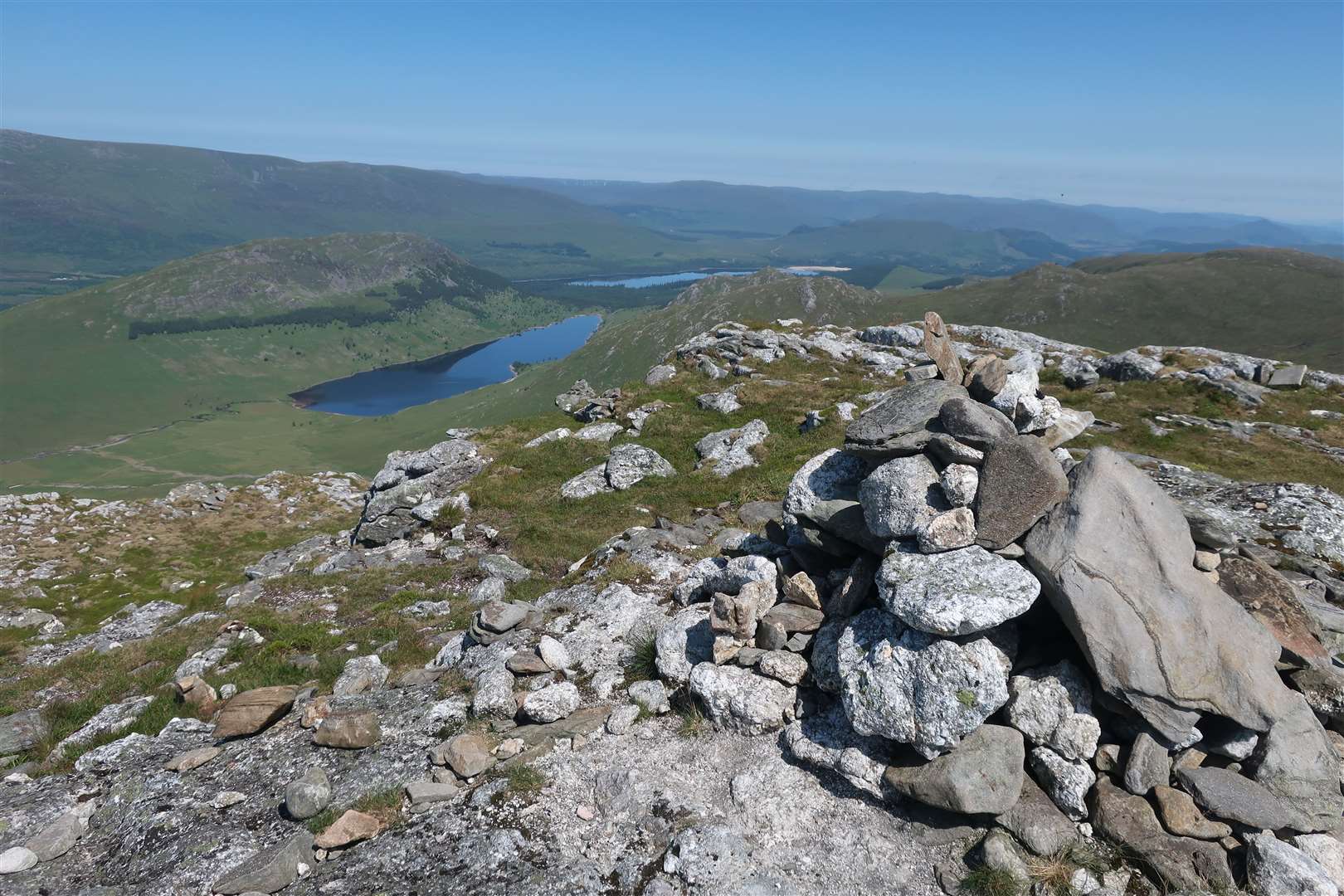
I spent some time here, taking in the view to the nearby Ben Alder range as well as more distant peaks including the Grey Corries and Ben Nevis, which had patches of snow still clinging to its north face despite the heat of the summer.
Taking a slightly more direct route down the ridge to the bealach, I somehow managed to slip into a muddy bog on one of the driest days I’ve had in the hills. Still, at least it dried off quickly.
Passing straight over the stalkers’ path, the route to Creag Pitridh was more clearly defined, and a steep route led up through rocks to the small cairn on this wonderful summit. Again, the panoramic views meant it was difficult to drag myself away, especially with so much of the day remaining.
The descent was a long one, but after heading for a level area roughly west of the summit, I aimed for the place where the Allt Coire Pitridh is forded by the path below. A line of flattened grass helped for much of the way down and I was relieved to reach the burn where I could fill up the water bottle with cool, refreshing water again.
All that was left was a plod down the path and the detour across the bog to reach the bike, where my spare water bottle had almost reached boiling point after sitting in the sunlight for so long. But I was glad of the wheels as I whizzed past a fellow walker on the easy tracks back to Luiblea after another glorious day among these fine hills.
Route details
Ardverikie Munros
Distance 10.5 miles / 17km walking, plus 3 miles / 5km each way bike in and out
Terrain Estate track, stalkers’ paths, pathless ridges, boulder fields, steep; navigation skills required
Start/finish Luiblea lay-by off A86 at Moy, grid ref NN433830
Map OS Landranger 42; OS Explorer OL50, Harvey Superwalker – Ben Alder
Feeling the heat on trio of Munros in the Ardverikie Forest